

Stob Choire Claurigh
Good walks are even better shared.
NN2673 : South-west ridge of Stob Choire Claurigh
Trevor Littlewood Photo source
Overview
Stob Choire Claurigh
Nestled in the heart of the Scottish Highlands, Stob Choire Claurigh stands proudly as a Munro at an impressive 1178 meters. The mountain's striking granite composition and rocky terrain make it a favourite for both hikers and climbers alike.
Geology
The geological features reveal a primarily granite formation, interspersed with schist layers, offering a fascinating landscape that begs to be explored. The craggy cliffs and lush valleys create a stunning contrast that draws photographers and nature lovers.
Hiking Routes
One of the most popular routes starts from Glen Nevis. This 10 km trek is classified as moderate, taking about 5 hours to complete. Its steady ascent is aided by well-worn paths, ensuring you won’t lose your way (unless you fancy an adventure, of course!).
Summit Features
Upon reaching the summit, you'll be greeted by a grand cairn, a nod to fellow hikers who have trodden this path before you. Don't forget to capture the moment; the views are just as majestic as the mountain itself.
Terrain Type
Expect a variety of terrain: rocky paths, grassy knolls, and the odd boggy patch to keep you on your toes. It's a mixed bag, just like life — full of surprises!
Views
From the top, the panorama is simply breathtaking. Marvel at iconic sights such as Ben Nevis, Loch Leven, and the beautifully rugged landscape that stretches for miles. For the best views, aim to hike during late spring or early autumn when the skies are clear and the temperatures are mild.
Hazards
As with any highland adventure, always be prepared for the unpredictable weather. It's Scotland after all; if you can see the blue sky, that's simply a sign to prepare for rain! Also, watch your step on the rocky terrain to avoid slips and trips — the mountain's charm includes the occasional (and humorous) bog encounter.
Access
If you're driving, the Glen Nevis Visitor Centre car park is the nearest and offers great access to the main trails. Public transport is quite handy as well, with regular buses running from Fort William. The Visitor Centre itself has other facilities like toilets and a café, making it an ideal starting point.
Nearby Summits
Adjacent peaks worth exploring include Sgurr a' Mhaim and the towering Ben Nevis, tempting the keen-eyed adventurer to tackle yet more Munros.
History
The name 'Stob Choire Claurigh' not only sounds mystical but carries meaning, translating to 'Peak of the Smoky Hollow'. There are whispers of folklore and ancient spirits residing within its slopes, adding an air of mystery.
Whether you’re a seasoned hiker or a weekend wanderer, Stob Choire Claurigh is a jewel in the highlands, ready to challenge and enchant in equal measure. It’s not just a hike; it’s an experience, one that’s likely to bubble up in conversation long after the ascent.
Happy hiking, and remember, the mountains are calling!
Explore routes near Stob Choire Claurigh
Walks starting near this hill. Open a route to check its map, distance and full itinerary.
Ben Nevis via Mountain Path
View route
Banavie to Glen Loy Aqueduct: Neptune’s Staircase Canal Towpath
View route
Coire Ardair lochan from Aberarder and back
View route
Fort Augustus to Kytra Lock: Caledonian Canal Towpath
View route
Route planning notes
These notes describe possible approaches. Check a route's map and access information when planning your walk.
Grey Corries Traverse from Corriechoille
A classic and popular route, this traverse covers the main peaks of the Grey Corries ridge, including Stob Choire Claurigh, the highest summit in the range. Starting from Corriechoille, the route ascends through forestry tracks before reaching the ridge. The ridge itself offers a stunning high-level walk with panoramic views of the surrounding mountains, including the Nevis Range and Glen Spean. The descent is via Coire Choimhlidh, returning to the start point.
Direct Ascent from Coirechoille Lodge
This route offers a more direct approach to Stob Choire Claurigh. Starting from Coirechoille Lodge, the path climbs steadily through forest tracks and open hillside to reach the summit. This is a straightforward ascent for experienced walkers, but the steep gradients and rough terrain demand good fitness levels. The views from the summit make the effort worthwhile, with a breathtaking panorama of the surrounding Lochaber peaks.
Circular Route via Stob Ban and Stob Choire Claurigh
This is a rewarding circuit that combines Stob Ban and Stob Choire Claurigh, offering a full day of ridge walking. Starting from the car park near Corriechoille, the route ascends Stob Ban first, traverses the ridge to Stob Choire Claurigh, and descends via the Grey Corries ridge path. This route showcases the rugged beauty of the Grey Corries and provides an opportunity to bag multiple Munros in one outing.
Grey Corries from Glen Nevis
This alternative route starts from Glen Nevis and approaches Stob Choire Claurigh from the south. The initial part of the route follows the scenic Steall Falls path before climbing steeply onto the ridge. Walkers then traverse the ridge to reach Stob Choire Claurigh. The descent is via the same route, making this an out-and-back walk. The route is strenuous but rewards with exceptional views of Ben Nevis and the Mamores.
Stob Choire Claurigh via Coire Laire
This quieter and less-travelled route ascends Stob Choire Claurigh via Coire Laire. Starting from the car park at the end of the Spean Bridge forestry road, the route climbs through undulating terrain before reaching the summit. It is a less direct but scenic ascent, ideal for those seeking solitude and a different perspective of the Grey Corries.
Make a day of it, together
Find someone to share the walk with, or organise a day out along a route you like.
Photo Gallery
View all Photo could not load
NN2673 : South-west ridge of Stob Choire Claurigh
Trevor Littlewood
 Photo could not load
NN2673 : Stob a' Choire Claurigh
Andrew Smith
 Photo could not load
NN2673 : On Stob Choire Claurigh - ridge leading to Stob coire na Ceannain
Colin Park
 Photo could not load
NN2673 : The Grey Corries in Snow
charlie kennedy
 Photo could not load
NN2673 : View from Stob Coire Gaibhre to Stob Choire Claurigh & Stob Coire na Ceannain
Colin Park
 Photo could not load
NN2673 : Stob Choire Claurigh
Rude Health
 Photo could not load
NN2673 : Stob Choire Claurigh
Rude Health
 Photo could not load
NN2673 : Reaching the Summit
Adam Ward
 Photo could not load
NN2673 : On the summit of Stob Choire Claurigh
Russel Wills

NN2673 : Moon-rise over the Mamores
Russel Wills
Hill facts and local notes
Classifications
Elevation
1,177m
3,862 ft
Prominence
446m
Coordinates
56.8238, -4.8496
NN261738
OS Map
41
Explorer: 392
At the Summit
The summit boasts a large, impressive cairn, providing a fantastic photo opportunity. On a clear day, you can almost hear the mountains calling your name!
Terrain & Geology
Stob Choire Claurigh is primarily composed of granite, which gives the mountain its rugged charm. The cliffs and rocky faces provide excellent climbing opportunities, while the underlying schist adds to the geological diversity of the area.
Views & Scenery
From the summit, you can see the iconic Ben Nevis, Loch Leven, and the Scottish Glens stretching into the distance.
History & Heritage
Name Origin
The name 'Stob Choire Claurigh' translates roughly to 'Peak of the Smoky Hollow', referencing the mist often found in the region.
Historical Significance
This peak is popular among Munro-baggers and is steeped in local folklore; some tales suggest the mountain is inhabited by ancient spirits.
Getting There & Facilities
Parking
Glen Nevis Visitor Centre car park is the closest, offering ample space and access to several trails.
Public Transport
Buses run from Fort William to Glen Nevis, with services available throughout the day. Check local timetables.
Nearby Facilities
The Glen Nevis Visitor Centre has toilets and a café for those looking to refuel before or after their adventure.
Safety Information
Known Hazards
- Weather can change rapidly, bring the right gear. Be cautious of slippery rocks and steep drops, especially after rainfall.
General Safety Tips
- Check weather conditions before setting out
- Carry appropriate clothing and equipment
- Let someone know your planned route
- Take a map, compass, and GPS device
- Carry emergency supplies: food, water, first aid kit, torch
Hills
Some common questions about the hills answered
Are there group walks up Stob Choire Claurigh?
Many walkers use Walkmates to join or organise walks with others. You can check for group walks around Stob Choire Claurigh through the maps
Are there other walkers around Stob Choire Claurigh?
Activity varies by location and time, but Walkmates lets you see whether others have shared walks or shown interest in this area. Find other people through the walking friends search walking friends for Stob Choire Claurigh search or of course create your own walk for Stob Choire Claurigh
Can I organise a walk to Stob Choire Claurigh?
Yes. If there aren’t any walks listed already, you can create a walk and make it available for others to join.
If you're signed up to Walkmates, you can create a walk to Stob Choire Claurigh.
How do I find a walk up this hill?
There are often multiple ways to walk this hill, depending on experience and route preference. Walkmates helps you explore walks and routes that others have shared.
Can I suggest a new route up Stob Choire Claurigh?
Yes. You can suggest or create routes to share with others. Walkmates focuses on the social side of walking, so routes are used to help people organise walks and explore areas together, rather than as detailed navigation tools or route libraries.
Other uses really appreciate knowledgeable walkers sharing their routes. Share your favourite route to Stob Choire Claurigh here
The is an error or something incorrect about this hill. How do I let you know?
We always strive to keep the information on Walkmates as accurate as possible. If you find an error, please let us know through the contact form and we'll aim to correct it as quickly as possible
Community Discussion
Comments
Location
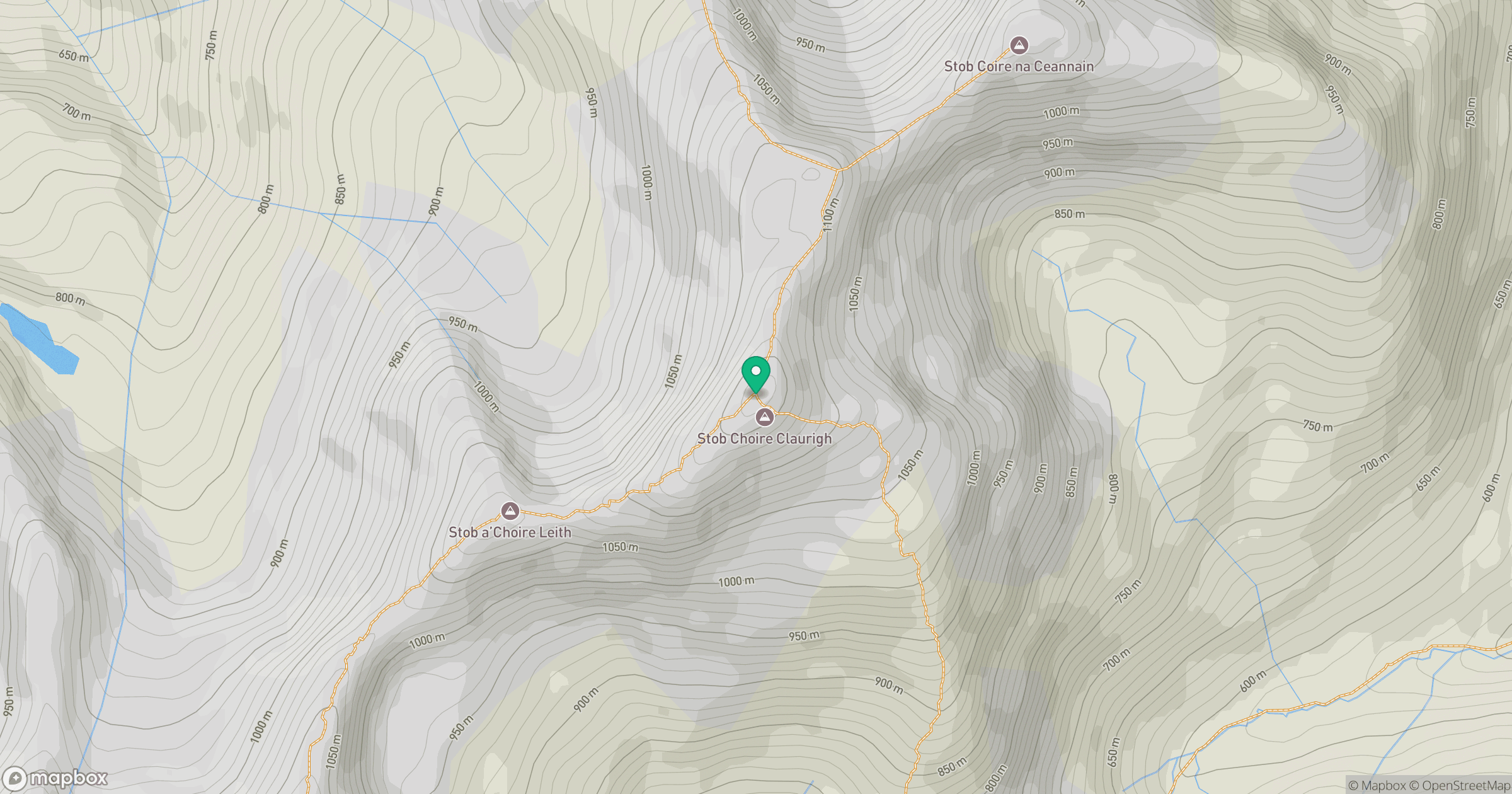
Grid reference: NN261738
View on OpenStreetMapOpens a map in a new tab, centred on the hill.
No comments yet. Be the first.