

Meall a' Mheanbh-chruidh
Good walks are even better shared.
Overview
Meall a' Mheanbh-chruidh
Overview
Meall a' Mheanbh-chruidh, standing tall at 790 meters, is a Marilyn in the Scottish Highlands, nestled within a captivating landscape of rolling hills and serene lochs. While it may not be the highest in the region, its charm lies in the peacefulness it offers to those who venture forth.
Geology
This impressive hill showcases a captivating geological profile primarily composed of Devonian sedimentary rocks. The quartzite areas offer a glimpse into ancient geological processes that have crafted the rugged beauty of the Highlands over millions of years.
Routes
East Ridge Route
One of the most cherished routes is the East Ridge, stretching over 7.5 km. This moderate trail is a great way to escape the hustle and bustle, featuring lovely grassy expanses and sections of rocky terrain as you approach the summit.
Summit Features
Upon reaching the summit, you'll be greeted by a humble cairn. It’s the ideal vantage point for snapping pictures and enjoying the panoramic vistas—don’t forget your snack, as you've certainly earned it!
Terrain Type
The trails are predominantly grassy, although you'll encounter rocky sections closer to the summit. It's a manageable trek but do watch out for the odd bog as you wander!
Views
Highlights
The summit offers stupendous views of Loch Awe and surrounding summits, including a distant yet mighty Ben Cruachan. These scenic rewards are well worth the effort!
Best Seasons
The best times to visit are late spring, when the heather is in full bloom, and autumn, which paints the landscape in hues of orange and gold.
Hazards
While the trails are manageable, always be wary of changing weather conditions—Scottish weather has a knack for keeping you on your toes! The terrain may also include wet and boggy areas, so sturdy boots are highly recommended.
Nearby Summits
Just a stone's throw away, you'll find Ben Juirach and Beinn Chochuill, both of which present their own delightful challenges and views.
Access
Getting here is fairly easy:
- Nearest Parking: A small parking area in Dalavich provides room for several cars.
- Public Transport: Limited bus services exist, so having a car is beneficial for smooth access.
- Nearest Town: Oban, approximately 30 km away, offers the closest amenities.
Facilities
Dalavich features basic facilities like a small shop, while Oban boasts a wider range, perfect for replenishing supplies and indulging in a post-hike treat.
History
The name 'Meall a' Mheanbh-chruidh' means ‘hill of the small cattle’, harking back to a pastoral lifestyle in this verdant land. Although often overshadowed by its taller neighbours, this mountain holds its own appeal, offering solitude in an otherwise busy hiking landscape.
Conclusion
Meall a' Mheanbh-chruidh is a gem waiting to be explored. Whether you're after tranquillity or stunning views, this mountain offers both in spades. Grab your hiking boots, and happy walking!
Explore routes near Meall a' Mheanbh-chruidh
Public walks starting within 80 km of this hill. Nearby does not mean a route reaches the summit; check its map and access before setting out.
Coire Ardair lochan from Aberarder and back
View route
Fort Augustus to Kytra Lock: Caledonian Canal Towpath
View route
Great Glen Way low route: Fort Augustus to Invermoriston Old Bridge
View route
Banavie to Glen Loy Aqueduct: Neptune’s Staircase Canal Towpath
View route
Route planning notes
These notes describe possible approaches, not verified navigable routes or permission to cross land. Check current paths, local access rules and conditions before setting out.
East Ridge Route
A popular ascent starting from the east that winds through scenic heather and grassland before reaching the summit.
Make a day of it, together
Find someone to share the walk with, or organise a day out along a route you like.
Photo Gallery
View all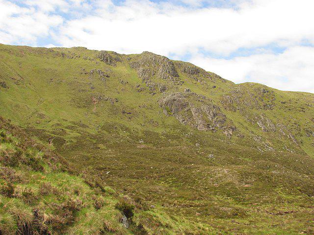 Photo could not load
NN3989 : Buttress, Meall a' Mheanbh-chruidh
Richard Webb
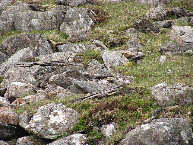 Photo could not load
NN3989 : Ptarmigan, Meall a' Mheanbh-chruidh
Richard Webb
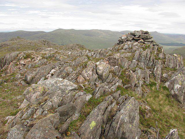 Photo could not load
NN3989 : Summit, Meall a' Mheanbh-chruidh
Richard Webb
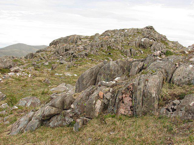 Photo could not load
NN3989 : Summit, Meall a' Mheanbh-chruidh
Richard Webb
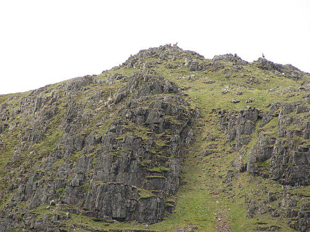 Photo could not load
NN3989 : Meall a' Mheanbh-chruidh
Richard Webb
Hill facts and local notes
Classifications
Elevation
818m
2,685 ft
Prominence
130m
Coordinates
56.9678, -4.6425
NN394894
OS Map
34 41
Explorer: OL55 401
At the Summit
The summit is capped with a small stone cairn, offering a perfect spot for a well-deserved snack and the obligatory summit photo.
Terrain & Geology
The mountain is primarily composed of Devonian sedimentary rocks, with some areas featuring quartzite. The geology provides a fascinating record of ancient river systems and the processes that shaped the Highlands.
Views & Scenery
From the top, enjoy sweeping views of Loch Awe, the surrounding mountains, and on clear days, a distant glimpse of Ben Cruachan.
History & Heritage
Name Origin
The name 'Meall a' Mheanbh-chruidh' translates loosely to 'hill of the small cattle', suggesting a pastoral landscape rich in grazing land.
Historical Significance
This mountain is often overlooked by busy hikers heading to nearby Munros, offering a tranquil hiking experience away from the crowds.
Getting There & Facilities
Check current local access restrictions, parking rules and transport timetables before travelling. These notes do not confirm public access to the summit.
Parking
There is a small parking area at the start of the route near the hamlet of Dalavich, suitable for a handful of vehicles.
Public Transport
Limited bus services operate to nearby villages, but a car is recommended for easier access.
Nearby Facilities
Basic facilities can be found in Dalavich, including a small shop. For more extensive options, head to Oban.
Safety Information
Known Hazards
- Watch for changes in weather; conditions can shift rapidly. The terrain can be tricky and boggy sections exist, so sturdy footwear is advisable.
General Safety Tips
- Check weather conditions before setting out
- Carry appropriate clothing and equipment
- Let someone know your planned route
- Take a map, compass, and GPS device
- Carry emergency supplies: food, water, first aid kit, torch
Hills
Some common questions about the hills answered
Are there group walks up Meall a' Mheanbh-chruidh?
Many walkers use Walkmates to join or organise walks with others. You can check for group walks around Meall a' Mheanbh-chruidh through the maps
Are there other walkers around Meall a' Mheanbh-chruidh?
Activity varies by location and time, but Walkmates lets you see whether others have shared walks or shown interest in this area. Find other people through the walking friends search walking friends for Meall a' Mheanbh-chruidh search or of course create your own walk for Meall a' Mheanbh-chruidh
Can I organise a walk to Meall a' Mheanbh-chruidh?
Yes. If there aren’t any walks listed already, you can create a walk and make it available for others to join.
If you're signed up to Walkmates, you can create a walk to Meall a' Mheanbh-chruidh.
How do I find a walk up this hill?
There are often multiple ways to walk this hill, depending on experience and route preference. Walkmates helps you explore walks and routes that others have shared.
Can I suggest a new route up Meall a' Mheanbh-chruidh?
Yes. You can suggest or create routes to share with others. Walkmates focuses on the social side of walking, so routes are used to help people organise walks and explore areas together, rather than as detailed navigation tools or route libraries.
Other uses really appreciate knowledgeable walkers sharing their routes. Share your favourite route to Meall a' Mheanbh-chruidh here
The is an error or something incorrect about this hill. How do I let you know?
We always strive to keep the information on Walkmates as accurate as possible. If you find an error, please let us know through the contact form and we'll aim to correct it as quickly as possible
Community Discussion
Comments
Location
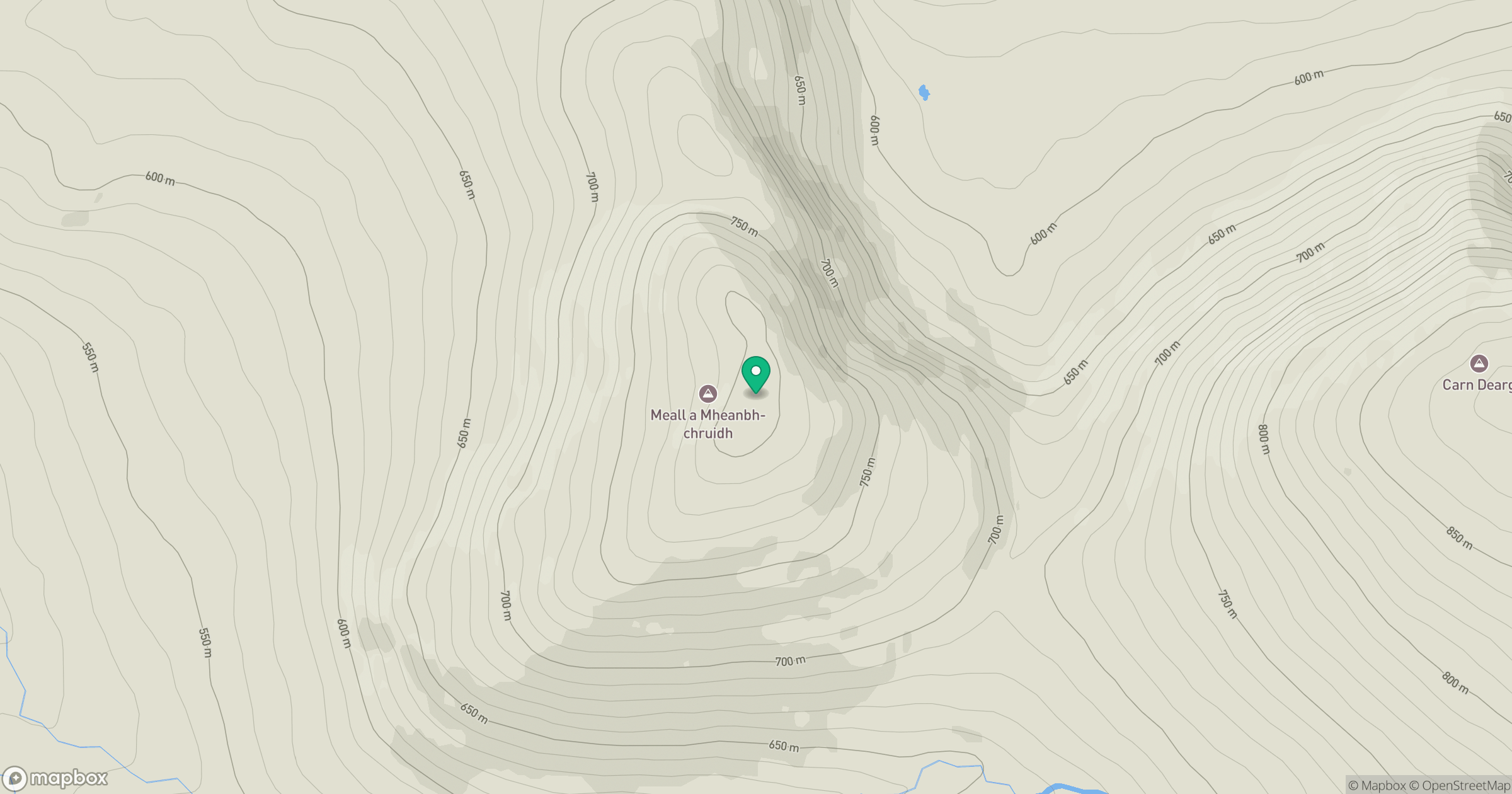
Grid reference: NN394894
View on OpenStreetMapOpens a map in a new tab, centred on the hill.
Hills within 30 km
Straight-line distance, not a walking route or confirmation of access.
Creag Meagaidh
1,128m
Ben Alder
1,148m
Beinn Mheadhoin
541m
Stob Choire Claurigh
1,177m
Stob Ban
977m
No comments yet. Be the first.