

Conic Hill
Good walks are even better shared.
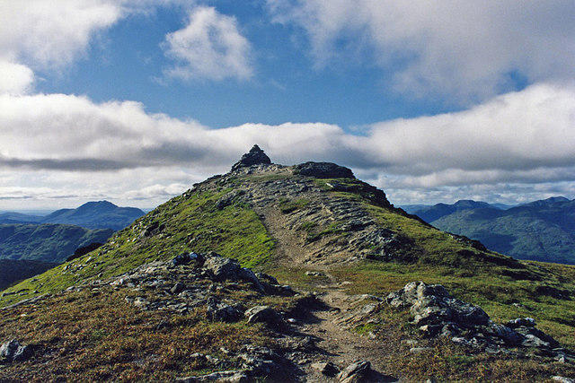
NS4392 : Upper slopes on Conic Hill
Jim Smillie Photo source
Overview
Conic Hill is a 361 m Marilyn above Balmaha on the east side of Loch Lomond. The usual walk follows the West Highland Way and a separate summit spur, with steep steps and rough, rocky ground. Its ridge and lower viewpoints overlook Loch Lomond’s islands, Ben Lomond and the Arrochar Alps.
Conic Hill
Conic Hill is a 361 m Marilyn above Balmaha on the eastern shore of Loch Lomond. Its compact ridge offers broad views over the loch and its islands, with Ben Lomond and the Arrochar Alps beyond. Although this is a short hillwalk, the climb is steep and the exposed upper ground needs sensible footwear, clothing and weather judgement.
The summit and the viewpoint
The Database of British and Irish Hills records a tiny cairn at the highest point, NS 43282 92393. The south-west top at NS 43040 92230 is at least 2.5 m lower. It is an attractive viewpoint, but walkers aiming for the recorded summit need to continue farther north-east along the ridge. Views are available well below the top too.
The walk from Balmaha
The usual out-and-back walk starts at Balmaha car park, approximately NS421909. Follow the West Highland Way through the woods and onto the steep stepped path. A separate summit detour leaves the Way for rough, rocky ground on the ridge; the long-distance trail itself does not visit the highest point. Return by the same route.
Walkhighlands gives about 4 km, 350 m of ascent and 2–3 hours for the return walk. Allow extra time for stops, your group’s pace and difficult conditions. Longer approaches from Drymen and Garadhban require a separately planned itinerary and return journey.
Geology and landscape
The ridge is formed from Old Red Sandstone conglomerate, a sedimentary rock containing pebbles and larger fragments, beside the Highland Boundary Fault zone. The line of hills and islands gives a striking view of the transition between the Highlands and Lowlands. The wider Conic Hill protected site also contains older rocks of the Highland Border Complex and valuable woodland, grassland and wetland habitats. Stay on established paths to limit erosion.
Getting there and facilities
Reach Balmaha via the B837 from Drymen. The main car park beside the National Park visitor centre is operated by Stirling Council and is pay-and-display. Check the signs and current tariff, use marked spaces and have an alternative plan if it is full.
For a car-free visit, take the train to Balloch and service 309 to Balmaha. SPT currently lists the bus as operated by McColl’s Travel via Drymen. Check the timetable and last return before setting out.
Balmaha has places to eat, a village shop and visitor-centre toilets. Facilities have opening hours, with reduced winter visitor-centre opening, so check ahead and bring enough drinking water and food. The lochside Tom Weir statue is a separate village stop after the walk.
Dogs, access and path work
Keep dogs on a lead and away from livestock. The West Highland Way notice for 2026 excludes dog walkers from the enclosed approach fields from 1 April to 31 May and directs them to a signed alternative. This concerns the fields on the eastern approach, rather than a general closure of the hill. Dates and arrangements can change; follow the latest notices.
The main Balmaha path improvement programme finished in 2025. Separate work on the eastern West Highland Way approach from the Burn of Mar was programmed into 2026–27. Check current National Park, Forestry and Land Scotland and West Highland Way notices before travelling, and obey temporary signs and barriers.
Safety
Stone steps and summit rock can be slippery when wet or icy. Strong winds and cloud can make the open ridge difficult even when conditions in Balmaha seem mild. Take a map and compass you know how to use, suitable clothing, food, water and a headtorch. Plan for daylight and turn back if the conditions are beyond your group’s skills.
Carry water from a known drinking-water supply. In May 2026, the West Highland Way relayed Lomond Mountain Rescue advice about livestock runoff near Conic Hill: stream water needs treatment, and filtering alone may be insufficient. Winter snow and ice can require equipment and skills beyond ordinary summer walking. In an emergency call 999, ask for Police, then Mountain Rescue.
Name and walking history
The name is commonly linked to Gaelic còinneach, meaning moss or mossy. The West Highland Way, which passes below the summit, opened on 6 October 1980. Balmaha’s statue of mountaineer, writer and broadcaster Tom Weir was unveiled in 2014.
Sources
- Database of British and Irish Hills: summit data, version 18.6, hill 64.
- Walkhighlands: the Balmaha return route.
- British Geological Survey: the conglomerate ridge and Highland Boundary Fault zone.
- National Park visitor guide: local information.
- West Highland Way notices: access and safety updates.
- Stirling Council parking and SPT timetables: travel planning.
Information reviewed: 15 October 2026.
Explore routes near Conic Hill
Walks starting near this hill. Open a route to check its map, distance and full itinerary.
Finnich Glen geology walk
View route
Ben Lomond in the trossachs
View route
Loch Ard Forest: Sculpture Trail and Little Loch Ard
View route
Aberfoyle woodland wellbeing walk
View route
Route planning notes
These notes describe possible approaches. Check a route's map and access information when planning your walk.
Conic Hill from Balmaha via the West Highland Way
Start at Balmaha car park (NS421909) and follow the West Highland Way through woodland and up the stepped hillside. Leave the Way for the steep, rocky summit detour. The true highest point lies farther north-east along the ridge than the popular south-west viewpoint. Return the same way. Allow 2–3 hours for about 4 km and 350 m of ascent; wet steps, wind and ice demand care. Follow current access signs.
Make a day of it, together
Find someone to share the walk with, or organise a day out along a route you like.
Photo Gallery
View all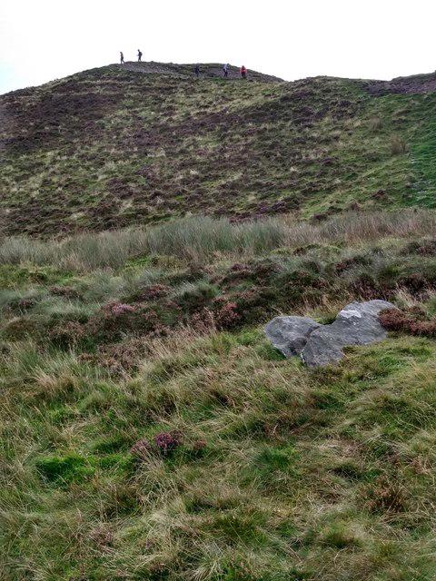 Photo could not load
NS4392 : Upper slopes on Conic Hill
Jim Smillie
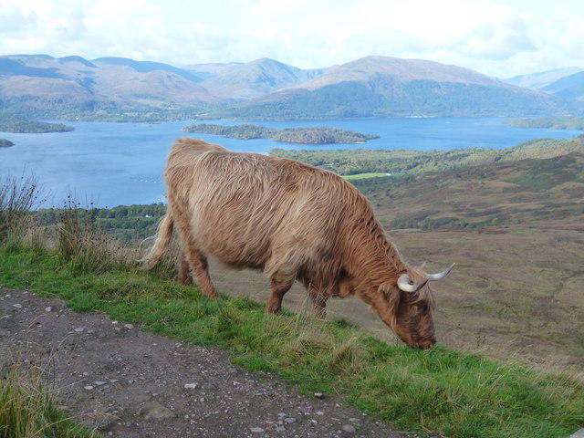 Photo could not load
NS4392 : Cattle grazing by the West Highland Way on Conic Hill
Dave Kelly
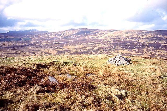 Photo could not load
NS4392 : Conic Hill
Richard Webb
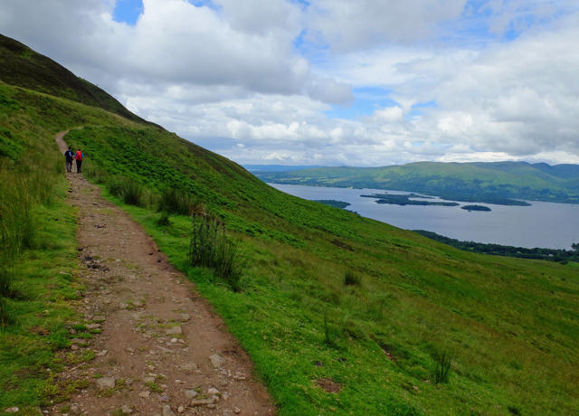 Photo could not load
NS4392 : Ascending Conic Hill
John Allan
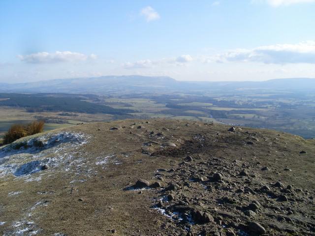 Photo could not load
NS4392 : Summit of the Conic Hill
Stephen Sweeney
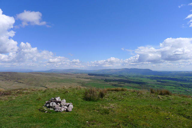 Photo could not load
NS4392 : Summit of Conic Hill
Tim Heaton
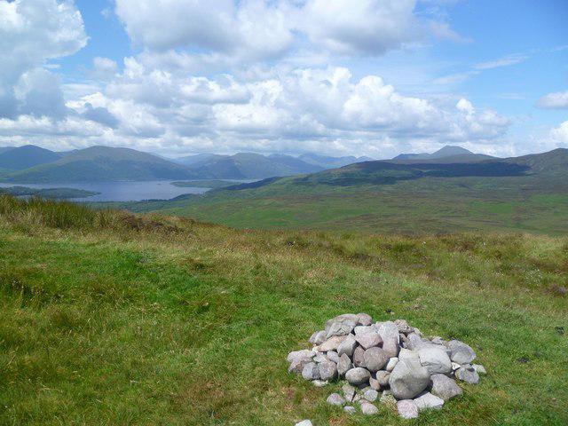 Photo could not load
NS4392 : On Conic Hill
Michael Graham
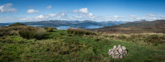 Photo could not load
NS4392 : Conic Hill Summit Panno, Loch Lomond, Stirling
Brian Deegan
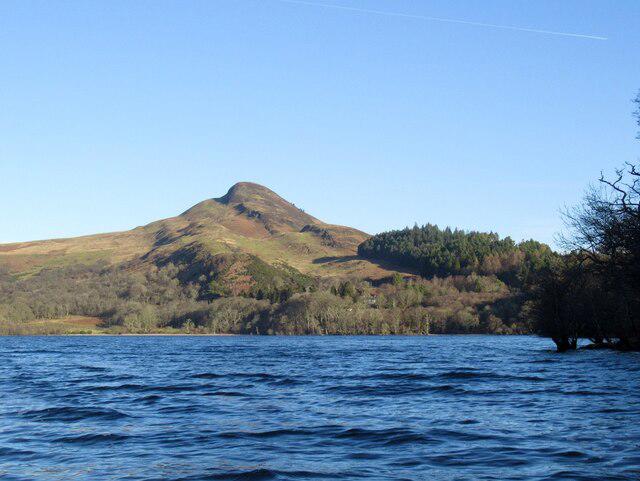 Photo could not load
NS4392 : Conic Hill
Richard Webb
Hill facts and local notes
Classifications
Elevation
361m
1,184 ft
Prominence
153m
Coordinates
56.0986, -4.5211
NS432924
OS Map
56
Explorer: OL38 347
At the Summit
A tiny cairn marks the recorded highest point at NS 43282 92393. The popular south-west top at NS 43040 92230 is at least 2.5 m lower; continue farther north-east along the ridge for the true summit.
Terrain & Geology
Conic Hill’s ridge is formed from Old Red Sandstone conglomerate, a sedimentary rock containing rounded stones and larger fragments, beside the Highland Boundary Fault zone. Older rocks of the Highland Border Complex occur nearby. The hill and Loch Lomond’s islands reveal the transition between Highland and Lowland landscapes.
Views & Scenery
Views across Loch Lomond and its islands, with Ben Lomond and the Arrochar Alps beyond. The island chain and ridge trace the Highland Boundary Fault zone. Good views begin below the summit; visibility depends on the weather.
History & Heritage
Name Origin
The name is commonly linked to Gaelic còinneach, meaning moss or mossy. Friends of Loch Lomond & The Trossachs gives this derivation; the original full Gaelic name is less certain.
Historical Significance
Conic Hill is a landmark on the West Highland Way, which opened on 6 October 1980; the trail passes below the true summit. In nearby Balmaha, a statue of mountaineer, writer and broadcaster Tom Weir was unveiled on 29 December 2014, the centenary of his birth.
Getting There & Facilities
Parking
Stirling Council’s main Balmaha car park beside the National Park visitor centre, approximately NS421909, is reached by the B837 from Drymen. Pay-and-display charges apply; check the signs and current tariff. Use marked spaces and have an alternative plan when busy. The hill path starts behind the car park.
Public Transport
Take a train to Balloch, then service 309 via Drymen to Balmaha car park. SPT currently lists the route as operated by McColl’s Travel, with Monday–Saturday and Sunday timetables. Check the current timetable, connections and last return before travelling.
Nearby Facilities
Balmaha has a National Park visitor centre with toilets, places to eat and a village shop. Opening hours are seasonal, with reduced visitor-centre opening in winter; check before travelling. Bring your own food and enough drinking water for the hill.
Safety Information
Known Hazards
- Steep stone steps and rough summit rock can be slippery when wet or icy; take particular care descending.
- The open ridge is exposed to wind and cloud. Carry suitable clothing, a map and compass, and know how to navigate.
- Stay on established paths, avoid eroded shortcuts and follow temporary signs or barriers.
- Livestock graze the hill and eastern approach. Keep dogs on a lead and follow seasonal field restrictions.
- Carry water from a known drinking-water supply. Livestock runoff can contaminate streams near Conic Hill; filtering alone may be insufficient.
Seasonal Hazards
Snow and ice can make the steep path and summit rock hazardous; winter conditions may require additional equipment and skills. Allow for short daylight hours and changing weather. The 2026 West Highland Way notice excludes dog walkers from the enclosed eastern approach fields from 1 April to 31 May, with a signed diversion. Check the latest seasonal notices and path-work restrictions before visiting.
General Safety Tips
- Check weather conditions before setting out
- Carry appropriate clothing and equipment
- Let someone know your planned route
- Take a map, compass, and GPS device
- Carry emergency supplies: food, water, first aid kit, torch
Hills
Some common questions about the hills answered
Are there group walks up Conic Hill?
Many walkers use Walkmates to join or organise walks with others. You can check for group walks around Conic Hill through the maps
Are there other walkers around Conic Hill?
Activity varies by location and time, but Walkmates lets you see whether others have shared walks or shown interest in this area. Find other people through the walking friends search walking friends for Conic Hill search or of course create your own walk for Conic Hill
Can I organise a walk to Conic Hill?
Yes. If there aren’t any walks listed already, you can create a walk and make it available for others to join.
If you're signed up to Walkmates, you can create a walk to Conic Hill.
How do I find a walk up this hill?
There are often multiple ways to walk this hill, depending on experience and route preference. Walkmates helps you explore walks and routes that others have shared.
Can I suggest a new route up Conic Hill?
Yes. You can suggest or create routes to share with others. Walkmates focuses on the social side of walking, so routes are used to help people organise walks and explore areas together, rather than as detailed navigation tools or route libraries.
Other uses really appreciate knowledgeable walkers sharing their routes. Share your favourite route to Conic Hill here
The is an error or something incorrect about this hill. How do I let you know?
We always strive to keep the information on Walkmates as accurate as possible. If you find an error, please let us know through the contact form and we'll aim to correct it as quickly as possible
Community Discussion
Comments
Location
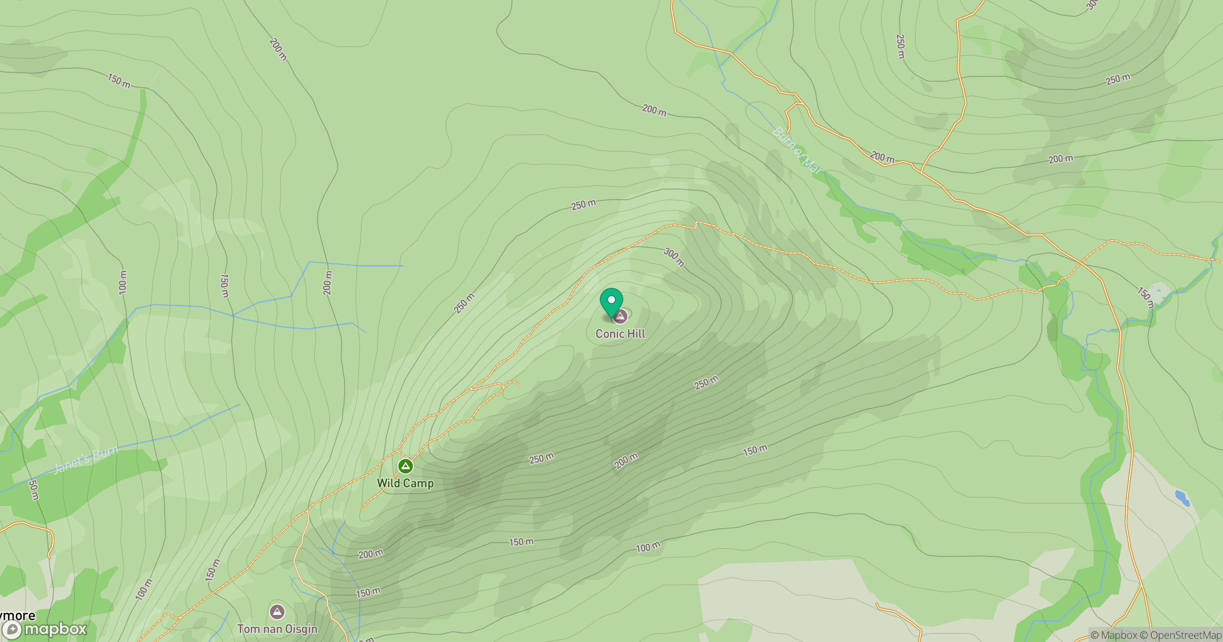
Grid reference: NS432924
View on OpenStreetMapOpens a map in a new tab, centred on the hill.
No comments yet. Be the first.