

Cnoc na h-Airighe
Good walks are even better shared.
Overview
Cnoc na h-Airighe: A Hidden Gem
Cnoc na h-Airighe is a modest yet captivating mountain located in the heart of the Scottish Highlands. Standing at 449 meters, it's classified as a Marilyn, which means it has a prominence of at least 150 meters, making it a rewarding hike for both seasoned walkers and enthusiastic novices.
Geology
This mountain is primarily composed of schist, a type of metamorphic rock, interspersed with striking quartzite formations. As you hike, you'll witness the fascinating layers of sedimentary rock that tell the story of the Earth's ancient times, offering a touch of geological drama to your trek.
Routes
The Cnoc na h-Airighe Circular route is a popular choice. Covering roughly 8 km, this moderate trail takes around 3.5 hours to complete. It begins near the village of Dalavich and meanders through lush landscapes, culminating at the summit where you can catch your breath and take in the stunning views.
Summit Features
At the very top, hikers are greeted by a distinctive trig point and a small, lovingly built cairn. Remember to snap a picture here—this is the proof that you’re not just a couch potato!
Terrain
The terrain is a delightful mix of grassy slopes and occasional rocky outcrops. Be prepared for some bogginess, especially after a good downpour. A sturdy pair of waterproof boots is essential, or you might find yourself squelching more than striding!
Views
Highlights: From the summit, the panoramic views will quite literally take your breath away. Loch Awe sparkles in the distance, while the rugged backdrop of surrounding peaks paints a stunning portrait of Scotland's natural beauty.
Best Seasons: Late spring to early autumn is ideal for clear views, and the changing colours of autumn foliage offer a picturesque scene for photographers.
Hazards
As always in the Highlands, be aware of the potential for loose stones and sudden shifts in weather. It’s like the weather here has a touch of drama! Always come prepared, and don’t forget to check the forecast before setting off.
Access
- Nearest Parking: You’ll find a small parking area near Dalavich, about 5 km from the trailhead. Arrive early to grab a spot!
- Public Transport: Buses from Oban to Dalavich are infrequent, so planning ahead is key. Taxis are also available for those who prefer a more direct route.
- Nearest Town: Oban, known for its seafood and ferry connections to the islands, is your best bet for supplies.
Facilities
While the summit itself has no facilities, Dalavich offers a small shop, and Oban has public toilets for when nature calls!
History
Name Meaning: Cnoc na h-Airighe means 'Hill of the Pasture,' an homage to its agricultural roots.
Significance: The area is steeped in history, with remnants of ancient civilizations scattered throughout the landscape.
In conclusion, Cnoc na h-Airighe is a delightful hike, perfect for a day out in nature. Whether you're hunting for stunning views, a touch of geology, or just an excuse to escape the daily grind, this mountain won't disappoint!
Explore routes near Cnoc na h-Airighe
Public walks starting within 80 km of this hill. Nearby does not mean a route reaches the summit; check its map and access before setting out.
Glen Kin group walk
View route
West Bay walk and talk
View route
West Bay walk and talk
View route
Bishop’s Glen group walk
View route
Route planning notes
These notes describe possible approaches, not verified navigable routes or permission to cross land. Check current paths, local access rules and conditions before setting out.
Cnoc na h-Airighe Circular
A scenic route starting from the base, offering panoramic views of the surrounding landscape and the nearby lochs.
Make a day of it, together
Find someone to share the walk with, or organise a day out along a route you like.
Photo Gallery
View all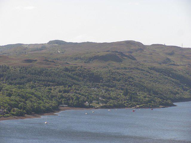 Photo could not load
NS2290 : Cnoc na h-Airighe
Richard Webb
Hill facts and local notes
Classifications
Elevation
219m
719 ft
Prominence
128m
Coordinates
56.0715, -4.8565
NS222902
OS Map
56
Explorer: OL37N OL38 347 363N
At the Summit
The summit boasts a prominent trig point and a small cairn, perfect for a photo op to prove to your friends that you really did conquer the mountain!
Terrain & Geology
The mountain is primarily composed of schist with some quartzite, characteristic of the complex geology found in this part of the Highlands. Layers of sedimentary rock can sometimes be spotted, offering a glimpse into Earth's ancient past.
Views & Scenery
From the summit, you can feast your eyes on the neighbouring peaks and Loch Awe in the distance—it's a sight that even your grumpy uncle would appreciate!
History & Heritage
Name Origin
Cnoc na h-Airighe translates to 'Hill of the Pasture' in Gaelic, reflecting its agricultural roots.
Historical Significance
The area is rich in history, with ancient sites and evidence of past communities that once thrived in the Highlands.
Getting There & Facilities
Check current local access restrictions, parking rules and transport timetables before travelling. These notes do not confirm public access to the summit.
Parking
There is a small parking area near the village of Dalavich, about 5 km from the trailhead. Arrive early, as it can fill up quickly on weekends.
Public Transport
Buses run infrequently from Oban to Dalavich, so check the schedule ahead of time. Alternatively, consider a taxi from Oban to Dalavich.
Nearby Facilities
While there are no facilities at the summit, Dalavich has a small shop and there are toilets available in Oban.
Safety Information
Known Hazards
- Watch out for loose stones and sudden changes in weather; the Highlands can be a moody mistress!
General Safety Tips
- Check weather conditions before setting out
- Carry appropriate clothing and equipment
- Let someone know your planned route
- Take a map, compass, and GPS device
- Carry emergency supplies: food, water, first aid kit, torch
Hills
Some common questions about the hills answered
Are there group walks up Cnoc na h-Airighe?
Many walkers use Walkmates to join or organise walks with others. You can check for group walks around Cnoc na h-Airighe through the maps
Are there other walkers around Cnoc na h-Airighe?
Activity varies by location and time, but Walkmates lets you see whether others have shared walks or shown interest in this area. Find other people through the walking friends search walking friends for Cnoc na h-Airighe search or of course create your own walk for Cnoc na h-Airighe
Can I organise a walk to Cnoc na h-Airighe?
Yes. If there aren’t any walks listed already, you can create a walk and make it available for others to join.
If you're signed up to Walkmates, you can create a walk to Cnoc na h-Airighe.
How do I find a walk up this hill?
There are often multiple ways to walk this hill, depending on experience and route preference. Walkmates helps you explore walks and routes that others have shared.
Can I suggest a new route up Cnoc na h-Airighe?
Yes. You can suggest or create routes to share with others. Walkmates focuses on the social side of walking, so routes are used to help people organise walks and explore areas together, rather than as detailed navigation tools or route libraries.
Other uses really appreciate knowledgeable walkers sharing their routes. Share your favourite route to Cnoc na h-Airighe here
The is an error or something incorrect about this hill. How do I let you know?
We always strive to keep the information on Walkmates as accurate as possible. If you find an error, please let us know through the contact form and we'll aim to correct it as quickly as possible
Community Discussion
Comments
Location
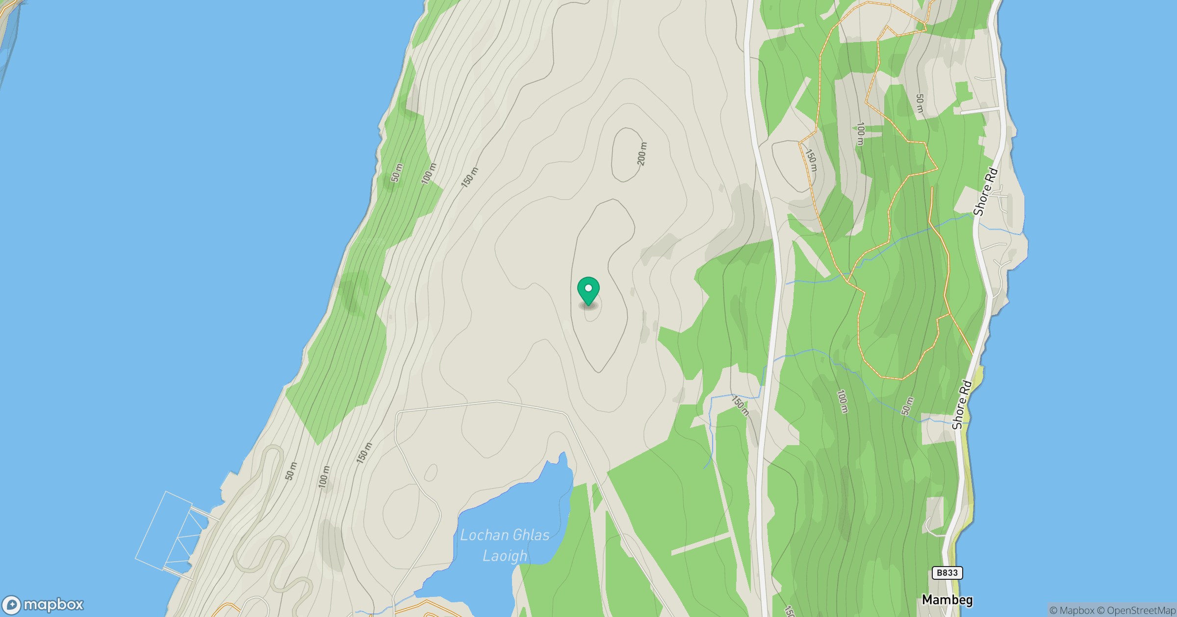
Grid reference: NS222902
View on OpenStreetMapOpens a map in a new tab, centred on the hill.
Hills within 30 km
Straight-line distance, not a walking route or confirmation of access.

No comments yet. Be the first.