
Creachan Mor
Good walks are even better shared.
Overview
Creachan Mor: A Hidden Gem in the Highlands
Nestled within the stunning Scottish Highlands, Creachan Mor rises to an elevation of 814 meters. This peak is a testament to nature's rugged beauty and offers outdoor enthusiasts an array of experiences.
Geology
Creachan Mor is predominantly formed from schist, a metamorphic rock rich in history, having been shaped during the Caledonian Orogeny. Adventurers can marvel at the ancient geology that has carved out this landscape over millions of years.
Routes
Inverlochlarig Route
This moderate 8 km trail begins at Inverlochlarig and follows a picturesque path through heather-covered moors. Expect to take about 3.5 hours to savour the landscapes while working up a sweat.
Automobile Road Route
If you’re in the mood for a gentle stroll, the 5 km road route is ideal. Suitable for families and those preferring a leisurely outing, it should only take around 2 hours.
Summit Features
Reaching the summit, hikers are greeted by a humble yet inviting cairn. It's an ideal spot to rest those weary legs and enjoy a picnic, or simply revel in the stunning panoramas. Look out for the trig point nearby, perfect for capturing that ‘I conquered this mountain’ selfie!
Terrain Type
The journey to Creachan Mor features grassy slopes interspersed with rocky outcrops. Keep your eyes peeled for the occasional boggy patch that may test your footwear choice. Waterproofs are recommended—no one enjoys squelchy socks!
Views
Highlights
Vistas from the summit are nothing short of spectacular! With Loch Katrine and Ben Venue gracing the horizon, it’s an Instagram-worthy view. On the right day, the beauty of Trossachs National Park unfolds in all its glory.
Best Seasons
Spring and autumn are the prime seasons to visit. These times usher in vibrant wildlife and extraordinary views, combined with usually stable weather conditions.
Hazards
The Highland weather can change quicker than you can say 'ooh, that looks like rain!' Sudden off-and-on rain and wind can occur, making sturdy, waterproof clothing essential. Mind the slippery rocks and boggy areas too—your safety is paramount!
Nearby Summits
For those looking to tick off some more peaks, nearby Ben Ledi (879 m) and Ben Venue (724 m) are excellent companions to your hiking adventure.
Access
Finding your way to Creachan Mor is a breeze. The nearest parking is a layby a little off Inverlochlarig Road, just be early to secure a spot!
Public Transport
Infrequent bus services from Callander serve as your only public transport option, so plan ahead for those schedules.
Nearest Town
Callander, just ten clicks away, provides a quaint selection of cafes and shops for your pre- or post-hike treats.
Facilities
Facilities near Creachan Mor are minimal, but don't fret! Callander has all the necessary amenities you might need—from pubs to shops to toilets. Just remember to pack your own food for the summit!
History
Name Meaning
Creachan Mor means 'the big hill', and rightly so, as it reigns over its surroundings with pride.
Significance
Beyond its natural beauty, Creachan Mor is woven into the local folklore, often celebrated in stories by early settlers.
Whether you fancy a good workout or a laid-back jaunt, Creachan Mor has something to offer. Lace-up those boots and set off on an adventure filled with breathtaking views and rich history!
Explore routes near Creachan Mor
Public walks starting within 80 km of this hill. Nearby does not mean a route reaches the summit; check its map and access before setting out.
Glen Kin group walk
View route
Bishop’s Glen group walk
View route
West Bay walk and talk
View route
West Bay walk and talk
View route
Route planning notes
These notes describe possible approaches, not verified navigable routes or permission to cross land. Check current paths, local access rules and conditions before setting out.
Inverlochlarig Route
A scenic route starting from Inverlochlarig that follows a well-trodden track across open moorland.
Automobile Road Route
A leisurely walk from the nearest car park along the road; suited for those who fancy a relaxed outing.
Make a day of it, together
Find someone to share the walk with, or organise a day out along a route you like.
Hill facts and local notes
Classifications
Elevation
657m
2,156 ft
Prominence
112m
Coordinates
56.0833, -4.9157
NS186916
OS Map
56
Explorer: OL37N 363N
At the Summit
The summit features a modest cairn that serves as both a marker and a perfect spot for a well-deserved snack break. On clear days, a trig point can be spotted in the vicinity, adding to the photo opportunities.
Terrain & Geology
Creachan Mor is primarily composed of metamorphic rocks, particularly schist, formed during the Caledonian Orogeny. This ancient rock formation gives the hill its rugged terrain and distinct character.
Views & Scenery
From the summit, hikers can admire views of the surrounding Trossachs National Park, including Loch Katrine and Ben Venue. On a clear day, the scenery is simply breathtaking.
History & Heritage
Name Origin
The name 'Creachan Mor' translates to 'the big hill', a fitting moniker for a peak that looms majestically over its surroundings.
Historical Significance
Like many peaks in the Highlands, Creachan Mor is steeped in folklore and has been part of local legends regarding early settlers and nature spirits.
Getting There & Facilities
Check current local access restrictions, parking rules and transport timetables before travelling. These notes do not confirm public access to the summit.
Parking
The nearest parking area is located at the small layby near the start of the Inverlochlarig road. It's crucial to arrive early, as it fills up quickly during peak season.
Public Transport
The nearest public transport link is from Callander, with infrequent bus services that connect to the surrounding areas. Make sure to check the latest schedules.
Nearby Facilities
Facilities are limited; however, Callander offers cafes, restaurants, and public toilets. Remember to pack your own snacks to enjoy at the summit!
Safety Information
Known Hazards
- Beware of sudden weather changes typical of the Highlands, and be cautious of slippery rocks and boggy ground, especially after wet weather.
General Safety Tips
- Check weather conditions before setting out
- Carry appropriate clothing and equipment
- Let someone know your planned route
- Take a map, compass, and GPS device
- Carry emergency supplies: food, water, first aid kit, torch
Hills
Some common questions about the hills answered
Are there group walks up Creachan Mor?
Many walkers use Walkmates to join or organise walks with others. You can check for group walks around Creachan Mor through the maps
Are there other walkers around Creachan Mor?
Activity varies by location and time, but Walkmates lets you see whether others have shared walks or shown interest in this area. Find other people through the walking friends search walking friends for Creachan Mor search or of course create your own walk for Creachan Mor
Can I organise a walk to Creachan Mor?
Yes. If there aren’t any walks listed already, you can create a walk and make it available for others to join.
If you're signed up to Walkmates, you can create a walk to Creachan Mor.
How do I find a walk up this hill?
There are often multiple ways to walk this hill, depending on experience and route preference. Walkmates helps you explore walks and routes that others have shared.
Can I suggest a new route up Creachan Mor?
Yes. You can suggest or create routes to share with others. Walkmates focuses on the social side of walking, so routes are used to help people organise walks and explore areas together, rather than as detailed navigation tools or route libraries.
Other uses really appreciate knowledgeable walkers sharing their routes. Share your favourite route to Creachan Mor here
The is an error or something incorrect about this hill. How do I let you know?
We always strive to keep the information on Walkmates as accurate as possible. If you find an error, please let us know through the contact form and we'll aim to correct it as quickly as possible
Community Discussion
Comments
Location
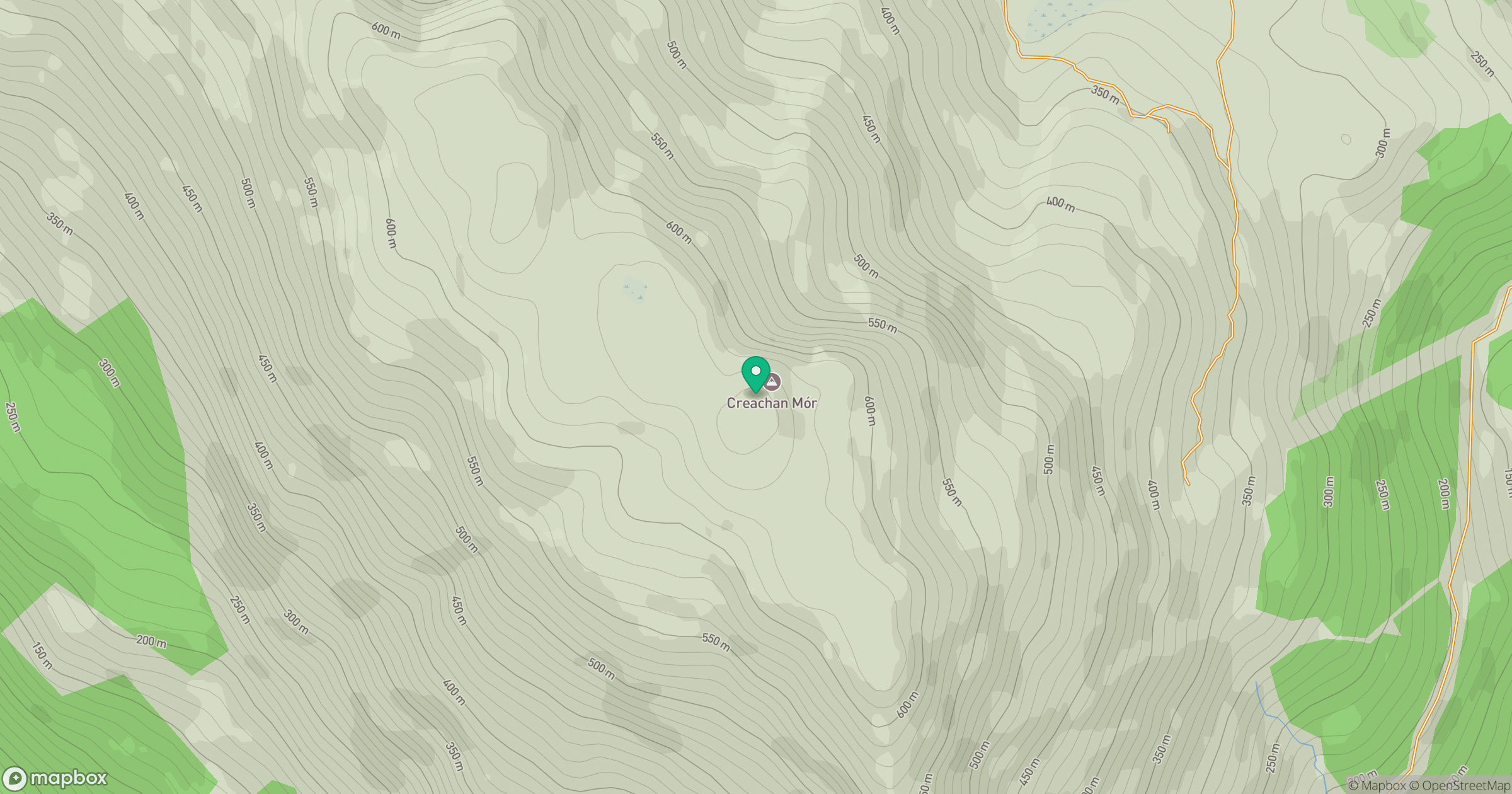
Grid reference: NS186916
View on OpenStreetMapOpens a map in a new tab, centred on the hill.
Hills within 30 km
Straight-line distance, not a walking route or confirmation of access.

No comments yet. Be the first.