
Beinn Ghlas
Good walks are even better shared.
Overview
Beinn Ghlas
Located in the breathtaking Scottish Highlands, Beinn Ghlas stands at a height of 1,103 meters and is classified as a Munro, offering a splendid adventure for hikers. Known for its rugged beauty and enticing views, it's a worthy peak for your hiking portfolio.
Geology
As you make your way up Beinn Ghlas, take a moment to appreciate the geology beneath your feet. The mountain is made up of metamorphic rock, specifically schist and gneiss, which has been shaped over millions of years. Not only are these rocks ancient, but they also contribute to the distinct character of this majestic mountain.
Route
Begin your ascent from the Ben Lawers Visitor Centre. This established route is a well-trodden path that provides a moderate challenge, making it suitable for those with a reasonable level of fitness. Expect to cover approximately 6.5 km, with an estimated time of around 3.5 hours to reach the summit.
Summit Features
The summit of Beinn Ghlas boasts a striking trig point that acts as a magnificent landmark. It's an irresistible spot for a photograph, especially with the sweeping vistas that stretch out below. Don’t forget to snap a pic and pretend you’re a mountain goat surveying your domain!
Terrain Type
The varied terrain includes rocky paths mixed with grassy slopes, though some boggy areas may surprise you, particularly after rainfall. A sturdy pair of boots is recommended—fashionable sneakers might not make the cut here!
Views
Oh, the views! Once at the summit, you’ll be greeted by a panorama of breathtaking sights, including Loch Tay and the majestic Ben Lawers to the north. For the best experience, aim to visit during late spring or early autumn when the landscape bursts with colour and clarity.
Hazards
While this is an accessible hike, don't underestimate the hazards: slippery paths can catch you off guard, especially when the weather decides to misbehave. Keep an eye on the changing conditions, and make sure to have a proper map and compass.
Nearby Summits
If you’re up for more adventure, consider bagging nearby summits such as Ben Lawers (the king of the stack at 1,214 meters) and Meall Greigh at 1,039 meters. Adding these to your list ensures your hiking stories never fall flat!
Access
Most will find parking at the Ben Lawers Visitor Centre. Alternatively, public transport links are available from Killin, but be mindful of their limited frequency. With a bit of planning, you'll be all set to explore.
Facilities
Upon your return, refuel at the café in the visitor centre. They serve a delightful selection of refreshments—just the thing to regain your strength after conquering Beinn Ghlas.
History
The name 'Beinn Ghlas', meaning 'Grey Hill' in Gaelic, encapsulates the essence of this marvellous mountain. It also has significant ecological importance, being part of the Ben Lawers range, which is designated as a site of Special Scientific Interest.
Gather your hiking gear and set forth to Beinn Ghlas—the reward is well worth the effort!
Explore routes near Beinn Ghlas
Walks starting near this hill. Open a route to check its map, distance and full itinerary.
Crinan Canal: Bellanoch and Dunardry towpath return
View route
Glen Kin group walk
View route
Bishop’s Glen group walk
View route
West Bay morning walk and silent disco
View route
Route planning notes
These notes describe possible approaches. Check a route's map and access information when planning your walk.
Beinn Ghlas and Ben Lawers via Nature Reserve
This popular route starts from the Ben Lawers Nature Reserve car park, following a clear path that ascends steadily through heather and grassland. The trail leads to the summit of Beinn Ghlas before continuing to the neighbouring Munro, Ben Lawers, offering exceptional views across Loch Tay. This is the classic route for those aiming to bag both peaks in one outing.
Beinn Ghlas Circuit via Coire Odhar
This circular route begins at the Ben Lawers Nature Reserve car park and follows the main path to Beinn Ghlas. From the summit, the descent leads south-eastward into Coire Odhar, looping back on a less-trodden path that reconnects with the starting point. This quieter route offers a more secluded experience while still delivering incredible views.
Beinn Ghlas from Lochan na Lairige
Starting from the Lochan na Lairige dam, this lesser-known route ascends Beinn Ghlas via the southern ridge. The path is faint in places but offers a more direct approach to the summit. This route is ideal for experienced hillwalkers seeking a quieter ascent.
Beinn Ghlas and Meall Corranaich Traverse
This challenging traverse begins at the Ben Lawers Nature Reserve car park and climbs Beinn Ghlas before heading west to Meall Corranaich. The route involves some steep sections and requires good navigation skills, but rewards walkers with panoramic views and a sense of achievement.
Beinn Ghlas Short Ascent
This straightforward route is suitable for those with limited time or looking for a simpler walk. Starting from the Ben Lawers Nature Reserve car park, the trail ascends directly to the summit of Beinn Ghlas. Though short, the route still offers stunning views over the surrounding peaks and Loch Tay.
Make a day of it, together
Find someone to share the walk with, or organise a day out along a route you like.
Hill facts and local notes
Classifications
Elevation
420m
1,378 ft
Prominence
197m
Coordinates
56.1437, -5.2382
NR989992
OS Map
55
Explorer: 360S
At the Summit
The summit of Beinn Ghlas features a prominent trig point, which has become a traditional photo spot for hikers. The surrounding landscape is dotted with small boulders and there is a small cairn marking the peak.
Terrain & Geology
Beinn Ghlas is predominantly composed of metamorphic rock, particularly schist and gneiss, which gives it a rugged appearance. These rocks are ancient and were formed under extreme pressure and temperature, making them a fascinating subject for geologists.
Views & Scenery
From the summit, you can enjoy spectacular views of Loch Tay, the Tarmachan Ridge, and the peak of Ben Lawers, which stands majestically to the north.
History & Heritage
Name Origin
The name 'Beinn Ghlas' translates to 'Grey Hill' in Gaelic, referencing the often misty and cloud-covered peak.
Historical Significance
The mountain is part of the Ben Lawers range, a site of Special Scientific Interest known for its rare plant species and diverse ecology.
Getting There & Facilities
Parking
The nearest parking is at the Ben Lawers Visitor Centre, which has a large car park available to visitors. A small fee may apply.
Public Transport
The nearest bus service operates from the town of Killin, which can connect to other public transport networks. However, services may be limited.
Nearby Facilities
The Ben Lawers Visitor Centre has toilets and a small café serving refreshments, perfect for a pre or post-hike treat.
Safety Information
Known Hazards
- Be wary of slippery paths, especially in wet conditions; also be cautious of sudden weather changes that can occur in the Highlands.
General Safety Tips
- Check weather conditions before setting out
- Carry appropriate clothing and equipment
- Let someone know your planned route
- Take a map, compass, and GPS device
- Carry emergency supplies: food, water, first aid kit, torch
Hills
Some common questions about the hills answered
Are there group walks up Beinn Ghlas?
Many walkers use Walkmates to join or organise walks with others. You can check for group walks around Beinn Ghlas through the maps
Are there other walkers around Beinn Ghlas?
Activity varies by location and time, but Walkmates lets you see whether others have shared walks or shown interest in this area. Find other people through the walking friends search walking friends for Beinn Ghlas search or of course create your own walk for Beinn Ghlas
Can I organise a walk to Beinn Ghlas?
Yes. If there aren’t any walks listed already, you can create a walk and make it available for others to join.
If you're signed up to Walkmates, you can create a walk to Beinn Ghlas.
How do I find a walk up this hill?
There are often multiple ways to walk this hill, depending on experience and route preference. Walkmates helps you explore walks and routes that others have shared.
Can I suggest a new route up Beinn Ghlas?
Yes. You can suggest or create routes to share with others. Walkmates focuses on the social side of walking, so routes are used to help people organise walks and explore areas together, rather than as detailed navigation tools or route libraries.
Other uses really appreciate knowledgeable walkers sharing their routes. Share your favourite route to Beinn Ghlas here
The is an error or something incorrect about this hill. How do I let you know?
We always strive to keep the information on Walkmates as accurate as possible. If you find an error, please let us know through the contact form and we'll aim to correct it as quickly as possible
Community Discussion
Comments
Location
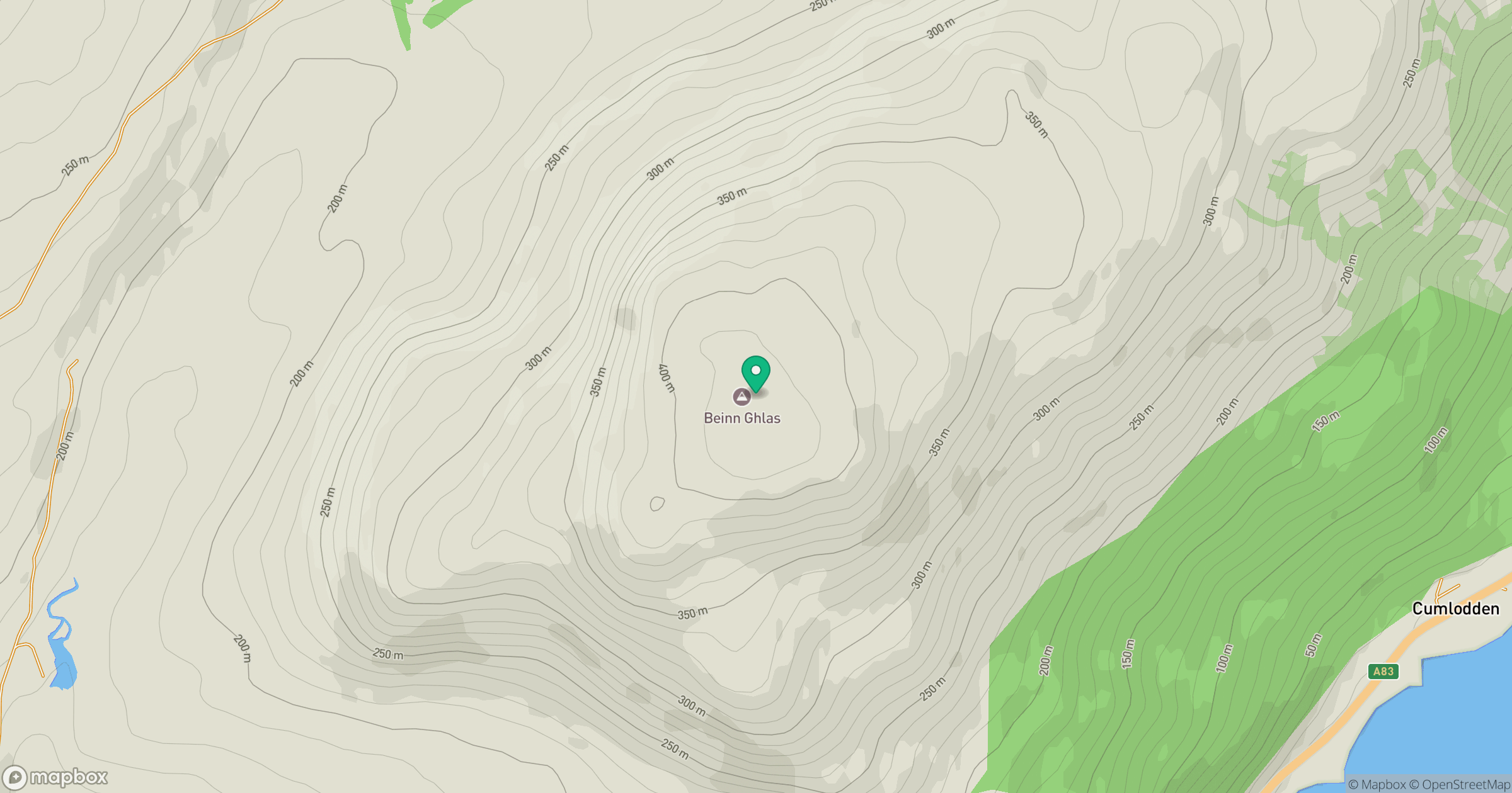
Grid reference: NR989992
View on OpenStreetMapOpens a map in a new tab, centred on the hill.

No comments yet. Be the first.