
Clach Bheinn
Good walks are even better shared.
Overview
Clach Bheinn
Nestled in the stunning Scottish Highlands, Clach Bheinn stands tall at 735 meters, classified as a Marilyn. Its distinctive geology primarily consists of schist, presenting a rugged terrain that captivates hikers and nature enthusiasts alike.
Routes to the Summit
A popular route starts from Inversnaid, covering approximately 8km and taking around 4 hours to complete. The charming ascent starts in the village, where you'll traverse a combination of forest paths leading you up the beautiful open slopes, along with the occasional rocky outcrop that may have you channeling your inner mountain goat!
The Summit Experience
At the summit, you'll find a modest cairn marking the peak. While it doesn't boast impressive grandeur, it provides a reliable spot for weary climbers to take a well-deserved rest and enjoy the surrounding vistas.
The views from the top are nothing short of spectacular. On a clear day, enjoy the breathtaking landscape of Loch Lomond and its adjacent peaks, including the majestic Ben Lomond. Late spring and early autumn are ideal times to visit, as you'll dodge the midges and revel in crisp, clear air.
Hazards and Safety
As with any Scottish hillwalking, be aware that conditions can change in the blink of an eye, often bringing rain when you'd least expect it. Lower sections can be boggy, so watch those footing placements!
Accessibility
Accessing Clach Bheinn is quite straightforward. There is a small parking area in Inversnaid, which can get busy, so don't be late to the party. Public transportation options exist, with buses connecting from Glasgow and other areas.
Nearby, you'll find the quaint village of Inversnaid, perfect for a post-hike meal at the local hotel or a quick coffee at the café.
Conclusion
So, if you’re up for an adventure, pack your gear and set out towards Clach Bheinn. Whether you’re a seasoned climber or just looking for a day in the hills, this Marilyn will not disappoint!
Explore routes near Clach Bheinn
Public walks starting within 80 km of this hill. Nearby does not mean a route reaches the summit; check its map and access before setting out.
Beinn Ime from Succoth
View route
The Cobbler from Succoth Carpark
View route
Glen Kin group walk
View route
Ben Lomond in the trossachs
View route
Route planning notes
These notes describe possible approaches, not verified navigable routes or permission to cross land. Check current paths, local access rules and conditions before setting out.
North-East Route from Inversnaid
A scenic ascent starting from the village of Inversnaid, offering a mix of forest paths and open hillside.
Make a day of it, together
Find someone to share the walk with, or organise a day out along a route you like.
Hill facts and local notes
Classifications
Elevation
441m
1,447 ft
Prominence
134m
Coordinates
56.1173, -4.8775
NS212953
OS Map
56
Explorer: OL37N 363N
At the Summit
The summit is marked by a modest cairn, which may not win any architectural awards, but serves as a reliable target for hikers.
Terrain & Geology
Clach Bheinn is primarily composed of schist, which is metamorphic rock noted for its layered appearance. This geological feature contributes to the rugged and picturesque character of the region.
Views & Scenery
From the summit, you can enjoy breathtaking views over Loch Lomond and the surrounding peaks, including Ben Lomond and the Arrochar Alps.
History & Heritage
Name Origin
Clach Bheinn translates to 'rocky hill' in Gaelic, aptly describing its rugged character.
Historical Significance
The mountain has been a part of local folklore, with many stories associated with its scenic beauty and challenging climbs.
Getting There & Facilities
Check current local access restrictions, parking rules and transport timetables before travelling. These notes do not confirm public access to the summit.
Parking
There is a small parking area at Inversnaid, which can get busy on weekends. Arriving early is recommended.
Public Transport
Buses run from various locations including Glasgow to Inversnaid, making it accessible for those without a car.
Nearby Facilities
Inversnaid has a hotel and a small café where you can grab a warm drink or a bite to eat after your adventure.
Safety Information
Known Hazards
- Weather can change rapidly, so always be prepared for the unexpected. Some sections can be slippery in wet weather.
General Safety Tips
- Check weather conditions before setting out
- Carry appropriate clothing and equipment
- Let someone know your planned route
- Take a map, compass, and GPS device
- Carry emergency supplies: food, water, first aid kit, torch
Hills
Some common questions about the hills answered
Are there group walks up Clach Bheinn?
Many walkers use Walkmates to join or organise walks with others. You can check for group walks around Clach Bheinn through the maps
Are there other walkers around Clach Bheinn?
Activity varies by location and time, but Walkmates lets you see whether others have shared walks or shown interest in this area. Find other people through the walking friends search walking friends for Clach Bheinn search or of course create your own walk for Clach Bheinn
Can I organise a walk to Clach Bheinn?
Yes. If there aren’t any walks listed already, you can create a walk and make it available for others to join.
If you're signed up to Walkmates, you can create a walk to Clach Bheinn.
How do I find a walk up this hill?
There are often multiple ways to walk this hill, depending on experience and route preference. Walkmates helps you explore walks and routes that others have shared.
Can I suggest a new route up Clach Bheinn?
Yes. You can suggest or create routes to share with others. Walkmates focuses on the social side of walking, so routes are used to help people organise walks and explore areas together, rather than as detailed navigation tools or route libraries.
Other uses really appreciate knowledgeable walkers sharing their routes. Share your favourite route to Clach Bheinn here
The is an error or something incorrect about this hill. How do I let you know?
We always strive to keep the information on Walkmates as accurate as possible. If you find an error, please let us know through the contact form and we'll aim to correct it as quickly as possible
Community Discussion
Comments
Location
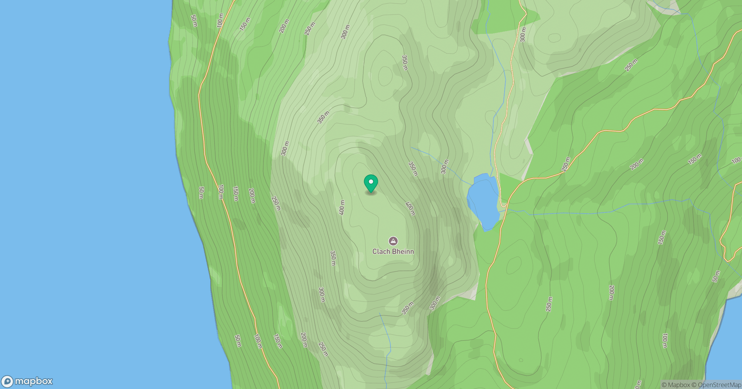
Grid reference: NS212953
View on OpenStreetMapOpens a map in a new tab, centred on the hill.
Hills within 30 km
Straight-line distance, not a walking route or confirmation of access.

No comments yet. Be the first.