

Clitheroe Castle Hill
Good walks are even better shared.
SD7441 : Old entrance through the castle buildings
John S Turner Photo source
Overview
Clitheroe Castle Hill
Clitheroe Castle Hill offers not only a gentle hike but also a delve into history. Standing at an elevation of just 80 meters, it’s a perfect outing for both seasoned hikers and those more accustomed to walking around the shopping centre!
Geological Overview
The hill itself is a splendid example of gritstone formation, with a few precarious rocks that might make you consider taking the next step with a bit of trepidation. It’s a landscape shaped by nature itself, and the view? Simply unbeatable!
Hiking Routes
The most popular route starts at Clitheroe’s bustling town centre. It's a leisurely 1.5 km walk taking about half an hour. Perfect for those who think a stroll in the park qualifies as adventuring! The path is well-marked; you really can't miss it — unless you're busy taking selfies!
Summit Features
As you reach the summit, you are immediately greeted by the historic remains of Clitheroe Castle, complete with an impressive keep. This spot is not just a walker’s paradise but also a history buff’s dream!
Scenic Views
From the summit, you’ll soak up sweeping panoramas of the Ribble Valley, Pendle Hill, and the pastel-hued peaks of the Forest of Bowland, especially glorious in spring and autumn. Get your camera ready, because these views are worth a thousand words!
Hazards to Consider
While the hike is relatively straightforward, remember to watch your footing near the castle ruins. It’d be a bit embarrassing to tell your friends you took a tumble at a historic site!
Local Access
Parking is a doddle with options available near Clitheroe’s Market Hall. If you're travelling via public transport, Clitheroe is well-connected by buses and trains, making it easy peasy to get to one of Lancashire’s iconic spots.
Facilities
Once you’re done flexing those leg muscles, grab a cuppa at one of Clitheroe’s charming cafes. Public toilets are conveniently located in the town for your comfort.
A Little History
As for the name, ‘Clitheroe’ refers to a muddy stream and hill, giving a little nod to its ancient roots. The castle, first built in the 12th century, played a crucial role in the area’s history and is still a centrepiece of local culture today.
In conclusion, Clitheroe Castle Hill is a delightful spot to stretch your legs, enjoy the fresh air, and take a wander through history. No matter your fitness level, it is a hike that most could tackle without breaking a sweat—unless, of course, you’re competing to be the first to the top!
Explore routes near Clitheroe Castle Hill
Walks starting near this hill. Open a route to check its map, distance and full itinerary.
Clitheroe Walk with Men Walking & Talking
View route
Stocks Reservoir: full circuit from School Lane
View route
Thieveley Pike, The Singing Ringing Tree loop from Holme Chapel
View route
Brockholes Reserve Tour
View route
Route planning notes
These notes describe possible approaches. Check a route's map and access information when planning your walk.
Clitheroe Town Centre to Castle Hill
A well-marked path leading directly from Clitheroe’s town centre to the summit, ideal for families and casual walkers.
Make a day of it, together
Find someone to share the walk with, or organise a day out along a route you like.
Photo Gallery
View all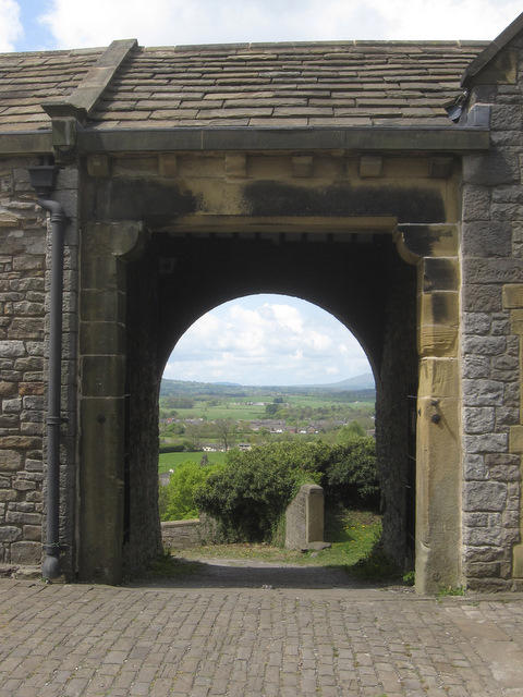 Photo could not load
SD7441 : Old entrance through the castle buildings
John S Turner
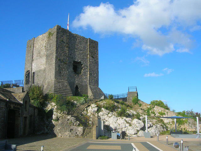 Photo could not load
SD7441 : Clitheroe Castle keep
John H Darch
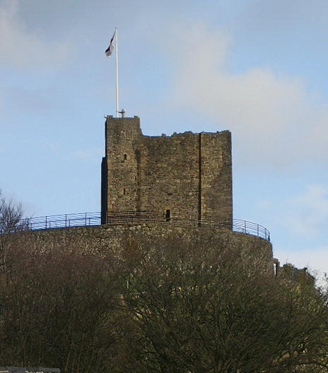 Photo could not load
SD7441 : Clitheroe Castle
Alexander P Kapp
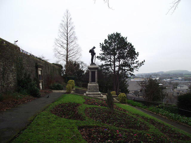 Photo could not load
SD7441 : War Memorial, Clitheroe
philandju
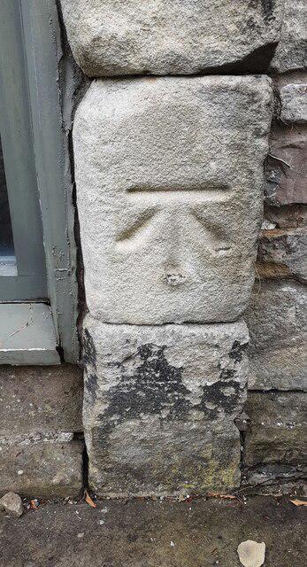 Photo could not load
SD7441 : Benchmark on building at Clitheroe Castle south of the castle keep
Roger Templeman
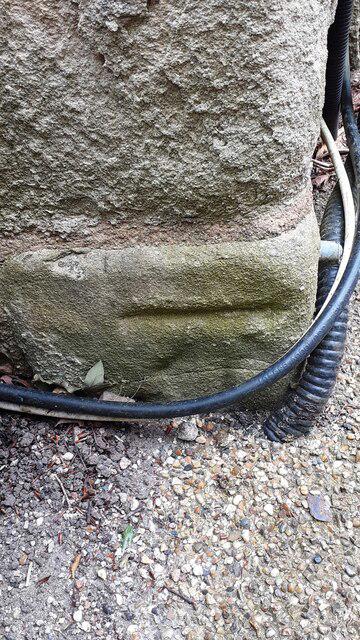 Photo could not load
SD7441 : Benchmark on Castle Museum
Roger Templeman
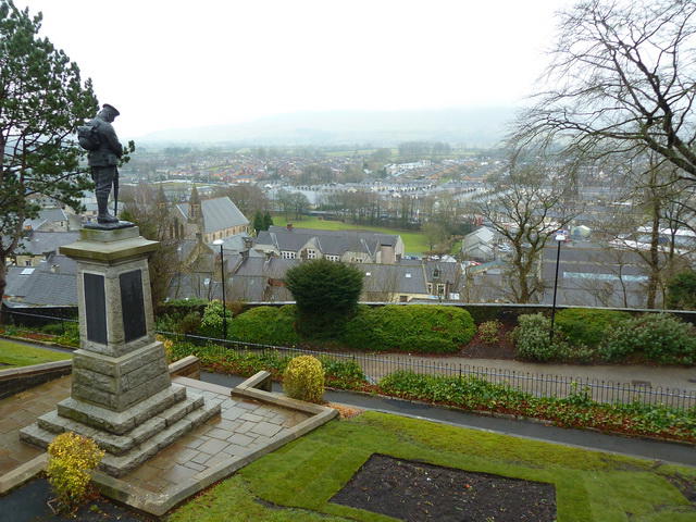 Photo could not load
SD7441 : Clitheroe
Alexander P Kapp
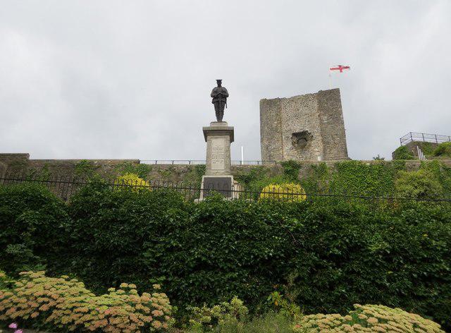 Photo could not load
SD7441 : War Memorial and Castle Keep, Clitheroe
philandju
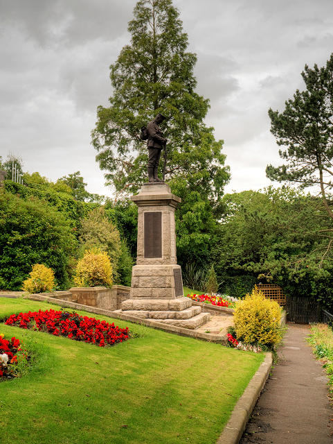 Photo could not load
SD7441 : Clitheroe War Memorial and Garden of Remembrance, Castle Hill
David Dixon
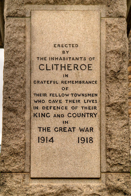
SD7441 : Dedication on Clitheroe War Memorial
David Dixon
Hill facts and local notes
Classifications
Elevation
116m
381 ft
Prominence
34m
Coordinates
53.8709, -2.3933
SD742416
OS Map
103
Explorer: OL41E
At the Summit
At the summit, you will find the historic remains of Clitheroe Castle, featuring a keep and stunning views of the Ribble Valley.
Terrain & Geology
The hill is predominantly composed of gritstone, with remnants of sedimentary layers, lending a rugged charm along its slopes.
Views & Scenery
Breathtaking views of the Ribble Valley, Pendle Hill, and the distant peaks of the Forest of Bowland.
History & Heritage
Name Origin
The name 'Clitheroe' is derived from the Old English 'Clither', meaning a muddy stream, and 'hoh', meaning hill.
Historical Significance
The castle dates back to the 12th century and played a key role in local governance and defence during the medieval period.
Getting There & Facilities
Parking
There is ample parking available at Clitheroe’s Market Hall and the nearby Castle Street car park.
Public Transport
Clitheroe has good bus services connecting to regional towns. The nearest railway station is a short walk from the town centre.
Nearby Facilities
Cafes and shops are plentiful in Clitheroe, as well as public toilets near the castle and town centre.
Safety Information
Known Hazards
- Watch out for uneven terrain and exposed edges near the castle ruins; it’s best to keep an eye on little ones!
General Safety Tips
- Check weather conditions before setting out
- Carry appropriate clothing and equipment
- Let someone know your planned route
- Take a map, compass, and GPS device
- Carry emergency supplies: food, water, first aid kit, torch
Hills
Some common questions about the hills answered
Are there group walks up Clitheroe Castle Hill?
Many walkers use Walkmates to join or organise walks with others. You can check for group walks around Clitheroe Castle Hill through the maps
Are there other walkers around Clitheroe Castle Hill?
Activity varies by location and time, but Walkmates lets you see whether others have shared walks or shown interest in this area. Find other people through the walking friends search walking friends for Clitheroe Castle Hill search or of course create your own walk for Clitheroe Castle Hill
Can I organise a walk to Clitheroe Castle Hill?
Yes. If there aren’t any walks listed already, you can create a walk and make it available for others to join.
If you're signed up to Walkmates, you can create a walk to Clitheroe Castle Hill.
How do I find a walk up this hill?
There are often multiple ways to walk this hill, depending on experience and route preference. Walkmates helps you explore walks and routes that others have shared.
Can I suggest a new route up Clitheroe Castle Hill?
Yes. You can suggest or create routes to share with others. Walkmates focuses on the social side of walking, so routes are used to help people organise walks and explore areas together, rather than as detailed navigation tools or route libraries.
Other uses really appreciate knowledgeable walkers sharing their routes. Share your favourite route to Clitheroe Castle Hill here
The is an error or something incorrect about this hill. How do I let you know?
We always strive to keep the information on Walkmates as accurate as possible. If you find an error, please let us know through the contact form and we'll aim to correct it as quickly as possible
Community Discussion
Comments
Location
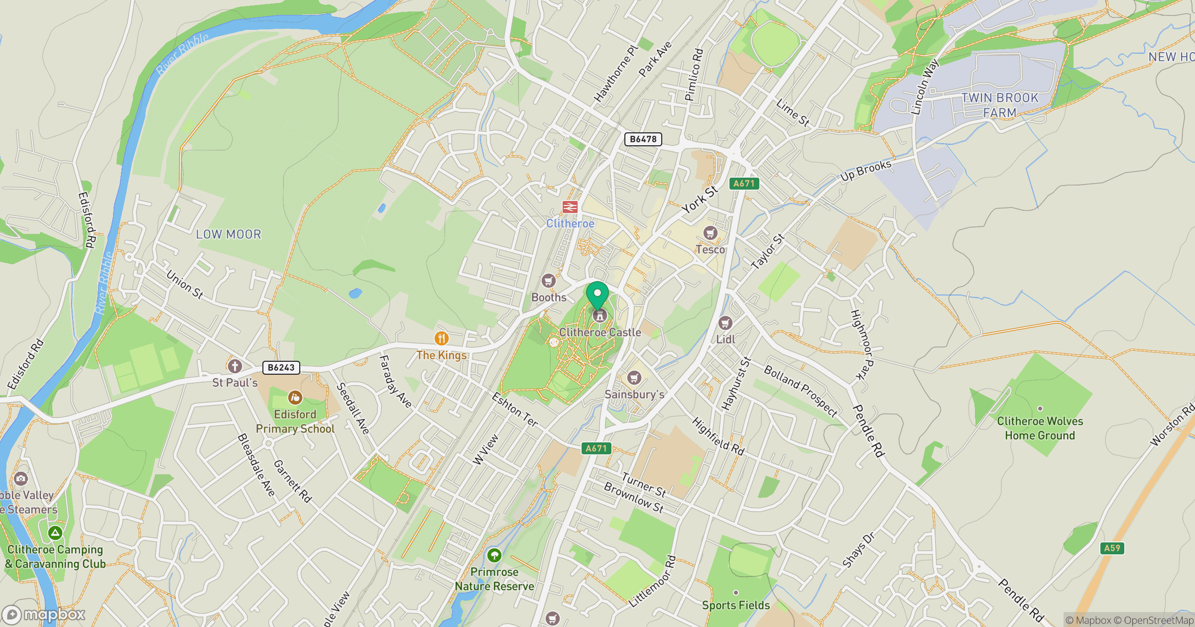
Grid reference: SD742416
View on OpenStreetMapOpens a map in a new tab, centred on the hill.




No comments yet. Be the first.