

Cardigan Island
Good walks are even better shared.
SN1651 : Fishing boat passing up the channel
John Firth Photo source
Overview
Cardigan Island
Cardigan Island, part of the stunning Cardigan Bay, is a delightful destination for nature lovers and casual strollers alike. Surrounded by the wild beauty of the Pembrokeshire coastline, this island might not reach any high altitudes, but it offers a plethora of breathtaking views.
Geology
The cliffs are made of limestone and mudstone, remnants of the Jurassic period. They have weathered beautifully over millions of years, leading to a dramatic coastal landscape that’ll make geology buffs nod in approval.
Access and Parking
The nearest parking can be found in Gwbert, just a short drive or an easy stroll away. Not only is it free, but it’s also a prime spot to admire the initial seaside view before you head off on your adventure. If public transport is your cup of tea, buses from Cardigan take you directly to Gwbert.
The Route
The Coastal Path from Gwbert is an accessible route that spans approximately 3.5 kilometres. It’s an easy trek with gentle elevation changes, allowing flower enthusiasts to really soak in the local flora as the trail winds by the seaside. Just keep your eyes peeled for the sea breeze tackling a bad hair day!
The Views
Once you reach the island, prepare to feast your eyes on panoramic views unlike any other. From rugged cliffs to the sparkling waters of Cardigan Bay, the scenery is a photographer’s dream—just be sure to have your camera charged.
Hazards
Caution is the name of the game! Given the rocky terrain and the cliffs, it's advisable to keep a respectful distance from the edges. Also, watch your step; the ground can get slippery, especially if the good old British weather decides to throw a bit of rain into the mix.
Facilities
While the island lacks facilities, fear not! The nearby Gwbert is resistant to the pull of wilderness and offers cafes and bathrooms, a handy point for a quick refreshment stop.
History
The island's name, deriving from 'Ceredigion', links it closely to the rich history of the area. The island serves as a sanctuary for diverse wildlife, allowing visitors to witness nature thriving like the good old days.
In conclusion, Cardigan Island may not be the tallest or most famous, but it certainly holds its own with stunning views and an inviting atmosphere. So grab your walking shoes and set forth into this enchanting corner of Wales—it’s sure to be a treat!
Explore routes near Cardigan Island
Walks starting near this hill. Open a route to check its map, distance and full itinerary.
Llanerchaeron: Lanlas, Aberaeron and Aeron Valley circular
View route
Abergwili to Nantgaredig: Tywi Valley Path out and back
View route
Neyland to Johnston: Brunel and Westfield Railway Trail
View route
Dolaucothi Estate: Cothi Valley and Red Waymarked Circuit
View route
Route planning notes
These notes describe possible approaches. Check a route's map and access information when planning your walk.
Coastal Path from Gwbert
A scenic route along the Pembrokeshire Coast Path leading to the island, with beautiful views of the coastline.
Make a day of it, together
Find someone to share the walk with, or organise a day out along a route you like.
Photo Gallery
View all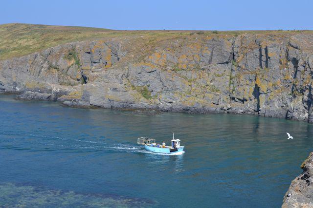 Photo could not load
SN1651 : Fishing boat passing up the channel
John Firth
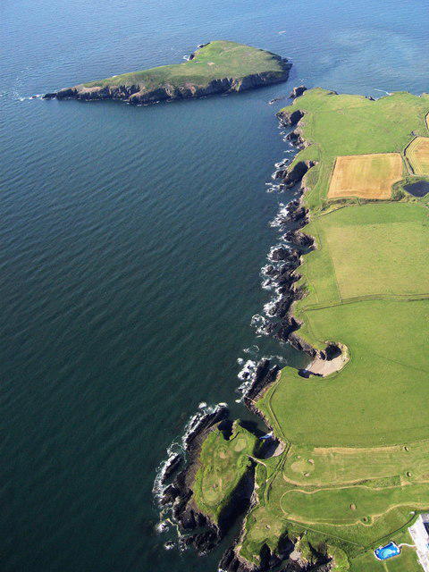 Photo could not load
SN1651 : Aerial view along the estuary to Cardigan Island
Dave Price
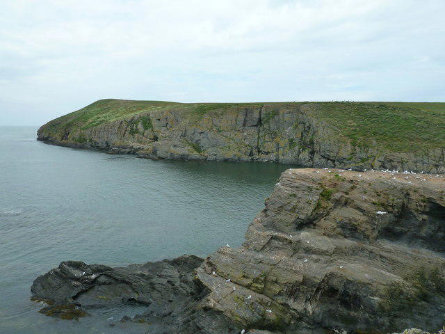 Photo could not load
SN1651 : Looking over Carreg Lydan to Cardigan Island
Dave Spicer
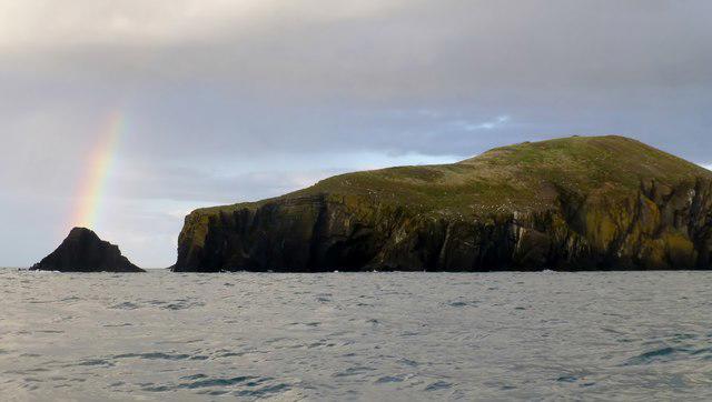 Photo could not load
SN1551 : Tour Around Cardigan Island
Rude Health
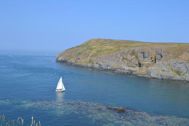 Photo could not load
SN1551 : Cardigan Island and yacht
John Firth
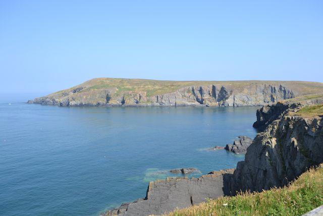 Photo could not load
SN1551 : West end of Cardigan Island from Farm Park
John Firth
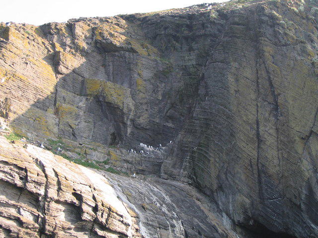 Photo could not load
SN1551 : Guillemots and gulls on Cardigan Island
Flopsy Designs
 Photo could not load
SN1551 : View towards Cardigan Island
Roger Cornfoot
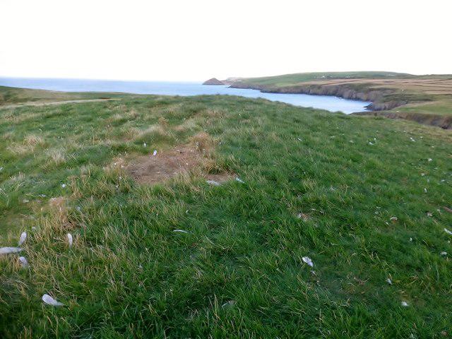 Photo could not load
SN1551 : Cardigan Island
Rude Health
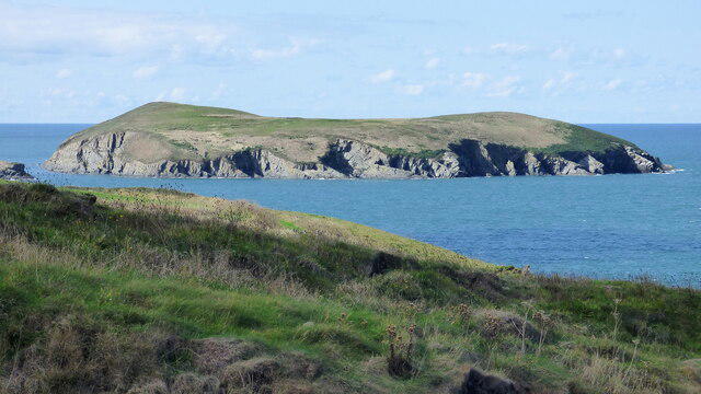
SN1551 : Cardigan Island
Sandy Gerrard
Hill facts and local notes
Classifications
Elevation
52m
171 ft
Prominence
52m
Coordinates
52.1309, -4.6925
SN158514
OS Map
145
Explorer: OL35E 198W
At the Summit
The island features rugged cliffs, with a few areas of grassy plateau. Remarkably, there's no official summit marker, but the highest point offers stunning vistas.
Terrain & Geology
Cardigan Island is primarily composed of limestone and mudstone, representing marine sediments from the Jurassic period. The island's cliffs offer fascinating geological formations dating back millions of years, ideal for both geology enthusiasts and casual visitors.
Views & Scenery
Visitors can enjoy panoramic views of Cardigan Bay, the stunning cliffs of the Pembrokeshire coastline, and on clear days, the distant mountains of Snowdonia.
History & Heritage
Name Origin
The name 'Cardigan' is derived from the Welsh 'Ceredigion', which is believed to mean 'the land of Ceredig'.
Historical Significance
Historically, the island is home to important wildlife habitats, particularly for seabirds and marine life. The area is also steeped in local legend and folklore.
Getting There & Facilities
Parking
Free parking is available at Gwbert, located approximately 1.5 km from the coastal path start.
Public Transport
Regular bus services run from Cardigan to Gwbert. Please check local schedules for current times.
Nearby Facilities
While the island itself has no facilities, Gwbert offers cafes and public toilets.
Safety Information
Known Hazards
- Strong tides and cliff edges require caution; the terrain can be uneven and slippery, especially after rain.
General Safety Tips
- Check weather conditions before setting out
- Carry appropriate clothing and equipment
- Let someone know your planned route
- Take a map, compass, and GPS device
- Carry emergency supplies: food, water, first aid kit, torch
Hills
Some common questions about the hills answered
Are there group walks up Cardigan Island?
Many walkers use Walkmates to join or organise walks with others. You can check for group walks around Cardigan Island through the maps
Are there other walkers around Cardigan Island?
Activity varies by location and time, but Walkmates lets you see whether others have shared walks or shown interest in this area. Find other people through the walking friends search walking friends for Cardigan Island search or of course create your own walk for Cardigan Island
Can I organise a walk to Cardigan Island?
Yes. If there aren’t any walks listed already, you can create a walk and make it available for others to join.
If you're signed up to Walkmates, you can create a walk to Cardigan Island.
How do I find a walk up this hill?
There are often multiple ways to walk this hill, depending on experience and route preference. Walkmates helps you explore walks and routes that others have shared.
Can I suggest a new route up Cardigan Island?
Yes. You can suggest or create routes to share with others. Walkmates focuses on the social side of walking, so routes are used to help people organise walks and explore areas together, rather than as detailed navigation tools or route libraries.
Other uses really appreciate knowledgeable walkers sharing their routes. Share your favourite route to Cardigan Island here
The is an error or something incorrect about this hill. How do I let you know?
We always strive to keep the information on Walkmates as accurate as possible. If you find an error, please let us know through the contact form and we'll aim to correct it as quickly as possible
Community Discussion
Comments
Location
View the hill's mapped position and surrounding paths.
Grid reference: SN158514
View on OpenStreetMapOpens a map in a new tab, centred on the hill.
Nearby Hills
Pen y Fan
142m
Rhossili Down - The Beacon
193m
Yr Eifl
561m
Cadair Idris - Penygadair
893m
Pumlumon Fawr [Plynlimon]
753m
No comments yet. Be the first.