

Ben Vane
Good walks are even better shared.
NN2709 : Summit ridge of Ben Vane
Russel Wills Photo source
Overview
Ben Vane is a steep, rocky Munro in the Arrochar Alps west of Loch Lomond. Its surveyed height is 915.76 m. The usual ascent starts at Inveruglas and climbs the south-east ridge through several false tops to a small summit plateau. Rocky steps and eroded ground make this a strenuous mountain walk despite its modest height. Loch Lomond and the surrounding Arrochar hills are the main views.
Ben Vane from Inveruglas
Ben Vane rises to 915.76 m in the Arrochar Alps. Its steep flanks and repeated rocky tops make it a demanding outing even though it is one of the lowest Munros. The Gaelic name is usually translated as middle hill or middle mountain.
The standard ascent
Start at the paid Inveruglas car park beside Loch Lomond (NN322098). Cross the A82 carefully, pass Sloy Power Station and follow the pedestrian route to the hydro road beneath the railway. Continue past the earlier Arrochar junction; the Ben Vane approach crosses Inveruglas Water farther up the glen. Beyond the next burn, a stepped path leads onto the south-east ridge.
The climb is sustained. Grass gives way to eroded rock steps and a succession of false tops. Short scrambles have easier bypasses, but choosing the right line still matters, particularly in mist or on wet rock. The usual descent retraces the ascent.
Walkhighlands gives 11 km and 4.5–6.5 hours for the full return route. Combining Ben Vane with Beinn Ime or Beinn Narnain involves substantial extra descent and re-ascent over rough ground; those hills are not included in these figures.
Find the true summit
DoBIH identifies the highest point as the rock outcrop at NN 27757 09837, 7 m north-west of a small cairn. The cairn above a gully about 35 m east, at NN 27790 09830, is 0.52 m lower. In cloud, confirm both your summit position and the east/south-east line back to the ascent path before leaving the plateau.
Rock, water and views
BGS maps the summit as Beinn Bheula Schist Formation, comprising metamorphic psammite and pelite. Contains British Geological Survey materials © UKRI 2026.
Clear-weather views include Loch Lomond, Loch Sloy, Beinn Ime, Beinn Narnain and Ben Vorlich. The hydro infrastructure on the approach belongs to the Sloy scheme, constructed from 1945 to 1951.
Planning the day
A local visitor report updated for 2026 lists toilets at Inveruglas and says its café has closed. Bring food and drink, and check current opening times. Citylink and Ember call at the A82 power-station stops; check return times and advance-booking requirements.
Snow and ice can cover the path and complicate the rock steps. Winter conditions call for navigation skills, suitable boots, crampons and an ice axe, with the ability to use them. Short daylight and a slow descent need to be allowed for.
Sloy's proposed pumped-storage conversion received consent in July 2026. Check the SSE project updates and signs at Inveruglas for the latest parking and pedestrian-access arrangements.
Explore routes near Ben Vane
Walks starting near this hill. Open a route to check its map, distance and full itinerary.
Beinn Ime from Succoth
View route
The Cobbler from Succoth Carpark
View route
Ben Lomond in the trossachs
View route
Loch Katrine: Brenachoile Point Shore Walk from Trossachs Pier
View route
Route planning notes
These notes describe possible approaches. Check a route's map and access information when planning your walk.
From Inveruglas via the south-east ridge
From Inveruglas, cross the A82 and follow the path past Sloy Power Station to the hydro road under the railway. Continue beyond the Arrochar turn, then turn left over Inveruglas Water. Take the stepped hill path just beyond the next burn and climb the south-east ridge past rocky steps and false tops. Return the same way. Walkhighlands estimates 11 km and 4.5–6.5 hours for the full return walk.
Make a day of it, together
Find someone to share the walk with, or organise a day out along a route you like.
Photo Gallery
View all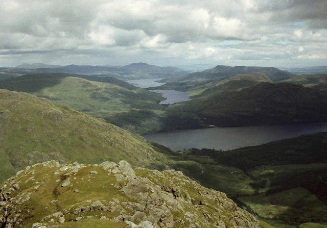 Photo could not load
NN2709 : Summit ridge of Ben Vane
Russel Wills
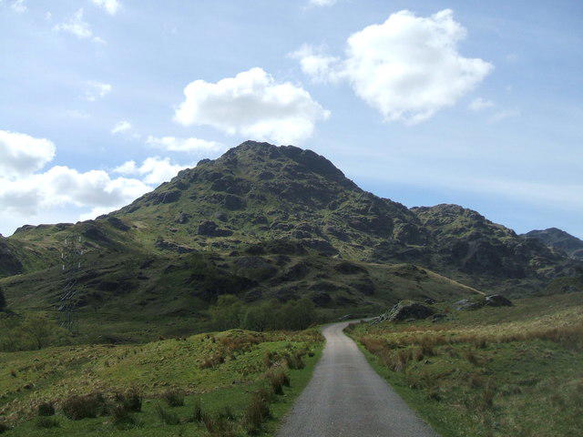 Photo could not load
NN2709 : Ben Vane
Iain Russell
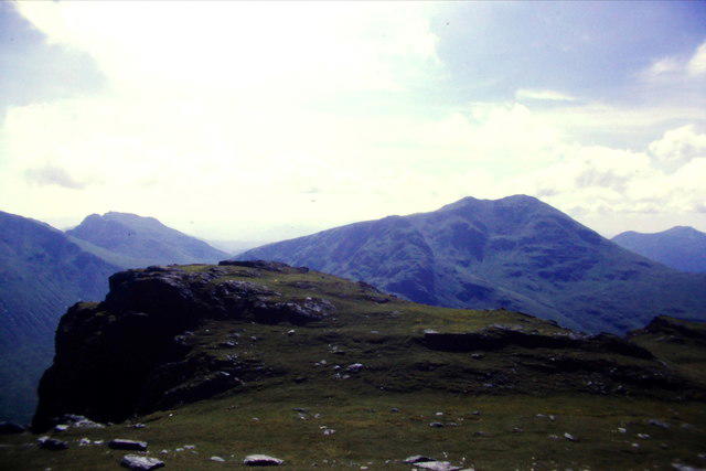 Photo could not load
NN2709 : Towards Ben Ime and The Cobbler from the summit area of Ben Vane
Richard Law
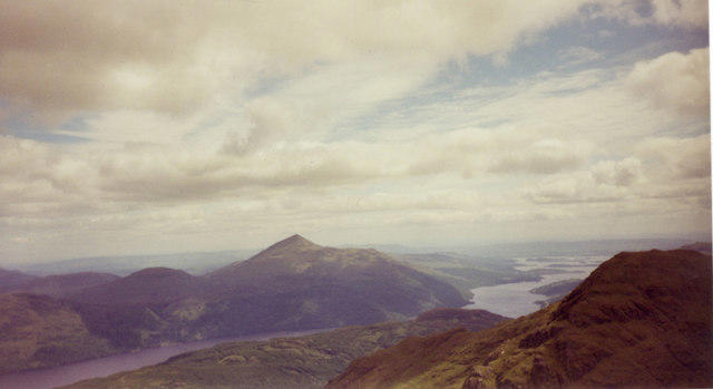 Photo could not load
NN2709 : View Southeast from summit of Ben Vane.
Alan Murray Walsh
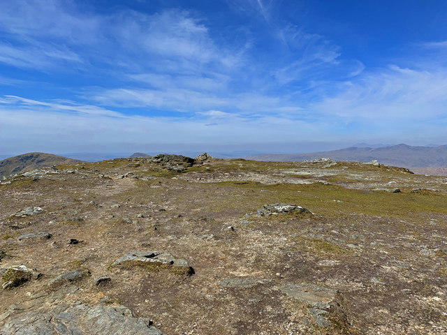 Photo could not load
NN2709 : Summit plateau, Ben Vane
John Allan
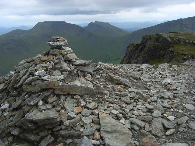 Photo could not load
NN2709 : Ben Vane summit
Andrew Smith
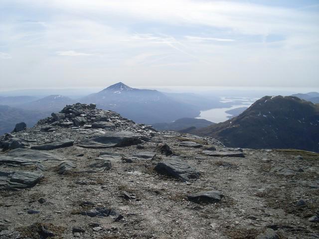 Photo could not load
NN2709 : Summit cairn, Ben Vane
Stephen Sweeney
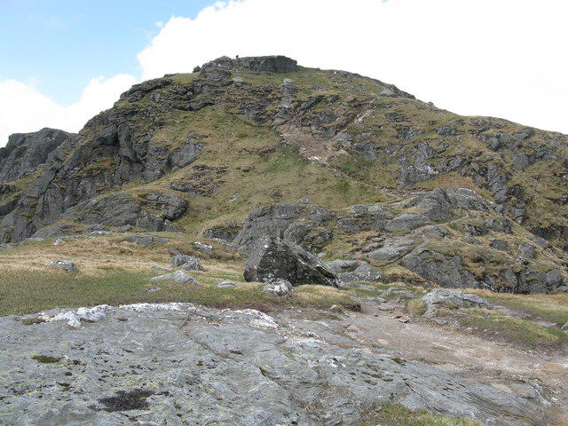 Photo could not load
NN2709 : Ben Vane
G Laird
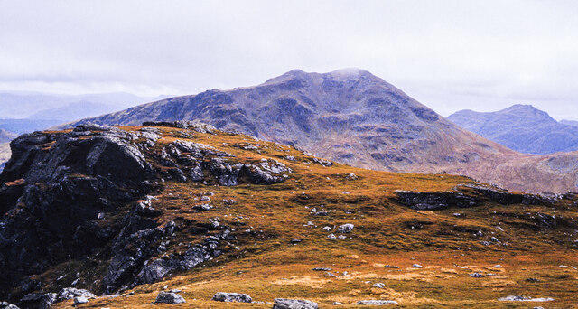 Photo could not load
NN2709 : Ground to south-west of summit of Ben Vane
Trevor Littlewood
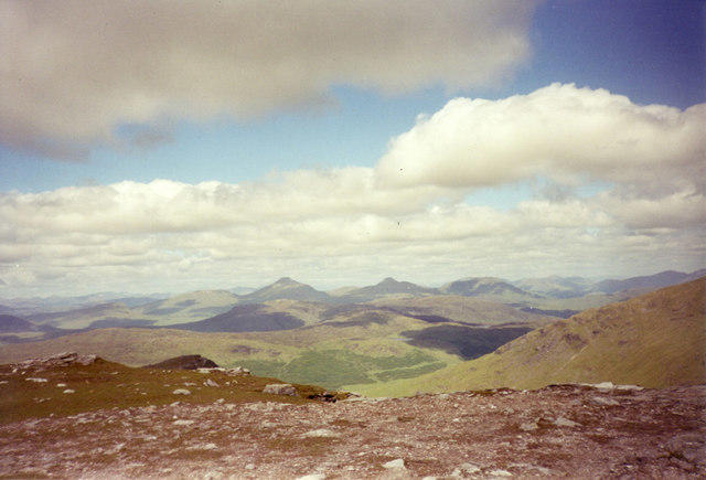
NN2709 : View North from summit of Ben Vane.
Alan Murray Walsh
Hill facts and local notes
Classifications
Elevation
916m
3,004 ft
Prominence
424m
Coordinates
56.2498, -4.7817
NN277098
OS Map
56
Explorer: OL39S 364S
At the Summit
The surveyed highest point is a rock outcrop 7 m north-west of a small cairn, at NN 27757 09837. A separate cairn above a gully, about 35 m east at NN 27790 09830, is 0.52 m lower. Several false tops precede the small summit plateau; reaching a cairn does not by itself identify the highest point.
Terrain & Geology
The summit is mapped as Beinn Bheula Schist Formation: psammite and pelite, metamorphic rocks derived from ancient sedimentary deposits. These belong to the Dalradian Supergroup. Contains British Geological Survey materials © UKRI 2026.
Views & Scenery
In clear weather, the outlook includes Loch Lomond, Loch Sloy and the surrounding Arrochar Alps, including Beinn Ime, Beinn Narnain and Ben Vorlich. Higher neighbouring hills limit parts of the wider panorama.
History & Heritage
Name Origin
Ben Vane is commonly translated from Gaelic Beinn Mheadhain as “middle hill” or “middle mountain”.
Historical Significance
The approach passes the Sloy hydroelectric scheme. Construction began in 1945 and was completed in 1951, the first scheme developed under the North of Scotland Hydro-Electric Board. Its power station, pipelines and access roads remain prominent features of the Inveruglas approach.
Getting There & Facilities
Parking
Inveruglas pay-and-display car park, NN322098, beside the A82 on the west shore of Loch Lomond opposite Sloy Power Station. This is the start of the standard return route. Check the current tariff and any access notices on arrival.
Public Transport
Citylink and Ember serve Inveruglas at the Loch Sloy Power Station stops on the A82, beside the route start. Coaches do not enter the car park. Check the outward and return timetable and book ahead; Ember uses pre-booked stops. Make yourself visible to the driver and take care crossing the A82.
Nearby Facilities
The National Park’s 2019 guide lists public toilets at Inveruglas. A local visitor report updated for 2026 also lists toilets and says the café has closed. Bring food and drink, and check current opening times. Arrochar has places to eat and stay.
Safety Information
Known Hazards
- Cross the busy A82 carefully at Inveruglas and watch for vehicles at power-station access junctions.
- Steep, eroded ground and wet rock require care, especially on descent; keep clear of crag edges.
- False tops and the broad summit area can be confusing in cloud. Identify the correct east/south-east return line before descending.
- Rock steps may require hands; use the easier bypasses where appropriate rather than following a steeper direct line.
- Wind, rain and low cloud can make the exposed upper mountain much more demanding.
Seasonal Hazards
Snow and ice can hide the path and make the steep rock steps hazardous, including on descent. Winter conditions require suitable boots, crampons, an ice axe and the skills to use them, plus reliable navigation. Allow for shorter daylight and slower progress; conditions, rather than calendar dates, determine the difficulty.
General Safety Tips
- Check weather conditions before setting out
- Carry appropriate clothing and equipment
- Let someone know your planned route
- Take a map, compass, and GPS device
- Carry emergency supplies: food, water, first aid kit, torch
Hills
Some common questions about the hills answered
Are there group walks up Ben Vane?
Many walkers use Walkmates to join or organise walks with others. You can check for group walks around Ben Vane through the maps
Are there other walkers around Ben Vane?
Activity varies by location and time, but Walkmates lets you see whether others have shared walks or shown interest in this area. Find other people through the walking friends search walking friends for Ben Vane search or of course create your own walk for Ben Vane
Can I organise a walk to Ben Vane?
Yes. If there aren’t any walks listed already, you can create a walk and make it available for others to join.
If you're signed up to Walkmates, you can create a walk to Ben Vane.
How do I find a walk up this hill?
There are often multiple ways to walk this hill, depending on experience and route preference. Walkmates helps you explore walks and routes that others have shared.
Can I suggest a new route up Ben Vane?
Yes. You can suggest or create routes to share with others. Walkmates focuses on the social side of walking, so routes are used to help people organise walks and explore areas together, rather than as detailed navigation tools or route libraries.
Other uses really appreciate knowledgeable walkers sharing their routes. Share your favourite route to Ben Vane here
The is an error or something incorrect about this hill. How do I let you know?
We always strive to keep the information on Walkmates as accurate as possible. If you find an error, please let us know through the contact form and we'll aim to correct it as quickly as possible
Community Discussion
Comments
Location
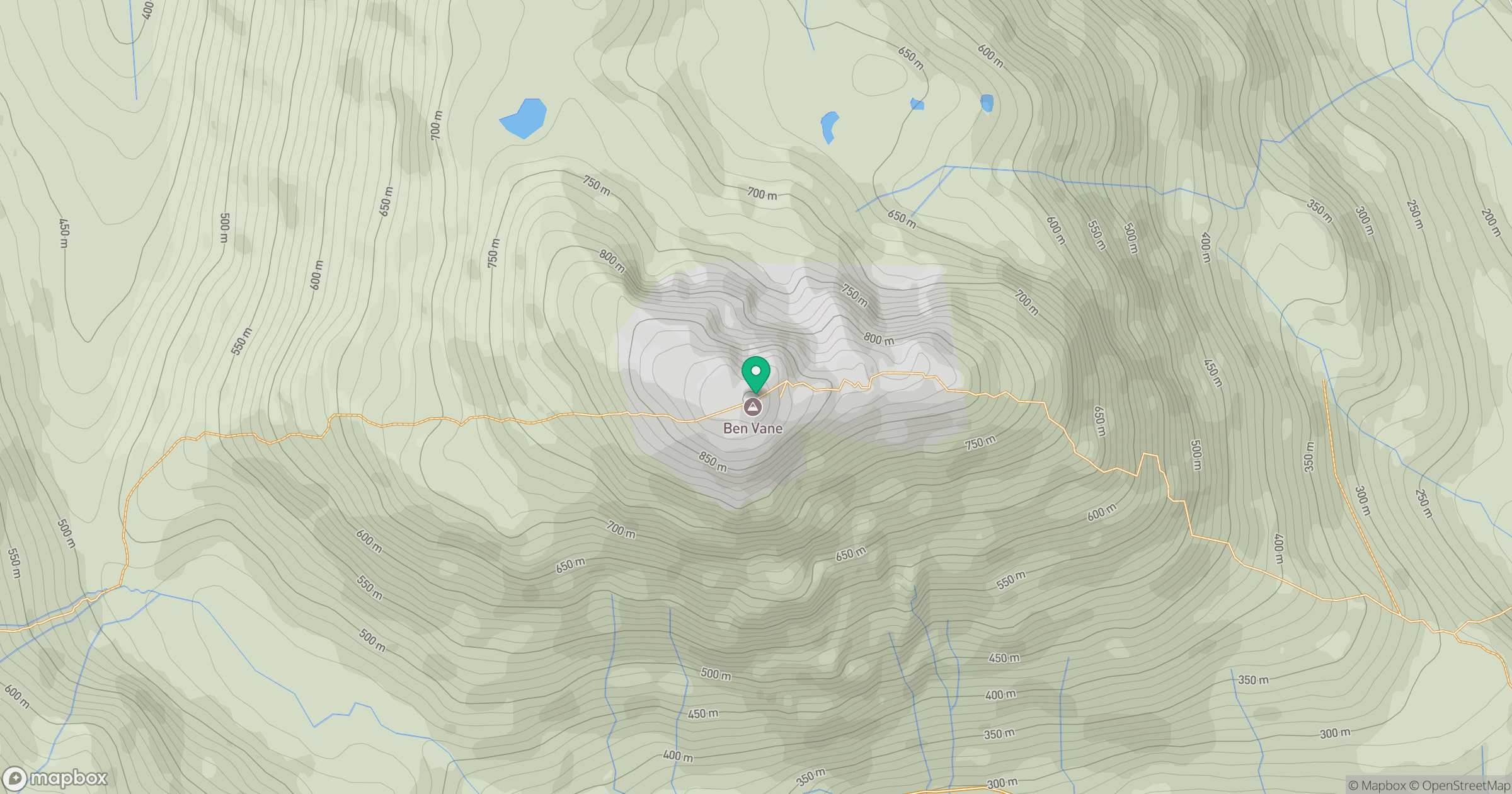
Grid reference: NN277098
View on OpenStreetMapOpens a map in a new tab, centred on the hill.
![The Cobbler [Ben Arthur]](https://cdn.walkmates.com/gallery-images/a1b697040769474a8338b3fb586ebc7a.jpg)
No comments yet. Be the first.