

Ben Ledi
Good walks are even better shared.
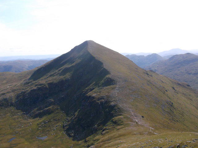
NN5609 : Ben Ledi - North Ridge
Ian Cleland Photo source
Overview
Ben Ledi is an 878.6 m Corbett above Callander and Loch Lubnaig in the Trossachs. The usual ascent follows the south-east ridge; a longer circuit returns through Stank Glen. Expect a steep mountain walk, exposed upper slopes and more demanding conditions in snow or poor visibility.
Ben Ledi: a Trossachs Corbett
Ben Ledi rises above Callander and Loch Lubnaig on the southern edge of the Highlands. Its recorded height is 878.6 m, usually rounded to 879 m. It is a Corbett, with 528 m of prominence.
Choose the right route
The usual approach starts beside the bridge off the A84, at NN587091, and climbs the south-east ridge. Returning the same way gives a shorter outing. Plan its distance and timing from the exact start point and route you intend to follow.
The longer Stank Glen circuit is about 10 km with 770 m of ascent. Allow 4–6 hours in suitable conditions, plus extra time for stops or slower progress. It continues beyond the summit before descending into the glen. The 10 km figure is for the complete circuit, not the climb alone.
Underfoot and navigation
Expect steep stretches, stone steps, open grass and rocky ground. Stank Glen is rougher and can be boggy. Carry a map, compass and backup navigation, and know how to use them. The mountain route is not continuously waymarked.
The Stank Glen turn at Bealach nan Corp is easily missed. Continuing too far can lead towards craggy ground. Poor visibility makes this descent more demanding; retracing the ascent is the simpler option.
Snow or ice changes the outing substantially. Cornices can develop above the corrie east of the summit ridge. Keep away from their edges and be prepared for winter navigation, ice axe and crampon use where conditions require them. Check the forecast, allow for short daylight and choose a lower walk if the conditions exceed your skills.
Parking and facilities
Follow the A84 turn signed Strathyre Cabins, south of Loch Lubnaig, cross the bridge and turn left for the Ben Ledi car park. This is not Strathyre village. Parking is limited and can fill early. Check Forestry and Land Scotland's visitor information and current notices before travel.
Use Callander or Strathyre for toilets, shops and refreshments. There is no bus to the trailhead; the Kilmahog stop has an additional approach on foot. Check the current Trossachs Explorer timetable and your return connection.
Summit, views and history
The summit has a trig point and cairn, with an iron memorial cross nearby. Clear conditions open views across Loch Lubnaig and Loch Venachar to Ben Lomond, the Arrochar Alps and the southern Highlands.
The cairn commemorates Queen Victoria's Golden Jubilee in 1887. The cross remembers Sergeant Harry Lawrie of Killin Mountain Rescue Team, who died during a rescue helicopter crash on Ben More on 1 February 1987.
The name is usually linked to Gaelic Beinn Leitir, meaning 'hill of the slope', although its derivation is debated. The Ben Ledi area's Dalradian bedrock includes metamorphosed sandstone and finer metasedimentary rocks of the Ben Ledi Grit Formation.
Explore routes near Ben Ledi
Walks starting near this hill. Open a route to check its map, distance and full itinerary.
Loch Lubnaig: West Shore Railway Path from Ben Ledi Car Park
View route
Loch Katrine: Brenachoile Point Shore Walk from Trossachs Pier
View route
Aberfoyle woodland wellbeing walk
View route
Loch Ard Forest: Sculpture Trail and Little Loch Ard
View route
Route planning notes
These notes describe possible approaches. Check a route's map and access information when planning your walk.
South-east ridge, returning the same way
Start at the Ben Ledi parking area beside the bridge off the A84 (NN587091). Climb the south-east ridge and retrace the ascent for a shorter outing than the Stank Glen circuit. Plan distance and timing from your exact route. A steep mountain walk with stone steps and open upper slopes; the route is not continuously waymarked.
Ben Ledi and Stank Glen circuit
A complete circuit from NN587091, climbing the south-east ridge and returning via Stank Glen: about 10 km, 770 m ascent and 4–6 hours in suitable conditions. The descent is rougher and boggier, with an easily missed turn at Bealach nan Corp. Good navigation is essential.
Make a day of it, together
Find someone to share the walk with, or organise a day out along a route you like.
Photo Gallery
View all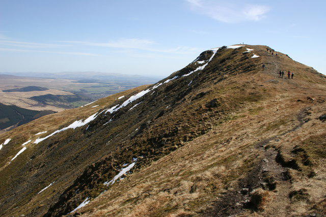 Photo could not load
NN5609 : Ben Ledi - North Ridge
Ian Cleland
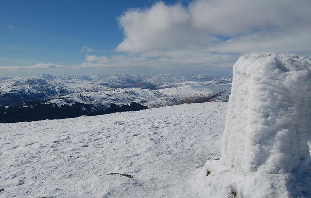 Photo could not load
NN5609 : Looking West from the summit of Ben Ledi
Donald MacDonald
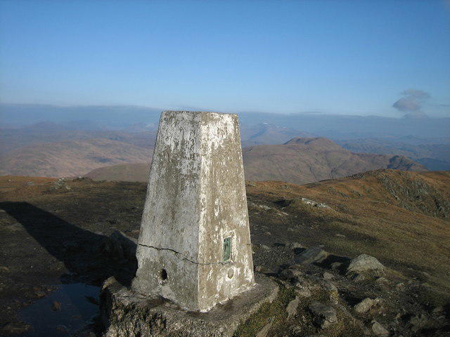 Photo could not load
NN5609 : Trig Point at the summit of Ben Ledi
Dannie Calder
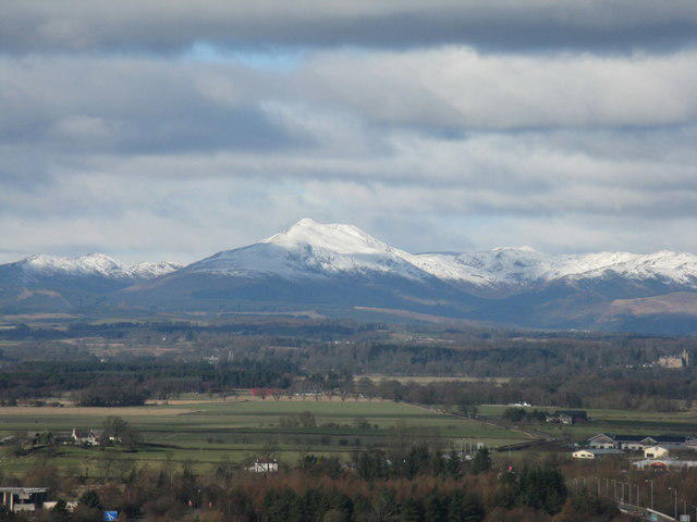 Photo could not load
NN5609 : Ben Ledi from Stirling Castle
M J Richardson
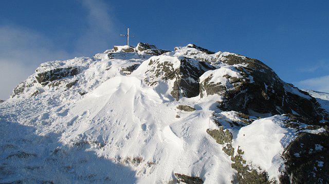 Photo could not load
NN5609 : Memorial on Ben Ledi
Richard Webb
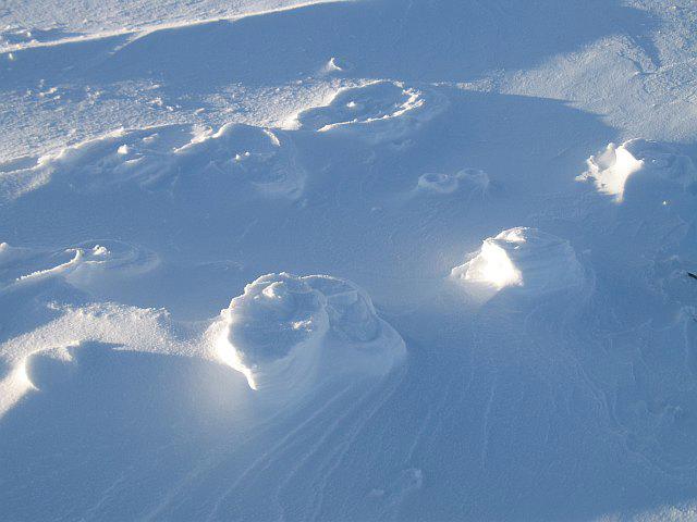 Photo could not load
NN5609 : Raised footprints
Richard Webb
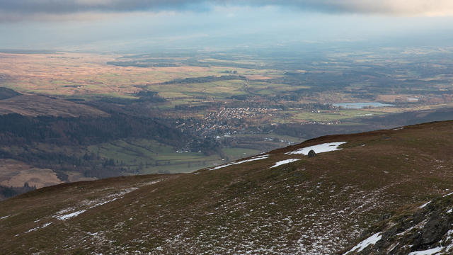 Photo could not load
NN5609 : Callander and surroundings from the Southeast ridge of Ben Ledi
Doug Lee
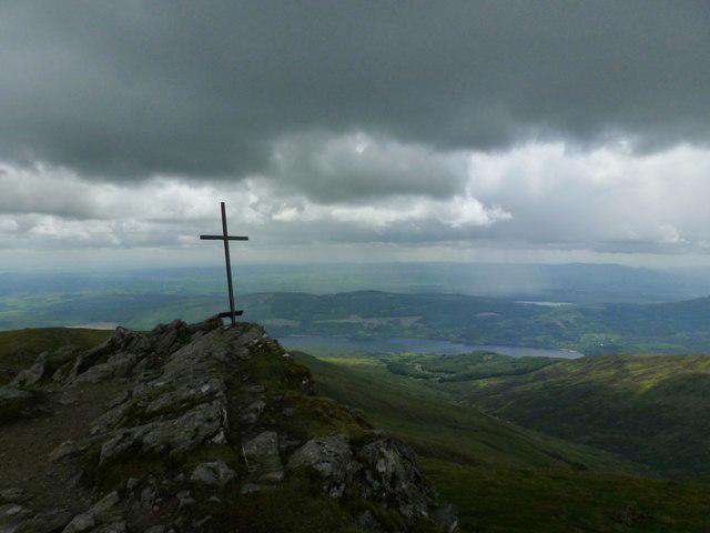 Photo could not load
NN5609 : Cross on Ben Ledi
Derek Mayes
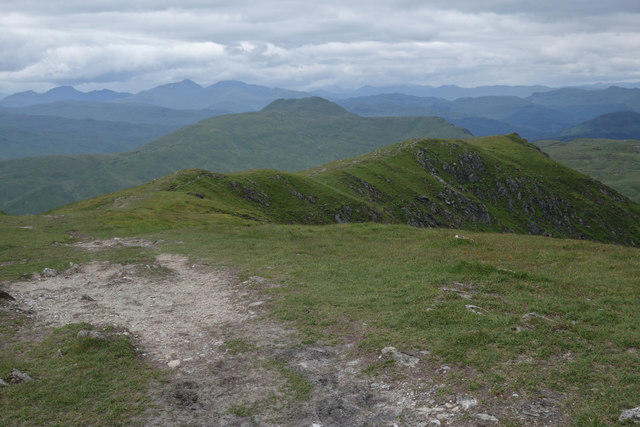 Photo could not load
NN5609 : North Ridge of Ben Ledi
Doug Lee
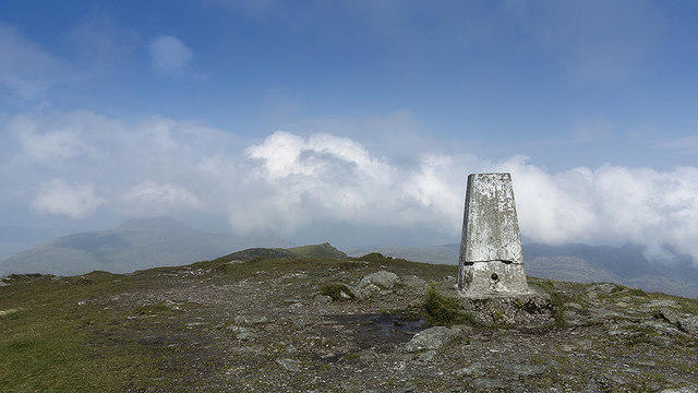
NN5609 : Summit of Ben Ledi
William Starkey
Hill facts and local notes
Classifications
Elevation
879m
2,883 ft
Prominence
528m
Coordinates
56.2587, -4.3224
NN562097
OS Map
57
Explorer: OL46S 365S
At the Summit
Trig point and cairn at the rocky summit, with an iron memorial cross nearby. The cross commemorates Sergeant Harry Lawrie of Killin Mountain Rescue Team. The survey record identifies the trig point; the slightly higher cairn base to its south may be artificial.
Terrain & Geology
The Ben Ledi area lies in the Dalradian Southern Highland Group. Its Ben Ledi Grit Formation includes metamorphosed sandstone with finer metasedimentary layers. These ancient sedimentary rocks have been folded and metamorphosed during mountain building.
Views & Scenery
In clear conditions, Loch Lubnaig and Loch Venachar lie below, with views towards Ben Lomond, the Arrochar Alps, Ben More and the Lawers range. Stirling Castle and the Pentlands may also be visible.
History & Heritage
Name Origin
Usually linked to Gaelic Beinn Leitir, 'hill of the slope'. The older 'mountain of God' interpretation also occurs, but the derivation is not certain.
Historical Significance
The summit cairn commemorates Queen Victoria's Golden Jubilee in 1887. The nearby iron cross remembers Sergeant Harry Lawrie of Killin Mountain Rescue Team, who died in a rescue helicopter crash on Ben More on 1 February 1987.
Getting There & Facilities
Parking
Ben Ledi car park beside the bridge off the A84, south of Loch Lubnaig (route start NN587091). Follow the Strathyre Cabins sign, cross the bridge and turn left; this is not Strathyre village. FLS lists parking as free, but spaces are limited and summer weekends can be busy. Nearest postcode: FK17 8HF. Check current FLS notices before travelling.
Public Transport
No bus reaches the trailhead. The Trossachs Explorer serves Kilmahog; Walkhighlands gives an approximately 2 km approach past the Falls of Leny. Check Stirling Council's current route, timetable and return connections. Buses to Strathyre village do not deliver you to the Ben Ledi start.
Nearby Facilities
Parking at the start. FLS directs visitors to Callander or Strathyre village for public toilets, shops and cafés; plan to use these before heading onto the hill.
Safety Information
Known Hazards
- Steep paths, wet rock and boggy ground can make footing difficult. Upper slopes are exposed to wind and rapidly changing mountain weather.
- The Stank Glen descent needs careful navigation. Missing the turn at Bealach nan Corp can lead towards crags; carry a map, compass and backup navigation.
- Do not assume the mountain path is continuously waymarked. Snow and low cloud can conceal it.
Seasonal Hazards
Snow and ice can demand winter navigation skills, an ice axe and crampons with the ability to use them. Cornices can form above the corrie east of the summit ridge; keep well away from their edges. Allow extra time and daylight. Check conditions before setting out.
General Safety Tips
- Check weather conditions before setting out
- Carry appropriate clothing and equipment
- Let someone know your planned route
- Take a map, compass, and GPS device
- Carry emergency supplies: food, water, first aid kit, torch
Hills
Some common questions about the hills answered
Are there group walks up Ben Ledi?
Many walkers use Walkmates to join or organise walks with others. You can check for group walks around Ben Ledi through the maps
Are there other walkers around Ben Ledi?
Activity varies by location and time, but Walkmates lets you see whether others have shared walks or shown interest in this area. Find other people through the walking friends search walking friends for Ben Ledi search or of course create your own walk for Ben Ledi
Can I organise a walk to Ben Ledi?
Yes. If there aren’t any walks listed already, you can create a walk and make it available for others to join.
If you're signed up to Walkmates, you can create a walk to Ben Ledi.
How do I find a walk up this hill?
There are often multiple ways to walk this hill, depending on experience and route preference. Walkmates helps you explore walks and routes that others have shared.
Can I suggest a new route up Ben Ledi?
Yes. You can suggest or create routes to share with others. Walkmates focuses on the social side of walking, so routes are used to help people organise walks and explore areas together, rather than as detailed navigation tools or route libraries.
Other uses really appreciate knowledgeable walkers sharing their routes. Share your favourite route to Ben Ledi here
The is an error or something incorrect about this hill. How do I let you know?
We always strive to keep the information on Walkmates as accurate as possible. If you find an error, please let us know through the contact form and we'll aim to correct it as quickly as possible
Community Discussion
Comments
Location
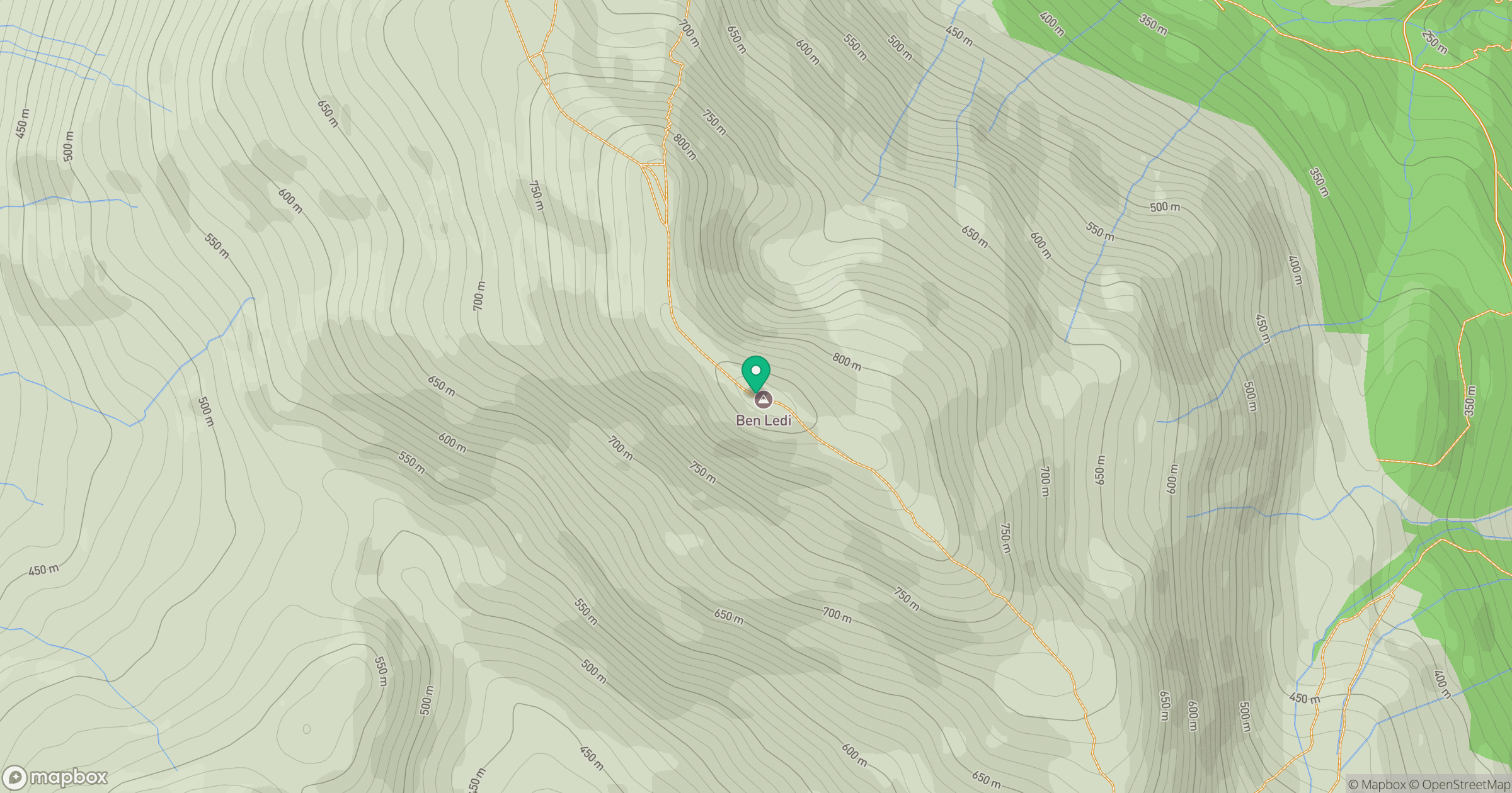
Grid reference: NN562097
View on OpenStreetMapOpens a map in a new tab, centred on the hill.


No comments yet. Be the first.