
Bell Hill
Good walks are even better shared.
Overview
Bell Hill: A Friendly Hike with Lovely Views
Overview
Nestled in the Shropshire Hills, Bell Hill (282 meters) may not be the tallest peak, but it certainly is a crowd-pleaser. An easy hike suitable for families, it welcomes both novice and seasoned hikers with open arms—and a few sheep.
Geology
Bell Hill is crafted from sandstone, a rock type that speaks to the ancient past of this area. Its rough patches and grassy slopes make it a pleasant locale for both flora and fauna, supporting a variety of ecosystems. If geology isn't your strong suit, just know it's a lovely place for a stroll.
Route Details
The main route from Loughton is an easy walk of approximately 3.5 km, which generally takes around an hour and a half to two hours to complete. The gradient is gentle, but don't fret if you find yourself out of breath—it's perfectly normal when surrounded by such natural beauty.
Views
Once you reach the summit, grab a seat on the stone bench, unwrap your sandwiches, and enjoy spectacular views of the surrounding landscape. On clear days, the vistas of the Breidden Hills and Long Mynd make for perfect photo opportunities. Capture those moments, especially when the sheep photo-bomb you!
Hazards
While the path is mostly friendly, watch your step in muddy areas after rain. And remember, sheep have the right of way; their unwavering gaze can throw off even the most confident hiker.
Nearby Attractions
For those wishing to extend their adventure, nearby summits include The Wrekin and Caer Caradoc, each offering their own unique challenges and stunning views. Think of it as a workout with a view!
Access
Bell Hill is conveniently located near the charming town of Church Stretton. Visitors can park at Loughton Road, with public transport options linking back to Shrewsbury. Make sure to fuel up on cake and tea before or after your adventure!
Conclusion
Bell Hill is more than a hill; it's an opportunity to connect with nature, recharge your batteries, and maybe even share a chuckle or two with those local sheep. Happy hiking!
Explore routes near Bell Hill
Walks starting near this hill. Open a route to check its map, distance and full itinerary.
Sturminster Newton, Cutt Mill and Stalbridge Lane
View route
Badbury Rings and The Oaks from Heron Drove, Dorset
View route
Hardy's Cottage, Stinsford and Dorchester from Thorncombe Wood
View route
Dorchester Walk with Men Walking & Talking
View route
Route planning notes
These notes describe possible approaches. Check a route's map and access information when planning your walk.
Main Trail from Loughton
A well-trodden path leading up to Bell Hill, offering gentle gradients and a chance to enjoy the surrounding flora.
Make a day of it, together
Find someone to share the walk with, or organise a day out along a route you like.
Hill facts and local notes
Classifications
Elevation
258m
846 ft
Prominence
50m
Coordinates
50.8748, -2.2851
ST800084
OS Map
194
Explorer: 117E
At the Summit
The summit features a modest cairn and offers a stone bench, perfect for resting your legs and enjoying a packed lunch while taking in the views.
Terrain & Geology
Bell Hill is composed mainly of sedimentary rocks, predominantly sandstone, which contribute to the area's rugged topography and rich soils. The hill's slopes are home to a variety of plant species, making it a small hotspot for biodiversity.
Views & Scenery
From the summit, you can see the majestic Breidden Hills to the west and the Long Mynd to the south. On a clear day, the numbers of sheep you can count in a field might just rival the views!
History & Heritage
Name Origin
The name 'Bell Hill' likely refers to its bell-like shape when viewed from certain angles.
Historical Significance
Bell Hill is a cherished local landmark, providing recreational opportunities and being part of the Shropshire Hills Area of Outstanding Natural Beauty.
Getting There & Facilities
Parking
There is a small car park located at the end of Loughton Road, just a short walk from the trailhead.
Public Transport
Regular bus services from Shrewsbury provide access to the nearby villages.
Nearby Facilities
There are no facilities on the hill itself, but Church Stretton offers cafes, pubs, and public toilets. Don't forget to treat yourself to a slice of cake post-hike!
Safety Information
Known Hazards
- Be aware of the occasional sheep on the path. They have a tendency to stare you down as if judging your hiking prowess!
- Muddy sections after heavy rain can make parts of the trail slippery.
General Safety Tips
- Check weather conditions before setting out
- Carry appropriate clothing and equipment
- Let someone know your planned route
- Take a map, compass, and GPS device
- Carry emergency supplies: food, water, first aid kit, torch
Hills
Some common questions about the hills answered
Are there group walks up Bell Hill?
Many walkers use Walkmates to join or organise walks with others. You can check for group walks around Bell Hill through the maps
Are there other walkers around Bell Hill?
Activity varies by location and time, but Walkmates lets you see whether others have shared walks or shown interest in this area. Find other people through the walking friends search walking friends for Bell Hill search or of course create your own walk for Bell Hill
Can I organise a walk to Bell Hill?
Yes. If there aren’t any walks listed already, you can create a walk and make it available for others to join.
If you're signed up to Walkmates, you can create a walk to Bell Hill.
How do I find a walk up this hill?
There are often multiple ways to walk this hill, depending on experience and route preference. Walkmates helps you explore walks and routes that others have shared.
Can I suggest a new route up Bell Hill?
Yes. You can suggest or create routes to share with others. Walkmates focuses on the social side of walking, so routes are used to help people organise walks and explore areas together, rather than as detailed navigation tools or route libraries.
Other uses really appreciate knowledgeable walkers sharing their routes. Share your favourite route to Bell Hill here
The is an error or something incorrect about this hill. How do I let you know?
We always strive to keep the information on Walkmates as accurate as possible. If you find an error, please let us know through the contact form and we'll aim to correct it as quickly as possible
Community Discussion
Comments
Location
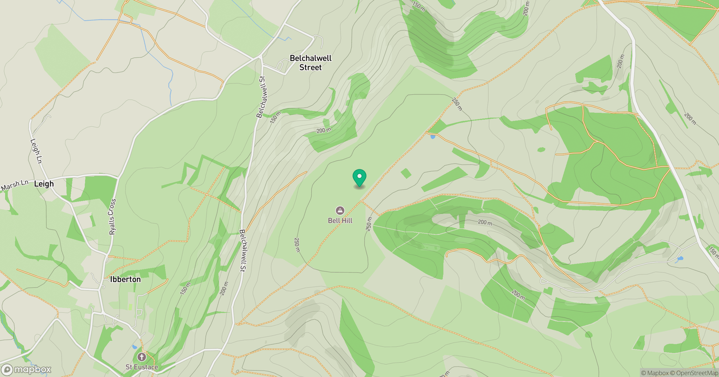
Grid reference: ST800084
View on OpenStreetMapOpens a map in a new tab, centred on the hill.


No comments yet. Be the first.