
Beinn Odhar
Good walks are even better shared.
Overview
Beinn Odhar
Overview
Beinn Odhar, a Munro standing at 1001 meters, is a striking peak located in the Scottish Highlands. Known as the 'Brown Mountain', it beckons hikers with its rugged charm and stunning vistas. It’s a favourite among both seasoned and novice hikers alike, proving that beauty comes in all elevations.
Geology
The geological composition of Beinn Odhar includes schist and gneiss, formed over billions of years, giving the mountain its durable appearance. This rocky backbone offers a unique insight into the Earth's history, all the way back to the Precambrian era. Don't be surprised if you feel a little dwarfed by the sheer majesty of these ancient rocks!
Routes
There are several routes to the summit, ranging from moderate to challenging. The West Highland Way Access is popular for those looking for a more leisurely approach. It weaves through beautiful glens and is well signposted.
If you're feeling adventurous, try the route from Dalmally, which is a steep ascent navigating through woodlands and rocky terrain. Don’t forget to stretch your legs and pace yourself, as the mountain doesn't take kindly to rushers.
Access Information
Nearest Parking
You can park at a small, free car park located at the end of the access road from Dalmally, but remember it gets busy during the summer months. Get there early if you want to grab a good spot!
Public Transport
Dalmally can be reached by buses running from Oban and Tyndrum, adding a nice touch of adventure to your visit. Plan your trip well, as services may be limited.
Nearest Town
The charming town of Dalmally is the nearest settlement, perfect for a pre-hike coffee or a post-hike pint!
Facilities
While Beinn Odhar is wild and unspoiled, nearby Dalmally has a few quaint cafes and shops. Stock up on essentials, or just indulge in some Scottish shortbread for fuel!
Summit Features
At the summit, be sure to check out the stone cairn and the trig point. They're worthy of a snap for your hiking album and are essential for every intrepid explorer's checklist!
Views and Best Seasons
When you make it to the top, the rewarding views of Loch Awe and the expansive Grampians are simply breathtaking. Spring and autumn are the prime seasons to visit, offering clear skies and stunning light perfect for photography enthusiasts.
Hazards
As with any mountain adventure, be aware that conditions can change in a snap. Wrap up warm, wear sturdy shoes, and keep an eye on the weather. Loose rocks are the order of the day, so proceed with care to avoid trip-ups!
Nearby Summits
Don’t miss out on nearby peaks such as Ben Starav and Meall nan Tarmachan for additional hiking adventures, each offering their own unique charms and challenges.
Conclusion
Beinn Odhar is a true gem in the Highlands, perfect for a day out in nature. Whether you’re a seasoned hiker or a family looking for an adventure, this mountain has something to offer everyone. Lace up those boots and get ready for a day filled with stunning views and fresh mountain air!
Don’t forget your camera and maybe a wee snack. Happy hiking!
Explore routes near Beinn Odhar
Walks starting near this hill. Open a route to check its map, distance and full itinerary.
Glen Affric: Coire Loch Woodland Trail
View route
Fort Augustus to Kytra Lock: Caledonian Canal Towpath
View route
Banavie to Glen Loy Aqueduct: Neptune’s Staircase Canal Towpath
View route
Beinn Eighe Lancaster Wreckage at Coire Mhic Fhearchair
View route
Route planning notes
These notes describe possible approaches. Check a route's map and access information when planning your walk.
West Highland Way Access
This route follows a well-trodden path that is part of the famous West Highland Way, offering a guided approach through scenic glens.
From Dalmally
Starting from the village of Dalmally, this route ascends through woodland before climbing the rocky slopes of Beinn Odhar.
Make a day of it, together
Find someone to share the walk with, or organise a day out along a route you like.
Hill facts and local notes
Classifications
Elevation
895m
2,936 ft
Prominence
24m
Coordinates
57.1798, -5.3128
NG998147
OS Map
33
Explorer: 414N 414S
At the Summit
The summit features a stone cairn, which provides a perfect photo opportunity and serves as a landmark for weary wanderers. There's also a trig point for those who like their summits to be scientifically documented!
Terrain & Geology
Beinn Odhar is primarily composed of schist and gneiss, which give the mountain its rugged, steely appearance. These rocks formed during the Precambrian era when the landscape was dramatically different, offering a glimpse into ancient geological histories.
Views & Scenery
From the summit, enjoy breathtaking views of Loch Awe and the distant peaks of the Grampians. On a clear day, the vistas are simply unbeatable.
History & Heritage
Name Origin
Beinn Odhar translates as 'Brown Mountain' in Gaelic, a fitting title for its heather-clad slopes.
Historical Significance
The mountain is part of the historic landscape that has shaped Scottish culture and was frequented by early Scottish clans.
Getting There & Facilities
Parking
There is a small car park at the end of the access road from Dalmally, which is free but can fill up quickly during peak times.
Public Transport
Buses from Oban and Tyndrum connect to Dalmally, making it relatively easy to access the area without a vehicle.
Nearby Facilities
While the mountain itself doesn't have any facilities, Dalmally offers a couple of quaint cafes and a shop for supplies. Always good to stock up on shortbread!
Safety Information
Known Hazards
- Weather can change rapidly, so be prepared for all seasons. Be cautious of loose rocks and potential slips, especially in wet conditions.
General Safety Tips
- Check weather conditions before setting out
- Carry appropriate clothing and equipment
- Let someone know your planned route
- Take a map, compass, and GPS device
- Carry emergency supplies: food, water, first aid kit, torch
Hills
Some common questions about the hills answered
Are there group walks up Beinn Odhar?
Many walkers use Walkmates to join or organise walks with others. You can check for group walks around Beinn Odhar through the maps
Are there other walkers around Beinn Odhar?
Activity varies by location and time, but Walkmates lets you see whether others have shared walks or shown interest in this area. Find other people through the walking friends search walking friends for Beinn Odhar search or of course create your own walk for Beinn Odhar
Can I organise a walk to Beinn Odhar?
Yes. If there aren’t any walks listed already, you can create a walk and make it available for others to join.
If you're signed up to Walkmates, you can create a walk to Beinn Odhar.
How do I find a walk up this hill?
There are often multiple ways to walk this hill, depending on experience and route preference. Walkmates helps you explore walks and routes that others have shared.
Can I suggest a new route up Beinn Odhar?
Yes. You can suggest or create routes to share with others. Walkmates focuses on the social side of walking, so routes are used to help people organise walks and explore areas together, rather than as detailed navigation tools or route libraries.
Other uses really appreciate knowledgeable walkers sharing their routes. Share your favourite route to Beinn Odhar here
The is an error or something incorrect about this hill. How do I let you know?
We always strive to keep the information on Walkmates as accurate as possible. If you find an error, please let us know through the contact form and we'll aim to correct it as quickly as possible
Community Discussion
Comments
Location
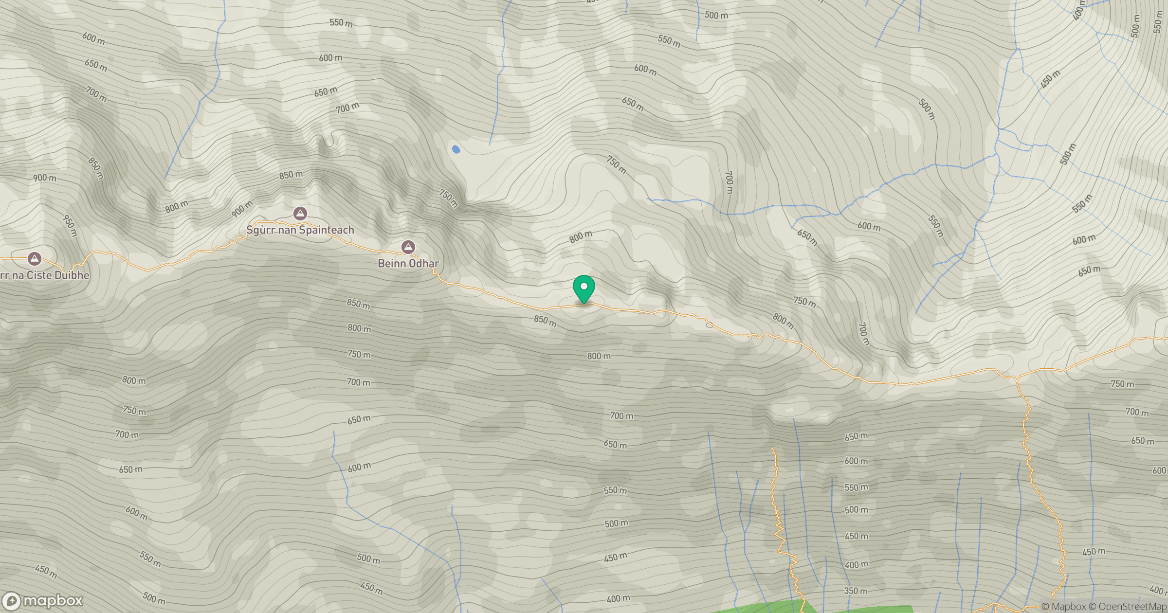
Grid reference: NG998147
View on OpenStreetMapOpens a map in a new tab, centred on the hill.
No comments yet. Be the first.