

Beinn Each
Good walks are even better shared.
NN6015 : Ascending the west ridge of Ben Each in the annual Stuc a Chroin Race
Keith Burns Photo source
Overview
Beinn Each
Rising to a height of 851 meters, Beinn Each is a majestic Munro in the heart of the Scottish Highlands. This mountain, known for its rugged beauty, attracts hikers from near and far.
Geology
The mountain's foundation consists mainly of ancient metamorphic rocks, primarily schists and gneisses. These rocks tell a story of geological history that stretches back millions of years. The erosion over time has created unique landscapes dotted with fascinating mineral deposits.
Routes
Hiking Beinn Each can be achieved via several established routes. The East Ridge Route is notably popular, providing a relatively straight forward ascent from Balquhidder village. This path rewards climbers with stunning views across Loch Voil, making it a photographer’s dream.
Alternatively, the West Ridge Route offers a more challenging adventure, taking you through enchanting glens before the steep but rewarding final ascent. It suits those with a bit more experience under their belt.
Summit Features and Terrain
At the summit, you will find a substantial cairn and a trig point marking your achievement. The terrain is a blend of heather-covered slopes, rocky outcrops, and patches of marsh which can make each step a unique experience, so watch your step!
Views
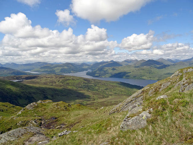
The views from Beinn Each are simply spectacular. Looking out, hikers can see the picturesque landscapes of Trossachs National Park, with the tranquil Lochs Voil and Doine at your feet and the majestic Ben Lomond in the far distance. Those who time their hike to coincide with sunset will be met with a breathtaking palette of colours painting the sky.
Hazards
One must bear in mind that weather conditions can change in an instant in the Highlands. Be vigilant about visibility and always check forecasts before hiking. The terrain can also be slippery and uneven, especially in wet weather, adding an extra layer of challenge.
Access
Getting to Beinn Each is relatively easy. The closest parking is found at Balquhidder Village Hall, where space is available on the roadside. Buses also stop at Balquhidder, linking it to Callander and Lochearnhead, though it’s best to verify timetables, especially off-season.
Facilities
Café culture is embraced in Balquhidder with options for refreshments after your adventure. Don't forget to enjoy some cake – you’ve earned it!
History
The name 'Beinn Each' means 'Horse Mountain', which makes sense when you look at its shape! Historically, this area plays a vital role in Scottish heritage, particularly related to the infamous MacGregor clan. There's certainly more to this mountain than meets the eye!
Get out there and enjoy all that Beinn Each has to offer, but remember: The mountains are calling, and you must go!
Final Thoughts
Climbing Beinn Each offers not only a physical challenge but also a chance to absorb the rich history and stunning landscapes of the Scottish Highlands. Whether you choose the popular East Ridge Route or the more secluded West Ridge, be prepared for a journey that is sure to be memorable.
Explore routes near Beinn Each
Walks starting near this hill. Open a route to check its map, distance and full itinerary.
Loch Lubnaig: West Shore Railway Path from Ben Ledi Car Park
View route
Loch Katrine: Brenachoile Point Shore Walk from Trossachs Pier
View route
Aberfoyle woodland wellbeing walk
View route
Killin: Falls of Dochart, Finlarig and Moirlanich Longhouse
View route
Route planning notes
These notes describe possible approaches. Check a route's map and access information when planning your walk.
East Ridge Route
A popular ascent starting from the village of Balquhidder, taking you up the scenic eastern ridge with views across to Loch Voil.
West Ridge Route
This route offers a less travelled path by starting from the northeastern side, traversing through lush glens before the steep final ascent.
Make a day of it, together
Find someone to share the walk with, or organise a day out along a route you like.
Photo Gallery
View all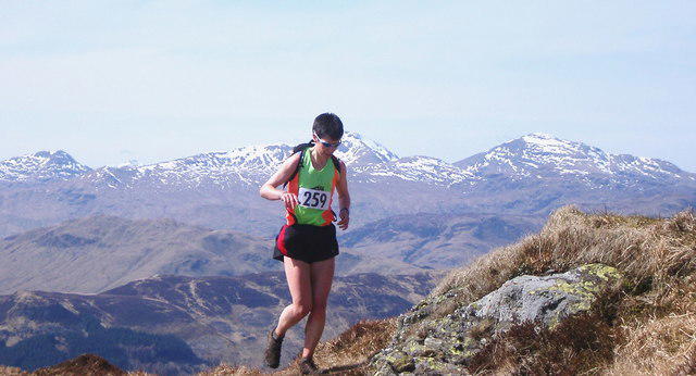 Photo could not load
NN6015 : Ascending the west ridge of Ben Each in the annual Stuc a Chroin Race
Keith Burns
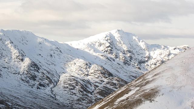 Photo could not load
NN6015 : East face of Beinn Each
Richard Webb
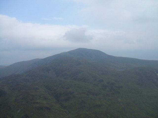 Photo could not load
NN6015 : Stuc a' Chroin
Iain Russell
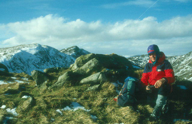 Photo could not load
NN6015 : Summit of Beinn Each
Alan Reid
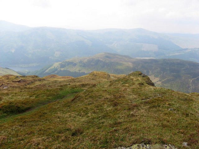 Photo could not load
NN6015 : Summit of Beinn Each
Marion Boyle
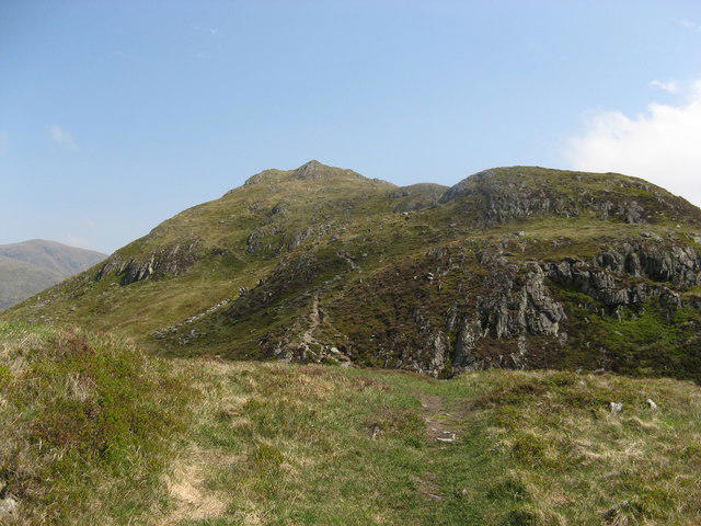 Photo could not load
NN6015 : Approaching summit of Beinn Each
Marion Boyle
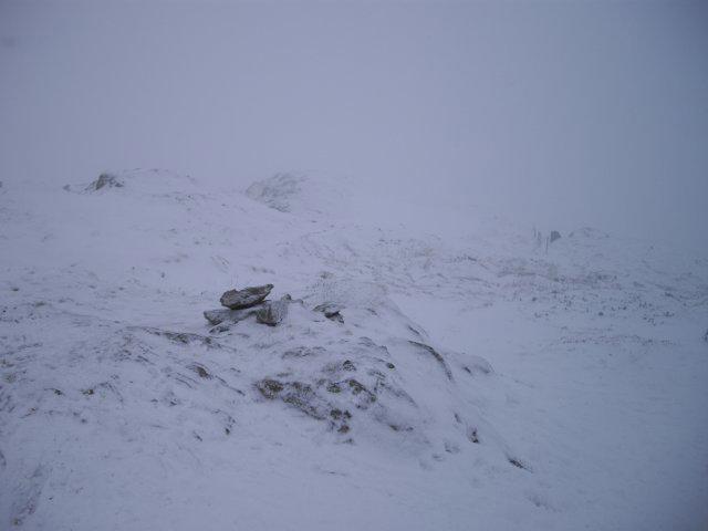 Photo could not load
NN6015 : Beinn Each summit
Callum Black
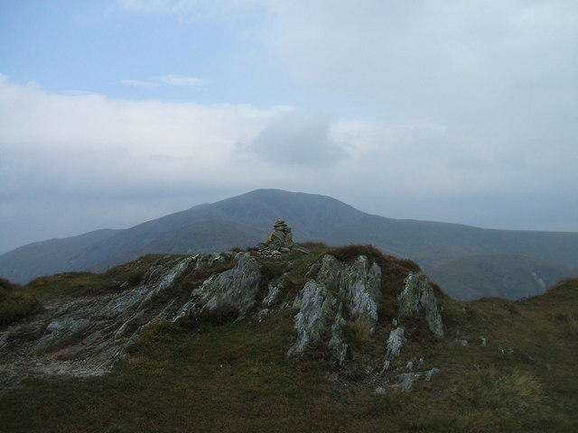 Photo could not load
NN6015 : Beinn Each
Iain Russell
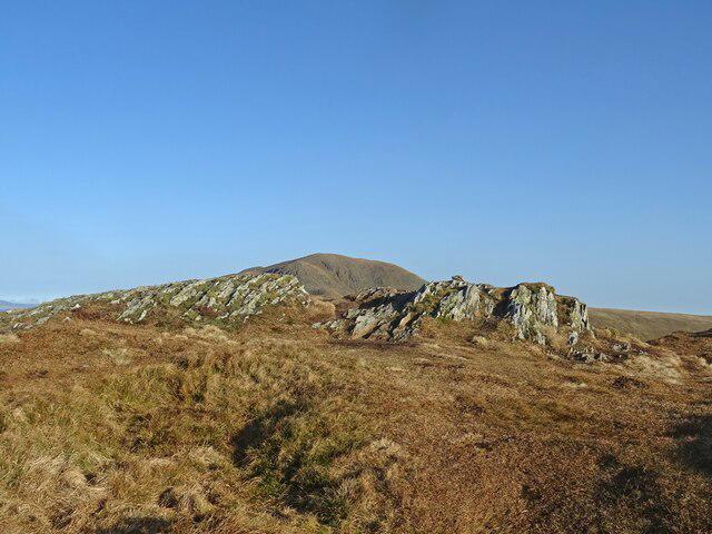 Photo could not load
NN6015 : Munro from a Corbett
Adam Ward
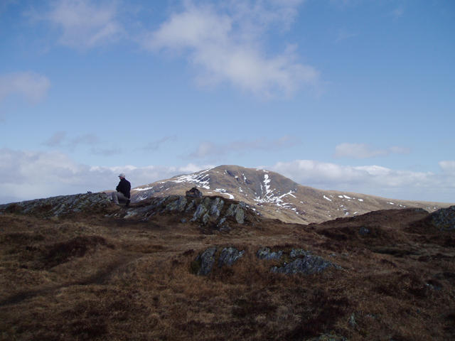
NN6015 : The Summit of Beinn Each
Kevin Rae
Hill facts and local notes
Classifications
Elevation
811m
2,661 ft
Prominence
157m
Coordinates
56.3140, -4.2622
NN601158
OS Map
57
Explorer: OL46N 365N
At the Summit
The summit features a prominent cairn, which is often adorned with weathered mementoes left by past climbers. There's also a trig point marking this magnificent height.
Terrain & Geology
Beinn Each is primarily composed of ancient metamorphic rock, predominantly schists and gneisses, which give the mountain its rugged character. The weathered rocks provide an interesting array of mineral deposits that can be seen along the trails.
Views & Scenery
From the summit, one can gaze upon the stunning landscapes of the surrounding Trossachs National Park, with views of Lochs Voil and Doine, and on a clear day, Ben Lomond looms majestically on the horizon.
History & Heritage
Name Origin
The name 'Beinn Each' translates to 'Horse Mountain' in Gaelic, believed to derive from the mountain's horse-shoe shape.
Historical Significance
The area surrounding Beinn Each is steeped in local history, with connections to the MacGregor clan and significant events of Scottish heritage.
Getting There & Facilities
Parking
Parking is available at the Balquhidder Village Hall, with ample roadside spots. Ensure you park considerately and don’t block access.
Public Transport
Regular bus services run to Balquhidder from Callander or Lochearnhead; check local timetables as services might be seasonal.
Nearby Facilities
The nearby village of Balquhidder offers a small shop and café, perfect for coffee and cake post-hike, with public toilets available during the tourist season.
Safety Information
Known Hazards
- Be aware of changing weather conditions which can lead to reduced visibility. Wet and rocky terrain can make footing precarious, especially on descent.
General Safety Tips
- Check weather conditions before setting out
- Carry appropriate clothing and equipment
- Let someone know your planned route
- Take a map, compass, and GPS device
- Carry emergency supplies: food, water, first aid kit, torch
Hills
Some common questions about the hills answered
Are there group walks up Beinn Each?
Many walkers use Walkmates to join or organise walks with others. You can check for group walks around Beinn Each through the maps
Are there other walkers around Beinn Each?
Activity varies by location and time, but Walkmates lets you see whether others have shared walks or shown interest in this area. Find other people through the walking friends search walking friends for Beinn Each search or of course create your own walk for Beinn Each
Can I organise a walk to Beinn Each?
Yes. If there aren’t any walks listed already, you can create a walk and make it available for others to join.
If you're signed up to Walkmates, you can create a walk to Beinn Each.
How do I find a walk up this hill?
There are often multiple ways to walk this hill, depending on experience and route preference. Walkmates helps you explore walks and routes that others have shared.
Can I suggest a new route up Beinn Each?
Yes. You can suggest or create routes to share with others. Walkmates focuses on the social side of walking, so routes are used to help people organise walks and explore areas together, rather than as detailed navigation tools or route libraries.
Other uses really appreciate knowledgeable walkers sharing their routes. Share your favourite route to Beinn Each here
The is an error or something incorrect about this hill. How do I let you know?
We always strive to keep the information on Walkmates as accurate as possible. If you find an error, please let us know through the contact form and we'll aim to correct it as quickly as possible
Community Discussion
Comments
Location
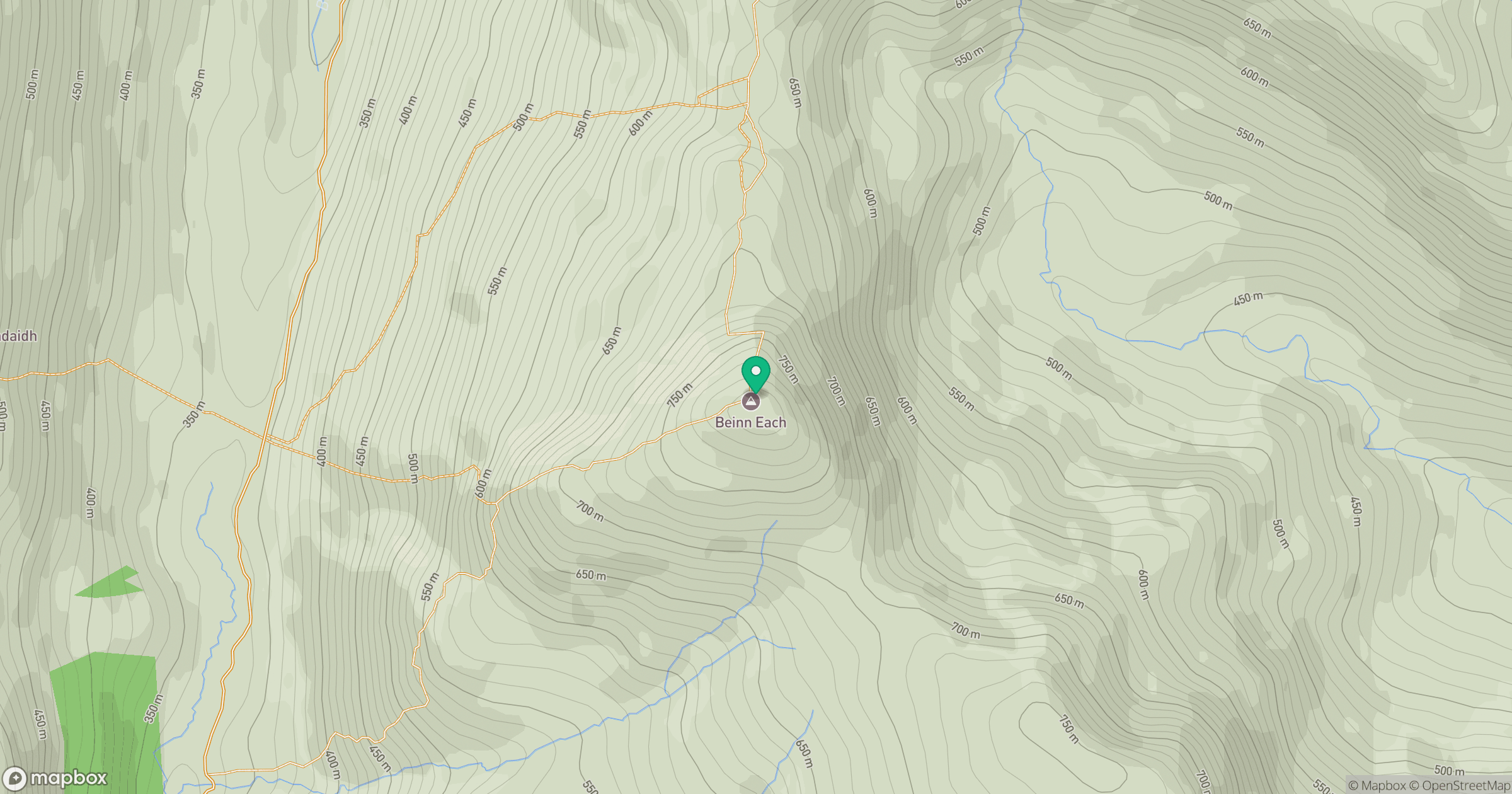
Grid reference: NN601158
View on OpenStreetMapOpens a map in a new tab, centred on the hill.


No comments yet. Be the first.