

Beinn Dubhchraig
Good walks are even better shared.
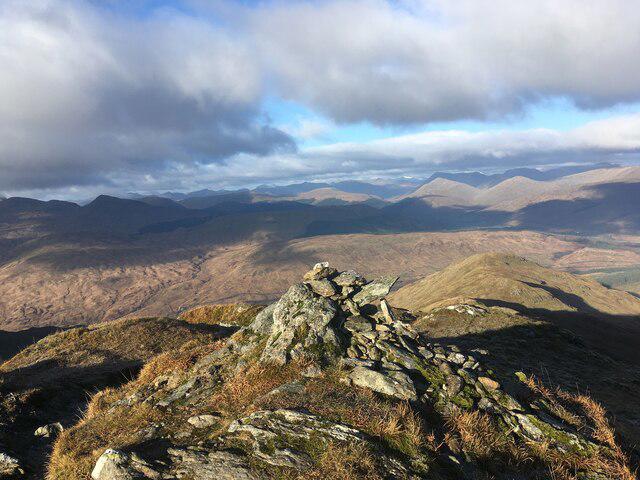
NN3025 : Looking south from Beinn Dubhchraig
Russel Wills Photo source
Overview
Beinn Dubhchraig
Overview
Beinn Dubhchraig is a splendid Munro located in the heart of the Scottish Highlands. Rising to an elevation of 848 meters, this mountain offers a delightful challenge for both seasoned climbers and enthusiastic walkers. Its name, which means 'hill of the black ridge', captures the slate-grey rocks that line its upper slopes, making it a distinctive feature against the vibrant greens of the surrounding landscape.
Geology
The geology of Beinn Dubhchraig is fascinating, as it is primarily made up of schist. The characteristic layers and crevices formed through ancient geological activity reveal much about the Earth’s history in this area. Additionally, glacial erosion can be observed, providing insight into the powerful forces that have shaped these majestic hills over eons.
Routes
From Dalrigh
The most frequented route begins at Dalrigh car park, where you'll be greeted with a gentle ascent at first, meandering through picturesque farmland. As you continue your journey, you’ll encounter steeper sections that elevate the heart rate, but the views on the way up are well worth the effort. At around 14.5 km in length, this moderate trek typically takes about 5.5 hours, allowing for plenty of photo ops along the way!
Summit Features
The summit of Beinn Dubhchraig is adorned by a small cairn, a kind of rock pile that provides a delightful spot for a well-earned sit down. From here, the vistas are breathtaking, offering stunning sights of the Crianlarich hills and beyond.
Terrain Type
Expect varied terrain, featuring grassy slopes, rocky outcrops, and occasionally boggy ground, especially after a decent rainfall. Good hiking boots are highly recommended—unless you fancy an unexpected mud bath!
Views
Once you reach the summit, your hard work is rewarded with awe-inspiring panoramas. Notable sights from atop include Ben More, Stob Binnein, and the glistening Loch Awe. For the best views, aim for spring and autumn when the visibility is often at its peak. Don't forget to pack your binoculars; nature lovers won't want to miss the fascinating sights!
Hazards
Beinn Dubhchraig has its fair share of hazards. As with many Scottish mountains, beware of steep sections and loose rocks. Weather can change faster than one can say 'There's no such thing as bad weather, only inappropriate clothing!', so ensure you’re well-prepared with a trusty map and a good pair of boots.
Access
Getting to Beinn Dubhchraig is straightforward. The nearest parking facility is at Dalrigh car park, with room for about a dozen vehicles. Public transport is available via bus services from Glasgow or Fort William, and visitors can also take the train to Crianlarich for a scenic trip through the Highlands. After the climb, return to nearby Crianlarich for a warm meal and perhaps a hot drink to toast your achievement!
Nearby Summits
When you’ve bagged Beinn Dubhchraig, consider tackling other nearby peaks such as Ben More (1174 m) and Stob Binnein (1165 m) to unleash your inner peak-bagger!
In conclusion, Beinn Dubhchraig is not just a climb; it's an adventure that promises scenic views and a genuine ear-to-ear smile upon its victorious ascent. Don't forget your camera – every snapshot is a memory waiting to happen!
Finish strong and enjoy your hike!
Explore routes near Beinn Dubhchraig
Walks starting near this hill. Open a route to check its map, distance and full itinerary.
The Cobbler from Succoth Carpark
View route
Beinn Ime from Succoth
View route
Loch Katrine: Brenachoile Point Shore Walk from Trossachs Pier
View route
Ben Lomond in the trossachs
View route
Route planning notes
These notes describe possible approaches. Check a route's map and access information when planning your walk.
From Dalrigh
The most popular route, starting at the Dalrigh car park, offers a mix of gentle slopes and steeper sections through beautiful countryside.
Make a day of it, together
Find someone to share the walk with, or organise a day out along a route you like.
Photo Gallery
View all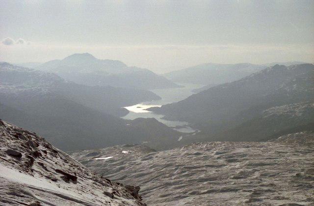 Photo could not load
NN3025 : Looking south from Beinn Dubhchraig
Russel Wills
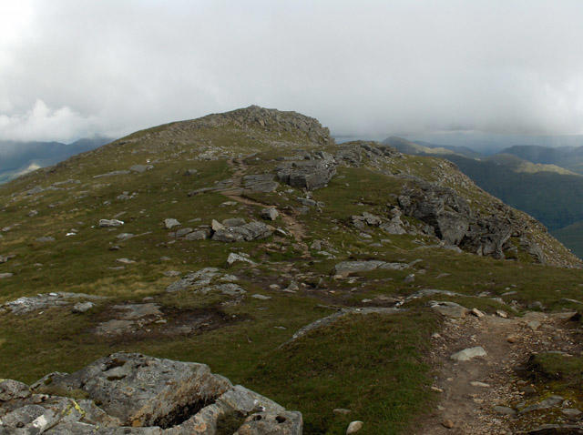 Photo could not load
NN3025 : Beinn Dubhchraig
Andrew Smith
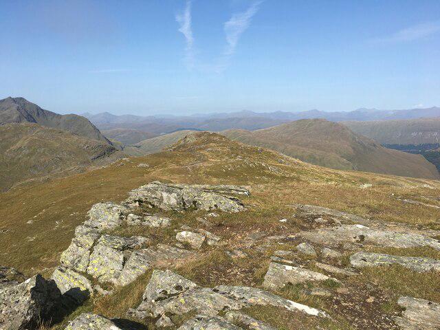 Photo could not load
NN3025 : Summit area of Beinn Dubhchraig
Steven Brown
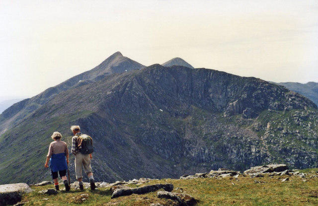 Photo could not load
NN3025 : Leaving Beinn Dubhchraig
wfmillar
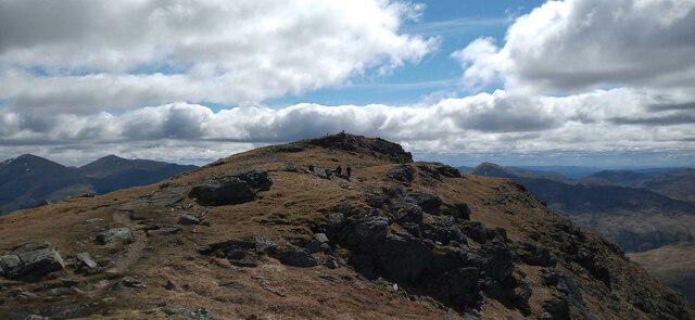 Photo could not load
NN3025 : Beinn Dubhchraig summit approach
Iain Russell
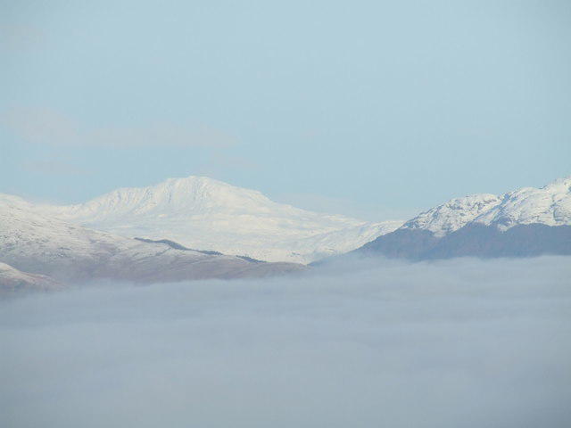 Photo could not load
NN3025 : Beinn Dubhchraig from Bromley Muir trigpoint
Stan Campbell
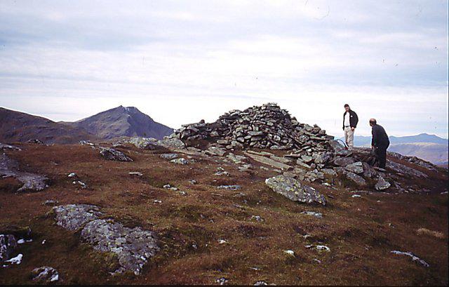 Photo could not load
NN3025 : Beinn Dubhchreag
Richard Webb
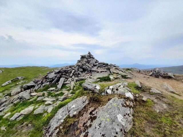 Photo could not load
NN3025 : Summit, Beinn Dubhchraig
Euan Nelson
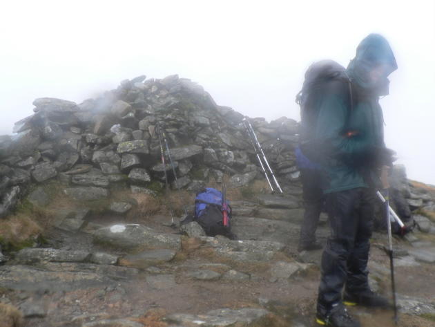 Photo could not load
NN3025 : Beinn Dubhchraig summit cairn/shelter
Liz Gray
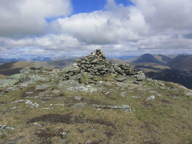
NN3025 : Summit cairn of Beinn Dubhchraig
Colin Park
Hill facts and local notes
Classifications
Elevation
979m
3,211 ft
Prominence
199m
Coordinates
56.3913, -4.7432
NN307254
OS Map
50
Explorer: OL39N 364N 377E
At the Summit
The summit is marked by a small cairn and offers a stunning panorama of the surrounding mountainous landscape, including the nearby Crianlarich hills.
Terrain & Geology
Composed primarily of schist, Beinn Dubhchraig showcases the typical geological features of the Southern Highlands, including glacial erosion patterns that can be clearly observed along its slopes.
Views & Scenery
From the top, you can admire views of Ben More, Stob Binnein, and Loch Awe, with the thrilling outline of Schiehallion visible on clear days.
History & Heritage
Name Origin
Beinn Dubhchraig translates to 'hill of the black ridge', referring to the distinctive dark rock formations that adorn its slopes.
Historical Significance
A popular choice among Munro baggers, Beinn Dubhchraig has significant local importance in the tradional Highland landscape.
Getting There & Facilities
Parking
Dalrigh car park (NN348257), which has space for about a dozen cars and is free of charge, though it can fill up quickly during peak seasons.
Public Transport
The area is accessible via bus services from Glasgow or Fort William, and there's a train station in Crianlarich for a scenic journey through the Highlands.
Nearby Facilities
A café and some shops can be found in Crianlarich, perfect for stocking up on goodies before or after your trek.
Safety Information
Known Hazards
- Steep sections, loose rocks, and potential for sudden weather changes; be sure to have good footwear and a trusty map.
General Safety Tips
- Check weather conditions before setting out
- Carry appropriate clothing and equipment
- Let someone know your planned route
- Take a map, compass, and GPS device
- Carry emergency supplies: food, water, first aid kit, torch
Hills
Some common questions about the hills answered
Are there group walks up Beinn Dubhchraig?
Many walkers use Walkmates to join or organise walks with others. You can check for group walks around Beinn Dubhchraig through the maps
Are there other walkers around Beinn Dubhchraig?
Activity varies by location and time, but Walkmates lets you see whether others have shared walks or shown interest in this area. Find other people through the walking friends search walking friends for Beinn Dubhchraig search or of course create your own walk for Beinn Dubhchraig
Can I organise a walk to Beinn Dubhchraig?
Yes. If there aren’t any walks listed already, you can create a walk and make it available for others to join.
If you're signed up to Walkmates, you can create a walk to Beinn Dubhchraig.
How do I find a walk up this hill?
There are often multiple ways to walk this hill, depending on experience and route preference. Walkmates helps you explore walks and routes that others have shared.
Can I suggest a new route up Beinn Dubhchraig?
Yes. You can suggest or create routes to share with others. Walkmates focuses on the social side of walking, so routes are used to help people organise walks and explore areas together, rather than as detailed navigation tools or route libraries.
Other uses really appreciate knowledgeable walkers sharing their routes. Share your favourite route to Beinn Dubhchraig here
The is an error or something incorrect about this hill. How do I let you know?
We always strive to keep the information on Walkmates as accurate as possible. If you find an error, please let us know through the contact form and we'll aim to correct it as quickly as possible
Community Discussion
Comments
Location
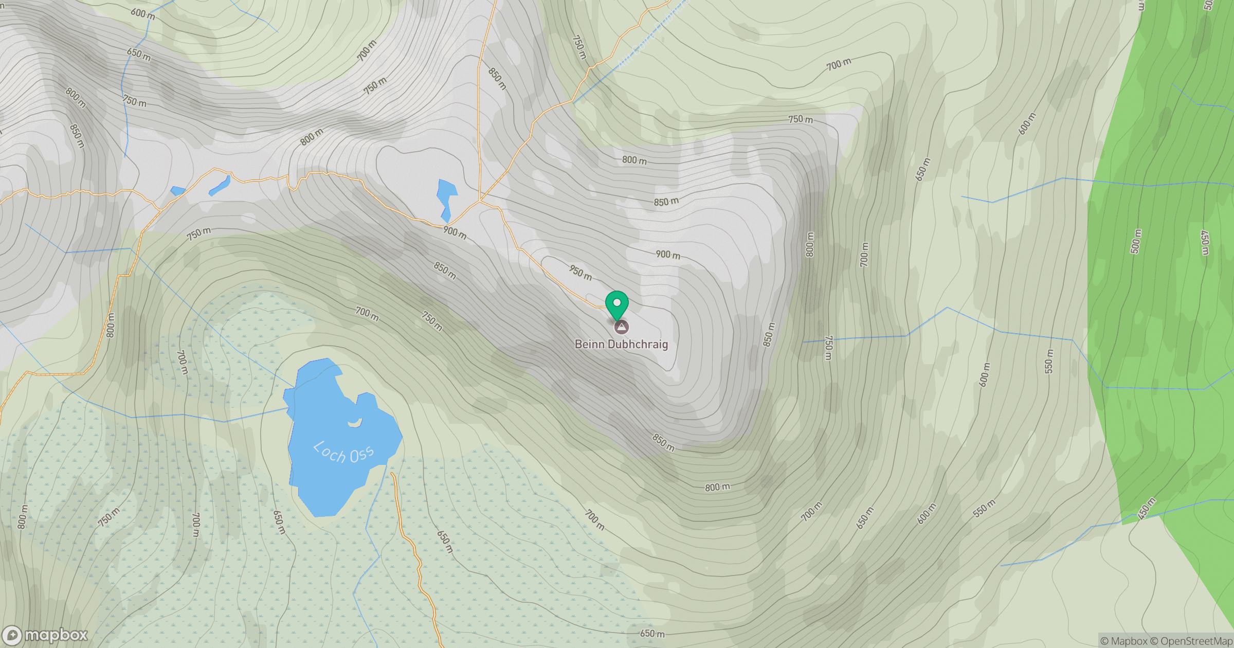
Grid reference: NN307254
View on OpenStreetMapOpens a map in a new tab, centred on the hill.
Nearby Hills
![Ben Lui [Beinn Laoigh]](https://cdn.walkmates.com/gallery-images/20d4da67f4984b329a102d7c3aba012b.jpg)
Ben Lui [Beinn Laoigh]
1,131m
Beinn Dorain
1,076m
Ben Vorlich
943m
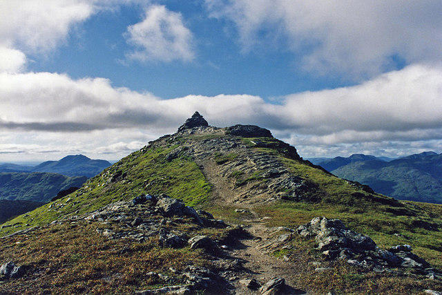
Beinn Chabhair
932m
An Caisteal
996m
No comments yet. Be the first.