

Beinn Damhain
Good walks are even better shared.
NN2817 : View towards Glen Falloch from Beinn Damhain
Alan O'Dowd Photo source
Overview
Beinn Damhain: The Hill of the Deer
Beinn Damhain, standing tall at 787 metres, is a captivating Munro nestled in the heart of the Scottish Highlands. This magnificent mountain offers an exciting blend of outdoor adventure and stunning natural beauty.
Geology
The geological composition of Beinn Damhain is predominantly quartzite, a sturdy rock that not only gives the mountain its character but also serves as a reminder of the Highland's turbulent past. The remnants of glacial till can be seen, a testament to the relentless forces of nature that have shaped this landscape.
Routes
South-East Ridge Route
For those looking to tackle Beinn Damhain, the South-East Ridge Route is a favourite among hikers. Covering approximately 10 km, this route takes you up a mix of grassy slopes and rocky sections, providing a moderate challenge that is rewarding with every step. Estimated time to complete is around 4.5 hours, depending on how often you stop to admire the views—or to catch your breath!
Summit Features
Upon reaching the summit, hikers are greeted with a flat expanse crowned by a stone cairn. It's a perfect spot to take a breather and soak in the panoramic views. Be prepared to snap a few photos, as the sheer beauty surrounding you is nothing short of breath-taking.
Terrain
Beinn Damhain features a delightful mix of terrain, from rocky outcrops to lush grassy slopes. However, keep your eyes peeled for the occasional boggy patch; it would be a pity to ruin those hiking boots!
Views
Once at the summit, enjoy unparalleled vistas including Loch Fyne and, on a good day, the distant hills of Arran and Kintyre. It's the kind of view that makes you feel on top of the world—just be sure to bring a camera!
Hazards
As with any mountain adventure, Beinn Damhain has its fair share of hazards. Slippery rocks and unpredictable weather can be challenging, and let’s not forget the infamous Scottish midges that can turn a lovely summer’s day into a bug buffet.
Nearby Summits
If you're up for more adventure, nearby summits include Beinn Tarsuin and Beinn a' Chleibh, both offering unique landscapes and hiking experiences.
Access
Nearest Parking
Parking is available at the end of the A83, close to Inveraray, making access relatively easy for those itching to summit.
Public Transport
Regular bus services operate between Glasgow and Inveraray, so you can leave the car behind and immerse yourself in the full Highland experience.
Nearest Town
Inveraray is the closest town and offers various amenities, including cosy cafés and essential facilities.
Facilities
If you're in need of a pick-me-up after your hike, Inveraray has café options to delight your taste buds, along with public restrooms for that essential freshening up.
History
The name 'Beinn Damhain' loosely translates to 'Hill of the Deer', a nod to the rich wildlife that calls the area home. Historically, this region is steeped in Gaelic lore, embodying the spirit of the Scottish Highlands.
In summary, Beinn Damhain is not just another mountain; it’s an experience waiting to be had. From its stunning views to the variety of routes and rich history, adventurers of all levels will find something to love about this iconic Munro.
Remember, every hike is an adventure! Enjoy the journey and take care out there.
Explore routes near Beinn Damhain
Walks starting near this hill. Open a route to check its map, distance and full itinerary.
Beinn Ime from Succoth
View route
The Cobbler from Succoth Carpark
View route
Ben Lomond in the trossachs
View route
Loch Katrine: Brenachoile Point Shore Walk from Trossachs Pier
View route
Route planning notes
These notes describe possible approaches. Check a route's map and access information when planning your walk.
South-East Ridge Route
This popular route takes you up the south-east ridge, providing a mix of grassy slopes and rocky scrambles as you ascend towards the summit.
Make a day of it, together
Find someone to share the walk with, or organise a day out along a route you like.
Photo Gallery
View all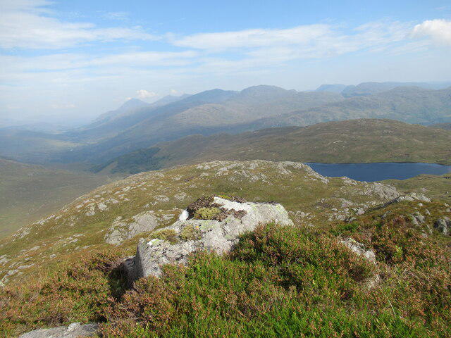 Photo could not load
NN2817 : View towards Glen Falloch from Beinn Damhain
Alan O'Dowd
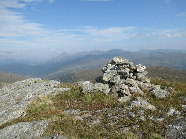 Photo could not load
NN2817 : Summit cairn on Beinn Damhain
Alan O'Dowd
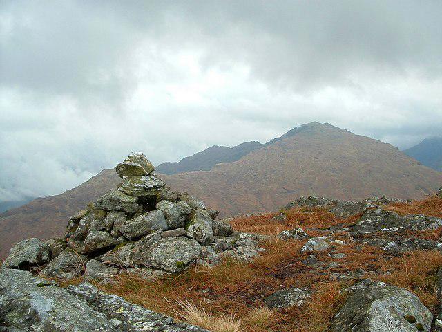 Photo could not load
NN2817 : Beinn Damhain
Raibeart MacAoidh
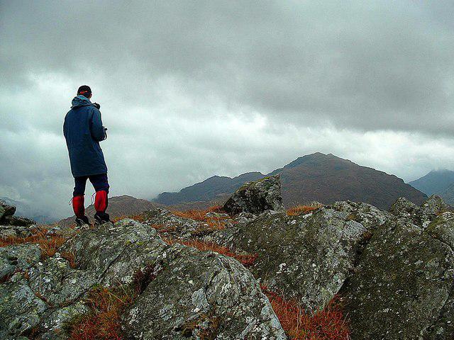 Photo could not load
NN2817 : Beinn Damhain (summit)
Raibeart MacAoidh
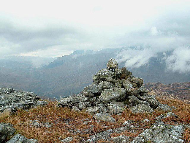 Photo could not load
NN2817 : Beinn Damhain (summit cairn)
Raibeart MacAoidh
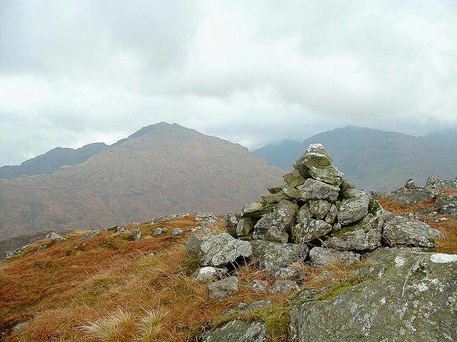 Photo could not load
NN2817 : Beinn Damhain (summit cairn)
Raibeart MacAoidh
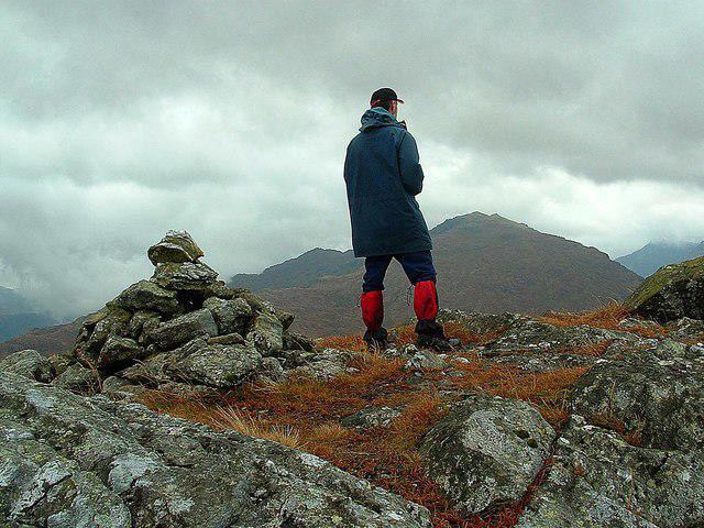 Photo could not load
NN2817 : Beinn Damhain (summit cairn)
Raibeart MacAoidh
Hill facts and local notes
Classifications
Elevation
684m
2,245 ft
Prominence
220m
Coordinates
56.3168, -4.7790
NN282172
OS Map
50 56
Explorer: OL39N 364N
At the Summit
A relatively flat summit adorned with a stone cairn, offering a perfect spot for a well-deserved rest and a view of the surroundings.
Terrain & Geology
Beinn Damhain is primarily composed of quartzite, a robust rock that can withstand the battering of the infamous Highland weather. The mountain's ruggedness is complemented by patches of glacial till, a reminder of the earth's icy history.
Views & Scenery
Panoramic views of Loch Fyne, the distant hills of Arran, and the rugged beauty of Kintyre. On a clear day, you might just see your house (if you live nearby).
History & Heritage
Name Origin
The name 'Beinn Damhain' translates to 'Hill of the Deer', reflecting its wildlife-rich surrounding area.
Historical Significance
Historically, the region has been associated with Gaelic clans and has tales steeped in Scottish folklore.
Getting There & Facilities
Parking
There is a small parking area at the end of the A83, near the village of Inveraray, about 5 km from the start of the route.
Public Transport
Regular bus services run from Glasgow to Inveraray, providing access to the region. Check local timetables for details.
Nearby Facilities
Inveraray offers various facilities, including cafés, restaurants, and public toilets.
Safety Information
Known Hazards
- Potentially slippery rocks, sudden weather changes, and, of course, the legendary midges during the summer months. Don't say you weren't warned!
General Safety Tips
- Check weather conditions before setting out
- Carry appropriate clothing and equipment
- Let someone know your planned route
- Take a map, compass, and GPS device
- Carry emergency supplies: food, water, first aid kit, torch
Hills
Some common questions about the hills answered
Are there group walks up Beinn Damhain?
Many walkers use Walkmates to join or organise walks with others. You can check for group walks around Beinn Damhain through the maps
Are there other walkers around Beinn Damhain?
Activity varies by location and time, but Walkmates lets you see whether others have shared walks or shown interest in this area. Find other people through the walking friends search walking friends for Beinn Damhain search or of course create your own walk for Beinn Damhain
Can I organise a walk to Beinn Damhain?
Yes. If there aren’t any walks listed already, you can create a walk and make it available for others to join.
If you're signed up to Walkmates, you can create a walk to Beinn Damhain.
How do I find a walk up this hill?
There are often multiple ways to walk this hill, depending on experience and route preference. Walkmates helps you explore walks and routes that others have shared.
Can I suggest a new route up Beinn Damhain?
Yes. You can suggest or create routes to share with others. Walkmates focuses on the social side of walking, so routes are used to help people organise walks and explore areas together, rather than as detailed navigation tools or route libraries.
Other uses really appreciate knowledgeable walkers sharing their routes. Share your favourite route to Beinn Damhain here
The is an error or something incorrect about this hill. How do I let you know?
We always strive to keep the information on Walkmates as accurate as possible. If you find an error, please let us know through the contact form and we'll aim to correct it as quickly as possible
Community Discussion
Comments
Location
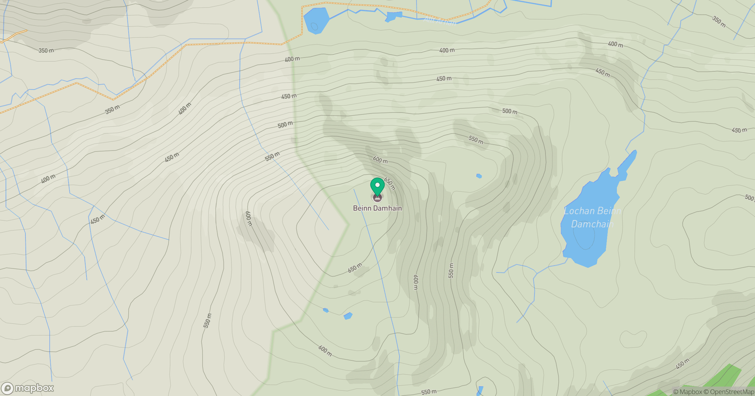
Grid reference: NN282172
View on OpenStreetMapOpens a map in a new tab, centred on the hill.
Nearby Hills
Ben Vorlich
943m
![Ben Lui [Beinn Laoigh]](https://cdn.walkmates.com/gallery-images/20d4da67f4984b329a102d7c3aba012b.jpg)
Ben Lui [Beinn Laoigh]
1,131m
Beinn Ime
1,012m
Beinn Narnain
927m
![The Cobbler [Ben Arthur]](https://cdn.walkmates.com/gallery-images/a1b697040769474a8338b3fb586ebc7a.jpg)
The Cobbler [Ben Arthur]
887m
No comments yet. Be the first.