
Beinn Bhuidhe
Good walks are even better shared.
Overview
Beinn Bhuidhe: The Yellow Mountain
Overview
Beinn Bhuidhe, standing proudly at 942 meters, is a captivating Munro located in the stunning Scottish Highlands. Just south of the picturesque Loch Fyne, it offers both seasoned hikers and casual walkers a chance to indulge in breathtaking views and remarkable natural beauty.
Geology
As you trek up Beinn Bhuidhe, take a moment to appreciate its sandstone and slate composition. The rocky outcrops reveal the geological history of the region, showcasing the ancient and powerful forces of nature that formed these mountains over ages.
Routes
Two routes stand out for their scenic charm. The Whistlefield Route is a moderate trek, weaving through welcoming woodlands before a more strenuous ascent to the summit. On the other hand, the Glen Croe Route presents a challenging adventure, perfect for those looking to push their limits.
Summit Features
Upon reaching the summit, you'll be greeted by a substantial cairn, a traditional marker that serves as both a sign of achievement and a spot for memorable photos. The trig point awaits those who want that classic 'I made it!' shot against an incredible backdrop.
Terrain and Views
Expect a varied terrain of rocky paths interspersed with softer grassy patches. The views are nothing short of spectacular! Look out towards the majestic Arrochar Alps and Loch Fyne, especially on a clear day when the scenery is simply extraordinary. Late spring and autumn provide the best vistas.
Hazards
While hiking Beinn Bhuidhe, be mindful of strong winds and the potential for loose rocks underfoot during descent. A cautious attitude ensures a safe and enjoyable experience.
Nearby Summits
For those keen to extend their adventure, nearby peaks such as Ben Arthur and Ben Vorlich offer additional challenges and spectacular views.
Access and Facilities
Parking is available at Whistlefield but can fill up quickly. Should public transport be more your style, regular buses from towns like Arrochar can get you to the start points hassle-free. Facilities like cafes in Arrochar provide a warm welcome after your hiking exploits.
History
The name 'Beinn Bhuidhe' refers to its striking yellow-tinted grass. It has significant cultural resonance, capturing the imagination of many throughout Scottish history.
Trekking Beinn Bhuidhe is not just an outdoor activity; it's a chance to connect with nature and enjoy the breathtaking scenery that the Scottish Highlands have to offer. So lace up those hiking boots, and let the adventure begin!
Happy hiking!
Explore routes near Beinn Bhuidhe
Walks starting near this hill. Open a route to check its map, distance and full itinerary.
Beinn Ime from Succoth
View route
The Cobbler from Succoth Carpark
View route
Ben Lomond in the trossachs
View route
Monachyle Glen pack-pony short walk
View route
Route planning notes
These notes describe possible approaches. Check a route's map and access information when planning your walk.
The Whistlefield Route
This popular path starts from Whistlefield and meanders up through lush woodlands before ascending steeply to the summit, making it a favourite among locals and visitors alike.
The Glen Croe Route
A longer trek, this route leads you through Glen Croe, offering challenging terrain and breathtaking views as you approach the summit.
Make a day of it, together
Find someone to share the walk with, or organise a day out along a route you like.
Hill facts and local notes
Classifications
Elevation
948m
3,112 ft
Prominence
592m
Coordinates
56.3267, -4.9067
NN203187
OS Map
50 56
Explorer: OL39N 364N
At the Summit
The summit features a prominent cairn, which stands proudly at the top, often adorned with stones contributed by climbers from afar. The trig point also offers excellent photo opportunities, just in case you want to prove you were really here!
Terrain & Geology
Beinn Bhuidhe is primarily composed of sandstone and slate, giving it a rugged, yet welcoming appearance. The underlying geology is fascinating, as it showcases the processes of erosion and uplift that have shaped these highlands over millennia.
Views & Scenery
From the summit, you can enjoy sweeping views of the surrounding mountains, including the Arrochar Alps and Loch Fyne on a clear day. Keep your eyes peeled for the famous Ben Arthur, also known as 'The Cobbler'.
History & Heritage
Name Origin
The name 'Beinn Bhuidhe' translates to 'Yellow Mountain' in Gaelic, likely referring to the grassy slopes that are tinged golden during the late summer months.
Historical Significance
This mountain holds cultural significance in Scottish folklore and is a popular destination among those seeking an authentic Highland experience.
Getting There & Facilities
Parking
The nearest parking area is located at Whistlefield, with spaces available for a few cars. Arriving early is advisable, as this spot can fill up quickly.
Public Transport
Regular bus services operate from nearby towns, including Arrochar and Tarbet, making it fairly straightforward to access the start points for the routes.
Nearby Facilities
Facilities are limited in the immediate area, but Arrochar offers various options including cafes and public toilets. A quick pit stop here before or after your hike is essential for a coffee refill!
Safety Information
Known Hazards
- High winds can be common at the summit, making it essential to check the weather forecast. Loose rocks are also a potential hazard when descending, especially during wet conditions.
General Safety Tips
- Check weather conditions before setting out
- Carry appropriate clothing and equipment
- Let someone know your planned route
- Take a map, compass, and GPS device
- Carry emergency supplies: food, water, first aid kit, torch
Hills
Some common questions about the hills answered
Are there group walks up Beinn Bhuidhe?
Many walkers use Walkmates to join or organise walks with others. You can check for group walks around Beinn Bhuidhe through the maps
Are there other walkers around Beinn Bhuidhe?
Activity varies by location and time, but Walkmates lets you see whether others have shared walks or shown interest in this area. Find other people through the walking friends search walking friends for Beinn Bhuidhe search or of course create your own walk for Beinn Bhuidhe
Can I organise a walk to Beinn Bhuidhe?
Yes. If there aren’t any walks listed already, you can create a walk and make it available for others to join.
If you're signed up to Walkmates, you can create a walk to Beinn Bhuidhe.
How do I find a walk up this hill?
There are often multiple ways to walk this hill, depending on experience and route preference. Walkmates helps you explore walks and routes that others have shared.
Can I suggest a new route up Beinn Bhuidhe?
Yes. You can suggest or create routes to share with others. Walkmates focuses on the social side of walking, so routes are used to help people organise walks and explore areas together, rather than as detailed navigation tools or route libraries.
Other uses really appreciate knowledgeable walkers sharing their routes. Share your favourite route to Beinn Bhuidhe here
The is an error or something incorrect about this hill. How do I let you know?
We always strive to keep the information on Walkmates as accurate as possible. If you find an error, please let us know through the contact form and we'll aim to correct it as quickly as possible
Community Discussion
Comments
Location
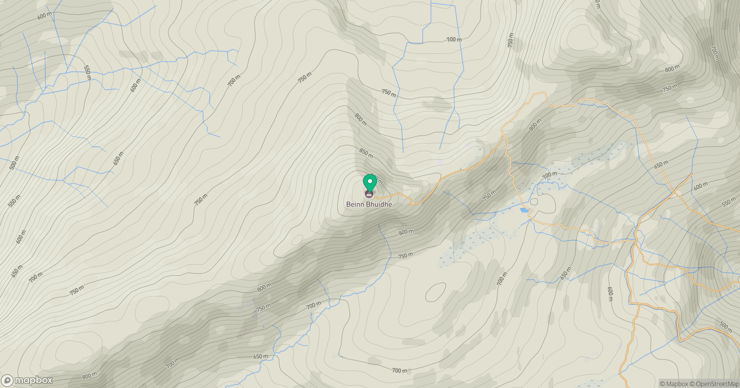
Grid reference: NN203187
View on OpenStreetMapOpens a map in a new tab, centred on the hill.
Nearby Hills
![Ben Lui [Beinn Laoigh]](https://cdn.walkmates.com/gallery-images/20d4da67f4984b329a102d7c3aba012b.jpg)
Ben Lui [Beinn Laoigh]
1,131m
Beinn Ime
1,012m
![The Cobbler [Ben Arthur]](https://cdn.walkmates.com/gallery-images/a1b697040769474a8338b3fb586ebc7a.jpg)
The Cobbler [Ben Arthur]
887m
Beinn Narnain
927m
Ben Vorlich
943m
No comments yet. Be the first.