
Beinn a' Chuirn
Good walks are even better shared.
Overview
Explore Beinn a' Chuirn
Overview
Beinn a' Chuirn is a prominent Munro standing proudly at 941 meters, located in the heart of the Scottish Highlands. This elegant peak, often overshadowed by its more famous neighbours, offers a rewarding trek with unforgettable scenery.
Geology
The foundation of Beinn a' Chuirn consists mainly of schist and gneiss, a testament to the powerful geological forces at play in the region. You might ponder, as you tackle the ascent, how ancient this rock is compared to your everyday life choices.
Routes
The South Ridge Route provides an accessible and picturesque ascent for most hikers, while the East Ridge offers a slightly more challenging option. Whether you are looking to take it easy or up the ante, there's a path for everyone. Just remember to pack your sense of adventure!
Summit Features
Upon reaching the summit, expect to be greeted by a charming stone cairn, a landmark that has surely witnessed countless triumphs over the years. Feel free to participate in the time-honoured tradition of posing with your friends or fellow hikers!
Terrain
The ascent features a varying landscape, from soft grassy slopes to rocky outcrops, and a wee bit of bog to keep you on your toes. Make sure to bring sturdy boots!
Views
Enjoy sweeping vistas from the top; the sight of Loch Awe shimmering in the distance will surely take your breath away. Timing your visit in spring or autumn can reward you with incredible colours and crystal-clear skies.
Hazards
Like most of the Scottish Highlands, the weather can turn on a dime. Be prepared for rain, wind, and maybe even a little sunshine if you're lucky!
Access
Parking at Auchlean is your best bet, with facilities just a stone's throw away in Crianlarich. Why not grab a coffee before your adventure?
History
The name Beinn a' Chuirn hints at the lush flora that flourished in its domain, with evidence of historic settlements scattered throughout the hills. Who knows, perhaps a poet once wandered these paths?
Whether you're a seasoned Munro-bagger or a weekend warrior seeking a new challenge, Beinn a' Chuirn is more than just a mountain—it's an experience waiting to unfold. So pack your bag, lace up those boots, and prepare for a delightful journey through the captivating landscapes of the Scottish Highlands.
Happy hiking!
Explore routes near Beinn a' Chuirn
Walks starting near this hill. Open a route to check its map, distance and full itinerary.
Monachyle Glen pack-pony short walk
View route
Beinn Ime from Succoth
View route
The Cobbler from Succoth Carpark
View route
Killin: Falls of Dochart, Finlarig and Moirlanich Longhouse
View route
Route planning notes
These notes describe possible approaches. Check a route's map and access information when planning your walk.
South Ridge Route
A popular ascent beginning from the car park near Auchlean, following well-trodden paths up steep grassy slopes before reaching rocky areas toward the summit.
East Ridge Route
Starting from the east, this route is a little more challenging, traversing some boggy patches and rocky outcrops. Ideal for those seeking a more strenuous hike.
Make a day of it, together
Find someone to share the walk with, or organise a day out along a route you like.
Hill facts and local notes
Classifications
Elevation
569m
1,868 ft
Prominence
159m
Coordinates
56.4941, -4.8977
NN217373
OS Map
50
Explorer: 377E
At the Summit
The summit features a classic stone cairn that provides an excellent vantage point for John's 'I've Made It!' selfies.
Terrain & Geology
The mountain primarily consists of schist and gneiss, offering a view into the fascinating metamorphic processes that shaped the Highlands. Beinn a' Chuirn's rugged characteristics make it a splendid specimen of the geological diversity found in this area.
Views & Scenery
From the summit, the majestic Loch Awe is visible to the west, alongside the stunning peaks of the surrounding Argyll mountains. On a clear day, you might even glimpse the distant outline of the Isle of Mull.
History & Heritage
Name Origin
The name Beinn a' Chuirn translates approximately to 'Hill of the Honeysuckle', which hints at its rich flora.
Historical Significance
The area is steeped in history, with remnants of ancient settlements and evidence of past tribes that roamed these hills.
Getting There & Facilities
Parking
Parking is available at Auchlean, where you can find a small dedicated space suitable for several cars. Arrive early, especially on weekends, as it can fill up quickly.
Public Transport
Public transport is limited; however, you can take a bus to Tyndrum and arrange a taxi from there to Auchlean.
Nearby Facilities
Crianlarich offers a few cafes and shops where you can grab some refreshments before or after your hike. Toilets are available in some establishments or at the train station.
Safety Information
Known Hazards
- Be mindful of changing weather conditions, which can shift from sunshine to rain quicker than you can say 'Scottish weather'. The paths can be wet and slippery, particularly on the descent.
General Safety Tips
- Check weather conditions before setting out
- Carry appropriate clothing and equipment
- Let someone know your planned route
- Take a map, compass, and GPS device
- Carry emergency supplies: food, water, first aid kit, torch
Hills
Some common questions about the hills answered
Are there group walks up Beinn a' Chuirn?
Many walkers use Walkmates to join or organise walks with others. You can check for group walks around Beinn a' Chuirn through the maps
Are there other walkers around Beinn a' Chuirn?
Activity varies by location and time, but Walkmates lets you see whether others have shared walks or shown interest in this area. Find other people through the walking friends search walking friends for Beinn a' Chuirn search or of course create your own walk for Beinn a' Chuirn
Can I organise a walk to Beinn a' Chuirn?
Yes. If there aren’t any walks listed already, you can create a walk and make it available for others to join.
If you're signed up to Walkmates, you can create a walk to Beinn a' Chuirn.
How do I find a walk up this hill?
There are often multiple ways to walk this hill, depending on experience and route preference. Walkmates helps you explore walks and routes that others have shared.
Can I suggest a new route up Beinn a' Chuirn?
Yes. You can suggest or create routes to share with others. Walkmates focuses on the social side of walking, so routes are used to help people organise walks and explore areas together, rather than as detailed navigation tools or route libraries.
Other uses really appreciate knowledgeable walkers sharing their routes. Share your favourite route to Beinn a' Chuirn here
The is an error or something incorrect about this hill. How do I let you know?
We always strive to keep the information on Walkmates as accurate as possible. If you find an error, please let us know through the contact form and we'll aim to correct it as quickly as possible
Community Discussion
Comments
Location
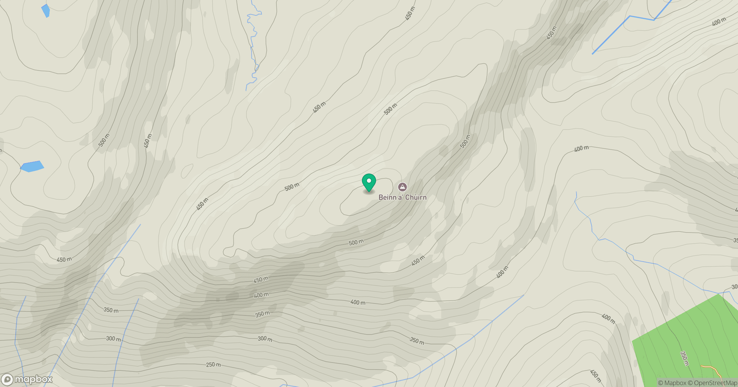
Grid reference: NN217373
View on OpenStreetMapOpens a map in a new tab, centred on the hill.
![Ben Lui [Beinn Laoigh]](https://cdn.walkmates.com/gallery-images/20d4da67f4984b329a102d7c3aba012b.jpg)
No comments yet. Be the first.