

Buachaille Etive Beag - Stob Dubh
Good walks are even better shared.
NN1853 : Approaching the summit of Stob Dubh
Iain Russell Photo source
Overview
Stob Dubh is the higher, southwestern Munro of Buachaille Etive Beag, above Glen Etive and Glen Coe. Its 956.7 m summit is reached along a rocky ridge from Mam Buidhe. The other Munro on this ridge is Stob Coire Raineach; Buachaille Etive Mòr is a separate mountain across the Lairig Gartain.
Buachaille Etive Beag - Stob Dubh
Stob Dubh is the southwestern and higher Munro of the Buachaille Etive Beag ridge, at 956.7 m. Stob Coire Raineach is the other Munro; the larger Buachaille Etive Mòr lies across the Lairig Gartain.
Walking the ridge
The usual approach starts at NN187562 beside the A82 and climbs from the Lairig Èilde path to Mam Buidhe. Stob Dubh lies southwest of this bealach. A visit to both Munros returns to the same bealach and approach path: Walkhighlands gives 8 km and 5–6 hours for that complete outing.
The Glen Etive approach climbs the steep southwest ridge. A longer circuit described by Walking Britain descends that shoulder and returns through the Lairig Èilde; its full itinerary is 14.6 km. Stream levels matter on this alternative.
Summit and surroundings
The rocky summit has a cairn, with a lower viewpoint cairn beyond. Loch Etive, the neighbouring Buachaille and the Bidean massif form the principal views. The massif belongs to the Glencoe volcanic complex. Its Gaelic name means “small herdsman of Etive”; Stob Dubh means “black” or “dark peak”.
Conditions and access
The narrow ridge needs care in wind, snow and ice; winter cornices and avalanche conditions can affect the route. Poor visibility makes the return from Stob Coire Raineach particularly easy to misjudge. The Glen Etive descent is steep, and Lairig Èilde burns may prevent a circuit after heavy rain.
Visitor-centre facilities are near Glencoe village. Kingshouse coach stops require separate onward access to the starting car park.
Explore routes near Buachaille Etive Beag - Stob Dubh
Walks starting near this hill. Open a route to check its map, distance and full itinerary.
Ben Nevis via Mountain Path
View route
Banavie to Glen Loy Aqueduct: Neptune’s Staircase Canal Towpath
View route
Killin: Falls of Dochart, Finlarig and Moirlanich Longhouse
View route
Coire Ardair lochan from Aberarder and back
View route
Route planning notes
These notes describe possible approaches. Check a route's map and access information when planning your walk.
Stob Dubh via Mam Buidhe
Start at the A82 car park at NN187562. Follow the Lairig Èilde approach, then the constructed uphill path to Mam Buidhe. Turn southwest along the ridge, over the north top, to Stob Dubh. Return by the same ridge and approach path. This out-and-back omits Stob Coire Raineach.
Both Munros from Glen Coe
From NN187562, climb the western path to Mam Buidhe. Visit Stob Dubh along the southwest ridge, return to the bealach, then climb Stob Coire Raineach to the northeast. Return to Mam Buidhe and descend the approach path. Walkhighlands gives 8 km, 900 m ascent and 5–6 hours for the full outing.
Glen Etive via the southwest ridge
From parking near Dalness, follow the Lairig Èilde/Lairig Gartain access path, then climb the steep south-southwest ridge to Stob Dubh, with scree higher up. Continue northeast to Mam Buidhe, descend towards the River Coupall and return southwest through the Lairig Gartain to Glen Etive. The bealach descent requires careful navigation.
Ridge traverse and Lairig Èilde circuit
Walking Britain’s circuit starts at NN196563 on the A82: approach Mam Buidhe, climb Stob Coire Raineach, then traverse southwest to Stob Dubh. Descend its steep southwest shoulder towards Glen Etive and return north through the Lairig Èilde to the start. Allow about 8 hours 20 minutes for 14.6 km and 1,294 m ascent. Wet grass, unbridged burns and the A82 approach are significant hazards.
Stob Dubh in winter via Mam Buidhe
Use the western approach from NN187562 to Mam Buidhe and the southwest ridge towards Stob Dubh, returning the same way when conditions permit. Snow, ice, cornices and avalanche conditions can change the viable line and turnaround point. Ice-axe and crampon skills, winter navigation and an assessment of current snow stability are essential.
Make a day of it, together
Find someone to share the walk with, or organise a day out along a route you like.
Photo Gallery
View all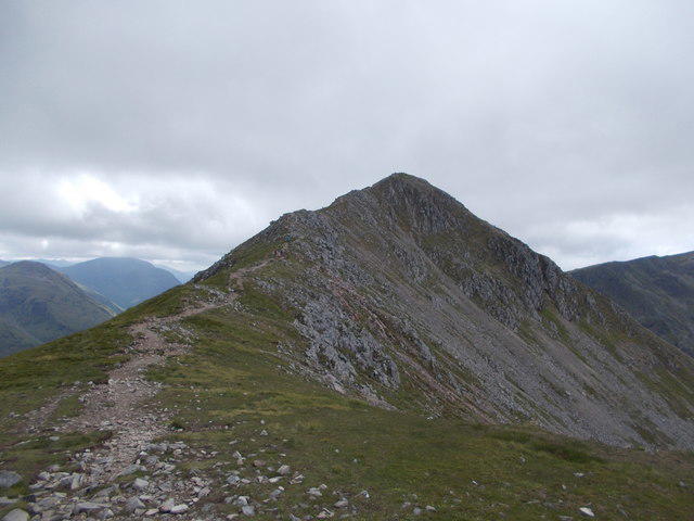 Photo could not load
NN1853 : Approaching the summit of Stob Dubh
Iain Russell
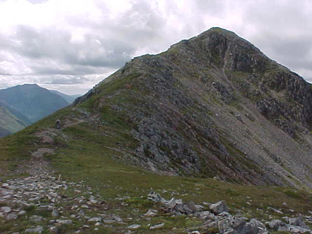 Photo could not load
NN1853 : Path on Buachaille Etive Beag
Tim Glover
 Photo could not load
NN1853 : Stob Dubh summit appears in view
Iain Lees
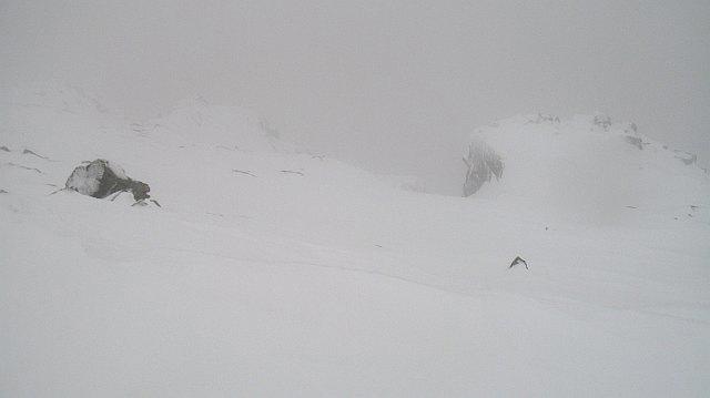 Photo could not load
NN1753 : Crags, Stob Dubh
Richard Webb
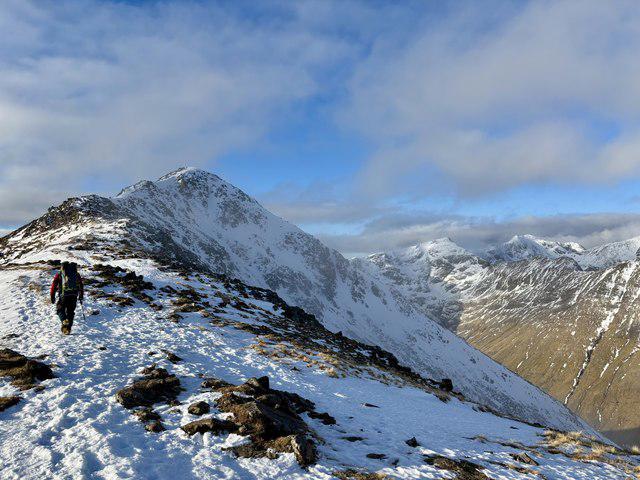 Photo could not load
NN1853 : Nearing the Summit of Stob Dubh
Iain Lees
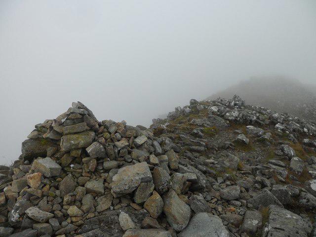 Photo could not load
NN1753 : The rocky summit of Stob Dubh (Buachaille Etive Beag)
Stephen Sweeney
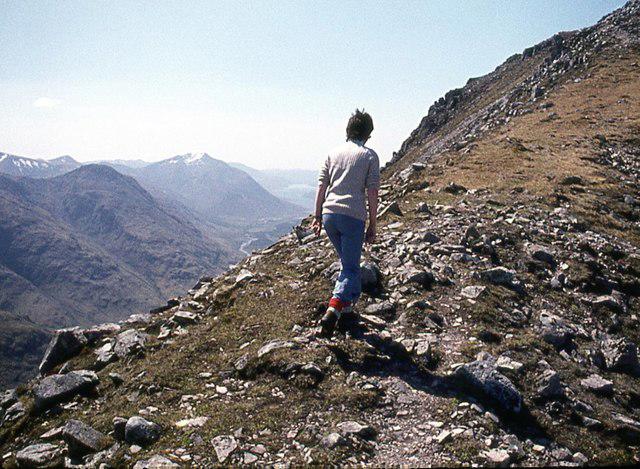 Photo could not load
NN1853 : Walking the ridge on Buachaille Etive Beag
Alan Reid
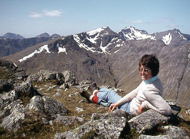 Photo could not load
NN1753 : Resting easy on Stob Dubh, Buachaille Etive Beag
Alan Reid
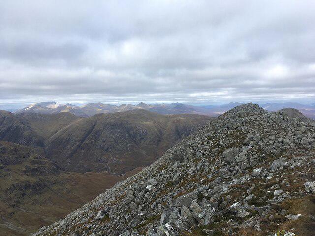 Photo could not load
NN1753 : Summit of Stob Dubh
Steven Brown
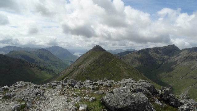
NN1753 : On Buachaille Etive Beag - On Stob Coire Raineach with view to Stob Dubh
Colin Park
Hill facts and local notes
Classifications
Elevation
957m
3,139 ft
Prominence
468m
Coordinates
56.6382, -4.9708
NN179535
OS Map
41
Explorer: 384
At the Summit
A cairn marks the rocky summit area. A second, lower cairn farther southwest provides a view down Glen Etive; it is not the highest point.
Terrain & Geology
Buachaille Etive Beag is part of the ancient Glencoe volcanic complex. The massif preserves volcanic and sedimentary layers; rhyolitic ignimbrites are particularly well exposed at Stob nan Cabar on its northeastern end. Later glaciation helped shape the surrounding glens.
Views & Scenery
Views down Glen Etive towards Loch Etive, across the Lairig Gartain to Buachaille Etive Mòr, and towards the Bidean nam Bian massif.
History & Heritage
Name Origin
Buachaille Etive Beag means “small herdsman of Etive”; Stob Dubh means “black” or “dark peak”.
Getting There & Facilities
Parking
The usual western approach starts at the A82 car park opposite the beehive-shaped cairn, near The Study, at NN187562. Spaces can fill at busy times.
Public Transport
Glasgow–Fort William/Skye coaches use the A82; Walkhighlands identifies Kingshouse as the nearest stop for this route. The stop is separate from the NN187562 trailhead, so allow for onward access and confirm the service and return journey before travel.
Nearby Facilities
Glencoe Visitor Centre near Glencoe village has toilets, a café and a shop, subject to opening hours. NTS lists public toilets in Glencoe village as the alternative when the visitor-centre toilets are closed.
Safety Information
Known Hazards
- The ridge towards Stob Dubh narrows above steep slopes; wind and wet or icy rock increase the consequences of a slip.
- On the return from Stob Coire Raineach, misleading paths can lead onto craggy western slopes in poor visibility.
- The southwest descent towards Glen Etive is very steep and slippery when wet. Stream crossings on the Lairig Èilde circuit can become impassable after heavy rain.
Seasonal Hazards
Snow and ice can hide the path, and cornices can form on the Stob Dubh ridge. Winter travel requires ice-axe and crampon skills, navigation in poor visibility and avalanche-aware route choice. Consult current mountain-weather and Glencoe avalanche information.
General Safety Tips
- Check weather conditions before setting out
- Carry appropriate clothing and equipment
- Let someone know your planned route
- Take a map, compass, and GPS device
- Carry emergency supplies: food, water, first aid kit, torch
Hills
Some common questions about the hills answered
Are there group walks up Buachaille Etive Beag - Stob Dubh?
Many walkers use Walkmates to join or organise walks with others. You can check for group walks around Buachaille Etive Beag - Stob Dubh through the maps
Are there other walkers around Buachaille Etive Beag - Stob Dubh?
Activity varies by location and time, but Walkmates lets you see whether others have shared walks or shown interest in this area. Find other people through the walking friends search walking friends for Buachaille Etive Beag - Stob Dubh search or of course create your own walk for Buachaille Etive Beag - Stob Dubh
Can I organise a walk to Buachaille Etive Beag - Stob Dubh?
Yes. If there aren’t any walks listed already, you can create a walk and make it available for others to join.
If you're signed up to Walkmates, you can create a walk to Buachaille Etive Beag - Stob Dubh.
How do I find a walk up this hill?
There are often multiple ways to walk this hill, depending on experience and route preference. Walkmates helps you explore walks and routes that others have shared.
Can I suggest a new route up Buachaille Etive Beag - Stob Dubh?
Yes. You can suggest or create routes to share with others. Walkmates focuses on the social side of walking, so routes are used to help people organise walks and explore areas together, rather than as detailed navigation tools or route libraries.
Other uses really appreciate knowledgeable walkers sharing their routes. Share your favourite route to Buachaille Etive Beag - Stob Dubh here
The is an error or something incorrect about this hill. How do I let you know?
We always strive to keep the information on Walkmates as accurate as possible. If you find an error, please let us know through the contact form and we'll aim to correct it as quickly as possible
Community Discussion
Comments
Location
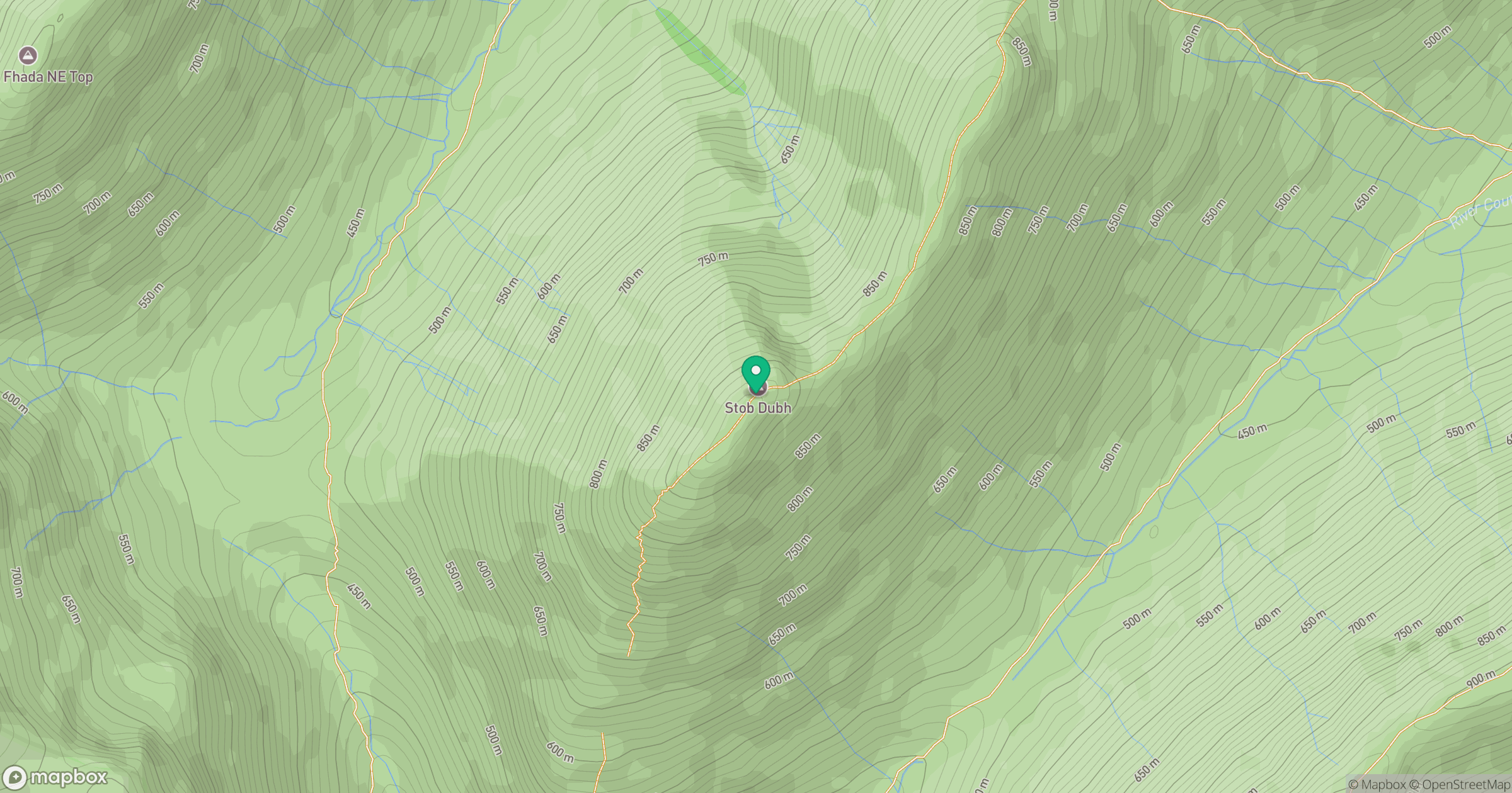
Grid reference: NN179535
View on OpenStreetMapOpens a map in a new tab, centred on the hill.
No comments yet. Be the first.