

Auchensoul Hill
Good walks are even better shared.
Overview
Auchensoul Hill
Overview
Auchensoul Hill, standing at 224 meters, is a rewarding jaunt for anyone looking to enjoy the landscapes of the Southern Uplands. It's classified as a Marilyn, meaning it's got just enough height to get you puffing on the way up, but easy-going enough to leave you with plenty of energy for view appreciation at the summit.
Geology
The hill's rocky surfaces and rolling grass are predominantly made of sandstone and mudstone. These geological features contribute to the vibrancy of the flora here, so keep your eyes peeled for varied wildlife.
Routes
The primary route from Langholm is straightforward and offers a blend of grassy paths mixed with rugged patches, keeping your walk interesting. It's neither too long at 6.5 km nor too short, making it a perfect daylight venture for those with a moderate level of fitness.
Summit Features
The trig point at the top is not only a navigation aid but a pianist’s dream if you fancy a quick serenade for the sheep in the vicinity! Snap a photo here; it’s practically a rite of passage.
Terrain
Prepare for a bit of grass underfoot, with rocky outcrops that provide fun and challenge. Ensure your boots are vanquished for mud, especially after a rainy day.
Views
Once at the summit, take time to soak in the panoramic views, especially as the sun dips below the horizon, painting the sky a shade that would make even the most stubborn artist weep.
Hazards
Weather in the Southern Uplands can shift faster than you can say 'hot tea', so come prepared. While the terrain is generally safe, slippery sections exist, particularly after precipitation.
Nearby Summits
Extend your hike by bagging nearby summits like Castle Hill or Tinnis Hill; nothing beats the 2-for-1 deal on scenic vistas.
Access
The Langholm Common car park is your go-to for parking. Local buses make the trip to Langholm fairly easy, and you’ll find plenty of quaint cafes awaiting your return.
Facilities
You can find comfortable spots to rest and refuel in Langholm, as it offers several cafes and bars, alongside public toilets. Not to mention a chance to rehydrate with something a tad stronger, if you fancy.
History
The name 'Auchensoul' speaks volumes, with its roots hinting at the soul of the land itself. The cultural tapestry of the region is rich, and it’s noticeable in the warmth of the people you’ll encounter.
Conclusion
Whether you’re plodding up for the exercise, the views, or to tick off another hill from your list, Auchensoul Hill is a hill that charms every visitor. Don’t forget your camera – your friends will want evidence of your adventure!
Happy hiking!
Explore routes near Auchensoul Hill
Public walks starting within 80 km of this hill. Nearby does not mean a route reaches the summit; check its map and access before setting out.
Carrick Forest Drive: Stinchar Bridge to Loch Doon
View route
Glentrool Water of Trool and Spout Head Trail
View route
Loch Trool: Full Loch and Oak Woodland Circuit
View route
Wood of Cree Waterfalls and Scrubland Circuit
View route
Route planning notes
These notes describe possible approaches, not verified navigable routes or permission to cross land. Check current paths, local access rules and conditions before setting out.
Langholm to Auchensoul Hill
A well-trodden path from Langholm that leads you steadily up the grassy slopes of Auchensoul Hill, with scenic views along the way.
Make a day of it, together
Find someone to share the walk with, or organise a day out along a route you like.
Photo Gallery
View all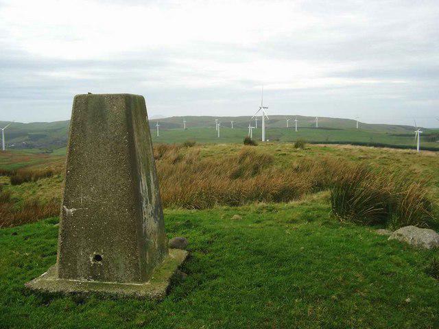 Photo could not load
NX2694 : The trig on Auchensoul Hill
Gordon Brown
Hill facts and local notes
Classifications
Elevation
314m
1,030 ft
Prominence
119m
Coordinates
55.2146, -4.7304
NX263945
OS Map
76
Explorer: 317
At the Summit
The summit features a prominent trig point, giving you a taste of the views while also being a great excuse for a selfie.
Terrain & Geology
The hill is primarily composed of sedimentary rock, with layers of sandstone and mudstone. This geological formation creates a varied terrain that supports lush vegetation and delicate ecosystems.
Views & Scenery
On a clear day, the view stretches toward the Solway Firth and across the rolling hills of the Southern Uplands. Mighty sights like Criffel and the distant hills of the Scottish Borders may also catch your eye.
History & Heritage
Name Origin
The name 'Auchensoul' likely derives from Scottish Gaelic, meaning 'field of the soul' – an intriguing thought for those who ponder the metaphysical while hiking.
Historical Significance
Historically, the area has been a significant pastureland and played a role in local agriculture, reflecting the region's strong farming heritage.
Getting There & Facilities
Check current local access restrictions, parking rules and transport timetables before travelling. These notes do not confirm public access to the summit.
Parking
Parking is available at the Langholm Common car park, which is about 2 km from the starting point of the main route.
Public Transport
Regular bus services operate from nearby towns, with the closest stop being in Langholm. Check local timings as they can be a bit hit or miss.
Nearby Facilities
In Langholm, you'll find a number of cafes and pubs to refuel after your hike, as well as public toilets.
Safety Information
Known Hazards
- Manageable terrain, but watch for muddy patches after rain. Also, be cautious of sudden weather changes typical of the region.
General Safety Tips
- Check weather conditions before setting out
- Carry appropriate clothing and equipment
- Let someone know your planned route
- Take a map, compass, and GPS device
- Carry emergency supplies: food, water, first aid kit, torch
Hills
Some common questions about the hills answered
Are there group walks up Auchensoul Hill?
Many walkers use Walkmates to join or organise walks with others. You can check for group walks around Auchensoul Hill through the maps
Are there other walkers around Auchensoul Hill?
Activity varies by location and time, but Walkmates lets you see whether others have shared walks or shown interest in this area. Find other people through the walking friends search walking friends for Auchensoul Hill search or of course create your own walk for Auchensoul Hill
Can I organise a walk to Auchensoul Hill?
Yes. If there aren’t any walks listed already, you can create a walk and make it available for others to join.
If you're signed up to Walkmates, you can create a walk to Auchensoul Hill.
How do I find a walk up this hill?
There are often multiple ways to walk this hill, depending on experience and route preference. Walkmates helps you explore walks and routes that others have shared.
Can I suggest a new route up Auchensoul Hill?
Yes. You can suggest or create routes to share with others. Walkmates focuses on the social side of walking, so routes are used to help people organise walks and explore areas together, rather than as detailed navigation tools or route libraries.
Other uses really appreciate knowledgeable walkers sharing their routes. Share your favourite route to Auchensoul Hill here
The is an error or something incorrect about this hill. How do I let you know?
We always strive to keep the information on Walkmates as accurate as possible. If you find an error, please let us know through the contact form and we'll aim to correct it as quickly as possible
Community Discussion
Comments
Location
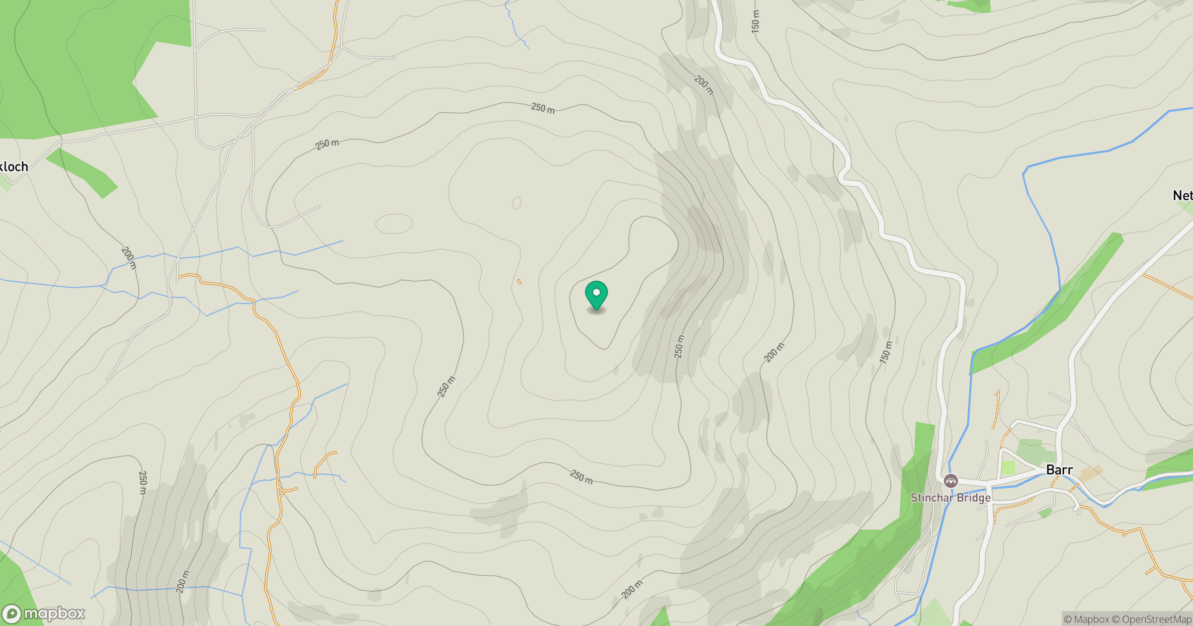
Grid reference: NX263945
View on OpenStreetMapOpens a map in a new tab, centred on the hill.
Hills within 30 km
Straight-line distance, not a walking route or confirmation of access.
No comments yet. Be the first.