

Knockdaw Hill
Good walks are even better shared.
Overview
Knockdaw Hill
Knockdaw Hill, standing majestically at 270 meters, is a splendid Marilyn tucked away in the Southern Uplands of Scotland. This charming hill offers both breathtaking views and a touch of adventure, perfect for seasoned hikers and those just looking to stretch their legs.
Geology
The geological features of Knockdaw Hill are nothing short of fascinating. Primarily composed of volcanic rock, the hill showcases an array of basalt formations that exhibit a rugged charm. These ancient rocks form dramatic cliffs and ridges that will make geology buffs swoon. Think of it as nature's very own artistic showcase, sculpted over millennia!
Routes
One of the most popular ways to ascend is via the Cree Valley Trail. Starting from the beautiful Cree Valley, the route meanders through lush woodlands before making the gradual ascent to the summit. It covers about 6.5 km and should take roughly 2.5 hours. Just enough time to ponder life’s big questions—like why do they call it a “drive-thru” if you have to stop?
Summit Features
At the zenith of your journey lies a modest cairn—an ideal spot for that all-important summit selfie. It’s the kind of place you’ll want to remember, not just for the view but for the sense of achievement that comes with reaching the top!
Terrain
Get ready for a mix of grassy landscapes interspersed with rocky outcrops. Be aware that certain areas can be a bit boggy, especially after good rainfall. Smart footwear is encouraged unless you fancy an unexpected dip!
Views
The panoramic views from Knockdaw Hill are one of its biggest highlights. You can feast your eyes on the Galloway Forest Park and, if you’re fortunate, catch a glimpse of the Solway Firth off to the west—ideal for daydreaming or planning your next adventure!
Best Seasons for Views
Spring and early autumn are prime times for basking in the hill's beauty. Witness the spring flowers or the brilliant foliage in autumn; either way, you'll feel like you've walked into a postcard.
Access
Getting there is a cinch! The nearest parking area is a small lot near Newton Stewart, just on the verge of the Cree Valley Trail. Public transport links are also favourable, with buses connecting Newton Stewart to nearby towns.
Facilities
Don’t forget to refuel! Newton Stewart boasts several cafes and shops where you can grab a caffeinated pick-me-up or a quick snack before your adventure or after conquering the hill.
Hazards
As with all outdoor adventures, be aware of rapidly changing weather conditions in the area. Visibility can drop faster than you can say ‘windy day’, so come prepared! Additionally, the terrain can be slippery during wet spells, so tread carefully.
Nearby Summits
While you’re at it, why not consider tackling other impressive summits nearby, such as Merrick, towering at 843 meters, or Corserine, a commendable 812 meters? These hills provide plenty of challenges and opportunities for spectacular views.
Conclusion
Knockdaw Hill is a delightful destination for hikers craving spectacular views and a pinch of adventure. So pack your bag, don your best hiking boots, and get ready for a day of exploration in this stunning pocket of Scotland!
Happy hiking!
Explore routes near Knockdaw Hill
Public walks starting within 80 km of this hill. Nearby does not mean a route reaches the summit; check its map and access before setting out.
Glentrool Water of Trool and Spout Head Trail
View route
Carrick Forest Drive: Stinchar Bridge to Loch Doon
View route
Loch Trool: Full Loch and Oak Woodland Circuit
View route
Wood of Cree Waterfalls and Scrubland Circuit
View route
Route planning notes
These notes describe possible approaches, not verified navigable routes or permission to cross land. Check current paths, local access rules and conditions before setting out.
Cree Valley Trail
Starting from the Cree Valley, this route winds through lush woodlands before ascending to the summit of Knockdaw Hill.
Make a day of it, together
Find someone to share the walk with, or organise a day out along a route you like.
Photo Gallery
View all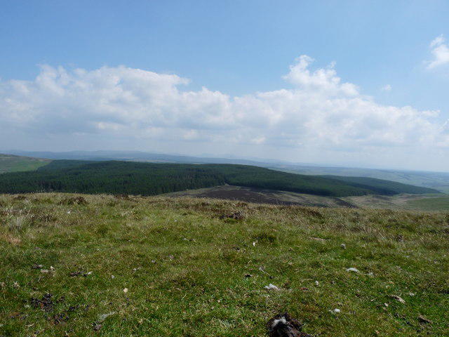 Photo could not load
NX1688 : Knockdaw Hill
Billy McCrorie
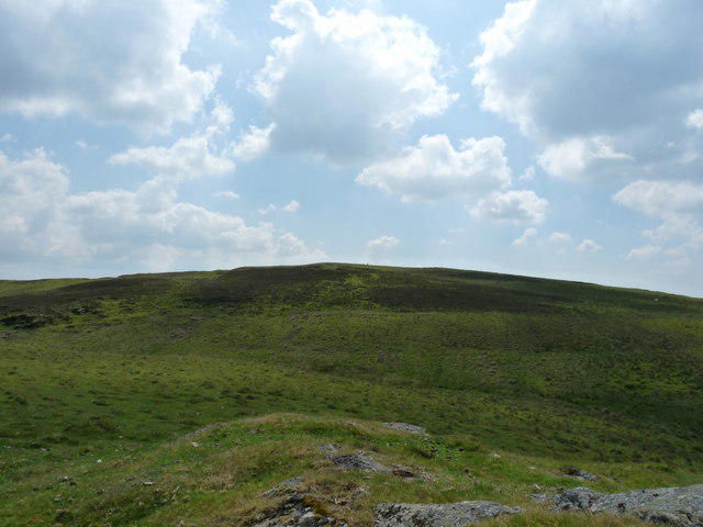 Photo could not load
NX1689 : Knockdaw Hill
Billy McCrorie
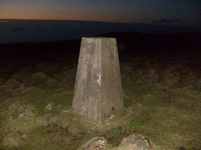 Photo could not load
NX1688 : Knockdaw trig and Ailsa Craig
Rob Woodall
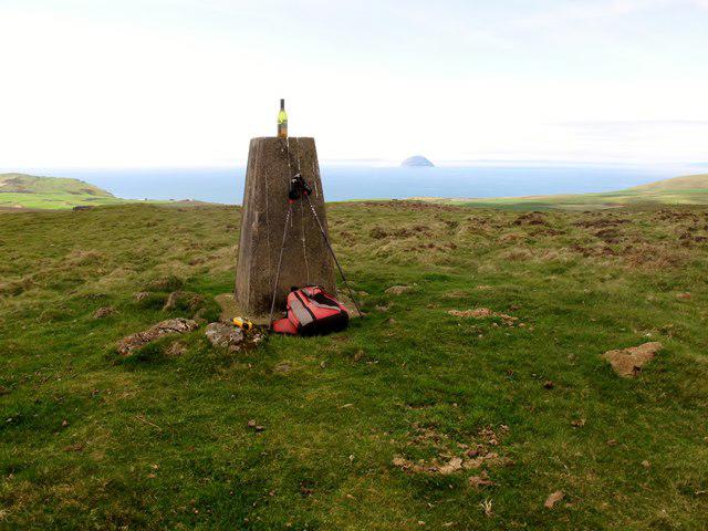 Photo could not load
NX1688 : Knockdaw Hill
Rude Health
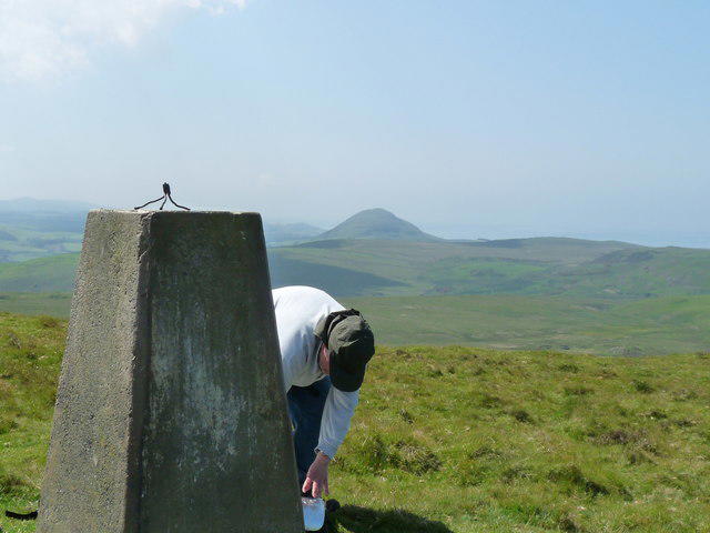 Photo could not load
NX1688 : Knockdaw Trig Point
Billy McCrorie
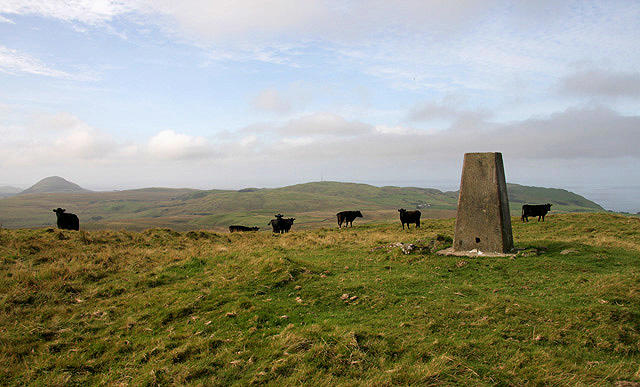 Photo could not load
NX1688 : The trig point on Knockdaw Hill
Walter Baxter
Hill facts and local notes
Classifications
Elevation
260m
853 ft
Prominence
122m
Coordinates
55.1604, -4.8864
NX162889
OS Map
76
Explorer: 317
At the Summit
At the summit, you will find a modest cairn marking the highest point, offering a perfect spot for a well-deserved photo op.
Terrain & Geology
The hill is predominantly composed of volcanic rock, with layers of basalt and other igneous formations that create dramatic ridges and cliffs.
Views & Scenery
From the summit, one can enjoy sweeping views over the surrounding hills and stunning vistas of the Galloway Forest Park. Look out for the Solway Firth stretching into the distance.
History & Heritage
Name Origin
The name 'Knockdaw' comes from the Scots Gaelic 'Cnoc Dubh', meaning 'black hill.'
Historical Significance
Historically, Knockdaw Hill has served as a lookout point for local shepherds and farmers, providing excellent visibility over the surrounding countryside.
Getting There & Facilities
Check current local access restrictions, parking rules and transport timetables before travelling. These notes do not confirm public access to the summit.
Parking
There is a small parking area at the start of the Cree Valley Trail near the village of Newton Stewart.
Public Transport
Buses run regularly from nearby towns to Newton Stewart. Check local schedules for current times.
Nearby Facilities
There are several cafes and shops in Newton Stewart where you can grab a bite or use the restroom before or after your hike.
Safety Information
Known Hazards
- Beware of rapidly changing weather conditions typical of the region; visibility can drop quickly. The terrain, while generally grassy, can become slippery when wet, especially in boggy areas.
General Safety Tips
- Check weather conditions before setting out
- Carry appropriate clothing and equipment
- Let someone know your planned route
- Take a map, compass, and GPS device
- Carry emergency supplies: food, water, first aid kit, torch
Hills
Some common questions about the hills answered
Are there group walks up Knockdaw Hill?
Many walkers use Walkmates to join or organise walks with others. You can check for group walks around Knockdaw Hill through the maps
Are there other walkers around Knockdaw Hill?
Activity varies by location and time, but Walkmates lets you see whether others have shared walks or shown interest in this area. Find other people through the walking friends search walking friends for Knockdaw Hill search or of course create your own walk for Knockdaw Hill
Can I organise a walk to Knockdaw Hill?
Yes. If there aren’t any walks listed already, you can create a walk and make it available for others to join.
If you're signed up to Walkmates, you can create a walk to Knockdaw Hill.
How do I find a walk up this hill?
There are often multiple ways to walk this hill, depending on experience and route preference. Walkmates helps you explore walks and routes that others have shared.
Can I suggest a new route up Knockdaw Hill?
Yes. You can suggest or create routes to share with others. Walkmates focuses on the social side of walking, so routes are used to help people organise walks and explore areas together, rather than as detailed navigation tools or route libraries.
Other uses really appreciate knowledgeable walkers sharing their routes. Share your favourite route to Knockdaw Hill here
The is an error or something incorrect about this hill. How do I let you know?
We always strive to keep the information on Walkmates as accurate as possible. If you find an error, please let us know through the contact form and we'll aim to correct it as quickly as possible
Community Discussion
Comments
Location
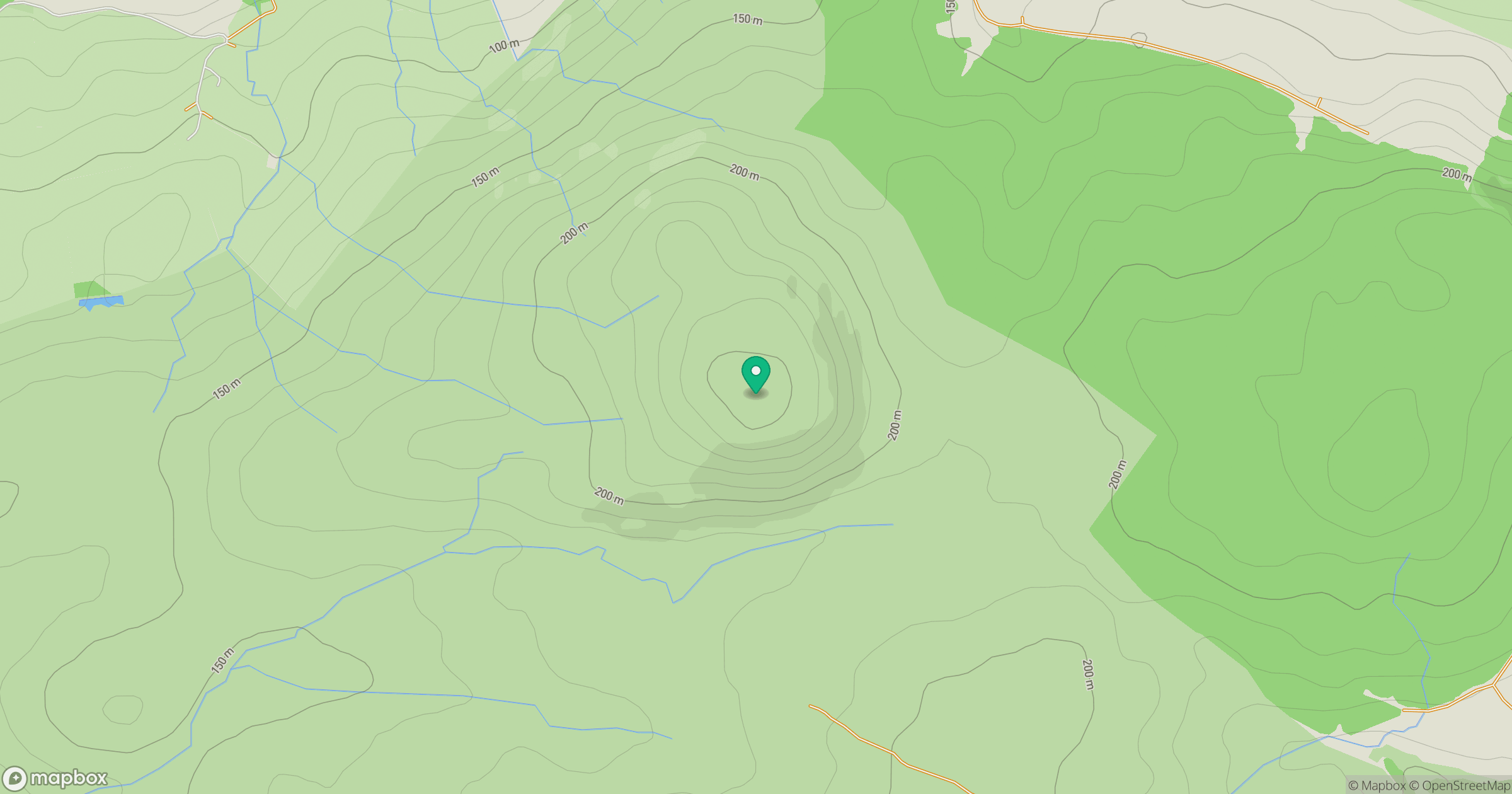
Grid reference: NX162889
View on OpenStreetMapOpens a map in a new tab, centred on the hill.
Hills within 30 km
Straight-line distance, not a walking route or confirmation of access.
No comments yet. Be the first.