

Carlock Hill
Good walks are even better shared.
Overview
Carlock Hill
Nestled in the scenic Southern Uplands of Scotland, Carlock Hill offers outdoor enthusiasts a delightful escape into nature. With an elevation of 340 meters, it's classified as a Marilyn, which is simply a fancy term for a hill with a height of at least 150 meters and a prominence that makes it stand out from the surrounding terrain.
Geology
The hill is primarily composed of sandstone, creating a sturdy foundation for the vibrant heather and grassland that blanket its slopes. This unique geology supports a rich array of wildlife, making the area a biodiversity hotspot. Be sure to look out for the local flora and fauna—who knows, you might just stumble upon a rare species or two!
Route Description
The recommended route is the Carlock Hill Circular Walk, which spans approximately 8.5 kilometers and takes about 2.5 hours. Starting from the charming village of Charrington, this moderate trail weaves through picturesque woodlands and opens up to beautiful heathland. Remember to pace yourself; you want to enjoy the scenery without ending up breathless—unless, of course, you’re competing with a sheep!
Summit Features
Upon reaching the summit, don’t forget to check out the large stone cairn and the small trig point. These landmarks are not just perfect for that Instagram-worthy shot; they also serve as great conversation starters with fellow hikers about the epic journey you’ve just completed.
Terrain and Views
The terrain is mainly grassy, with rocky outcrops here and there, offering a gentle challenge without the fear of climbing Everest! The views from the top are simply breathtaking, showcasing the rolling hills of the Southern Uplands. On a clear day, you might even spot the distant peaks of the Lowther Hills. The best time to appreciate the vistas is undoubtedly in spring and early autumn when the weather is just right for a hike.
Hazards
Keep your wits about you during wet weather; paths can turn into a slippery challenge. A royal tip: if you sense a slip coming, just remember to channel your inner ice skater!
Nearby Summits
If you’re still full of energy after conquering Carlock Hill, consider making your way to the nearby Too Cold Hill or White Hill. Each offers a unique perspective of the area and more chances to soak in Scotland's natural beauty.
Access
Getting to Carlock Hill is easy. The nearest parking is conveniently located in Charrington, only a stone’s throw from the trailhead. For those relying on public transport, regular bus services make it simple to get to Charrington from nearby towns.
Facilities
While the hill itself boasts no facilities (unless you count the great outdoors as one!), Charrington features a delightful café to enjoy a post-hike treat. Nothing says accomplishment quite like sharing stories with a cuppa and cake!
History
The name 'Carlock' is said to mean 'place of the fortress' in old Gaelic—fitting for a peak that guards such magnificent views. Locally, Carlock Hill might not have witnessed the dramatic history of battles or conquests, but you'll find ample folk tales scattered throughout the area, perfect for some spooky storytelling under the stars.
In conclusion, Carlock Hill may not be the highest mountain in Scotland, but it offers a perfect blend of accessibility, charm, and stunning views, making it a must-visit for hikers and nature lovers alike. Don your hiking boots and hit the trail—adventure awaits!
Explore routes near Carlock Hill
Public walks starting within 80 km of this hill. Nearby does not mean a route reaches the summit; check its map and access before setting out.
Glentrool Water of Trool and Spout Head Trail
View route
Wood of Cree Waterfalls and Scrubland Circuit
View route
Loch Trool: Full Loch and Oak Woodland Circuit
View route
Knockman Wood Cairn and Woodland Trail
View route
Route planning notes
These notes describe possible approaches, not verified navigable routes or permission to cross land. Check current paths, local access rules and conditions before setting out.
Carlock Hill Circular Walk
A pleasant circular route starting from the village of Charrington, offering a mix of woodland and open heathland.
Make a day of it, together
Find someone to share the walk with, or organise a day out along a route you like.
Photo Gallery
View all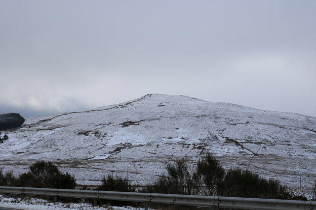 Photo could not load
NX0877 : Carlock Hill
Billy McCrorie
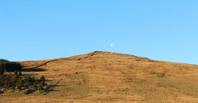 Photo could not load
NX0877 : Moon over Carlock
Billy McCrorie
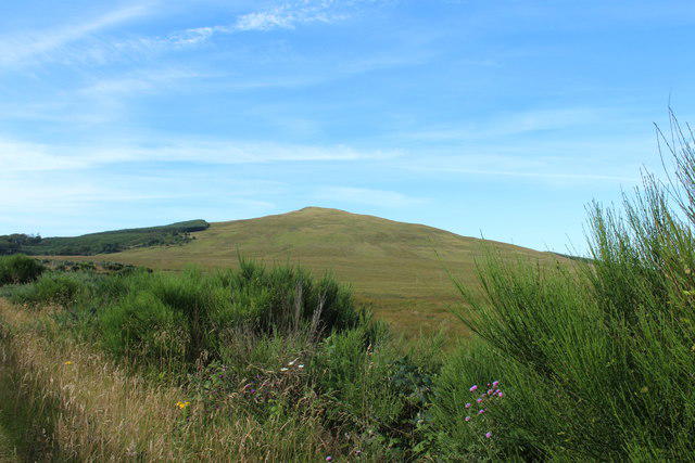 Photo could not load
NX0877 : Carlock Hill
Billy McCrorie
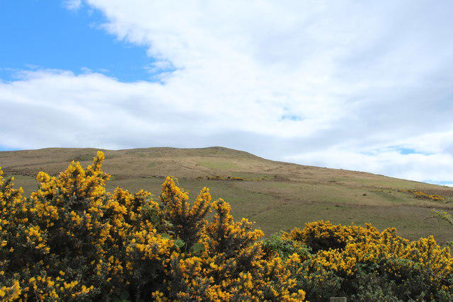 Photo could not load
NX0877 : Carlock Hill
Billy McCrorie
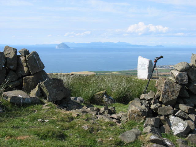 Photo could not load
NX0877 : The summit of Carlock Hill
David Purchase
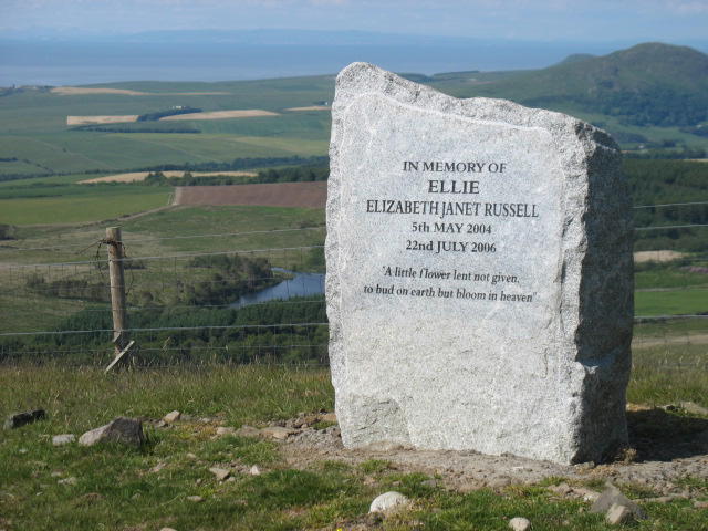 Photo could not load
NX0877 : Memorial stone on Carlock Hill
David Purchase
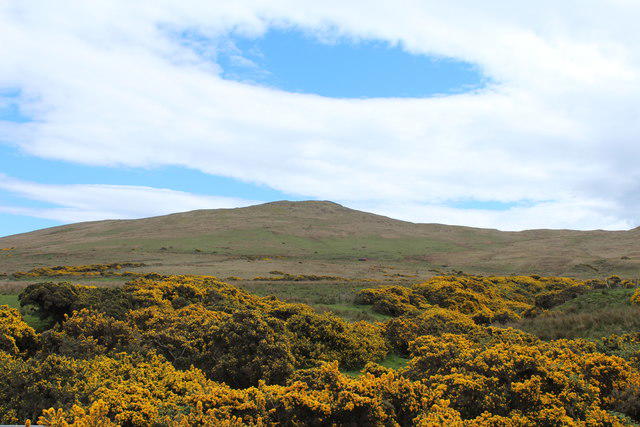 Photo could not load
NX0877 : Carlock Hill
Billy McCrorie
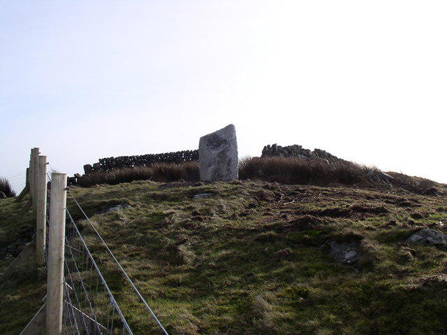 Photo could not load
NX0877 : Carlock Summit
Billy McCrorie
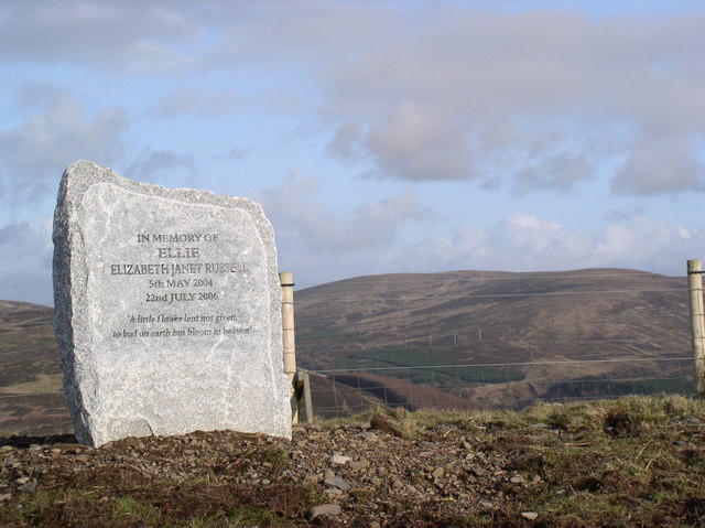 Photo could not load
NX0877 : Memorial Stone
Billy McCrorie
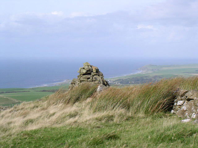
NX0877 : Carlock Cairn
Billy McCrorie
Hill facts and local notes
Classifications
Elevation
322m
1,056 ft
Prominence
148m
Coordinates
55.0526, -4.9984
NX085772
OS Map
76
Explorer: 317
At the Summit
The summit features a large stone cairn and a small trig point, perfect for a celebratory selfie after the climb.
Terrain & Geology
The hill is predominantly composed of sandstone, with large areas of heather and grassland covering the slopes. This combination of geology contributes to its rich biodiversity.
Views & Scenery
From the summit, you can enjoy sweeping views of the surrounding Southern Uplands, with the distant peaks of the Lowther Hills faintly visible on a clear day.
History & Heritage
Name Origin
The name 'Carlock' is thought to derive from the old Gaelic terms meaning 'place of the fortress' – perhaps a nod to its commanding views.
Historical Significance
While not steeped in deep historical events, the area around Carlock Hill has seen its fair share of local folklore, making it a charming spot for storytelling around the campfire.
Getting There & Facilities
Check current local access restrictions, parking rules and transport timetables before travelling. These notes do not confirm public access to the summit.
Parking
The nearest parking area is located in Charrington, just a short walk from the start of the trail.
Public Transport
Regular bus services run to Charrington from nearby towns, making it accessible for public transport users.
Nearby Facilities
There are no facilities on the hill itself, but Charrington has a small café where you can refuel with a slice of cake and a cup of tea after your hike.
Safety Information
Known Hazards
- In wet weather, the paths can become quite muddy and slippery. Watch your step, as it’s easy to do the ‘slip and slide’ even if you're not skiing!
General Safety Tips
- Check weather conditions before setting out
- Carry appropriate clothing and equipment
- Let someone know your planned route
- Take a map, compass, and GPS device
- Carry emergency supplies: food, water, first aid kit, torch
Hills
Some common questions about the hills answered
Are there group walks up Carlock Hill?
Many walkers use Walkmates to join or organise walks with others. You can check for group walks around Carlock Hill through the maps
Are there other walkers around Carlock Hill?
Activity varies by location and time, but Walkmates lets you see whether others have shared walks or shown interest in this area. Find other people through the walking friends search walking friends for Carlock Hill search or of course create your own walk for Carlock Hill
Can I organise a walk to Carlock Hill?
Yes. If there aren’t any walks listed already, you can create a walk and make it available for others to join.
If you're signed up to Walkmates, you can create a walk to Carlock Hill.
How do I find a walk up this hill?
There are often multiple ways to walk this hill, depending on experience and route preference. Walkmates helps you explore walks and routes that others have shared.
Can I suggest a new route up Carlock Hill?
Yes. You can suggest or create routes to share with others. Walkmates focuses on the social side of walking, so routes are used to help people organise walks and explore areas together, rather than as detailed navigation tools or route libraries.
Other uses really appreciate knowledgeable walkers sharing their routes. Share your favourite route to Carlock Hill here
The is an error or something incorrect about this hill. How do I let you know?
We always strive to keep the information on Walkmates as accurate as possible. If you find an error, please let us know through the contact form and we'll aim to correct it as quickly as possible
Community Discussion
Comments
Location
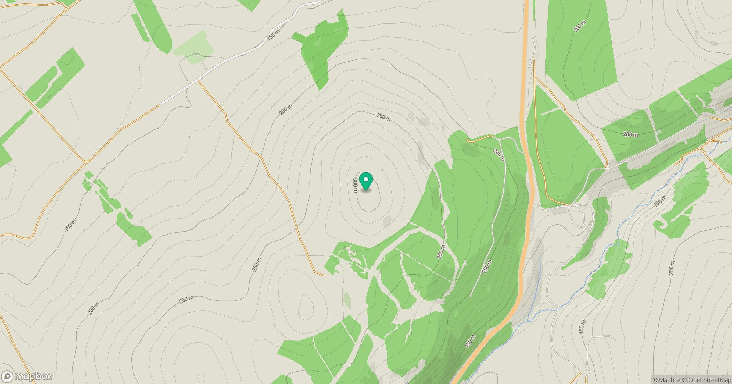
Grid reference: NX085772
View on OpenStreetMapOpens a map in a new tab, centred on the hill.
Hills within 30 km
Straight-line distance, not a walking route or confirmation of access.
No comments yet. Be the first.