

An Coileachan
Good walks are even better shared.
NH2467 : Near the summit of An Coileachan
Steven Brown Photo source
Overview
An Coileachan: A Munro with Character
Nestled in the breathtaking expanse of the Scottish Highlands, An Coileachan stands proudly at 850 meters, offering both seasoned hikers and eager newcomers a rewarding challenge. Its impressive prominence and stunning views make it a cherished destination for many.
Geology
An Coileachan is primarily built of granite, a resilient rock community that has withstood the test of time—much like your uncle at family gatherings. This granite is not just for show; it shapes the rugged and dramatic landscape around the peak, featuring striking glacial sculpting that dates back thousands of years.
Routes
The most popular route is the Coileachan Circuit, a moderate loop that starts from the north side. Over a distance of 10 km, hikers typically find themselves enveloped in picturesque surroundings, with wildflowers in spring and colourful foliage in autumn.
Summit Features
Upon reaching the summit, hikers will be greeted by a sizeable cairn — a favourite spot for photos and perhaps a cheeky nibble of that packed lunch. The views are simply spectacular, stretching across several major landmarks of the Highlands.
Terrain
Expect a mix of rocky paths and grassy slopes, interspersed with several boggy areas (a true Scottish experience!). Good hiking boots are essential to tackle the changes in terrain.
Views
The summit showcases highlights like Ben Wyvis, the shimmering Lochcarron, and a good chance of spotting red deer in the valleys below if you're quiet—as quiet as a mum in a sweet shop.
Hazards
While traversing An Coileachan, be wary of rapidly shifting weather conditions. A sunny day can turn unexpectedly gloomy with no warning, so prepare appropriately with gear to handle both sun and rain.
Access
For those driving, the nearest parking is situated at NH 244 678, accommodating around 10 vehicles. It’s a good idea to arrive early to stake your claim. Public transportation options are limited, but a bus from Inverness to Ullapool will get you partway there. Garve offers the nearest amenities to rest and refuel post-hike.
Conclusion
An Coileachan is not just another tick on your Munro list but rather a day spent in the heart of the Highlands, with all the beauty and thrill it has to offer. Whether you’re searching for solitude atop the peak or seeking camaraderie in the wild, this mountain has something to give. Bring your sense of adventure and perhaps a snack or two—just don’t leave the wrappers behind!
Happy hiking!
Explore routes near An Coileachan
Walks starting near this hill. Open a route to check its map, distance and full itinerary.
Beinn Eighe Lancaster Wreckage at Coire Mhic Fhearchair
View route
Glen Affric: Coire Loch Woodland Trail
View route
Fairy Lochs Liberator Wreckage Circuit
View route
Loch Migdale from Torroy: Spinningdale pinewood and loch shore walk
View route
Route planning notes
These notes describe possible approaches. Check a route's map and access information when planning your walk.
The Coileachan Circuit
A popular loop that ascends from the north with stunning views towards the surrounding hills.
Make a day of it, together
Find someone to share the walk with, or organise a day out along a route you like.
Photo Gallery
View all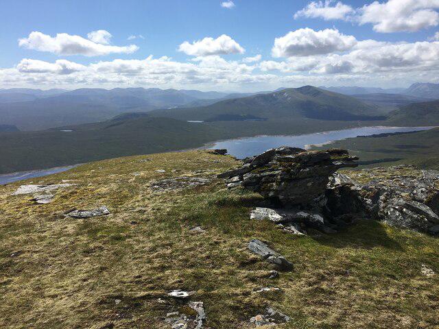 Photo could not load
NH2467 : Near the summit of An Coileachan
Steven Brown
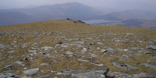 Photo could not load
NH2467 : Fionn Bheinn from An Coilleachan summit
Alistair Nixon
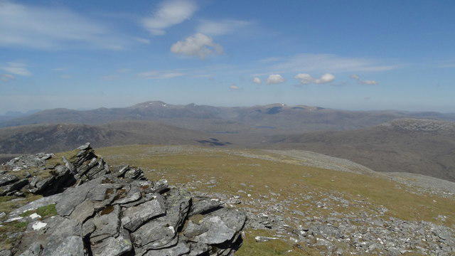 Photo could not load
NH2468 : On the summit of An Coileachan, Fannichs - view towards Beinn Dearg
Colin Park
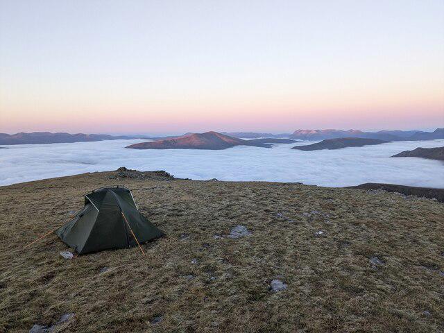 Photo could not load
NH2467 : Cloud sea
Callum Black
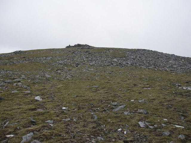 Photo could not load
NH2468 : Approaching the summit of An Coileachan
Hugh Venables
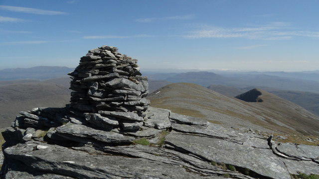 Photo could not load
NH2468 : The summit cairn on An Coileachan, Fannichs
Colin Park
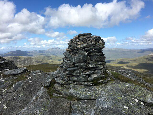 Photo could not load
NH2468 : Summit cairn of An Coileachan
Steven Brown
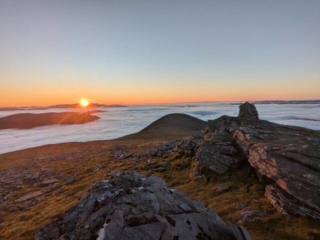 Photo could not load
NH2468 : Cloud sea
Callum Black
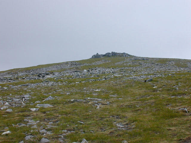 Photo could not load
NH2468 : The summit of An Coileachan
Nigel Brown
Hill facts and local notes
Classifications
Elevation
924m
3,031 ft
Prominence
148m
Coordinates
57.6676, -4.9495
NH241680
OS Map
20
Explorer: 436S
At the Summit
The summit boasts a prominent cairn and a breathtaking panoramic view, making it a great spot for a well-deserved sandwich break.
Terrain & Geology
The mountain is primarily composed of granite, a rock that can be as old as the hills—quite literally. The rugged terrain showcases impressive glacial features, including U-shaped valleys and rocky outcrops.
Views & Scenery
From the summit, enjoy expansive views of the surrounding peaks including Ben Wyvis and the glistening waters of Lochcarron.
History & Heritage
Name Origin
The name 'An Coileachan' translates roughly to 'the little hill or knoll', showcasing a blend of Gaelic heritage.
Historical Significance
An Coileachan is a popular destination amongst the Munro-bagging community and is known for its stunning landscapes and diverse wildlife, including occasional sightings of red deer.
Getting There & Facilities
Parking
There is a small parking area at NH 244 678, just off the A835, offering space for about 10 vehicles. It’s wise to arrive early—this mountain does attract attention.
Public Transport
The nearest bus service runs from Inverness to Ullapool with a stop at Contin; however, the last leg to the trailhead requires a bit of a walk.
Nearby Facilities
While facilities are limited in the immediate area, the nearest pub in Garve offers a good selection of local ale and hearty highland fare post-hike.
Safety Information
Known Hazards
- Treacherous weather conditions can change rapidly; visibility can drop and paths may become slippery. Always come prepared!
General Safety Tips
- Check weather conditions before setting out
- Carry appropriate clothing and equipment
- Let someone know your planned route
- Take a map, compass, and GPS device
- Carry emergency supplies: food, water, first aid kit, torch
Hills
Some common questions about the hills answered
Are there group walks up An Coileachan?
Many walkers use Walkmates to join or organise walks with others. You can check for group walks around An Coileachan through the maps
Are there other walkers around An Coileachan?
Activity varies by location and time, but Walkmates lets you see whether others have shared walks or shown interest in this area. Find other people through the walking friends search walking friends for An Coileachan search or of course create your own walk for An Coileachan
Can I organise a walk to An Coileachan?
Yes. If there aren’t any walks listed already, you can create a walk and make it available for others to join.
If you're signed up to Walkmates, you can create a walk to An Coileachan.
How do I find a walk up this hill?
There are often multiple ways to walk this hill, depending on experience and route preference. Walkmates helps you explore walks and routes that others have shared.
Can I suggest a new route up An Coileachan?
Yes. You can suggest or create routes to share with others. Walkmates focuses on the social side of walking, so routes are used to help people organise walks and explore areas together, rather than as detailed navigation tools or route libraries.
Other uses really appreciate knowledgeable walkers sharing their routes. Share your favourite route to An Coileachan here
The is an error or something incorrect about this hill. How do I let you know?
We always strive to keep the information on Walkmates as accurate as possible. If you find an error, please let us know through the contact form and we'll aim to correct it as quickly as possible
Community Discussion
Comments
Location
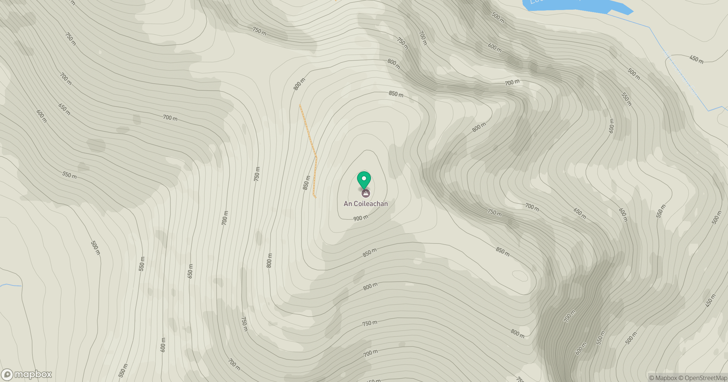
Grid reference: NH241680
View on OpenStreetMapOpens a map in a new tab, centred on the hill.
No comments yet. Be the first.