

A' Chrois
Good walks are even better shared.
NN2807 : A 'Chrois, below the summit of Beinn Narnain
Tim Cook Photo source
Overview
A' Chrois: A Hidden Gem in the Scottish Highlands
A' Chrois, standing tall at 745 meters, may not be the biggest player in the Arrochar Alps, but it certainly has its fair share of charm and dramatic scenery.
Geology
The mountain is primarily composed of granite and schist, offering a unique geological perspective of Scotland's ancient past. Keep your eyes peeled for the hints of gneiss layered within the rocky outcrops, revealing the forces that shaped this land long before we came to tread on it.
Routes
Glen Croe Route
This route takes you from the picturesque Glen Croe, providing a moderate hike perfect for those looking to enjoy a day out without biting off more than they can chew. With a distance of 8.4 km and a recommended time of about 3.5 hours, it's a great option.
The Cobbler Approach
Feeling a bit more adventurous? The Cobbler route is your ticket! It's a challenging option that will give you plenty of thrills, with rocky scrambles thrown in to keep you on your toes.
Summit Features
As you reach the summit, the sizeable cairn welcomes you like an old friend, offering a perfect backdrop for your triumphant selfie. The views are nothing short of breathtaking, letting you behold the surrounding peaks in all their glory.
Terrain
Be prepared for a mix of rocky, grassy, and heather-laden landscapes. Just be careful of the boggy bits; they might look innocent, but they’re the pranksters of the mountain world!
Hazards
While adventure is at every turn, do take heed: the rocky terrain can be particularly treacherous in wet conditions. A slip there could lead to an awkward tumble, so stay vigilant!
Access
The nearest parking is at the NTS Car Park in Glen Croe, just a stone's throw from the trailhead. If you're relying on public transport, local buses from Glasgow make the journey to Arrochar, a handy base before you hit the trails.
Facilities
Facilities in Arrochar are somewhat limited, but you’ll find a few charming cafes and a couple of pubs to help refuel after your hiking exploits.
History
The name A' Chrois translates to 'The Cross', possibly signifying its historical importance as a point of reference for travelers. The area itself is steeped in history, promising a rich experience as you walk in the footsteps of those who came before.
So why not grab your boots and make your way to A' Chrois? It's a delightful spot that promises both challenge and beauty, with plenty of stories woven into its very rocks.
Happy hiking!
Explore routes near A' Chrois
Walks starting near this hill. Open a route to check its map, distance and full itinerary.
Beinn Ime from Succoth
View route
The Cobbler from Succoth Carpark
View route
Ben Lomond in the trossachs
View route
Loch Katrine: Brenachoile Point Shore Walk from Trossachs Pier
View route
Route planning notes
These notes describe possible approaches. Check a route's map and access information when planning your walk.
Glen Croe Route
A scenic approach from Glen Croe that offers impressive views of the surrounding mountains.
The Cobbler Approach
A more challenging ascent via The Cobbler, this route offers rocky scrambles and a touch of adventure.
Make a day of it, together
Find someone to share the walk with, or organise a day out along a route you like.
Photo Gallery
View all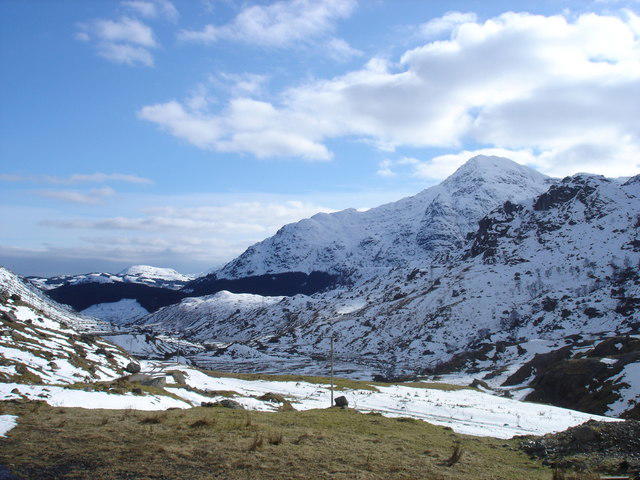 Photo could not load
NN2807 : A 'Chrois, below the summit of Beinn Narnain
Tim Cook
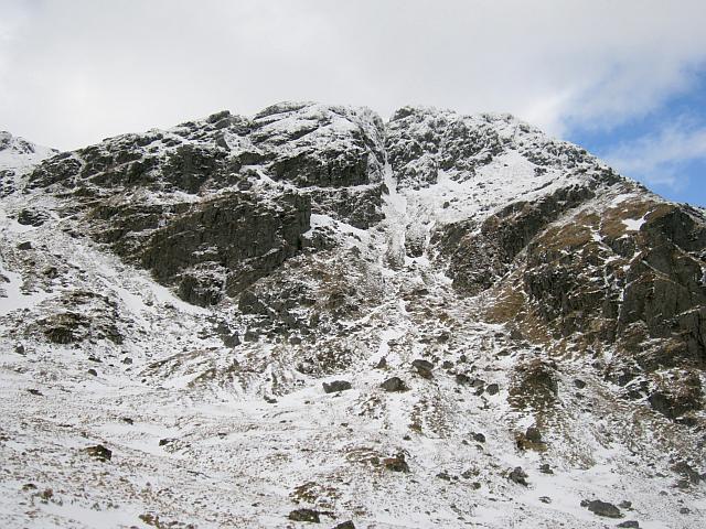 Photo could not load
NN2807 : Chrois Gully
Richard Webb
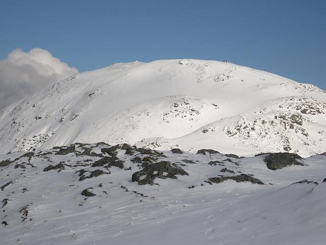 Photo could not load
NN2807 : A' Chrois
Richard Webb
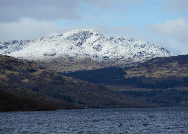 Photo could not load
NN2807 : A' Chrois
Richard Sutcliffe
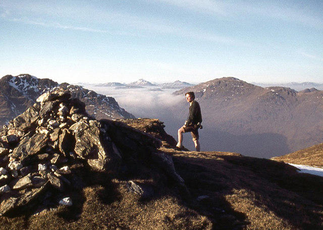 Photo could not load
NN2807 : Summit cairn on A' Chrois
Alan Reid
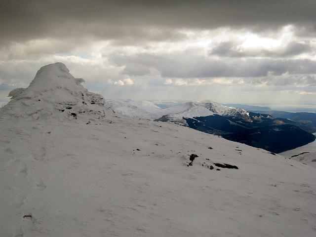 Photo could not load
NN2807 : Summit cairn, A' Chrois
Richard Webb
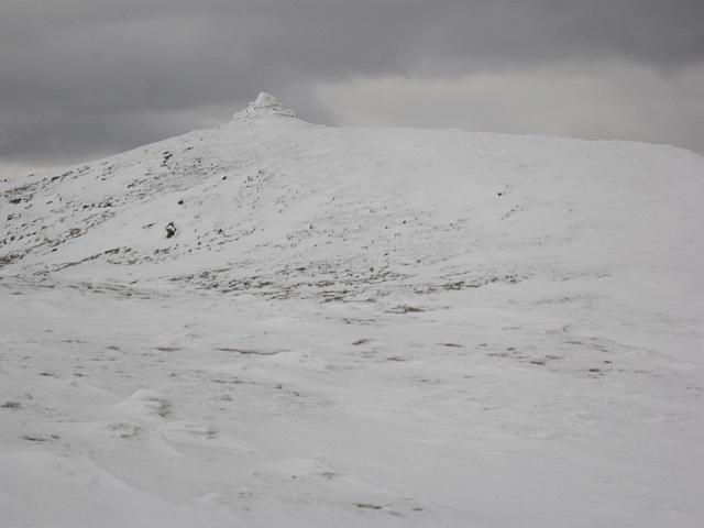 Photo could not load
NN2807 : Summit of A' Chrois
Richard Webb
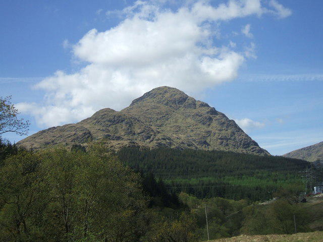 Photo could not load
NN2807 : A' Chrois
Iain Russell
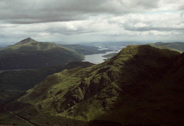 Photo could not load
NN2807 : Shadow on A' Chrois
Russel Wills
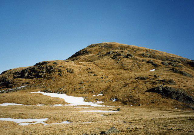 Photo could not load
NN2807 : A' Chrois
wfmillar
Hill facts and local notes
Classifications
Elevation
849m
2,784 ft
Prominence
107m
Coordinates
56.2313, -4.7628
NN288077
OS Map
56
Explorer: OL39S 364S
At the Summit
At the summit, you will find a sizeable cairn marking the peak, along with beautiful vistas to reward your efforts.
Terrain & Geology
A' Chrois is primarily composed of granite and schist, with hints of gneiss peeking through, creating a rugged landscape that tells tales of ancient geological processes.
Views & Scenery
From the summit, you can enjoy panoramic views of the surrounding Arrochar Alps, with the impressive Ben Arthur and Loch Long in sight.
History & Heritage
Name Origin
A' Chrois translates to 'The Cross' in Scots Gaelic, possibly hinting at its historical significance as a landmark.
Historical Significance
The surrounding area has a rich history, from ancient settlements to notable battles, making it a fascinating place to explore.
Getting There & Facilities
Parking
The nearest parking is at the (NTS) Car Park in Glen Croe, which accommodates several vehicles but can fill up on busy weekends.
Public Transport
Local buses operate to Arrochar from Glasgow, but check the local timetable as services may vary.
Nearby Facilities
There are limited facilities in Arrochar, but you'll find a few cafes and pubs to recharge after your hike.
Safety Information
Known Hazards
- Rocky terrain can be tricky in wet weather; watch your step, or you might find yourself in a bit of a pickle!
General Safety Tips
- Check weather conditions before setting out
- Carry appropriate clothing and equipment
- Let someone know your planned route
- Take a map, compass, and GPS device
- Carry emergency supplies: food, water, first aid kit, torch
Hills
Some common questions about the hills answered
Are there group walks up A' Chrois?
Many walkers use Walkmates to join or organise walks with others. You can check for group walks around A' Chrois through the maps
Are there other walkers around A' Chrois?
Activity varies by location and time, but Walkmates lets you see whether others have shared walks or shown interest in this area. Find other people through the walking friends search walking friends for A' Chrois search or of course create your own walk for A' Chrois
Can I organise a walk to A' Chrois?
Yes. If there aren’t any walks listed already, you can create a walk and make it available for others to join.
If you're signed up to Walkmates, you can create a walk to A' Chrois.
How do I find a walk up this hill?
There are often multiple ways to walk this hill, depending on experience and route preference. Walkmates helps you explore walks and routes that others have shared.
Can I suggest a new route up A' Chrois?
Yes. You can suggest or create routes to share with others. Walkmates focuses on the social side of walking, so routes are used to help people organise walks and explore areas together, rather than as detailed navigation tools or route libraries.
Other uses really appreciate knowledgeable walkers sharing their routes. Share your favourite route to A' Chrois here
The is an error or something incorrect about this hill. How do I let you know?
We always strive to keep the information on Walkmates as accurate as possible. If you find an error, please let us know through the contact form and we'll aim to correct it as quickly as possible
Community Discussion
Comments
Location
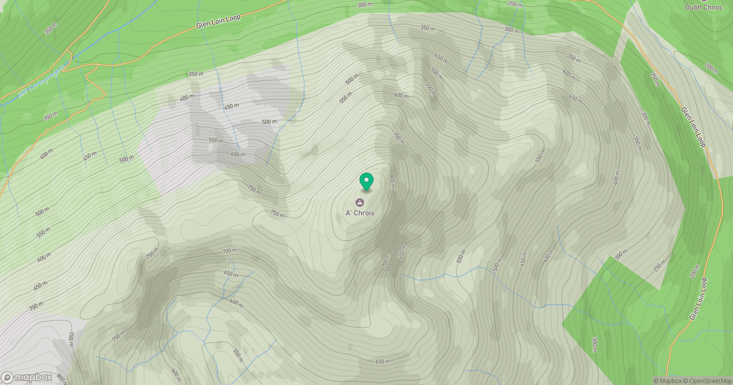
Grid reference: NN288077
View on OpenStreetMapOpens a map in a new tab, centred on the hill.
![The Cobbler [Ben Arthur]](https://cdn.walkmates.com/gallery-images/a1b697040769474a8338b3fb586ebc7a.jpg)
No comments yet. Be the first.