

Y Gribin
Good walks are even better shared.
SH9017 : Llanerchfydaf from Y Gribin
Richard Law Photo source
Overview
Y Gribin: A Hikers' Paradise
Nestled in the heart of Snowdonia National Park, Y Gribin is an impressive mountain that beckons both seasoned hikers and casual walkers alike. Standing at an elevation of 741 meters, this mountain offers not just a good workout but also some of the most breathtaking views in North Wales.
Geology
The geology of Y Gribin predominantly consists of mudstone and slate, typifying the rugged beauty of the area. The rock formations tell a geological tale of ancient seas and volcanic activity, so take a moment to appreciate the landscape as you navigate its rocky paths.
Routes
Whether you're looking for a gentle hike or a challenging climb, Y Gribin has something for everyone. The Llyn Gynhych Route is a favourite among families, offering a moderate climb with plenty of beautiful scenery along the way. For those feeling a bit more adventurous, the North Ridge Route provides a challenging ascent; just be prepared for a bit of a sweat!
Summit Features
At the summit, you'll find a substantial cairn that serves as a beacon for weary travelers. It's the perfect spot to catch your breath and snap that all-important summit selfie. Don’t forget to turn around for a photo of the views—your friends won’t believe you made it without the aid of a helicopter!
Terrain Type
Expect a mix of rocky and grassy trails with a few boggy spots sprinkled in for good measure. As they say, an adventure isn't an adventure without a little mud, right?
Views
The vistas from Y Gribin's summit are nothing short of spectacular, offering breathtaking views of Snowdon to the east and the Moelwyns to the south. The best time to soak in the panorama is during late spring or summer when the skies are clearer. But if you fancy a more colourful experience, autumn's shades are simply magical.
Hazards
While Y Gribin is accessible, it's important to remain cautious. Loose rocks and slippery slopes mean that proper footwear is essential. Sudden shifts in weather can catch the unprepared off guard, so always check the forecast before you embark on your journey.
Access
For those driving, there’s a car park at the base of Llyn Gynhych (SH 883 505), but get there early to avoid disappointment. If you prefer public transport, buses frequent the nearby village of Capel Curig. The nearest town, Betws-y-Coed, is only a short drive away and offers all the amenities you might need before or after your expedition.
Facilities
While Y Gribin might feel remote, you can find public toilets and cafes in Betws-y-Coed, a short journey from the trailhead. Remember to fuel up—hiking can get hungry work!
History
The name Y Gribin translates to 'The Ridge' in Welsh, aptly reflecting its physical form. This mountain has been a cherished destination for generations, revered not just for its physical beauty but also for its place in local stories and folklore.
In conclusion, Y Gribin is more than just a peak; it’s an experience waiting to be had. So lace up those boots, grab your trekking poles, and get ready for an adventure that will leave you smiling from ear to ear!
Explore routes near Y Gribin
Walks starting near this hill. Open a route to check its map, distance and full itinerary.
Waun-oer, Maesglase and Cribin Fawr guided mountain walk
View route
Aran Benllyn and Aran Fawddwy from LLanuwchllyn
View route
Coed y Brenin: Pont Ty'n-y-groes and Mawddach Forest Trail
View route
Cadair Idris - Pony Path
View route
Route planning notes
These notes describe possible approaches. Check a route's map and access information when planning your walk.
Llyn Gynhych Route
A popular route starting from Llyn Gynhych, meandering through stunning scenery with a gradual ascent leading to the summit.
North Ridge Route
A steeper and more challenging ascent, highly rewarding with panoramic views for those looking for a bit of a workout.
Make a day of it, together
Find someone to share the walk with, or organise a day out along a route you like.
Photo Gallery
View all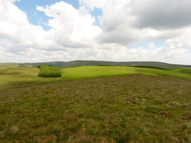 Photo could not load
SH9017 : Llanerchfydaf from Y Gribin
Richard Law
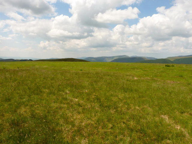 Photo could not load
SH9017 : The summit of Llanerchfydaf
Richard Law
Hill facts and local notes
Classifications
Elevation
485m
1,591 ft
Prominence
59m
Coordinates
52.7447, -3.6217
SH906175
OS Map
125
Explorer: OL23E
At the Summit
The summit of Y Gribin is marked by a substantial cairn offering some respite for weary hikers and a perfect backdrop for that all-important summit selfie!
Terrain & Geology
Y Gribin is primarily composed of mudstone and slate, characteristic of the Snowdonia area. This geology means visitors can expect rugged and weathered outcrops along the route, offering a glimpse into the geological history of this dramatic landscape.
Views & Scenery
From the summit, one can gaze at the stunning vistas of Snowdon to the east, the Moelwyns to the south, and the expansive views of Llyn Dinas below.
History & Heritage
Name Origin
The name Y Gribin translates loosely to 'The Ridge' in Welsh, reflecting its pinnacle position.
Historical Significance
Y Gribin holds cultural significance in local folklore and has been a popular destination for both hikers and climbers for generations.
Getting There & Facilities
Parking
There is a car park at the base of Llyn Gynhych (SH 883 505), suitable for a few dozen vehicles, but arrive early to secure a spot, especially on weekends.
Public Transport
Regular bus services run to nearby villages such as Capel Curig, from where the trailhead can be reached.
Nearby Facilities
Public toilets are available in Betws-y-Coed, with cafes and shops providing much-needed refreshments before or after your hike.
Safety Information
Known Hazards
- Loose rocks and slippery paths, especially after rain. Always be mindful of sudden weather changes common in this mountainous region.
General Safety Tips
- Check weather conditions before setting out
- Carry appropriate clothing and equipment
- Let someone know your planned route
- Take a map, compass, and GPS device
- Carry emergency supplies: food, water, first aid kit, torch
Hills
Some common questions about the hills answered
Are there group walks up Y Gribin?
Many walkers use Walkmates to join or organise walks with others. You can check for group walks around Y Gribin through the maps
Are there other walkers around Y Gribin?
Activity varies by location and time, but Walkmates lets you see whether others have shared walks or shown interest in this area. Find other people through the walking friends search walking friends for Y Gribin search or of course create your own walk for Y Gribin
Can I organise a walk to Y Gribin?
Yes. If there aren’t any walks listed already, you can create a walk and make it available for others to join.
If you're signed up to Walkmates, you can create a walk to Y Gribin.
How do I find a walk up this hill?
There are often multiple ways to walk this hill, depending on experience and route preference. Walkmates helps you explore walks and routes that others have shared.
Can I suggest a new route up Y Gribin?
Yes. You can suggest or create routes to share with others. Walkmates focuses on the social side of walking, so routes are used to help people organise walks and explore areas together, rather than as detailed navigation tools or route libraries.
Other uses really appreciate knowledgeable walkers sharing their routes. Share your favourite route to Y Gribin here
The is an error or something incorrect about this hill. How do I let you know?
We always strive to keep the information on Walkmates as accurate as possible. If you find an error, please let us know through the contact form and we'll aim to correct it as quickly as possible
Community Discussion
Comments
Location
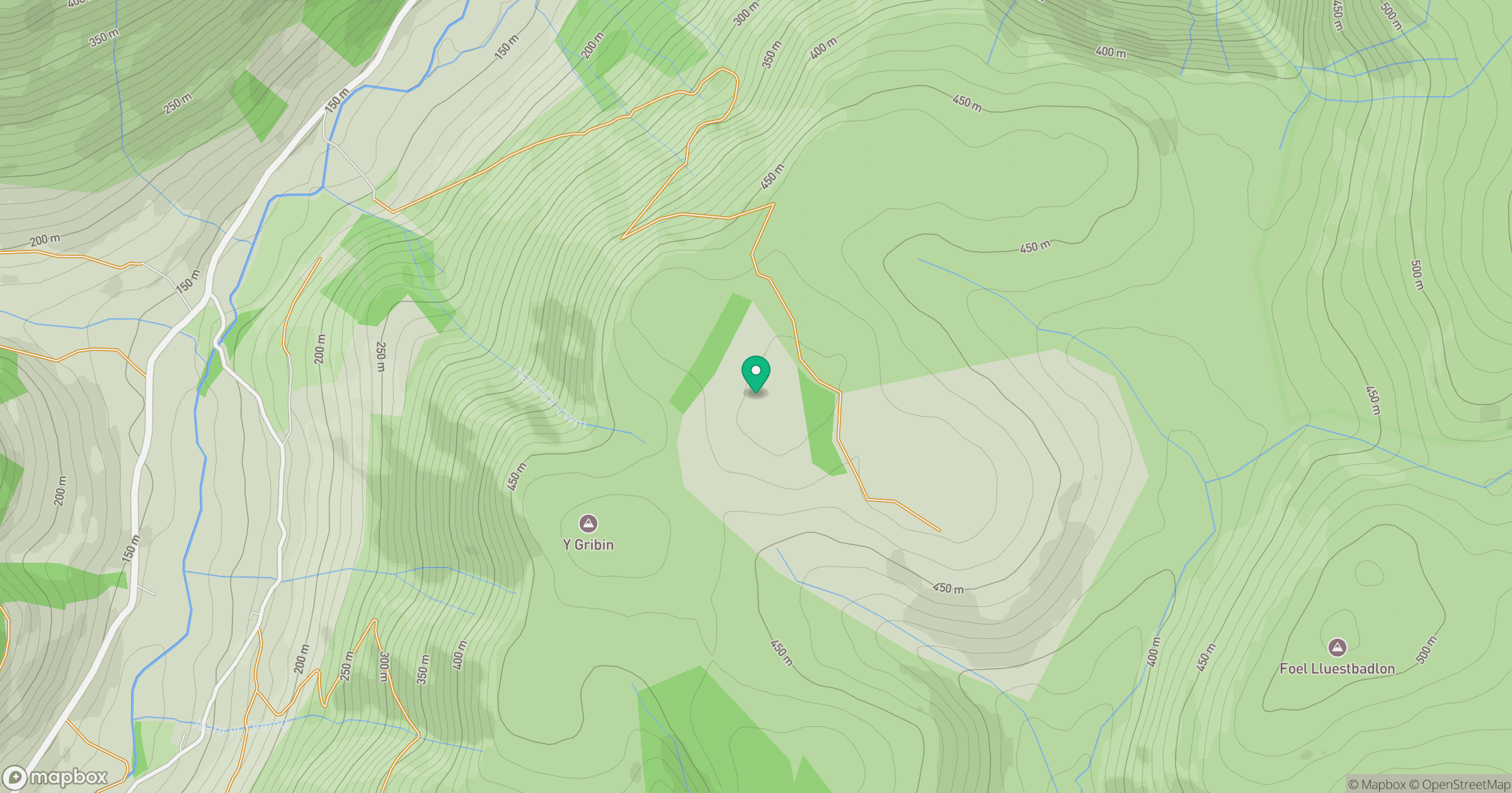
Grid reference: SH906175
View on OpenStreetMapOpens a map in a new tab, centred on the hill.
No comments yet. Be the first.