

Pen Foel-y-ffridd
Good walks are even better shared.
Overview
Welcome to Pen Foel-y-ffridd
Nestled in the heart of Snowdonia National Park, Pen Foel-y-ffridd is a splendid mountain that appeals to both seasoned climbers and casual walkers alike. Standing at 550 meters, it may not be the tallest, but it sure packs a scenic punch!
Geology
Granite and volcanic rock combine to tell the story of the earth's evolution. The rugged characteristics of this mountain, with its smooth hillsides and sculpted ridges, are the result of countless years of glacial polishing and erosion. Rock your socks off with knowledge as you trek!
Route Information
From the A470 Highway
- Distance: 5.0 km
- Estimated Time: 2.5 hours
- Difficulty: Moderate
This route is a classic ascent that showcases the best features of the area. Expect a well-defined path; just remember to look up now and then, or you might trip over a rock!
Summit Features
Once you reach the top, take a moment to admire the stone cairn marking the summit. Take a selfie with the backdrop of some of the most stunning landscapes in the UK!
Terrain Type
The terrain changes gently from minute splashes of rock to green, grassy slopes peppered with heather. Some steep sections may catch you off guard, so keep your wits about you!
Views
The summit of Pen Foel-y-ffridd offers spectacular vistas. You can see Cadair Idris soaring majestically to the south, along with an impressive view over the Dyfi Valley. The best time to take in these sights is during spring and autumn, when the landscape truly comes alive.
Hazards
As always, stay alert! Loose stones can become a tripping hazard, especially in wet weather. And let’s not forget how quickly the weather conditions can change in Snowdonia. One moment you’re soaking up the sun, and the next, you’re dodging rain clouds like a daredevil!
Access
- Nearest Parking: Free lay-bys along the A470
- Public Transport: Bus services from Machynlleth are available; timing is key!
- Nearest Town: Machynlleth, a charming spot for a post-hike pint.
Facilities
Though there are no facilities on the mountain, Machynlleth has plenty to offer, including cafes and shops to refuel after your adventure.
History
The name Pen Foel-y-ffridd hints at historical farming practices, meaning 'Head of the Hill of the Little Enclosure.' This area is steeped in local folklore, making your hike not just a physical challenge but a journey through time.
Now that you’re equipped with all this information, lace up those hiking boots and get ready for a memorable outing on Pen Foel-y-ffridd! Happy hiking!
Explore routes near Pen Foel-y-ffridd
Public walks starting within 80 km of this hill. Nearby does not mean a route reaches the summit; check its map and access before setting out.
Waun-oer, Maesglase and Cribin Fawr guided mountain walk
View route
Aran Benllyn and Aran Fawddwy from LLanuwchllyn
View route
Mawddach Trail: Dolgellau to Barmouth
View route
Coed y Brenin: Pont Ty'n-y-groes and Mawddach Forest Trail
View route
Route planning notes
These notes describe possible approaches, not verified navigable routes or permission to cross land. Check current paths, local access rules and conditions before setting out.
From the A470 Highway
A moderately steep ascent that follows a well-defined path leading directly to the summit, offering beautiful views of the surrounding valleys.
Make a day of it, together
Find someone to share the walk with, or organise a day out along a route you like.
Photo Gallery
View all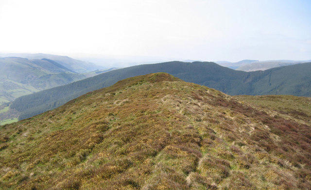 Photo could not load
SH8918 : The summit of Pen Foel-y-ffridd
Dave Croker
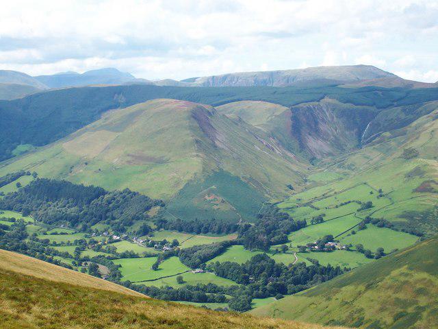 Photo could not load
SH8918 : Pen Foel-y-ffridd
Anton Ciritis
Hill facts and local notes
Classifications
Elevation
514m
1,686 ft
Prominence
114m
Coordinates
52.7556, -3.6438
SH891188
OS Map
124 125
Explorer: OL23E
At the Summit
At the summit, you'll find a stone cairn marking the highest point, along with a spectacular panoramic view of the surrounding peaks.
Terrain & Geology
The mountain is primarily composed of granite outcrops mixed with volcanic rocks, which offer a fascinating glimpse into the region's geological past. The landscape features sculpted ridges and smooth hillsides, shaped over millennia by glacial activity.
Views & Scenery
From the summit, enjoy stunning views of Cadair Idris and the southern parts of Snowdonia, as well as the expansive Dyfi Valley.
History & Heritage
Name Origin
The name 'Pen Foel-y-ffridd' translates to 'Head of the Hill of the Little Enclosure,' likely referring to local farming practices.
Historical Significance
This mountain is part of the ancient cultural landscape of Wales, connected to local folklore and history.
Getting There & Facilities
Check current local access restrictions, parking rules and transport timetables before travelling. These notes do not confirm public access to the summit.
Parking
Small lay-bys along the A470 provide free parking, but arrive early to secure a spot.
Public Transport
Buses run from Machynlleth to various points along the A470; check local timetables for details.
Nearby Facilities
Cafés and shops can be found in Machynlleth, but expect no facilities on the mountain itself.
Safety Information
Known Hazards
- Watch out for loose stones on the trail and unpredictable weather conditions that can change quickly.
General Safety Tips
- Check weather conditions before setting out
- Carry appropriate clothing and equipment
- Let someone know your planned route
- Take a map, compass, and GPS device
- Carry emergency supplies: food, water, first aid kit, torch
Hills
Some common questions about the hills answered
Are there group walks up Pen Foel-y-ffridd?
Many walkers use Walkmates to join or organise walks with others. You can check for group walks around Pen Foel-y-ffridd through the maps
Are there other walkers around Pen Foel-y-ffridd?
Activity varies by location and time, but Walkmates lets you see whether others have shared walks or shown interest in this area. Find other people through the walking friends search walking friends for Pen Foel-y-ffridd search or of course create your own walk for Pen Foel-y-ffridd
Can I organise a walk to Pen Foel-y-ffridd?
Yes. If there aren’t any walks listed already, you can create a walk and make it available for others to join.
If you're signed up to Walkmates, you can create a walk to Pen Foel-y-ffridd.
How do I find a walk up this hill?
There are often multiple ways to walk this hill, depending on experience and route preference. Walkmates helps you explore walks and routes that others have shared.
Can I suggest a new route up Pen Foel-y-ffridd?
Yes. You can suggest or create routes to share with others. Walkmates focuses on the social side of walking, so routes are used to help people organise walks and explore areas together, rather than as detailed navigation tools or route libraries.
Other uses really appreciate knowledgeable walkers sharing their routes. Share your favourite route to Pen Foel-y-ffridd here
The is an error or something incorrect about this hill. How do I let you know?
We always strive to keep the information on Walkmates as accurate as possible. If you find an error, please let us know through the contact form and we'll aim to correct it as quickly as possible
Community Discussion
Comments
Location
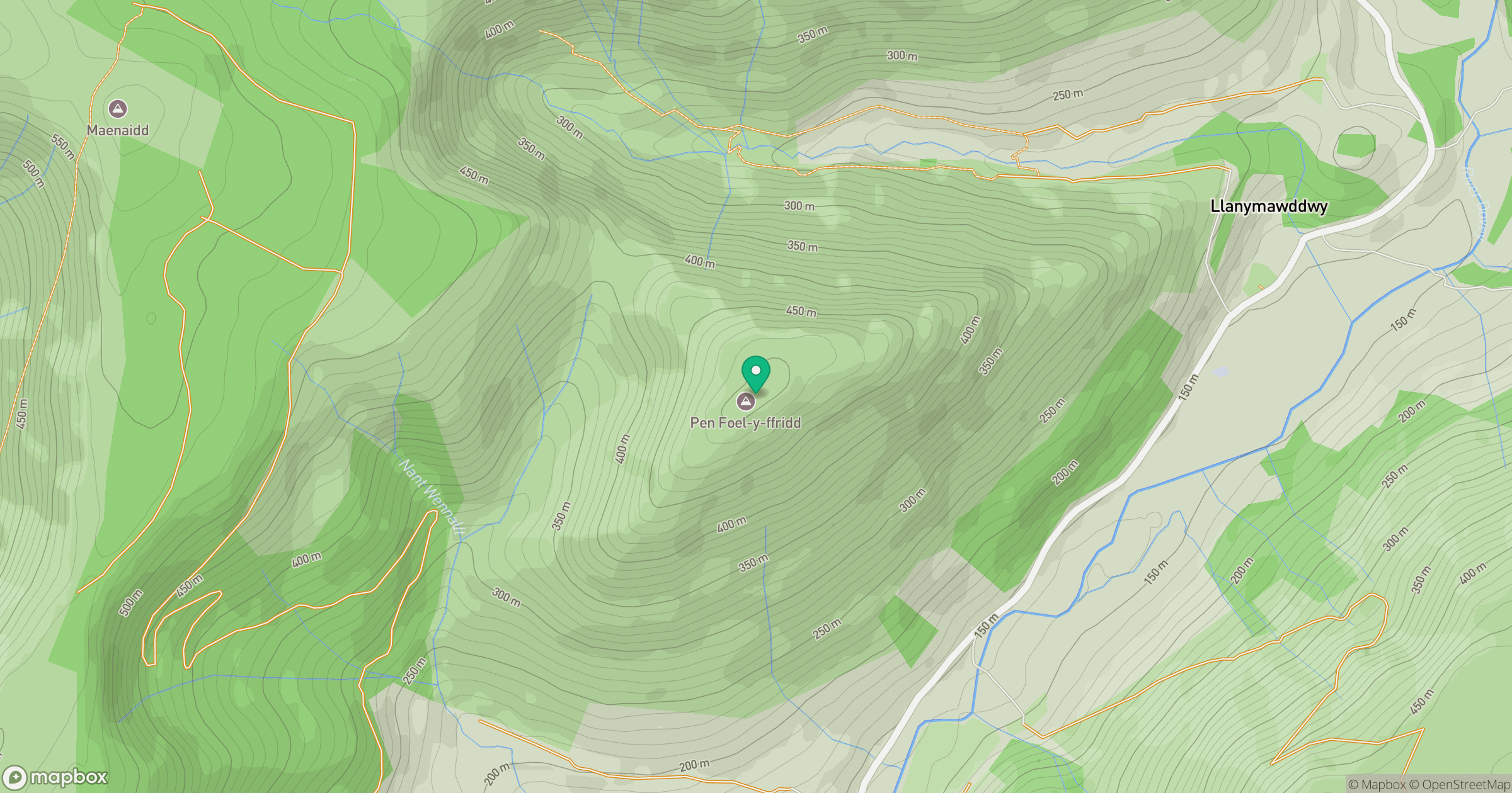
Grid reference: SH891188
View on OpenStreetMapOpens a map in a new tab, centred on the hill.
Hills within 30 km
Straight-line distance, not a walking route or confirmation of access.
No comments yet. Be the first.