
Foel Dugoed
Good walks are even better shared.
Overview
Foel Dugoed: A Hiker's Delight
Nestled in the picturesque Snowdonia National Park, Foel Dugoed stands proudly at an elevation of 557 meters. Don’t let its height fool you; this mountain packs a punch with stunning vistas and a rich tapestry of natural beauty.
Geology
Foel Dugoed is a product of ancient volcanic activity, which has crafted its steep, rocky outcrops and lush grasslands. As you trek along its paths, take a moment to ponder the geological forces that shaped this magnificent landscape.
Routes
One of the most popular ways to approach Foel Dugoed is the Bleanau Ffestiniog Route. This 7-kilometre path is moderately challenging, taking approximately 3.5 hours. As you make your ascent, expect a mix of scenery that will keep your camera clicking!
Summit Features
Upon reaching the summit, you’re greeted by a friendly cairn—a classic feature of many UK hills, perfect for a celebratory snap, and not to mention, a great place to catch your breath. Grab a seat on one of the rock outcrops and soak in the striking views of nearby peaks.
Terrain Type
The terrain is primarily grassy, interspersed with rocky sections that add just the right amount of adventure. Do keep your eyes peeled for the odd boggy patch, especially after the rain; your footwear may have a little mud wrestling match.
Views
From the top of Foel Dugoed, the views stretch out magnificently. With sights of Snowdon and the Glyderau dominating the horizon, you might just find yourself lost in the beauty of the surroundings. Spring and early autumn are perfect times for a visit; the colours are vibrant, and the weather often plays nice—most of the time!
Hazards
While the trek is manageable, stay alert for sudden weather shifts. The summit can turn foggy faster than you can say 'Where’s my map?'. Plus, slippery paths mean that a firm grip on the ground can be just as important as a good grip on your walking stick.
Nearby Summits
If you’re feeling adventurous, consider heading to Moel Gyw, which sits at 568 meters. It’s a logical extension for those wanting to add another peak to their day.
Access
Bleanau Ffestiniog is your gateway to Foel Dugoed. A small car park awaits those keen on driving, while public transport options like trains and local buses make the area accessible for many.
Facilities
Once you’ve conquered the mountain, reward yourself in the town of Bleanau Ffestiniog. There are plenty of cafes to enjoy a hot cuppa or a slice of cake, and public toilets for all the essential post-hike needs.
History
The name Foel Dugoed, meaning hill of the long ridge, reflects the configuration of this charming hill. The area has a rich mining history, with slate quarries shaping much of its heritage and scenery.
Whether you are an enthusiastic hiker or a casual walker, Foel Dugoed offers a delightful experience that shouldn't be missed. Lace up those boots and get ready for an adventure that ticks all the boxes!
Explore routes near Foel Dugoed
Public walks starting within 80 km of this hill. Nearby does not mean a route reaches the summit; check its map and access before setting out.
Waun-oer, Maesglase and Cribin Fawr guided mountain walk
View route
Aran Benllyn and Aran Fawddwy from LLanuwchllyn
View route
Mawddach Trail: Dolgellau to Barmouth
View route
Cadair Idris - Pony Path
View route
Route planning notes
These notes describe possible approaches, not verified navigable routes or permission to cross land. Check current paths, local access rules and conditions before setting out.
Bleanau Ffestiniog Route
A scenic route starting from Bleanau Ffestiniog, following well-marked footpaths through lush greenery and past tranquil lakes.
Make a day of it, together
Find someone to share the walk with, or organise a day out along a route you like.
Hill facts and local notes
Classifications
Elevation
439m
1,440 ft
Prominence
133m
Coordinates
52.7051, -3.6386
SH893131
OS Map
124 125
Explorer: OL23E
At the Summit
At the summit, you'll find a modest cairn celebrating the height, and for those keen on a photo op, the panoramic views make it a must, even if the winds might ruffle your hair a bit!
Terrain & Geology
Foel Dugoed primarily consists of volcanic rock, shaped by ancient geological processes, giving it a unique ruggedness. The remnants of eruptions from millions of years ago still hold sway over the landscape.
Views & Scenery
From the summit, you can enjoy striking views of the surrounding hills, including the impressive peaks of Snowdon and the Glyderau.
History & Heritage
Name Origin
The name 'Foel Dugoed' loosely translates to 'hill of the long ridge' in Welsh, giving a hint of its geographical features.
Historical Significance
The area surrounding Foel Dugoed is rich in mining history, with remnants of slate quarries nearby that tell tales of industry and innovation.
Getting There & Facilities
Check current local access restrictions, parking rules and transport timetables before travelling. These notes do not confirm public access to the summit.
Parking
There is a small car park at the start of the Bleanau Ffestiniog route, with room for about 10 vehicles. Arrive early to secure a spot, especially during peak seasons.
Public Transport
Bleanau Ffestiniog is accessible via train, and local buses also operate in the area. Check the latest schedules as they can vary.
Nearby Facilities
While there are no facilities at the summit, Bleanau Ffestiniog offers various options, including lovely cafes and public toilets to refresh after your hike.
Safety Information
Known Hazards
- Be cautious of changing weather conditions. The summit can become obscured in mist. Additionally, some paths may be slippery when wet.
General Safety Tips
- Check weather conditions before setting out
- Carry appropriate clothing and equipment
- Let someone know your planned route
- Take a map, compass, and GPS device
- Carry emergency supplies: food, water, first aid kit, torch
Hills
Some common questions about the hills answered
Are there group walks up Foel Dugoed?
Many walkers use Walkmates to join or organise walks with others. You can check for group walks around Foel Dugoed through the maps
Are there other walkers around Foel Dugoed?
Activity varies by location and time, but Walkmates lets you see whether others have shared walks or shown interest in this area. Find other people through the walking friends search walking friends for Foel Dugoed search or of course create your own walk for Foel Dugoed
Can I organise a walk to Foel Dugoed?
Yes. If there aren’t any walks listed already, you can create a walk and make it available for others to join.
If you're signed up to Walkmates, you can create a walk to Foel Dugoed.
How do I find a walk up this hill?
There are often multiple ways to walk this hill, depending on experience and route preference. Walkmates helps you explore walks and routes that others have shared.
Can I suggest a new route up Foel Dugoed?
Yes. You can suggest or create routes to share with others. Walkmates focuses on the social side of walking, so routes are used to help people organise walks and explore areas together, rather than as detailed navigation tools or route libraries.
Other uses really appreciate knowledgeable walkers sharing their routes. Share your favourite route to Foel Dugoed here
The is an error or something incorrect about this hill. How do I let you know?
We always strive to keep the information on Walkmates as accurate as possible. If you find an error, please let us know through the contact form and we'll aim to correct it as quickly as possible
Community Discussion
Comments
Location
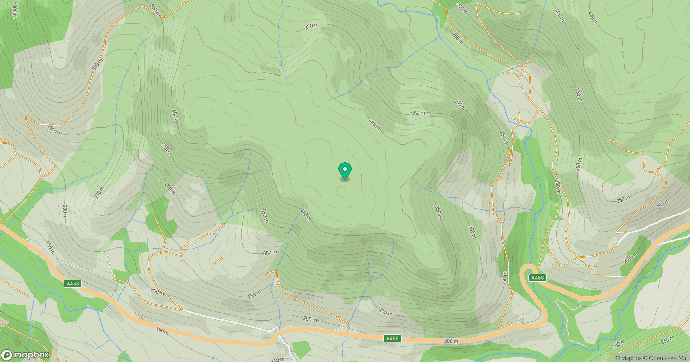
Grid reference: SH893131
View on OpenStreetMapOpens a map in a new tab, centred on the hill.
Hills within 30 km
Straight-line distance, not a walking route or confirmation of access.
Aran Fawddwy
906m
Arenig Fawr
854m
Cadair Idris - Penygadair
893m
Pumlumon Fawr [Plynlimon]
753m
Y Garn
629m
No comments yet. Be the first.