
Y Garn
Good walks are even better shared.
Overview
Y Garn: The Majestic Marilyn of Snowdonia
Y Garn, standing tall at 947 meters, is one of the prominent peaks in Snowdonia National Park and an absolute must-visit for hiking enthusiasts. Nestled amid a stunning, rugged landscape, Y Garn offers a variety of routes that cater to different abilities.
Geology
The mountain's rocky composition is primarily volcanic in nature, featuring andesite rock that has weathered beautifully over millions of years. This volcanic origin provides a fascinating backdrop for any geology lover or curious hiker keen to learn about the Earth’s history.
Routes
Among the most popular routes is The Main Ascent from Dillwyn's Quarry. A moderate path stretching around 6.5 km, it provides excellent views of the valley as you ascend. Alternatively, for those seeking a bit more adventure, the Ridge Walk from Elidir Fawr offers an invigorating challenge over a distance of 8 km.
Summit Features
Reaching the summit, you'll be greeted by a substantial stone cairn, a perfect spot to catch your breath and soak in the views. Look out towards Snowdon and the Glyderau – the scenery will make you feel like you're on top of the world!
Terrain
Expect a mixed terrain of rocky pathways, grassy knolls, and, yes, a few boggy patches here and there. The well-trodden trails are easy to follow, but sturdy footwear is highly recommended; your ankles will thank you later!
Views
From the summit, the panoramic vistas are simply breathtaking. In clear weather, you can spot neighboring peaks and even the striking coastline of Anglesey on the horizon. The best times to experience these views are in the late spring or early autumn when the skies are generally clearer.
Hazards
While hiking Y Garn is a thrill, it's not without its pitfalls. Watch out for those sneaky boggy areas, especially after a downpour. And remember, the mountain weather can change just as swiftly as a cat that sees a mouse; come prepared.
Access
You can easily reach Y Garn by parking at Dillwyn's Quarry, just a kilometer away from the trailhead. Public transport is available from Llanberis, the nearest town, which also offers delightful cafés and necessary facilities, like toilets. Perfect for a post-hike coffee!
Nearby Summits
Y Garn is part of a beautiful range of hills. To the north, you have Glyder Fawr, which also tempts climbers, and to the south, Elidir Fawr, adding to your hiking itinerary in this stunning region.
History
Y Garn's name, translating to 'the heap', evokes images of local lore, echoing its significance within the Welsh landscape. Generations of hikers have sought out its majesty, and you shouldn’t miss out!
In summary, Y Garn is a fantastic destination for any walker looking to enjoy the beauty of Snowdonia. With its significant elevation, unique geology, and breathtaking views, it's a peak that truly deserves a spot on your hiking bucket list.
Happy hiking!
Explore routes near Y Garn
Walks starting near this hill. Open a route to check its map, distance and full itinerary.
Coed y Brenin: Pont Ty'n-y-groes and Mawddach Forest Trail
View route
Mawddach Trail: Penmaenpool to Arthog Estuary Return
View route
Mawddach Trail: Penmaenpool to Dolgellau Riverside Return
View route
Cadair Idris - Pony Path
View route
Route planning notes
These notes describe possible approaches. Check a route's map and access information when planning your walk.
Ogwen Valley Circular via Devil's Kitchen
This classic route starts at Ogwen Cottage and ascends Y Garn via Llyn Idwal and Devil's Kitchen. You'll enjoy spectacular views of the Glyderau range and the Nant Ffrancon valley. The route follows a steep but well-trodden path through the dramatic rock scenery of Devil's Kitchen before reaching the summit of Y Garn. The descent loops back toward Llyn Idwal for a scenic finish.
Y Garn via Llyn Clyd and the Glyderau Traverse
Begin your hike at the Ogwen Visitor Centre and ascend towards Llyn Idwal. From there, head up to Llyn Clyd before tackling the steep climb to the summit of Y Garn. For an extended adventure, continue along the ridge to the Glyderau peaks (Glyder Fawr and Glyder Fach) before descending back to Ogwen Cottage.
Y Garn from Nant Peris via Foel Goch
This quieter route starts from the village of Nant Peris and ascends via Foel Goch. It offers a more gradual climb in its initial stages, with stunning views of Snowdon and the Llanberis Pass. After reaching the summit of Foel Goch, continue along the ridge to Y Garn before descending back to the valley.
Cwm Idwal and Y Garn Summit Hike
Starting from the popular Ogwen Cottage, this route ascends Y Garn via the scenic Cwm Idwal. The path climbs steadily past Llyn Idwal and Llyn Clyd before reaching the summit. This route is direct and straightforward, making it a popular choice for those looking for a shorter summit-focused experience.
Elidir Fawr and Y Garn Ridge Walk
This longer ridge walk begins in Dinorwig and takes in Elidir Fawr before continuing along the ridge to Y Garn. The route provides breathtaking views of Snowdonia and the surrounding peaks. Descend via Llyn Clyd and Llyn Idwal before returning to your starting point.
Make a day of it, together
Find someone to share the walk with, or organise a day out along a route you like.
Hill facts and local notes
Classifications
Elevation
629m
2,064 ft
Prominence
317m
Coordinates
52.7892, -3.9252
SH702230
OS Map
124
Explorer: OL18W
At the Summit
The summit features a substantial cairn and offers a stunning panoramic view of the surrounding mountains, including the peaks of Snowdonia.
Terrain & Geology
Y Garn is primarily composed of volcanic rock, specifically andesite, formed during the volcanic activity in the area millions of years ago. The rugged terrain and steep slopes are a testament to its geological history.
Views & Scenery
From the summit, you can spot notable peaks such as Snowdon, Glyder Fawr, and the distant coast of Anglesey.
History & Heritage
Name Origin
The name Y Garn translates to 'the heap' in Welsh, likely referring to the mountain's prominent shape.
Historical Significance
Y Garn holds cultural importance in the local area and has been a destination for walkers and climbers for generations.
Getting There & Facilities
Parking
Parking available at Dillwyn's Quarry, approximately 1 km from the trailhead.
Public Transport
Bus services run from nearby towns such as Llanberis to the vicinity of the quarry.
Nearby Facilities
Cafes and toilets are available in Llanberis, making it a convenient stop before or after your hike.
Safety Information
Known Hazards
- Boggy patches can be treacherous, particularly after rainfall. Weather can change unexpectedly, so carry appropriate gear.
General Safety Tips
- Check weather conditions before setting out
- Carry appropriate clothing and equipment
- Let someone know your planned route
- Take a map, compass, and GPS device
- Carry emergency supplies: food, water, first aid kit, torch
Hills
Some common questions about the hills answered
Are there group walks up Y Garn?
Many walkers use Walkmates to join or organise walks with others. You can check for group walks around Y Garn through the maps
Are there other walkers around Y Garn?
Activity varies by location and time, but Walkmates lets you see whether others have shared walks or shown interest in this area. Find other people through the walking friends search walking friends for Y Garn search or of course create your own walk for Y Garn
Can I organise a walk to Y Garn?
Yes. If there aren’t any walks listed already, you can create a walk and make it available for others to join.
If you're signed up to Walkmates, you can create a walk to Y Garn.
How do I find a walk up this hill?
There are often multiple ways to walk this hill, depending on experience and route preference. Walkmates helps you explore walks and routes that others have shared.
Can I suggest a new route up Y Garn?
Yes. You can suggest or create routes to share with others. Walkmates focuses on the social side of walking, so routes are used to help people organise walks and explore areas together, rather than as detailed navigation tools or route libraries.
Other uses really appreciate knowledgeable walkers sharing their routes. Share your favourite route to Y Garn here
The is an error or something incorrect about this hill. How do I let you know?
We always strive to keep the information on Walkmates as accurate as possible. If you find an error, please let us know through the contact form and we'll aim to correct it as quickly as possible
Community Discussion
Comments
Location
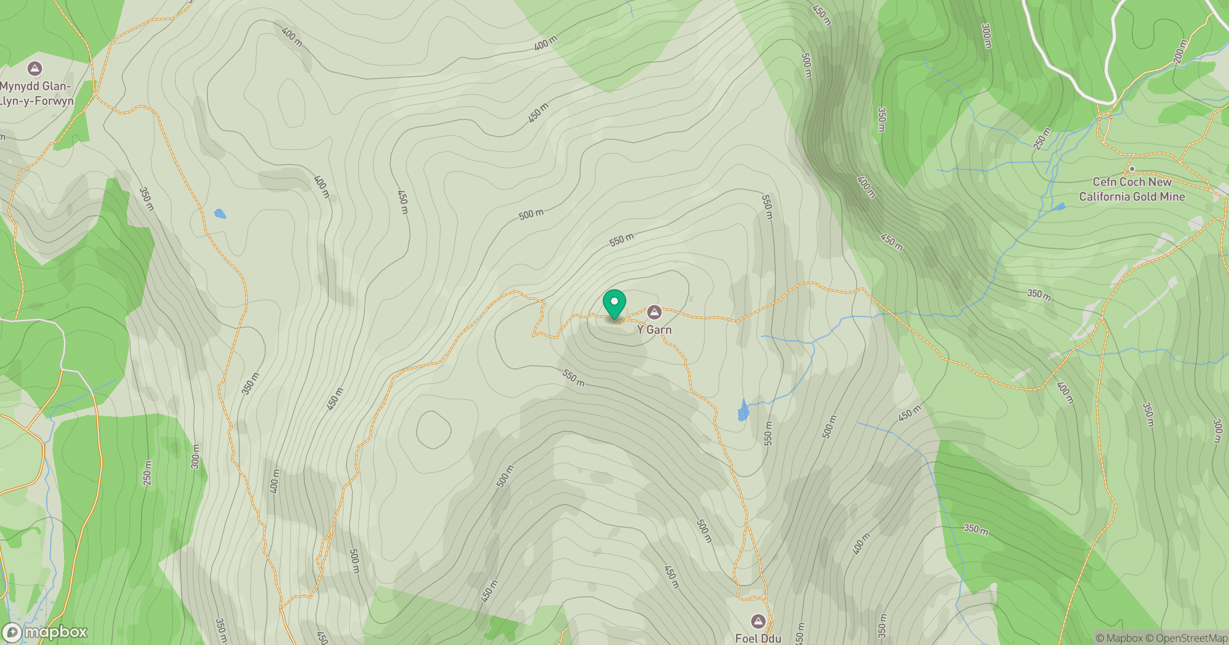
Grid reference: SH702230
View on OpenStreetMapOpens a map in a new tab, centred on the hill.
No comments yet. Be the first.