

Moel Hebog
Good walks are even better shared.
SH5646 : Dry Stone Wall Sheltering
Chris McAuley Photo source
Overview
Moel Hebog rises west of Beddgelert in Eryri, with a summit height of 783.7 m. The usual ascent climbs the rocky eastern shoulder; short scrambling sections and steep ground make this a substantial mountain walk. A direct summit return, a shorter loop from Bwlch Meillionen and the full ridge circuit over Moel yr Ogof and Moel Lefn are distinct outings. Clear weather opens views towards Yr Wyddfa, Nant Gwynant and the coast.
Moel Hebog
Moel Hebog rises west of Beddgelert, a rugged mountain of 783.7 m with views towards Yr Wyddfa, Nant Gwynant and the coast. Its rocky eastern shoulder makes a rewarding ascent, but the scrambling steps and steep ground call for mountain-walking experience.
The summit
Look for the elongated rock 10 m north-north-east of the cairn. The natural ground beside the raised trig point is 1.4 m lower, so the familiar pillar is not the highest natural point. These details follow the Database of British and Irish Hills, whose Moel Hebog record was revised on 21 July 2024.
Choose your route
Summit and back from Beddgelert
The usual approach leaves the village via the Welsh Highland Railway crossings and Cwm Cloch, then branches uphill from Lôn Gwyrfai. Steep grass gives way to rocky steps and scree before the summit. Retracing this route keeps the day to Moel Hebog, with care needed when descending the scrambling sections.
A shorter circular return
After the summit, descend north-west to Bwlch Meillionen. The shorter loop turns east towards the forest from the col, omitting Moel yr Ogof. The faint path and wet forest section need attention. This remains a demanding mountain outing, even though it omits the other two summits.
The three-summit circuit
Continue from Bwlch Meillionen over Moel yr Ogof and Moel Lefn for a longer ridge day. Beyond Moel Lefn, the descent towards Bwlch Cwm Trwsgl is steep and rocky, and can be awkward to locate in mist. Return through Beddgelert Forest to Lôn Gwyrfai. The forest tracks have several junctions; carry a map and compass rather than relying on an apparently obvious trail.
Western approaches and the gorge
Cwm Pennant lies west of the mountain. The Cwm Llefrith path reaches Bwlch Meillionen, from where the summit climb is steep. The approach includes wet and less distinct ground and needs a carefully chosen starting point.
Aberglaslyn is a separate riverside outing from Beddgelert. If combining it with Moel Hebog, return to the village first and plan the gorge section separately. The Fisherman’s Path has narrow rocky ground above the river and a stone buttress requiring particular care.
Access and conditions
Eryri’s Lôn Gwyrfai page currently carries a diversion at Coed Mawr, beside Meillionen station. Its map, dated 7 January 2025 and still linked when checked on 16 October 2026, redirects walkers onto forest roads north of the closed section. Follow the signed diversion on forest-return itineraries and check the official route notice before setting out.
Wet rock, loose scree and the steep grassy descent can be slippery. Snow, ice and low cloud increase the seriousness of the mountain; winter daylight is short. Take suitable boots, waterproofs, warm layers, a map, compass and torch. Use designated railway crossings and check for trains.
Getting there
Beddgelert’s village car parks serve the eastern approach. The forest car park farther north is a different start. The village has cafés, pubs, shops and public toilets. Sherpa’r Wyddfa buses S3 and S4 serve Beddgelert; check the current timetable and your last return service.
Rocks and name
The mountain’s Ordovician succession includes sedimentary sandstones as well as volcanic ash-flow tuffs. It records deposition, eruptions and later deformation, rather than a single uniform rock type.
The modern Welsh name is commonly understood as “bare hill of the hawk”. Older recorded forms have a more complex history: Peter Drummond relates them to “moel ehedog”, a poetic reference to flying. The familiar Glyndŵr cave tradition belongs to neighbouring Moel yr Ogof.
Explore routes near Moel Hebog
Walks starting near this hill. Open a route to check its map, distance and full itinerary.
Beddgelert Forest: Llyn Llywelyn Woodland Circuit
View route
Beddgelert Forest: Derwen Circuit and Llyn Llywelyn
View route
Snowdon Pyg Track returning by Miner's Track
View route
Northern Rhinogydd guided mountain walk
View route
Route planning notes
These notes describe possible approaches. Check a route's map and access information when planning your walk.
Moel Hebog summit return from Beddgelert
From Beddgelert, use the signed paths by the Welsh Highland Railway and Cwm Cloch, then leave Lôn Gwyrfai for the rocky eastern shoulder of Moel Hebog. The upper ascent includes short scrambling sections. Return by the same path, taking care on the steep descent. This outing finishes at Moel Hebog rather than continuing over Moel yr Ogof and Moel Lefn.
Moel Hebog from Cwm Pennant
Cwm Pennant is west of Moel Hebog. A western approach can use Cwm Llefrith to Bwlch Meillionen, followed by the steep climb south-east to the summit. The valley path has wet, less distinct ground. Choose the starting point and permitted access carefully; this is a mountain approach for confident navigators. Return by the same route.
Moel Hebog, Moel yr Ogof and Moel Lefn circuit
From Beddgelert climb Moel Hebog, descend north-west to Bwlch Meillionen, then continue over Moel yr Ogof and Moel Lefn. Find the steep rocky descent towards Bwlch Cwm Trwsgl, then return through Beddgelert Forest and Lôn Gwyrfai. UKHillwalking allows 6–8 hours for its circuit. Follow the current Coed Mawr diversion beside Meillionen station on the forest return.
Moel Hebog circular via Bwlch Meillionen
Climb the eastern shoulder from Beddgelert, then descend steeply north-west to Bwlch Meillionen. Turn east from the col towards Beddgelert Forest, omitting Moel yr Ogof, and return on forest paths and Lôn Gwyrfai. Perthi’s guide allows 3–5 hours. Expect faint, boggy paths and use the current Coed Mawr diversion. This shorter circuit still includes scrambling and steep mountain ground.
Moel Hebog with an Aberglaslyn extension
Complete the mountain walk back to Beddgelert before adding a separate riverside excursion south towards Aberglaslyn. The Fisherman’s Path has narrow rocky sections and a stone buttress above the river, plus railway crossings. Treat the gorge as an additional route with its own return plan; it is not the normal descent from Moel Hebog.
Make a day of it, together
Find someone to share the walk with, or organise a day out along a route you like.
Photo Gallery
View all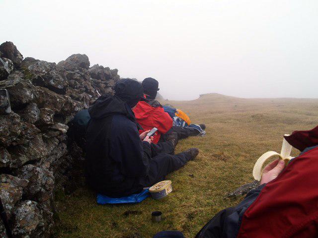 Photo could not load
SH5646 : Dry Stone Wall Sheltering
Chris McAuley
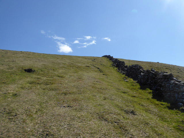 Photo could not load
SH5646 : Nearing the summit of Moel Hebog
Jeremy Bolwell
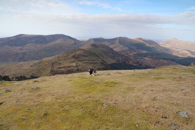 Photo could not load
SH5646 : Moel Hebog summit
Andy Waddington
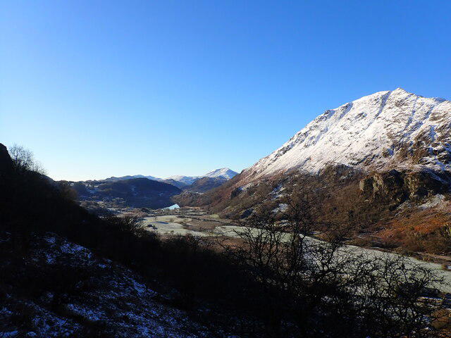 Photo could not load
SH5646 : Nant Gwynant, Moel Ddu and Moel Hebog
Phil Brandon Hunter
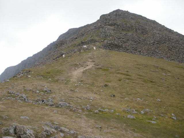 Photo could not load
SH5647 : Y Grisiau, Moel Hebog
Peter S
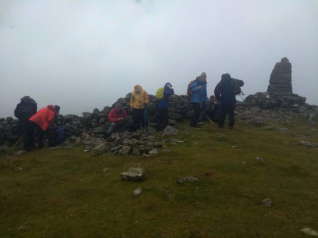 Photo could not load
SH5646 : The windswept, misty, summit of Moel Hebog
David Medcalf
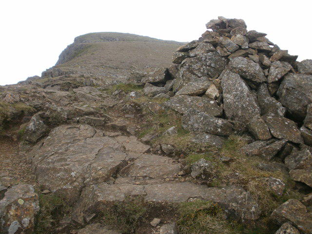 Photo could not load
SH5646 : Cairn on Moel Hebog summit ridge
Peter S
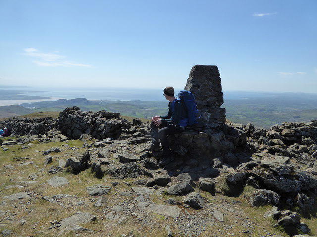 Photo could not load
SH5646 : The summit of Moel Hebog in May
Jeremy Bolwell
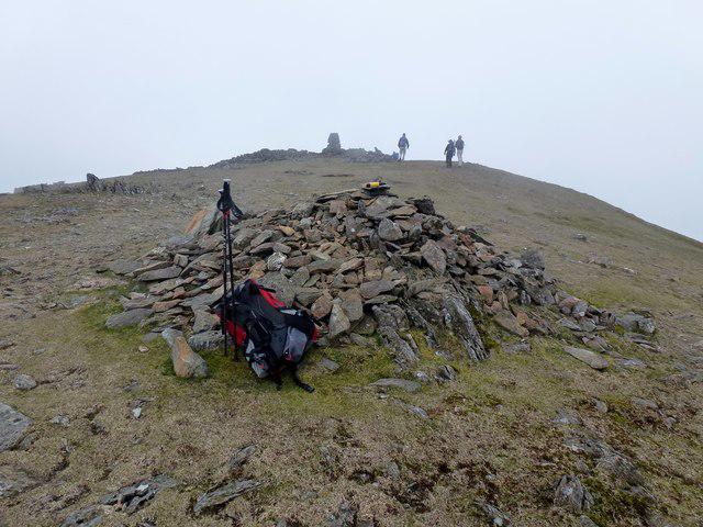 Photo could not load
SH5646 : Moel Hebog Barren Summit View
Rude Health
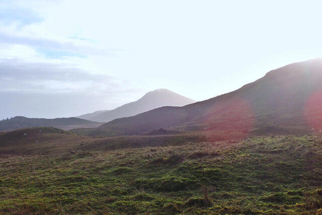
SH5646 : Moel Hebog, Eryri
Phil Brandon Hunter
Hill facts and local notes
Classifications
Elevation
784m
2,571 ft
Prominence
585m
Coordinates
53.0007, -4.1396
SH565469
OS Map
115
Explorer: OL17W 254
At the Summit
The highest point is an elongated rock 10 m north-north-east of the cairn. DoBIH records the natural ground beside the raised trig point at SH 56483 46943 as 1.4 m lower. The trig point is a useful landmark, but is separate from the highest natural ground.
Terrain & Geology
Moel Hebog exposes an Ordovician succession of sedimentary and volcanic rocks. The Moel Hebog Sandstone Member includes coarse sandstones and pebbly beds; above it are volcanic ash-flow deposits of the Pitts Head Tuff and Lower Rhyolitic Tuff formations. Folding and faulting have complicated the rock sequence.
Views & Scenery
In clear weather, the outlook includes Yr Wyddfa and the Nant Gwynant valleys, the neighbouring ridge summits and the coastline towards the Llŷn Peninsula.
History & Heritage
Name Origin
The modern Welsh name is commonly translated as “bare hill of the hawk”. Peter Drummond, citing Hywel Owen’s place-name research, relates it to the older “moel ehedog”, a poetic reference to flying, with the hawk spelling becoming established later.
Historical Significance
On neighbouring Moel yr Ogof, a cave is traditionally associated with Owain Glyndŵr hiding from the English. This is a local tradition connected with the wider ridge, rather than an established explanation of Moel Hebog’s name.
Getting There & Facilities
Parking
Use a designated Beddgelert village car park for the eastern ascent, including the National Park car park near the Welsh Highland Railway station. Colwyn Banc is another village option. Follow current signs and charges; do not block access. Beddgelert Forest car park at SH574503 is a different starting point, farther north.
Public Transport
Sherpa’r Wyddfa serves Beddgelert: S3 links it with Caernarfon and Dinorwig; S4 links it with Pen-y-Pass, Porthmadog and Morfa Bychan. The operator’s current timetable is effective from 28 March 2026. Check the timetable for your travel day and last return bus.
Nearby Facilities
Beddgelert has shops, cafés and pubs. Cyngor Gwynedd lists the village public toilets as open all year, including an accessible facility requiring a RADAR key.
Safety Information
Known Hazards
- The eastern ascent includes steep rock, loose scree and short scrambling sections; wet or icy rock makes these more serious.
- The north-west descent to Bwlch Meillionen is steep. In mist, identify the correct line rather than following an apparent slope away from the ridge.
- Moel Lefn has a steep, rocky descent towards Bwlch Cwm Trwsgl, with complex route-finding. Forest junctions and faint paths also require navigation.
- Eryri currently shows a Lôn Gwyrfai diversion at Coed Mawr beside Meillionen station. Forest-return routes should follow the signed diversion and current official map.
- Use the designated Welsh Highland Railway crossings and check for trains. Forest paths can be very wet and boggy.
- An Aberglaslyn extension adds narrow rocky ground above the river; take particular care at the stone buttress on the Fisherman’s Path.
Seasonal Hazards
Snow and ice can affect the upper mountain and scrambling sections. Heavy rain makes the forest return boggy and the steep grassy descent slippery. Mist complicates the ridge and Moel Lefn descent; allow for shorter winter daylight and carry a map, compass and torch.
General Safety Tips
- Check weather conditions before setting out
- Carry appropriate clothing and equipment
- Let someone know your planned route
- Take a map, compass, and GPS device
- Carry emergency supplies: food, water, first aid kit, torch
Hills
Some common questions about the hills answered
Are there group walks up Moel Hebog?
Many walkers use Walkmates to join or organise walks with others. You can check for group walks around Moel Hebog through the maps
Are there other walkers around Moel Hebog?
Activity varies by location and time, but Walkmates lets you see whether others have shared walks or shown interest in this area. Find other people through the walking friends search walking friends for Moel Hebog search or of course create your own walk for Moel Hebog
Can I organise a walk to Moel Hebog?
Yes. If there aren’t any walks listed already, you can create a walk and make it available for others to join.
If you're signed up to Walkmates, you can create a walk to Moel Hebog.
How do I find a walk up this hill?
There are often multiple ways to walk this hill, depending on experience and route preference. Walkmates helps you explore walks and routes that others have shared.
Can I suggest a new route up Moel Hebog?
Yes. You can suggest or create routes to share with others. Walkmates focuses on the social side of walking, so routes are used to help people organise walks and explore areas together, rather than as detailed navigation tools or route libraries.
Other uses really appreciate knowledgeable walkers sharing their routes. Share your favourite route to Moel Hebog here
The is an error or something incorrect about this hill. How do I let you know?
We always strive to keep the information on Walkmates as accurate as possible. If you find an error, please let us know through the contact form and we'll aim to correct it as quickly as possible
Community Discussion
Comments
Location
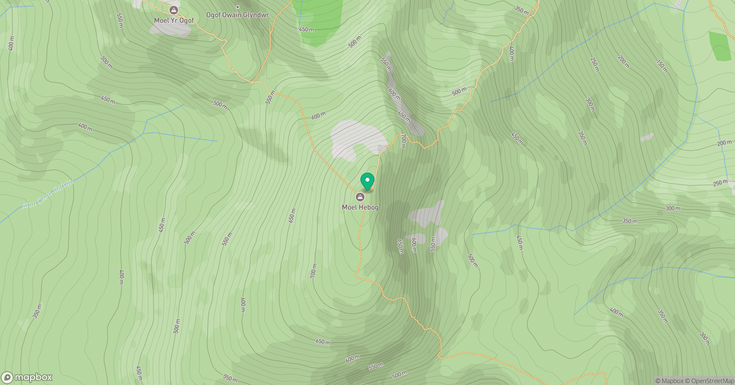
Grid reference: SH565469
View on OpenStreetMapOpens a map in a new tab, centred on the hill.
No comments yet. Be the first.