

Cnicht
Good walks are even better shared.
SH6446 : The ridge ahead
Ian Greig Photo source
Overview
Cnicht rises above Croesor in the Moelwynion of Eryri, Gwynedd. Its pointed profile from the southwest has earned it the nickname Welsh Matterhorn, although the summit stands at the end of a longer ridge. The main top is 690.9 m high. The popular Croesor ascent finishes with short rocky scrambles; longer circuits cross remote, sometimes boggy uplands around Llyn yr Adar and the former slate quarries.
Cnicht
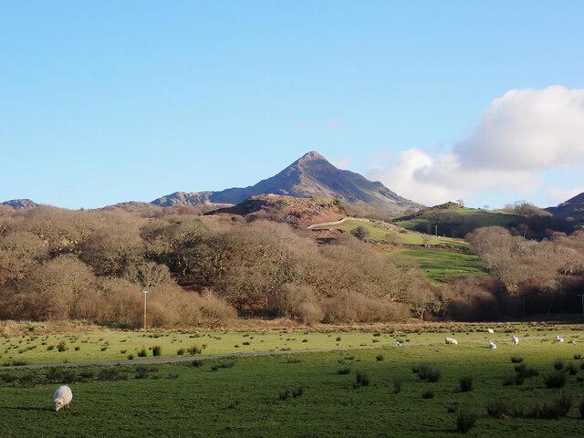
Cnicht is a 690.9 m mountain above Croesor in the Moelwynion, within Eryri National Park. Seen from the southwest, its pointed outline explains the familiar nickname Welsh Matterhorn. From other directions, the longer summit ridge becomes clear.
The summit and ridge
The main summit is the middle of three rocky outcrops. Cnicht North Top, at 690.2 m, is a separate summit farther northeast. Views include Moelwyn Mawr across Cwm Croesor, the Snowdon range and Tremadog Bay when conditions are clear.
Walking routes
Croesor is the usual starting village. Its direct ascent becomes steeper near the top and includes short rocky scrambles. Continuing along the ridge towards Llyn yr Adar opens up several longer circuits, but the terrain becomes less straightforward: paths can fade into wet grass and bog, and navigation matters in cloud.
The route choices below describe distinct published itineraries. The Llyn Cwm-y-foel circuit, the Rhosydd quarry circuit and the Moelwyn Mawr circuit have different returns and should not be treated as interchangeable. Approaches from Blaen Nanmor and Beddgelert make longer mountain days through the northern lake country.
Eryri National Park also promotes a 5.5 km Croesor Circular through the surrounding countryside. That route stays below Cnicht and does not visit its summit.
Landscape and history
Hard igneous rocks and glacial erosion helped shape this striking ridge and valley. Croesor grew with the nineteenth-century slate industry; quarry tracks, inclines and ruins remain a prominent part of the landscape.
Planning the walk
Use the designated Croesor village car park and keep access routes clear. Bring supplies for the hill and check seasonal café opening before relying on refreshments. The council lists an on-demand bus service to Croesor, so confirm booking and return arrangements ahead of travel.
Wet rock can make the summit steps slippery. Longer loops require confident navigation across the uplands. Quarry remains are best viewed from surface paths: avoid open shafts, unstable edges and underground workings. Carry suitable mountain equipment and change plans if conditions exceed the group’s ability.
Explore routes near Cnicht
Walks starting near this hill. Open a route to check its map, distance and full itinerary.
Beddgelert Forest: Derwen Circuit and Llyn Llywelyn
View route
Beddgelert Forest: Llyn Llywelyn Woodland Circuit
View route
Snowdon Pyg Track returning by Miner's Track
View route
Northern Rhinogydd guided mountain walk
View route
Route planning notes
These notes describe possible approaches. Check a route's map and access information when planning your walk.
Cnicht and Llyn Cwm-y-foel from Croesor
Walking Britain walk 1127 climbs Cnicht from Croesor, then crosses the ridge to Llyn yr Adar. It returns via rough ground above Llyn Cwm-y-foel and the Cwm Croesor valley. Short rocky scrambles lead to the summit; the upland section has faint paths. The publisher grades this complete circuit Moderate.
Cnicht and Moelwyn Mawr from Croesor
Walking Britain walk 1422 links Cnicht, the northern lakes and quarry country with Moelwyn Mawr, then returns via Bwlch Stwlan and the lower paths to Croesor. It has indistinct and marshy sections and passes unfenced quarry workings. The publisher grades the full circuit Moderate and estimates 6 hours 40 minutes.
Cnicht and Llyn yr Adar from Beddgelert
Mud and Routes describes a long circuit from Beddgelert via Llyn Dinas, the Nantmor road and the Llyn Llagi area to Llyn yr Adar and Cnicht. Descend the rocky southwest approach and return by Bwlchgwernog, Nantmor and the riverside path. Boggy ground, navigation in mist and a slippery descent add to the effort. The publisher grades it Strenuous Walk.
Cnicht from Blaen Nanmor via Gelli Iago
go4awalk route gw163 is a complete circuit through Gelli Iago, Bwlch y Battel and Croesor Bach to Cnicht and its separate North Top, returning past Llyn yr Adar and Llyn Llagi to Blaen Nanmor. It includes steep rocky scrambling and rough upland terrain. The publisher grades the route Hard.
Cnicht and Rhosydd Quarry circuit from Croesor
Mud and Routes climbs Cnicht from Croesor, continues towards Llyn yr Adar, then crosses faint upland paths to Rhosydd Quarry and descends past Croesor Quarry into Cwm Croesor. The publisher grades this complete circuit Hard Walk and suggests about 4 hours. Navigation beyond the summit needs care; remain on surface routes away from shafts and unstable quarry edges.
Make a day of it, together
Find someone to share the walk with, or organise a day out along a route you like.
Photo Gallery
View all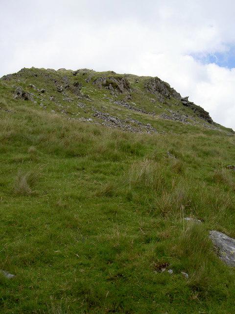 Photo could not load
SH6446 : The ridge ahead
Ian Greig
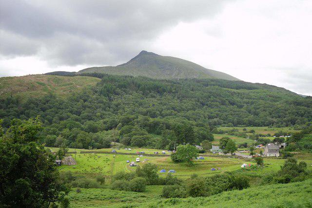 Photo could not load
SH6446 : Cnicht from the Nanmor Valley
Joseph Jones
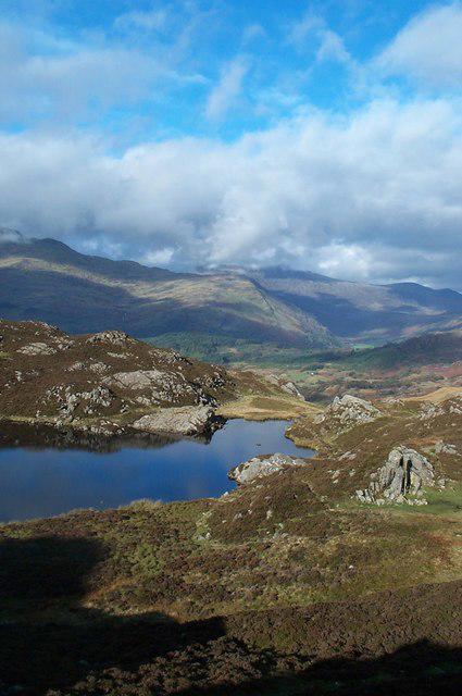 Photo could not load
SH6446 : View from Cnicht, Snowdonia
Graham Pritchard
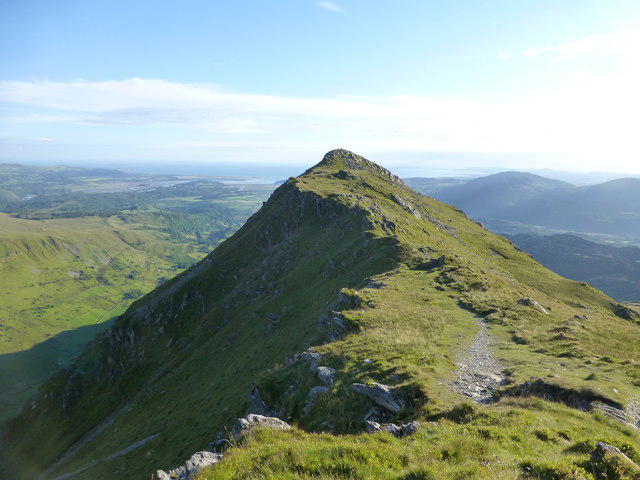 Photo could not load
SH6446 : Summit ridge of Cnicht
Clive Giddis
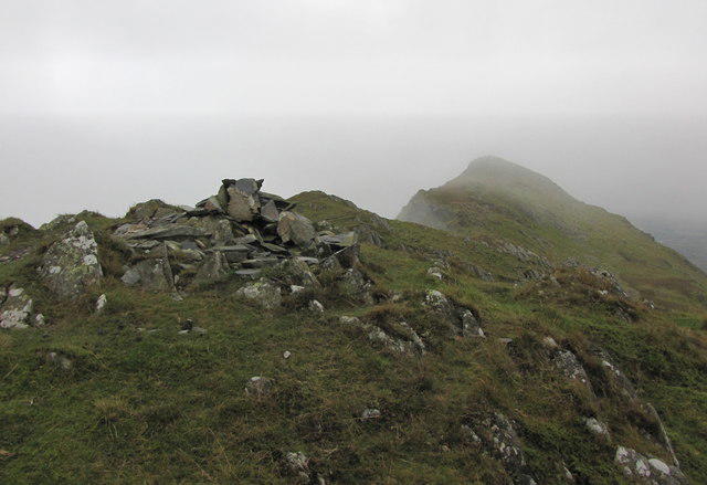 Photo could not load
SH6446 : Not a nice day on Cnicht
K A
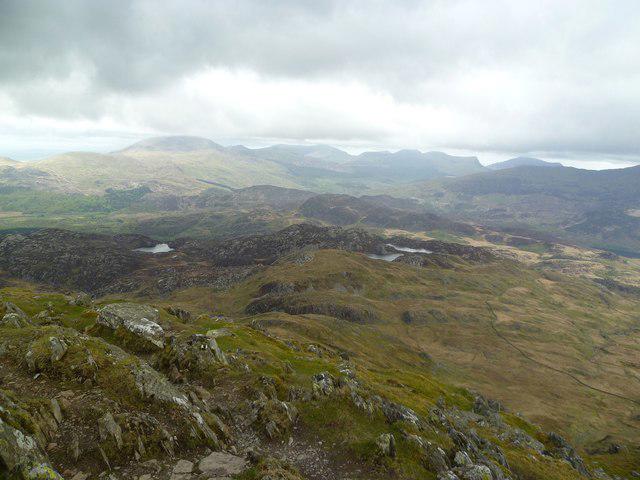 Photo could not load
SH6446 : On Cnicht
Michael Graham
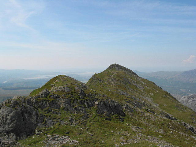 Photo could not load
SH6446 : View South-westwards along the summit ridge of the Cnicht
Eric Jones
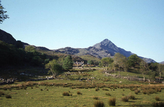 Photo could not load
SH6446 : Cnicht as seen from Croesor
Colin Park
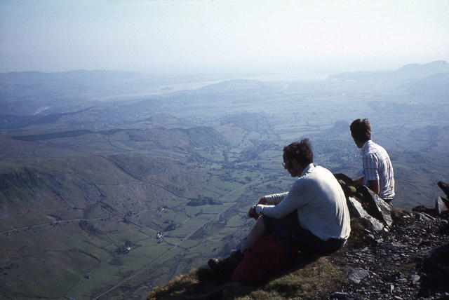 Photo could not load
SH6446 : On the summit of Cnicht & view to Cwm Croesor
Colin Park
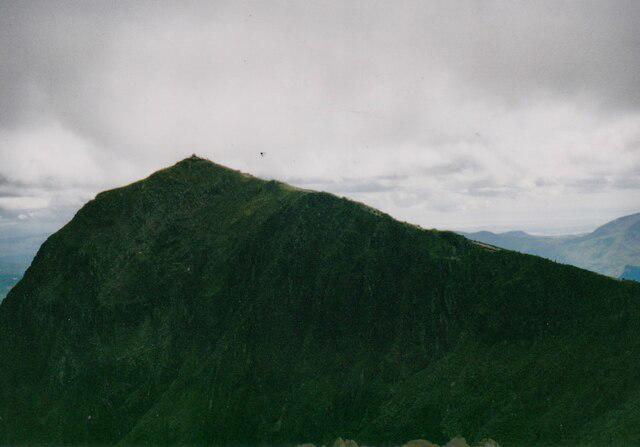
SH6446 : Cnicht of the Moelwyn massif
Phil Brandon Hunter
Hill facts and local notes
Classifications
Elevation
691m
2,267 ft
Prominence
105m
Coordinates
52.9997, -4.0199
SH645466
OS Map
115
Explorer: OL17W
At the Summit
The highest point is the middle of three rocky outcrops. Cnicht North Top is a separate, slightly lower summit farther along the ridge to the northeast.
Terrain & Geology
Cnicht belongs to the igneous landscape of the Moelwynion. Eryri National Park describes harder igneous intrusions surviving as surrounding Ordovician sedimentary rocks were eroded by glaciers. Glacial erosion also shaped Cwm Croesor below the ridge.
Views & Scenery
Moelwyn Mawr across Cwm Croesor, Yr Wyddfa and the Snowdon range, the upland lakes around Llyn yr Adar, and Porthmadog and Tremadog Bay in clear weather.
History & Heritage
Historical Significance
Croesor developed as a nineteenth-century slate-quarrying village. Quarry tracks, inclines and ruined buildings around Croesor and Rhosydd recall the industry that once linked the uplands with the coast. Cnicht’s pointed outline above the valley is widely known as the Welsh Matterhorn.
Getting There & Facilities
Parking
Use the designated village car park in Croesor, around OS grid reference SH631446. The approach roads are narrow. Keep field entrances, passing places and access to homes clear. Confirm any current charges or restrictions on arrival.
Public Transport
Gwynedd lists 99A/99B Porthmadog–Croesor–Rhyd as an on-demand service. Check current operating days, booking arrangements and your return journey with the council or operator before relying on it.
Nearby Facilities
Carry food and drinking water for the mountain. Oriel Caffi Croesor is listed by the Snowdonia Slate Trail Trust, but opening is seasonal and should be checked before a visit. Arrange supplies before reaching the trailhead.
Safety Information
Known Hazards
- Steep rocky steps and drops around the summit require care, particularly when wet or windy.
- Beyond the summit ridge, faint paths and boggy ground around Llyn yr Adar can be difficult to navigate in mist.
- Quarry circuits pass open shafts, unstable edges and loose slate. Stay on surface paths and keep out of adits and abandoned workings.
- Check the mountain forecast and carry a map, compass, suitable clothing, food and water.
General Safety Tips
- Check weather conditions before setting out
- Carry appropriate clothing and equipment
- Let someone know your planned route
- Take a map, compass, and GPS device
- Carry emergency supplies: food, water, first aid kit, torch
Hills
Some common questions about the hills answered
Are there group walks up Cnicht?
Many walkers use Walkmates to join or organise walks with others. You can check for group walks around Cnicht through the maps
Are there other walkers around Cnicht?
Activity varies by location and time, but Walkmates lets you see whether others have shared walks or shown interest in this area. Find other people through the walking friends search walking friends for Cnicht search or of course create your own walk for Cnicht
Can I organise a walk to Cnicht?
Yes. If there aren’t any walks listed already, you can create a walk and make it available for others to join.
If you're signed up to Walkmates, you can create a walk to Cnicht.
How do I find a walk up this hill?
There are often multiple ways to walk this hill, depending on experience and route preference. Walkmates helps you explore walks and routes that others have shared.
Can I suggest a new route up Cnicht?
Yes. You can suggest or create routes to share with others. Walkmates focuses on the social side of walking, so routes are used to help people organise walks and explore areas together, rather than as detailed navigation tools or route libraries.
Other uses really appreciate knowledgeable walkers sharing their routes. Share your favourite route to Cnicht here
The is an error or something incorrect about this hill. How do I let you know?
We always strive to keep the information on Walkmates as accurate as possible. If you find an error, please let us know through the contact form and we'll aim to correct it as quickly as possible
Community Discussion
Comments
Location
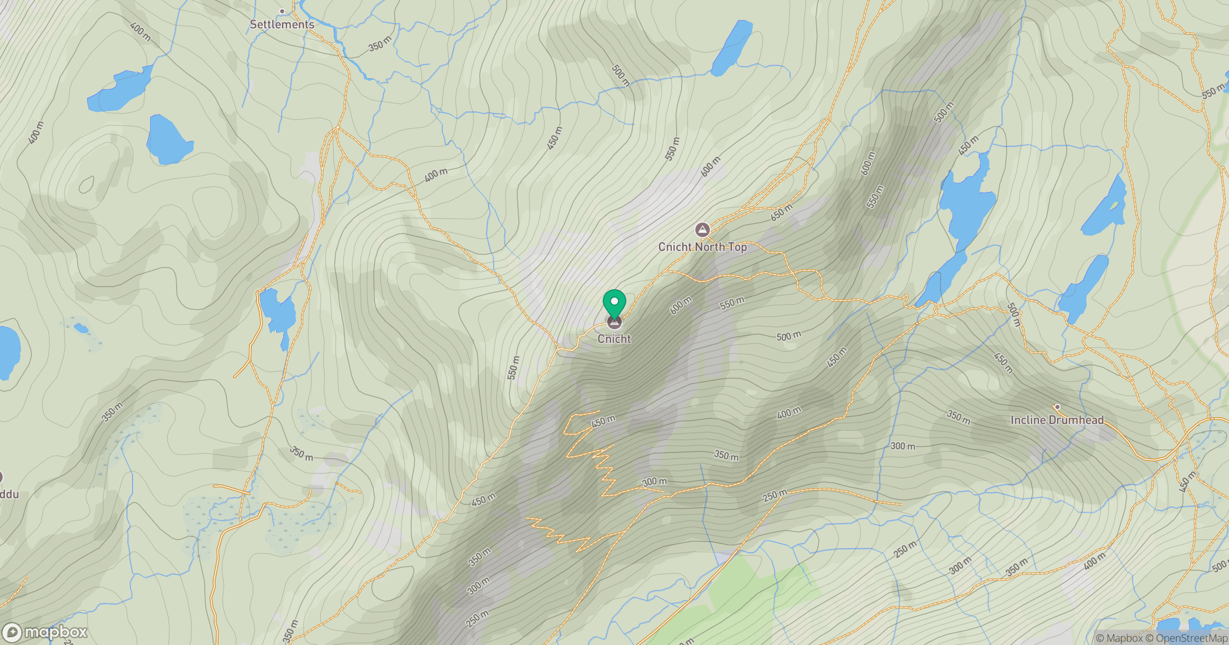
Grid reference: SH645466
View on OpenStreetMapOpens a map in a new tab, centred on the hill.
No comments yet. Be the first.