

Foel Cynwch
Good walks are even better shared.
Overview
Foel Cynwch: A Hidden Gem of Snowdonia
Foel Cynwch, standing at 429 meters, may not be the highest mountain in Wales, but it certainly holds its own charm among the peaks of Snowdonia National Park. Known affectionately as the 'Hill of the Swallow', this Marilyn beckons hikers and outdoor enthusiasts who fancy a mixed bag of easy-going trails and stunning views without the chaos of the major peaks.
Geology
The geology here is primarily made up of sedimentary rock formations that tell tales of ancient sedimentation processes. Mudstones with layers of sandstone create a diverse terrain, which not only adds aesthetic beauty but also provides unique habitats for local flora and fauna seeking solace.
Routes
Llyn Clywedog Circuit
A popular route that winds around the Llyn Clywedog reservoir and leads you gently to the summit of Foel Cynwch. Spanning approximately 10.5 km and taking about 3.5 hours, this trail invites you to take enjoyable breaks at scenic spots. Ideal for families and those out for a relaxed day.
Secluded Ridge Approach
If you prefer a bit more of a challenge while feasting upon great views, the Secluded Ridge Approach is for you. Despite its demanding nature over a 8.0 km trek taking up to 4 hours, the rewarding summit and tranquil atmosphere will tell you it was worth every step!
Terrain
The terrain is primarily grassy, dotted with rocky outcrops that lend a bit of character to your hike. With both stable footings and the occasional twisty ankle risk, keep your feet nimble and your stride steady.
Views
Once you gain the summit, brace yourself for breathtaking vistas that encompass Snowdon, the enchanting Llyn Clywedog, and the misty Cambrian Mountains. Best visited in spring and autumn for optimal visibility, this mountain offers perfect snaps for your adventure album. Don’t forget your camera; the sights are phenomenal!
Hazards
As with most Welsh hikes, you may find some tricky, muddy sections especially if you’re visiting after a rain shower. Approach these areas with a sense of caution, though a good pair of boots will save you from unintended mud wrestling!
Access
To get to Foel Cynwch, head for the minor road near SH726199 where limited parking is available. Getting to Llanidloes by bus is also a feasible option, with services operating regularly. Just check the schedules in advance to avoid waiting around too long. Nearby, Llanidloes gives you access to cafes and shops where you can stock up on hiking supplies and hot drinks before your climb.
History
The name Foel Cynwch, meaning 'Hill of the Swallow', roots itself in the natural beauty of the area. Historically significant for its surroundings, this mountain stands as a testament to the rich folklore embedded in the land, inviting adventurers to experience its charm.
In summary, Foel Cynwch offers a delightful escape from the mainstream hiking trails and a great opportunity to soak up the beauty of Snowdonia. Whether you're a seasoned hiker or just fancy a stroll, this mountain is well worth a visit. Bring a sandwich, a sense of adventure, and maybe a friend (if you’re feeling generous).
Happy hiking!
Explore routes near Foel Cynwch
Public walks starting within 80 km of this hill. Nearby does not mean a route reaches the summit; check its map and access before setting out.
Mawddach Trail: Dolgellau to Barmouth
View route
Mawddach Trail: Penmaenpool to Arthog Estuary Return
View route
Mawddach Trail: Penmaenpool to Dolgellau Riverside Return
View route
Coed y Brenin: Pont Ty'n-y-groes and Mawddach Forest Trail
View route
Route planning notes
These notes describe possible approaches, not verified navigable routes or permission to cross land. Check current paths, local access rules and conditions before setting out.
Llyn Clywedog Circuit
A scenic route that combines lakeside views with a gentle ascent towards the summit of Foel Cynwch, perfect for a leisurely hike.
Secluded Ridge Approach
This route takes you along quiet ridges offering stunning views but requires a bit more effort to reach the summit. Ideal for those seeking solitude.
Make a day of it, together
Find someone to share the walk with, or organise a day out along a route you like.
Photo Gallery
View all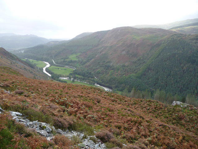 Photo could not load
SH7321 : Moorland on the flanks of Foel Cynwch
Jeremy Bolwell
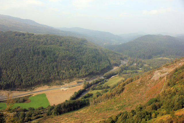 Photo could not load
SH7321 : View from the Precipice Walk
Jeff Buck
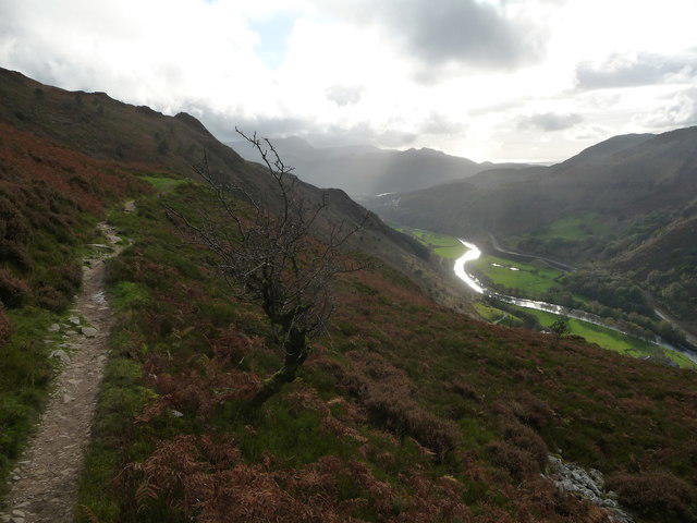 Photo could not load
SH7321 : Part of the Precipice Walk
Jeremy Bolwell
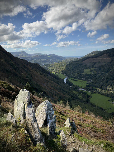 Photo could not load
SH7321 : View from The Precipice Walk
Petra
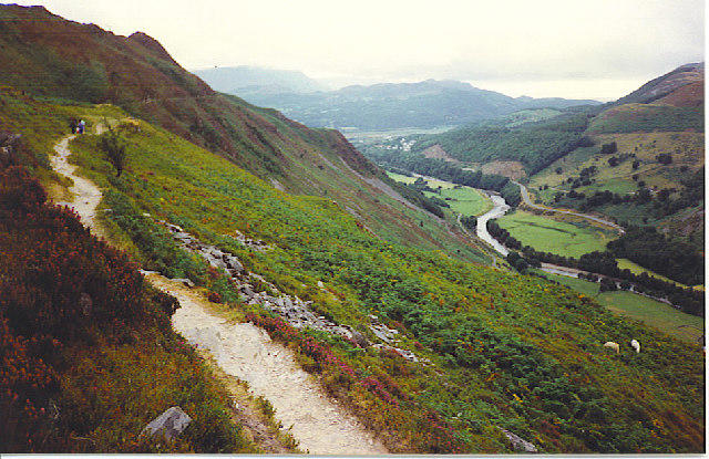 Photo could not load
SH7321 : The Precipice Walk, near Dolgellau.
Colin Smith
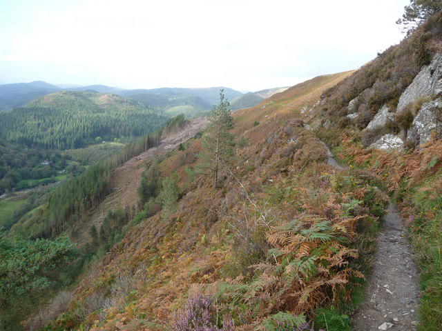 Photo could not load
SH7321 : Part of the Precipice Walk, Foel Cynwch
Jeremy Bolwell
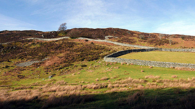 Photo could not load
SH7321 : The Precipice Walk
John Lucas
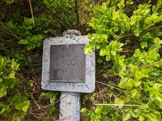 Photo could not load
SH7321 : A fallen Beacon - M.W.B. No. 11
David Medcalf
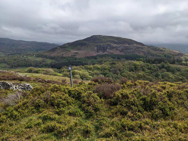 Photo could not load
SH7321 : Looking east from the slopes of Foel Cynwch
David Medcalf
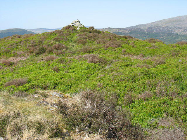 Photo could not load
SH7321 : The summit cairn on Foel Cynwch
David Purchase
Hill facts and local notes
Classifications
Elevation
326m
1,070 ft
Prominence
107m
Coordinates
52.7727, -3.8748
SH736211
OS Map
124
Explorer: OL18W
At the Summit
The summit features a small stone cairn and offers panoramic views of the surrounding hills and valleys, adding a touch of charm that impresses even the hardest of hearts.
Terrain & Geology
Foel Cynwch is primarily composed of sedimentary rocks, including mudstones and sandstones, characteristic of the Welsh landscape. The presence of these rocks offers a glimpse into the geological history of the region, formed over millions of years.
Views & Scenery
From the summit, you can enjoy views of Snowdon, Llyn Clywedog, and the Cambrian Mountains in the distance. Remember to bring your camera, as your social media followers will need their daily dose of 'wow'.
History & Heritage
Name Origin
The name 'Foel Cynwch' translates to 'Hill of the Swallow', a nod to the surrounding nature that once harboured these delightful birds.
Historical Significance
This mountain is part of a rich landscape that plays a role in Welsh folklore and the culture of the area, being a symbol for local walker’s pursuits.
Getting There & Facilities
Check current local access restrictions, parking rules and transport timetables before travelling. These notes do not confirm public access to the summit.
Parking
There is a small lay-by at the end of a minor road near SH726199, suitable for a few cars. Arrive early to secure a spot as it's popular with local walkers.
Public Transport
Services from the nearest town, Llanidloes, operate regularly, with bus routes allowing access to nearby locations. It's advisable to check schedules in advance.
Nearby Facilities
Llanidloes offers several cafes and shops where you can grab a bite or a cuppa before or after your hike. Toilets are available at various public points within the town.
Safety Information
Known Hazards
- Wet and muddy sections during wetter months can be slippery. Keep your eyes peeled and your boots steady!
General Safety Tips
- Check weather conditions before setting out
- Carry appropriate clothing and equipment
- Let someone know your planned route
- Take a map, compass, and GPS device
- Carry emergency supplies: food, water, first aid kit, torch
Hills
Some common questions about the hills answered
Are there group walks up Foel Cynwch?
Many walkers use Walkmates to join or organise walks with others. You can check for group walks around Foel Cynwch through the maps
Are there other walkers around Foel Cynwch?
Activity varies by location and time, but Walkmates lets you see whether others have shared walks or shown interest in this area. Find other people through the walking friends search walking friends for Foel Cynwch search or of course create your own walk for Foel Cynwch
Can I organise a walk to Foel Cynwch?
Yes. If there aren’t any walks listed already, you can create a walk and make it available for others to join.
If you're signed up to Walkmates, you can create a walk to Foel Cynwch.
How do I find a walk up this hill?
There are often multiple ways to walk this hill, depending on experience and route preference. Walkmates helps you explore walks and routes that others have shared.
Can I suggest a new route up Foel Cynwch?
Yes. You can suggest or create routes to share with others. Walkmates focuses on the social side of walking, so routes are used to help people organise walks and explore areas together, rather than as detailed navigation tools or route libraries.
Other uses really appreciate knowledgeable walkers sharing their routes. Share your favourite route to Foel Cynwch here
The is an error or something incorrect about this hill. How do I let you know?
We always strive to keep the information on Walkmates as accurate as possible. If you find an error, please let us know through the contact form and we'll aim to correct it as quickly as possible
Community Discussion
Comments
Location
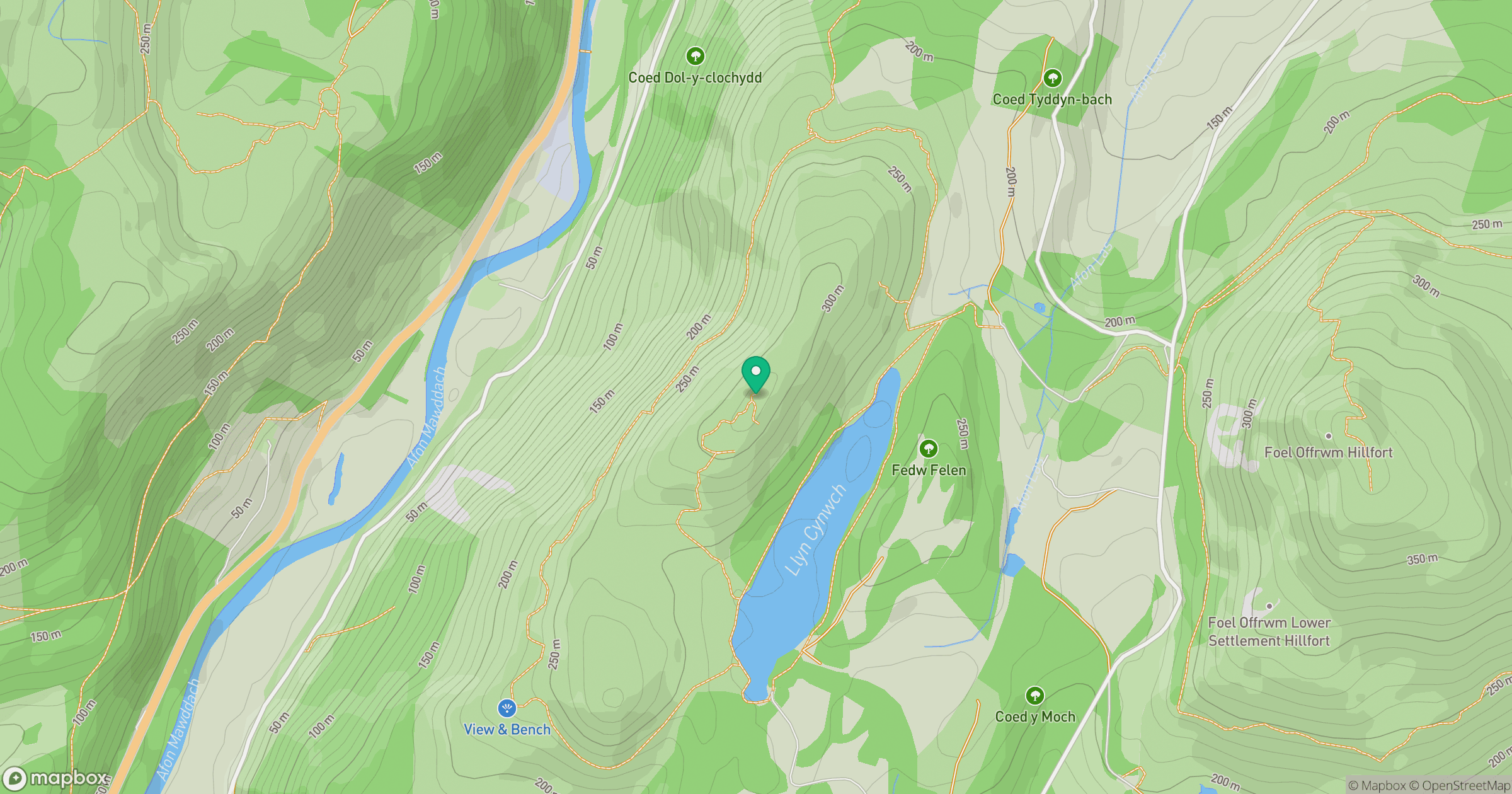
Grid reference: SH736211
View on OpenStreetMapOpens a map in a new tab, centred on the hill.
Hills within 30 km
Straight-line distance, not a walking route or confirmation of access.
No comments yet. Be the first.