

White Coomb
Good walks are even better shared.
NT1615 : Fence junction, White Coomb
Jim Barton Photo source
Overview
White Coomb: An Overview
Situated within the stunning Southern Uplands of Scotland, White Coomb invites adventurers and casual walkers alike to experience its breathtaking views and impressive terrain. Standing at an elevation of 842 meters, it proudly claims its title as a Marilyn, offering a gentle challenge to those with a penchant for the outdoors.
Geology
White Coomb is a geological marvel, chiefly composed of sturdy granite formed in epochs gone by. Did you know that the very rocks beneath your feet have stood the test of time over millions of years? It’s like walking on nature’s own time capsule! The surrounding sedimentary deposits add a fascinating layer of geological diversity.
Routes
The most well-trodden path begins at Grey Mare's Tail waterfall. This route is favoured for its picturesque scenery and not-so-shabby distance of 12 km. Typically, this jaunt will take about 4 hours and is rated as moderate—perfect for those who enjoy a bit of a workout without descending into the realm of hardcore mountaineering.
Summit Features
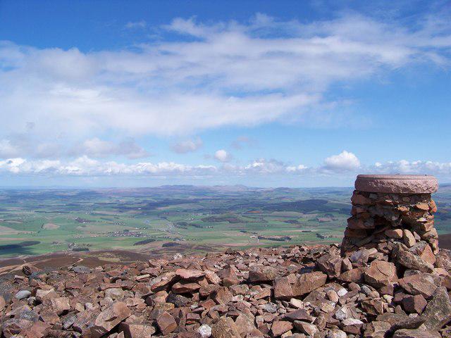
Upon reaching the summit, hikers are met with a stone cairn—an inviting sight for anyone seeking a moment of peace or, at the very least, a good photo opportunity. Don’t forget to flag your summit success on social media!
Terrain Type
The trek features a patchwork of moorland interspersed with rocky outcrops, particularly as one approaches the summit. Most of us enjoy a bit of a scramble now and then, don’t we?
Views
Breathtaking is an understatement! Expect sweeping vistas of The Merrick, Benyellary, and the lush landscapes that fill the eye as far as the horizon enables. If you arrive during the blooming season, the heather will present a vibrant purple canvas against the green hills. The best time for these views is from late spring through early autumn.
Hazards
As with any highland hike, the weather can be fickle—one moment you’re basking in sunlight, and the next, you’re questioning your life choices. Always check the weather forecast and prepare accordingly; dressing in layers is advisable to combat unpredictable temperatures.
Access
Parking is available at the Grey Mare's Tail visitor centre, approximately 2 km from the start of the trail. Public transport is limited, so a private vehicle or taxi may come in handy. The bustling town of Moffat, just a short drive away, is your closest hub for amenities.
Facilities
Facilities are basic but sufficient. The Grey Mare’s Tail visitor centre boasts toilets and ample parking. For a true Scottish experience, head to Moffat post-hike for a warm meal—remember, calories consumed on the trail don’t count!
History
The etymology of 'White Coomb' adds an intriguing touch; 'Cumb' refers to a hollow or depression, and with variances in geological forms, this name makes perfect sense. Rumour has it that the mountain is visited by the spirits of ancient warriors, but fear not—they’re said to be friendly souls!
Whether you seek solitude, adventure, or simply a reason to disconnect from the rat race, White Coomb delivers on all fronts. So pack your bags, lace up those hiking boots, and get ready for a grand Scottish adventure!
Happy hiking!
Explore routes near White Coomb
Walks starting near this hill. Open a route to check its map, distance and full itinerary.
Moffat Gallow Hill Woodland and Viewpoint Circuit
View route
Cademuir Forest Pilots Trail
View route
Peebles to Neidpath Castle: Tweed Riverside Walk
View route
Forest of Ae Water of Ae Riverside Trail
View route
Route planning notes
These notes describe possible approaches. Check a route's map and access information when planning your walk.
Grey Mare's Tail to White Coomb
A popular route that begins at the picturesque Grey Mare's Tail waterfall, taking you through scenic moorland and up to the summit.
Make a day of it, together
Find someone to share the walk with, or organise a day out along a route you like.
Photo Gallery
View all Photo could not load
NT1615 : Fence junction, White Coomb
Jim Barton
 Photo could not load
NT1614 : Snow Cornice on Coomb Craig, White Coomb
Alan O'Dowd
 Photo could not load
NT1615 : The grassy summit of White Coomb
Colin Park
 Photo could not load
NT1615 : Summit cairn, White Coomb
Jim Barton
 Photo could not load
NT1615 : White Coomb’s Historic Summit Cairn
Iain Lees
 Photo could not load
NT1615 : The Historic Cairn on top of White Coomb.
Iain Lees
 Photo could not load
NT1615 : White Coomb Summit Cairn
Adam Ward
 Photo could not load
NT1615 : White Coomb
Rude Health
 Photo could not load
NT1615 : The summit of White Coomb
Walter Baxter

NT1615 : White Coomb Summit
Iain Lees
Hill facts and local notes
Classifications
Elevation
822m
2,696 ft
Prominence
375m
Coordinates
55.4226, -3.3237
NT163150
OS Map
79
Explorer: 330
At the Summit
The summit is marked by a stone cairn and offers opportunities for celebratory selfies with a stunning backdrop.
Terrain & Geology
White Coomb is composed primarily of granite, contributing to its solid structure and stunning rock formations. These geological features are complemented by surrounding sedimentary deposits from the Paleozoic era.
Views & Scenery
Views of the surrounding hills such as The Merrick and the vast rolling landscapes of Galloway, as well as several lochs including Loch Trool.
History & Heritage
Name Origin
The name 'White Coomb' derives from the Old English word 'Cumb', meaning a hollow or depression, and its distinctive pale granite rock, giving it its 'white' appearance.
Historical Significance
White Coomb is steeped in local folklore, often thought to be haunted by spirits of ancient Scottish warriors; however, neither the visitors nor the mountain seem particularly perturbed by this fact.
Getting There & Facilities
Parking
There is a designated car park at the Grey Mare's Tail visitor centre, which is approximately 2 km from the trailhead.
Public Transport
Buses run from Moffat to the town of Selkirk, which is near the trail. However, a more direct connection is usually helpful from local taxi services.
Nearby Facilities
The Grey Mare's Tail visitor centre has toilets and parking facilities. Nearby Moffat offers cafes and shops for refreshments before or after your hike.
Safety Information
Known Hazards
- Variable weather conditions can create hazards including high winds and sudden changes in visibility. Ensure to check forecasts and dress appropriately.
General Safety Tips
- Check weather conditions before setting out
- Carry appropriate clothing and equipment
- Let someone know your planned route
- Take a map, compass, and GPS device
- Carry emergency supplies: food, water, first aid kit, torch
Hills
Some common questions about the hills answered
Are there group walks up White Coomb?
Many walkers use Walkmates to join or organise walks with others. You can check for group walks around White Coomb through the maps
Are there other walkers around White Coomb?
Activity varies by location and time, but Walkmates lets you see whether others have shared walks or shown interest in this area. Find other people through the walking friends search walking friends for White Coomb search or of course create your own walk for White Coomb
Can I organise a walk to White Coomb?
Yes. If there aren’t any walks listed already, you can create a walk and make it available for others to join.
If you're signed up to Walkmates, you can create a walk to White Coomb.
How do I find a walk up this hill?
There are often multiple ways to walk this hill, depending on experience and route preference. Walkmates helps you explore walks and routes that others have shared.
Can I suggest a new route up White Coomb?
Yes. You can suggest or create routes to share with others. Walkmates focuses on the social side of walking, so routes are used to help people organise walks and explore areas together, rather than as detailed navigation tools or route libraries.
Other uses really appreciate knowledgeable walkers sharing their routes. Share your favourite route to White Coomb here
The is an error or something incorrect about this hill. How do I let you know?
We always strive to keep the information on Walkmates as accurate as possible. If you find an error, please let us know through the contact form and we'll aim to correct it as quickly as possible
Community Discussion
Comments
Location
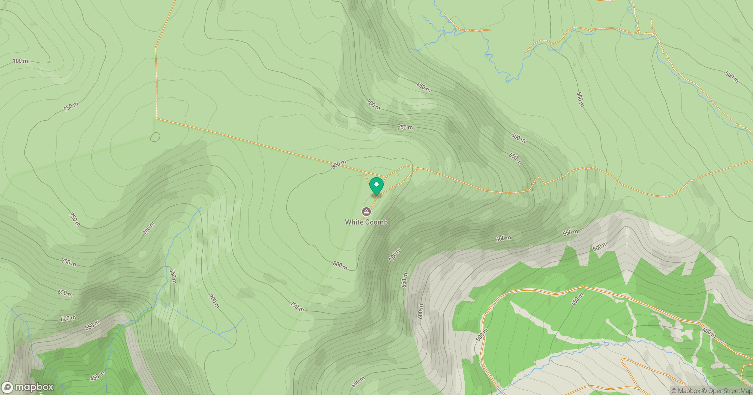
Grid reference: NT163150
View on OpenStreetMapOpens a map in a new tab, centred on the hill.
No comments yet. Be the first.