

Hart Fell
Good walks are even better shared.
NT1113 : Trig Point on Hart Fell
Colin Kinnear Photo source
Overview
Hart Fell
Nestled in the stunning Southern Uplands of Scotland, Hart Fell is a Marilyn that beckons hikers with its blend of challenge and beauty. Standing at an elevation of 823 meters, it offers a moderate hike that rewards adventurers with breathtaking views.
Geology
Hart Fell is primarily comprised of greywacke sandstone. This tough material has witnessed the dance of geological time, making the surrounding landscape rugged yet captivating. It's like nature's own art gallery, chiselled with patience.
Routes
The most popular route begins from Moffat and stretches approximately 10 km. This well-trodden path is clearly marked, so you can focus on enjoying the surrounding scenery rather than worrying about losing your way. As you climb, keep your eyes peeled for wildlife — you never know who might be watching you!
Summit Features
At the summit, you’re greeted by a prominent trig point standing tall, best known for its ability to collect a surprising number of selfies. Nearby, a quirky stone cairn serves as a reminder of the many hikers who have conquered this mountain before you.
Terrain Type
Don your best hiking boots because the terrain ranges from grassy slopes to rocky outcrops. Don’t be surprised if you find yourself navigating a few boggy patches — it adds to the adventure!
Views
The panoramic views from the top are simply exceptional. On clear days, expect to see the rolling hills of the Southern Uplands and even the distant peaks of the Lake District. Pack a picnic but be prepared to share if you want to make friends up there!
Hazards
Keep an eye on the weather: conditions can change quicker than you can say ‘scenic vista'. Prepare for gusty winds, especially at the summit, and tread carefully over the soggy ground to avoid an unexpected dip!
Access
Accessing Hart Fell is a breeze, with parking available in Moffat. For those relying on public transport, buses frequently run from nearby towns. Moffat itself is a charming town with all the amenities needed to prepare for your hike.
Facilities
Moffat has several cafes perfect for that pre-hike coffee or a post-hike treat. Public toilets are also available, so there's no need to hold it until the summit!
History
The name Hart Fell carries a touch of local folklore, possibly referencing the wild deer that once roamed these hills or rooted in Gaelic origins. This mountain has earned its place in the hearts and stories of the people.
Whether you're a seasoned trekker or just looking for a pleasant day out in nature, Hart Fell is worth the hike!
Happy hiking!
Explore routes near Hart Fell
Walks starting near this hill. Open a route to check its map, distance and full itinerary.
Moffat Gallow Hill Woodland and Viewpoint Circuit
View route
Forest of Ae Water of Ae Riverside Trail
View route
Cademuir Forest Pilots Trail
View route
Peebles to Neidpath Castle: Tweed Riverside Walk
View route
Route planning notes
These notes describe possible approaches. Check a route's map and access information when planning your walk.
Hart Fell from Moffat
A popular route starting from Moffat leading to the summit via a well-defined path. It's a scenic hike with picturesque views of the surrounding valleys.
Make a day of it, together
Find someone to share the walk with, or organise a day out along a route you like.
Photo Gallery
View all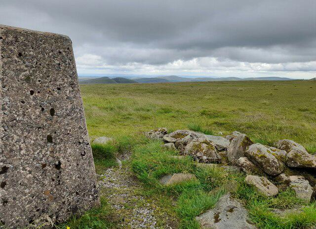 Photo could not load
NT1113 : Trig Point on Hart Fell
Colin Kinnear
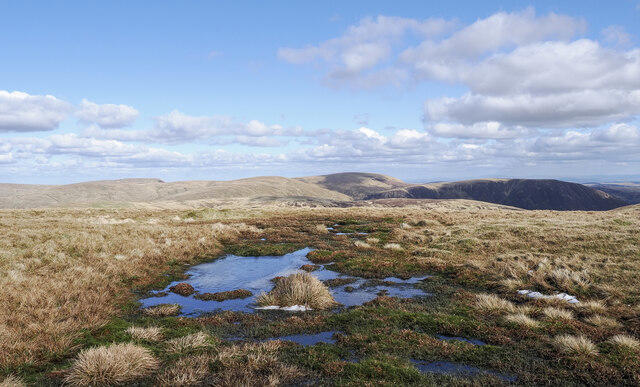 Photo could not load
NT1113 : Bog beside fence line on path for Hart Fell
Trevor Littlewood
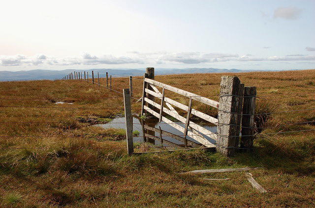 Photo could not load
NT1113 : Fence junction near Hart Fell summit
Jim Barton
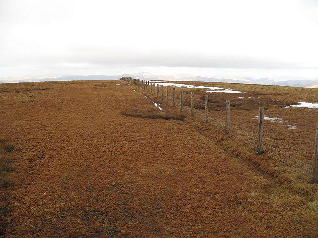 Photo could not load
NT1113 : Fence, Hart Fell
Richard Webb
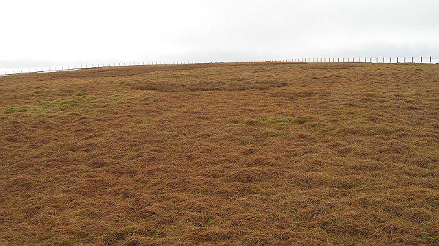 Photo could not load
NT1113 : Hart Fell
Richard Webb
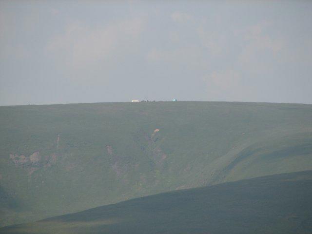 Photo could not load
NT1113 : Hart Fell
Callum Black
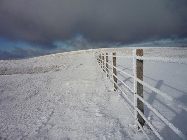 Photo could not load
NT1113 : Fences on Hart Fell summit plateau
Alan O'Dowd
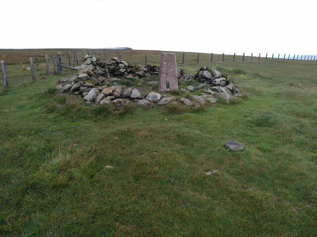 Photo could not load
NT1113 : Hart Fell Summit
Robert Struthers
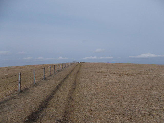 Photo could not load
NT1113 : Towards Hart Fell summit
Iain Russell
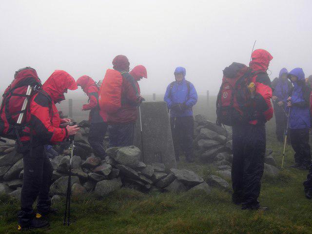
NT1113 : Hart Fell
Iain Lees
Hill facts and local notes
Classifications
Elevation
808m
2,651 ft
Prominence
200m
Coordinates
55.4081, -3.4014
NT113135
OS Map
78
Explorer: 330
At the Summit
The summit features a prominent trig point, offering a perfect spot for a photo op. There's also a small stone cairn where fellow hikers might leave messages or tokens.
Terrain & Geology
Hart Fell is primarily composed of greywacke sandstone, formed during the Caledonian Orogeny. Its rugged terrain and steep slopes are a testament to geological forces at play over millions of years.
Views & Scenery
On a clear day, the views stretch across the Southern Uplands, with the distant peaks of the Lake District visible to the south. Notable landmarks include the Moffat Water Valley and the broad expanse of the Annandale.
History & Heritage
Name Origin
The name 'Hart Fell' is believed to derive from the Gaelic 'Fèith', meaning 'hill' or 'mountain', but some say it references the legends of harts (deer) that once roamed the area.
Historical Significance
Hart Fell has long been a favourite among local walkers and has historical significance as it is often mentioned in local lore and poetry.
Getting There & Facilities
Parking
Parking is available at the Moffat town centre car park, which is approximately a 2 km walk from the trailhead.
Public Transport
Regular bus services operate to Moffat from surrounding towns such as Dumfries and Lockerbie.
Nearby Facilities
Moffat offers several cafes, a few pubs, and public toilets, making it a great base before or after your hike.
Safety Information
Known Hazards
- Watch out for sudden weather changes and gusty winds at the summit. Considerable care should also be taken on wet and muddy sections of the path.
General Safety Tips
- Check weather conditions before setting out
- Carry appropriate clothing and equipment
- Let someone know your planned route
- Take a map, compass, and GPS device
- Carry emergency supplies: food, water, first aid kit, torch
Hills
Some common questions about the hills answered
Are there group walks up Hart Fell?
Many walkers use Walkmates to join or organise walks with others. You can check for group walks around Hart Fell through the maps
Are there other walkers around Hart Fell?
Activity varies by location and time, but Walkmates lets you see whether others have shared walks or shown interest in this area. Find other people through the walking friends search walking friends for Hart Fell search or of course create your own walk for Hart Fell
Can I organise a walk to Hart Fell?
Yes. If there aren’t any walks listed already, you can create a walk and make it available for others to join.
If you're signed up to Walkmates, you can create a walk to Hart Fell.
How do I find a walk up this hill?
There are often multiple ways to walk this hill, depending on experience and route preference. Walkmates helps you explore walks and routes that others have shared.
Can I suggest a new route up Hart Fell?
Yes. You can suggest or create routes to share with others. Walkmates focuses on the social side of walking, so routes are used to help people organise walks and explore areas together, rather than as detailed navigation tools or route libraries.
Other uses really appreciate knowledgeable walkers sharing their routes. Share your favourite route to Hart Fell here
The is an error or something incorrect about this hill. How do I let you know?
We always strive to keep the information on Walkmates as accurate as possible. If you find an error, please let us know through the contact form and we'll aim to correct it as quickly as possible
Community Discussion
Comments
Location
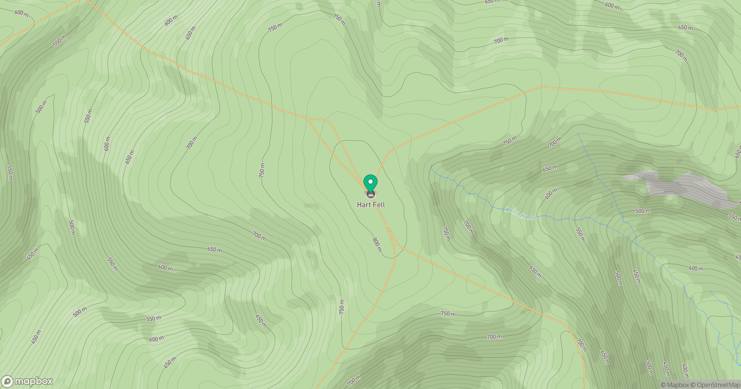
Grid reference: NT113135
View on OpenStreetMapOpens a map in a new tab, centred on the hill.


No comments yet. Be the first.