

Croft Head
Good walks are even better shared.
NT1505 : Gate
Callum Black Photo source
Overview
Croft Head: A Hidden Gem of the Southern Uplands
Croft Head is a delightful peak rising to 575 meters in the Southern Uplands of Scotland. Not classified as a Munro, it still boasts the charm and scenic splendor that attracts many outdoor enthusiasts looking to escape the bustling cities.
Geology
This mountain is primarily composed of sandstone interspersed with siltstones and shales. The layers revealed along the walks are remnants of ancient seabeds, reminding climbers and hikers alike of the deep geological history laid beneath their feet. It’s a wonderful opportunity to brush up on your geology whilst enjoying the great outdoors!
Routes
The Classic Ascent is the most popular route, starting from Moffat. At a manageable distance of 8 km, this hike typically takes about 3 hours, allowing for a leisurely ascent filled with ample opportunities to enjoy the view... or catch your breath!
Summary of The Classic Ascent:
- Distance: 8.0 km
- Time: Approximately 3 hours
- Difficulty: Moderate
Terrain Type
Expect a mix of grassy slopes interspersed with rocky outcrops. Be warned: some of the lower areas can be quite boggy, prompting splashes and some muddy banter amongst your hiking crew.
Summit Features
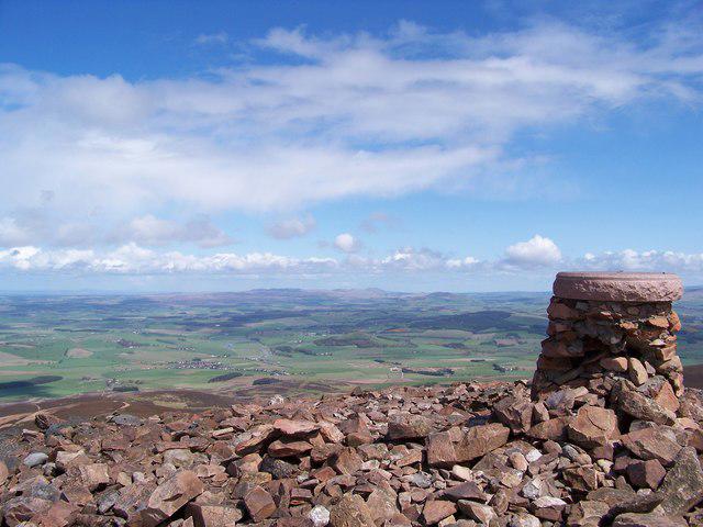
On reaching the summit, the trig point stands proud, offering commanding views of the surrounding area. There's even a small stone shelter for those seeking respite or a quick snack break. Don’t forget to take that iconic summit selfie!
Views
From the top, you will be treated to breathtaking views of the Moffat Hills and the Clyde Valley. Late spring and early autumn are the best times to catch the vibrant blooms and changing foliage.
Hazards
Be aware of unpredictable weather conditions. Mist can envelop the area quickly, turning your trek from delightful to decidedly disorienting in moments. Always check the forecast and prepare accordingly.
Nearby Summits
Croft Head is not alone in its glory. Nearby you can also explore:
- The Molls of Moffat (677 meters)
- Scaur Hill (649 meters)
Access
Moffat serves as the nearest town, with parking available at NT 151 047. If you prefer public transport, regular bus routes run conveniently.
Facilities
Before or after your adventure, Moffat has a variety of cafes and restaurants to satisfy your hunger or thirst. Public toilets are also available—not something to overlook when nature calls!
History
The name 'Croft Head' hints at its long-standing agricultural ties, as 'croft' means small farm in Scots. It has significant historical and cultural relevance for the region and remains a beloved destination for walkers.
So lace up your hiking boots, grab some friends, and revel in the beauty that Croft Head has to offer. Just remember: the hills are calling, and you must go! Enjoy your adventure.
Explore routes near Croft Head
Walks starting near this hill. Open a route to check its map, distance and full itinerary.
Moffat Gallow Hill Woodland and Viewpoint Circuit
View route
Forest of Ae Water of Ae Riverside Trail
View route
Hoddom Castle and River Annan Woodland Circuit
View route
Cademuir Forest Pilots Trail
View route
Route planning notes
These notes describe possible approaches. Check a route's map and access information when planning your walk.
The Classic Ascent
A straightforward ascent from the village of Moffat via the well-marked paths leading through scenic pastures and heather-covered slopes.
Make a day of it, together
Find someone to share the walk with, or organise a day out along a route you like.
Photo Gallery
View all Photo could not load
NT1505 : Gate
Callum Black
 Photo could not load
NT1505 : Cat Shoulder
Alan O'Dowd
 Photo could not load
NT1505 : The Southern Upland Way near Croft Head
Dave Kelly
 Photo could not load
NT1505 : Southern Uplands Way east of Croft Head
Colin Park
 Photo could not load
NT1505 : Croft Head
Rude Health
 Photo could not load
NT1505 : Summit of Croft Head
Iain Russell
 Photo could not load
NT1505 : Summit clutter on Croft Head
Alan O'Dowd
 Photo could not load
NT1505 : Summit of Croft Head
Colin Park
Hill facts and local notes
Classifications
Elevation
636m
2,087 ft
Prominence
194m
Coordinates
55.3376, -3.3368
NT153056
OS Map
79
Explorer: 330
At the Summit
The summit boasts a prominent triangulation pillar (trig point), which offers stunning panoramic views of the surrounding peaks and valleys. A small stone shelter nearby provides a perfect posing spot for that inevitable summit selfie.
Terrain & Geology
The mountain is primarily composed of sandstone, with some areas of siltstone and shale. The layers provide a fascinating glimpse into the geological history of the Southern Uplands, showcasing sedimentary processes that have occurred over millions of years.
Views & Scenery
From the summit, you can gaze upon the neighbouring Moffat Hills and the rolling landscape of the Southern Uplands, with the distinct contours of the Tinto and the gentle sweep of the Clyde Valley in the distance.
History & Heritage
Name Origin
The name 'Croft Head' suggests a connection to farming, with 'croft' referring to a small farm; an apt name given the surrounding pastoral landscape.
Historical Significance
Croft Head's strategic position within the Southern Uplands has made it a point of interest for walkers and naturalists alike, fostering an appreciation for Scotland's unblemished beauty.
Getting There & Facilities
Parking
There is a small car park near the village of Moffat, located at NT 151 047, which serves as a good starting point for the hike.
Public Transport
Regular bus services run to Moffat, with connections from larger towns like Dumfries and Edinburgh.
Nearby Facilities
Moffat is home to a variety of cafes, restaurants, and shops, as well as public toilets, in case nature calls before you embark on your journey.
Safety Information
Known Hazards
- Potential for sudden weather changes, particularly in winter. Harness a cautious spirit, as mist can roll in quickly, reducing visibility.
General Safety Tips
- Check weather conditions before setting out
- Carry appropriate clothing and equipment
- Let someone know your planned route
- Take a map, compass, and GPS device
- Carry emergency supplies: food, water, first aid kit, torch
Hills
Some common questions about the hills answered
Are there group walks up Croft Head?
Many walkers use Walkmates to join or organise walks with others. You can check for group walks around Croft Head through the maps
Are there other walkers around Croft Head?
Activity varies by location and time, but Walkmates lets you see whether others have shared walks or shown interest in this area. Find other people through the walking friends search walking friends for Croft Head search or of course create your own walk for Croft Head
Can I organise a walk to Croft Head?
Yes. If there aren’t any walks listed already, you can create a walk and make it available for others to join.
If you're signed up to Walkmates, you can create a walk to Croft Head.
How do I find a walk up this hill?
There are often multiple ways to walk this hill, depending on experience and route preference. Walkmates helps you explore walks and routes that others have shared.
Can I suggest a new route up Croft Head?
Yes. You can suggest or create routes to share with others. Walkmates focuses on the social side of walking, so routes are used to help people organise walks and explore areas together, rather than as detailed navigation tools or route libraries.
Other uses really appreciate knowledgeable walkers sharing their routes. Share your favourite route to Croft Head here
The is an error or something incorrect about this hill. How do I let you know?
We always strive to keep the information on Walkmates as accurate as possible. If you find an error, please let us know through the contact form and we'll aim to correct it as quickly as possible
Community Discussion
Comments
Location
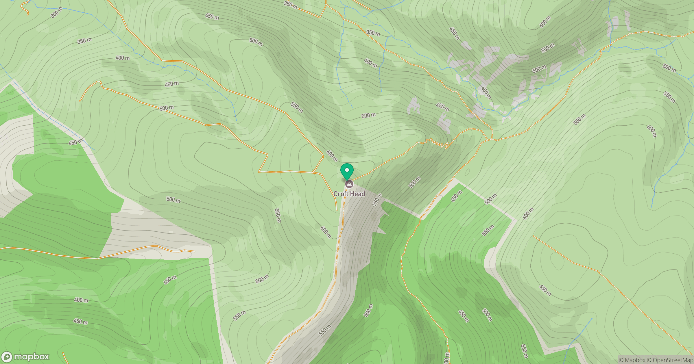
Grid reference: NT153056
View on OpenStreetMapOpens a map in a new tab, centred on the hill.
No comments yet. Be the first.