

Bodesbeck Law
Good walks are even better shared.
Overview
Bodesbeck Law: An Outdoor Gem
Bodesbeck Law, standing tall at 639 meters, is a Marilyn hidden in the stunning Southern Uplands of Scotland. This peak may not be the highest, but it offers a warm welcome to hikers eager to explore the undulating hills and enchanting landscapes.
Geology
The geology of Bodesbeck Law presents a fascinating study in sedimentary and metamorphic formations. The diverse rocky terrain is not only a treat for geologists but also a testimony to the power of glacial activity that has sculpted the mountain over thousands of years.
Routes
There are several routes to choose from, catering to different levels of fitness and adventure:
- Bodesbeck Law Circular: This moderate circular route starts from the Bodesbeck Forest car park. It's perfect for those who fancy a leisurely stroll while soaking in the scenic beauty.
- Direct Ascent from Bodesbeck Farm: For the more adventurous, this direct route provides a steep climb that rewards the effort with stunning views from the top.
Summit Features
At the summit, you'll find a sturdy trig point standing firm against the winds. Nearby, a small cairn calls out for hikers to contribute a stone or two, continuing the tradition of mountain lovers.
Terrain Type
Expect a delightful mix of rocky paths and soft grassy slopes, peppered with patches of vibrant heather and the occasional boggy surprise. Don’t forget your walking boots – no one likes soggy socks!
Views
The views from Bodesbeck Law are worth the climb! To the north, the scenic hills of the Scottish Borders can be admired, while to the south, the sweeping landscapes of Dumfries and Galloway stretch out as far as the eye can see.
For the best experience, visit in late spring or early autumn; the weather is usually clearer, and the heather is a riot of colour!
Hazards
Be mindful of the Scottish weather – it’s known for being temperamental. Quick weather changes can obscure visibility and turn trails muddy. Always check the forecast and come prepared!
Nearby Summits
Adventurers can also tackle nearby peaks such as White Coomb and Hartfell, both of which offer additional walking opportunities and magnificent views.
Access
Getting to Bodesbeck Law is straightforward, with the nearest parking located at the Bodesbeck Forest car park (NT185108). It accommodates about 10 cars, so arrive early! Public transport is a rarity, so having a car is your best bet. Moffat, the nearest town, is only about 10 km away and has all the essential amenities.
Facilities
While the mountain itself offers no facilities, head down to Moffat for delightful cafés, shops, and public toilets to make your hike smooth and enjoyable.
History
The mountain's name, Bodesbeck, suggests its rich cultural ties, translating roughly to 'the brook by the dwelling.' A local favourite, it carries historical significance among shepherds in the region, with folklore weaving its way into the peaks.
In conclusion, Bodesbeck Law may not be the highest peak on the map, but its charm, accessibility, and stunning vistas make it a must-visit for outdoor enthusiasts looking for a slice of Scottish beauty.
Happy hiking!
Explore routes near Bodesbeck Law
Public walks starting within 80 km of this hill. Nearby does not mean a route reaches the summit; check its map and access before setting out.
Moffat Gallow Hill Woodland and Viewpoint Circuit
View route
Forest of Ae Water of Ae Riverside Trail
View route
Cademuir Forest Pilots Trail
View route
Peebles to Neidpath Castle: Tweed Riverside Walk
View route
Route planning notes
These notes describe possible approaches, not verified navigable routes or permission to cross land. Check current paths, local access rules and conditions before setting out.
Bodesbeck Law Circular
A gentle circular route starting at the Bodesbeck Forest car park, perfect for soaking in the scenery with minimal effort.
Direct Ascent from Bodesbeck Farm
A straightforward ascent directly from Bodesbeck Farm, offering a steep but rewarding climb.
Make a day of it, together
Find someone to share the walk with, or organise a day out along a route you like.
Photo Gallery
View all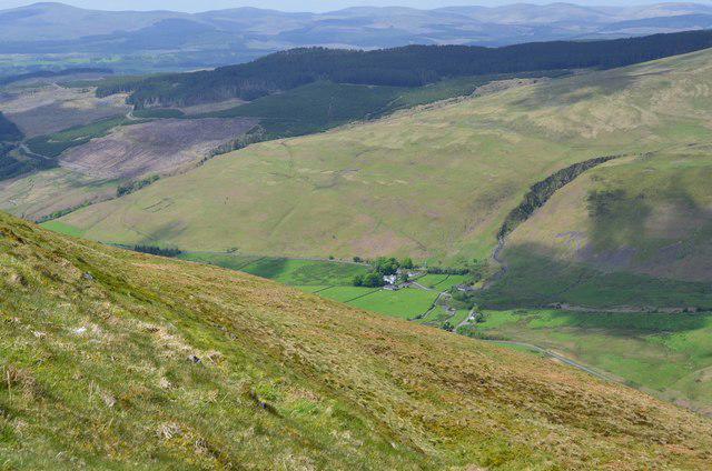 Photo could not load
NT1610 : Moffat Dale from Bodesbeck Law
Jim Barton
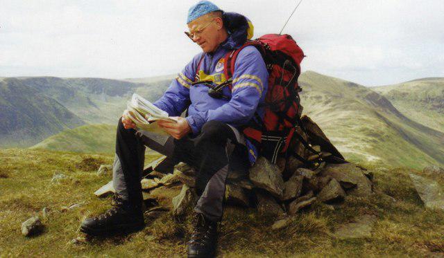 Photo could not load
NT1610 : Bodesbeck Law, Summit Cairn
Iain Lees
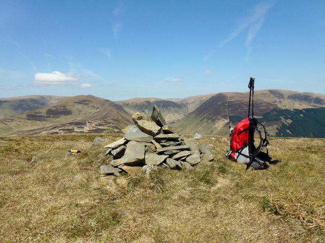 Photo could not load
NT1610 : Bodesbeck Law near Andrewhinney Hill
Rude Health
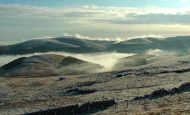 Photo could not load
NT1710 : Dyke/fence - Bodesbeck Law
Raibeart MacAoidh
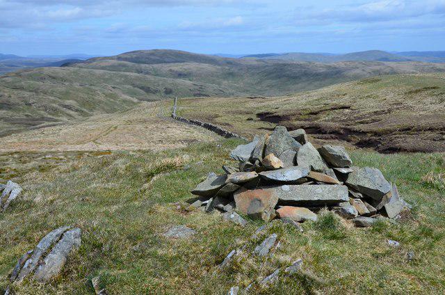 Photo could not load
NT1610 : Summit cairn, Bodesbeck Law
Jim Barton
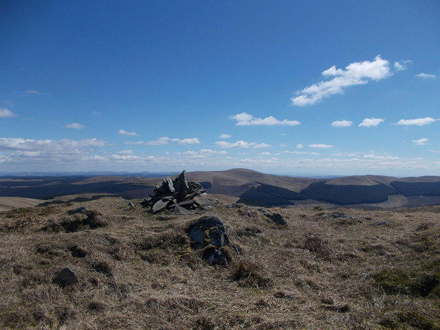 Photo could not load
NT1610 : Summit of Bodesbeck Law
Iain Russell
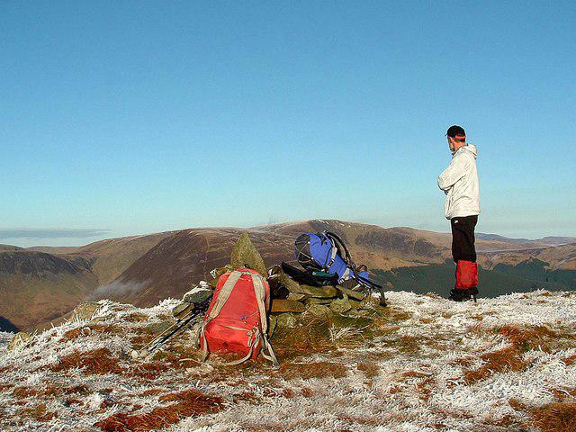 Photo could not load
NT1610 : Bodesbeck Law (summit cairn)
Raibeart MacAoidh
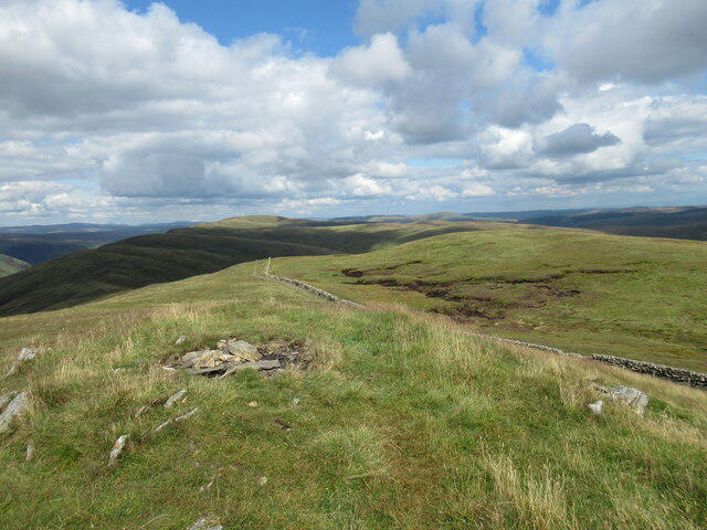 Photo could not load
NT1610 : Summit of Bodesbeck Law
Alan O'Dowd
Hill facts and local notes
Classifications
Elevation
664m
2,179 ft
Prominence
101m
Coordinates
55.3806, -3.3116
NT169104
OS Map
79
Explorer: 330
At the Summit
The summit is marked by a prominent trig point, offering panoramic views of the surrounding landscape. There's also a small cairn nearby for those who enjoy the thrill of adding a pebble to the collection.
Terrain & Geology
The summit is primarily composed of sedimentary rock, with some metamorphic layers. This rocky terrain has been shaped by glacial actions over the millennia, providing an intriguing glimpse into Earth's history.
Views & Scenery
To the north, you can catch sight of the amazing hills of the Scottish Borders, while the rolling landscapes of Dumfries and Galloway stretch out to the south.
History & Heritage
Name Origin
The name 'Bodesbeck' is derived from the Scots language, meaning 'the brook by the dwelling' reflecting local geography.
Historical Significance
Bodesbeck Law has been a significant navigation point for local shepherds and has roots in local folklore concerning the spirits of the hills.
Getting There & Facilities
Check current local access restrictions, parking rules and transport timetables before travelling. These notes do not confirm public access to the summit.
Parking
Bodesbeck Forest car park, located at NT185108. It's a small but adequate parking area for around 10 vehicles.
Public Transport
Public transport options are limited; it's advisable to drive. The nearest bus service passes through the village of Moffat, which is approximately 10 km away.
Nearby Facilities
There are no facilities directly on the mountain. However, Moffat offers a range of cafes, shops, and public toilets for pre- and post-hike needs.
Safety Information
Known Hazards
- Watch out for sudden changes in weather as conditions can shift quickly. The terrain can become muddy after rain, and visibility may be affected in poor weather.
General Safety Tips
- Check weather conditions before setting out
- Carry appropriate clothing and equipment
- Let someone know your planned route
- Take a map, compass, and GPS device
- Carry emergency supplies: food, water, first aid kit, torch
Hills
Some common questions about the hills answered
Are there group walks up Bodesbeck Law?
Many walkers use Walkmates to join or organise walks with others. You can check for group walks around Bodesbeck Law through the maps
Are there other walkers around Bodesbeck Law?
Activity varies by location and time, but Walkmates lets you see whether others have shared walks or shown interest in this area. Find other people through the walking friends search walking friends for Bodesbeck Law search or of course create your own walk for Bodesbeck Law
Can I organise a walk to Bodesbeck Law?
Yes. If there aren’t any walks listed already, you can create a walk and make it available for others to join.
If you're signed up to Walkmates, you can create a walk to Bodesbeck Law.
How do I find a walk up this hill?
There are often multiple ways to walk this hill, depending on experience and route preference. Walkmates helps you explore walks and routes that others have shared.
Can I suggest a new route up Bodesbeck Law?
Yes. You can suggest or create routes to share with others. Walkmates focuses on the social side of walking, so routes are used to help people organise walks and explore areas together, rather than as detailed navigation tools or route libraries.
Other uses really appreciate knowledgeable walkers sharing their routes. Share your favourite route to Bodesbeck Law here
The is an error or something incorrect about this hill. How do I let you know?
We always strive to keep the information on Walkmates as accurate as possible. If you find an error, please let us know through the contact form and we'll aim to correct it as quickly as possible
Community Discussion
Comments
Location
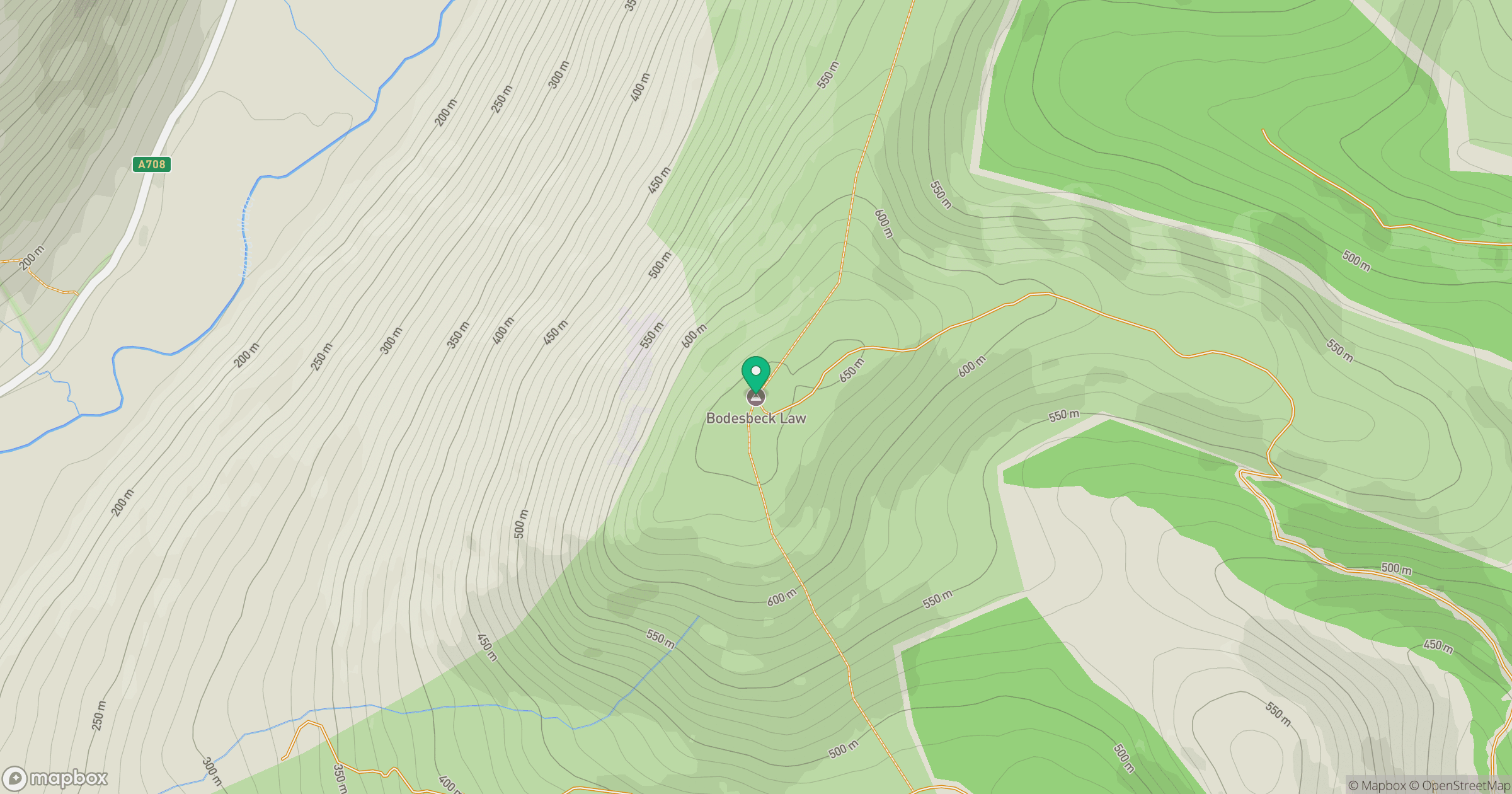
Grid reference: NT169104
View on OpenStreetMapOpens a map in a new tab, centred on the hill.
Hills within 30 km
Straight-line distance, not a walking route or confirmation of access.
No comments yet. Be the first.