

Garelet Dod
Good walks are even better shared.
Overview
Garelet Dod: A Gem in the Southern Uplands
Introduction
Garelet Dod stands proudly at 624 metres, beckoning outdoor enthusiasts to explore its grassy slopes and rocky outcrops.
Geology
The mountain's foundation is steeped in geological history, primarily volcanic rock formed during the Carboniferous era. Its rugged landscape showcases both igneous and metamorphic rocks, giving hikers an unparalleled insight into the earth's geological timeline.
Getting There
The nearest parking is conveniently located at the Leadhills car park. This provides a safe place to stash your car whilst you embark on your adventure. Once you’ve parked, it’s just a short stroll to the trailhead.
The Route
The Garelet Dod Circular route is a must-try, stretching approximately 10.5 km with a moderate ascent. Be prepared for the occasional squelchy bog, but the views are worth their weight in gold!
Summit Features
At the apex, you’ll discover a charming stone cairn and a trig point that’s practically begging to be photographed. It offers a perfect rest stop while you take in the breathtaking sights.
Terrain and Hazards
The terrain is a mix of grassy knolls, rocky outcrops, and spots where your boots might meet unexpected mud. Keep an eye on the weather, as it can change faster than you can say ‘wet socks’!
Stunning Views
From the summit, the sweeping vistas reveal the beauty of the Southern Uplands. Take a moment to appreciate the rolling hills and valleys below – a sight that never fails to impress.
Nearby Summits
After conquering Garelet Dod, consider extending your adventure to nearby summits such as Moffat Hill or Sneck Yate Hill for even more panoramic views.
Conclusion
Whether you’re a seasoned hiker or just looking for a delightful day out in nature, Garelet Dod is sure to impress. Just remember to pack a snack (or several) and your sense of adventure.
Enjoy your hiking journey!
Explore routes near Garelet Dod
Public walks starting within 80 km of this hill. Nearby does not mean a route reaches the summit; check its map and access before setting out.
Moffat Gallow Hill Woodland and Viewpoint Circuit
View route
Cademuir Forest Pilots Trail
View route
Peebles to Neidpath Castle: Tweed Riverside Walk
View route
Forest of Ae Water of Ae Riverside Trail
View route
Route planning notes
These notes describe possible approaches, not verified navigable routes or permission to cross land. Check current paths, local access rules and conditions before setting out.
Garelet Dod Circular
A popular circular route starting from the village of Leadhills, offering a moderate ascent and scenic surroundings.
Make a day of it, together
Find someone to share the walk with, or organise a day out along a route you like.
Photo Gallery
View all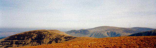 Photo could not load
NT1217 : Looking North to Erie Hill From the Summit of Garelet Dod
Iain Lees
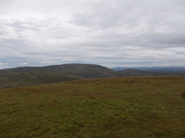 Photo could not load
NT1217 : Summit of Garelet Dod
Iain Russell
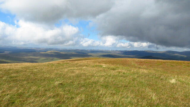 Photo could not load
NT1217 : Featureless summit of Garelet Dod - view towards Clyde Wind Farm
Colin Park
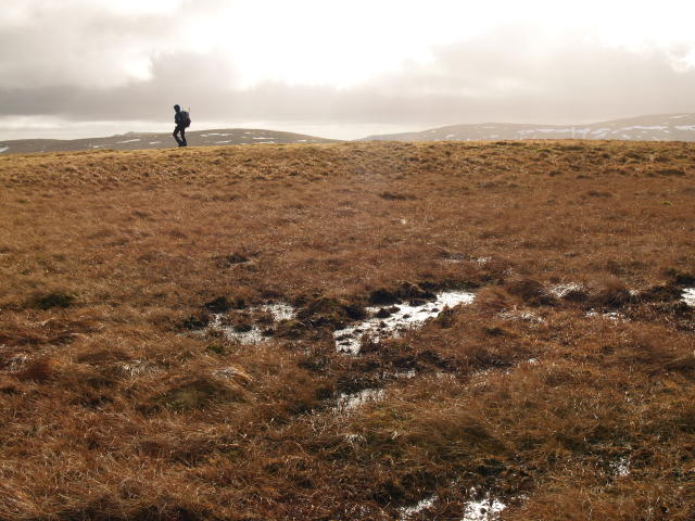 Photo could not load
NT1217 : Boggy summit, Garelet Dod
Chris Eilbeck
Hill facts and local notes
Classifications
Elevation
698m
2,290 ft
Prominence
126m
Coordinates
55.4414, -3.3831
NT125172
OS Map
78
Explorer: 330
At the Summit
At the summit, you'll find a well-constructed stone cairn that serves as a perfect backdrop for your summit selfies. Keep an eye out for the trig point which stands watch like a faithful sentinel.
Terrain & Geology
Garelet Dod is primarily composed of volcanic rock from the Carboniferous period, characterized by igneous and metamorphic formations that provide a unique landscape for exploration.
Views & Scenery
From the summit, enjoy expansive views over the Southern Uplands, including the picturesque valleys of the River Nith and the rolling hills towards the east.
History & Heritage
Name Origin
The name Garelet Dod is thought to derive from the Gaelic ‘Garbh-leat’, which translates roughly to ‘steep hill’ - aptly named for its sharp ascent.
Historical Significance
Historically, Garelet Dod has been a part of the local grazing grounds and plays a role in the cultural heritage of the Southern Uplands.
Getting There & Facilities
Check current local access restrictions, parking rules and transport timetables before travelling. These notes do not confirm public access to the summit.
Parking
There is parking available at the Leadhills car park, where you can leave your vehicle safely. It’s about a 20-minute walk to the base of the trail from there.
Public Transport
Regular bus services from nearby towns like Moffat will drop you off at Leadhills, but check local schedules as they can vary.
Nearby Facilities
The village has a small café that offers hot drinks and light snacks, perfect for refueling before or after your hike. Public toilets are also available in the village.
Safety Information
Known Hazards
- Watch out for sudden changes in weather, as the hills can become enveloped in mist swiftly. Also, the terrain can be slippery after rainfall.
General Safety Tips
- Check weather conditions before setting out
- Carry appropriate clothing and equipment
- Let someone know your planned route
- Take a map, compass, and GPS device
- Carry emergency supplies: food, water, first aid kit, torch
Hills
Some common questions about the hills answered
Are there group walks up Garelet Dod?
Many walkers use Walkmates to join or organise walks with others. You can check for group walks around Garelet Dod through the maps
Are there other walkers around Garelet Dod?
Activity varies by location and time, but Walkmates lets you see whether others have shared walks or shown interest in this area. Find other people through the walking friends search walking friends for Garelet Dod search or of course create your own walk for Garelet Dod
Can I organise a walk to Garelet Dod?
Yes. If there aren’t any walks listed already, you can create a walk and make it available for others to join.
If you're signed up to Walkmates, you can create a walk to Garelet Dod.
How do I find a walk up this hill?
There are often multiple ways to walk this hill, depending on experience and route preference. Walkmates helps you explore walks and routes that others have shared.
Can I suggest a new route up Garelet Dod?
Yes. You can suggest or create routes to share with others. Walkmates focuses on the social side of walking, so routes are used to help people organise walks and explore areas together, rather than as detailed navigation tools or route libraries.
Other uses really appreciate knowledgeable walkers sharing their routes. Share your favourite route to Garelet Dod here
The is an error or something incorrect about this hill. How do I let you know?
We always strive to keep the information on Walkmates as accurate as possible. If you find an error, please let us know through the contact form and we'll aim to correct it as quickly as possible
Community Discussion
Comments
Location
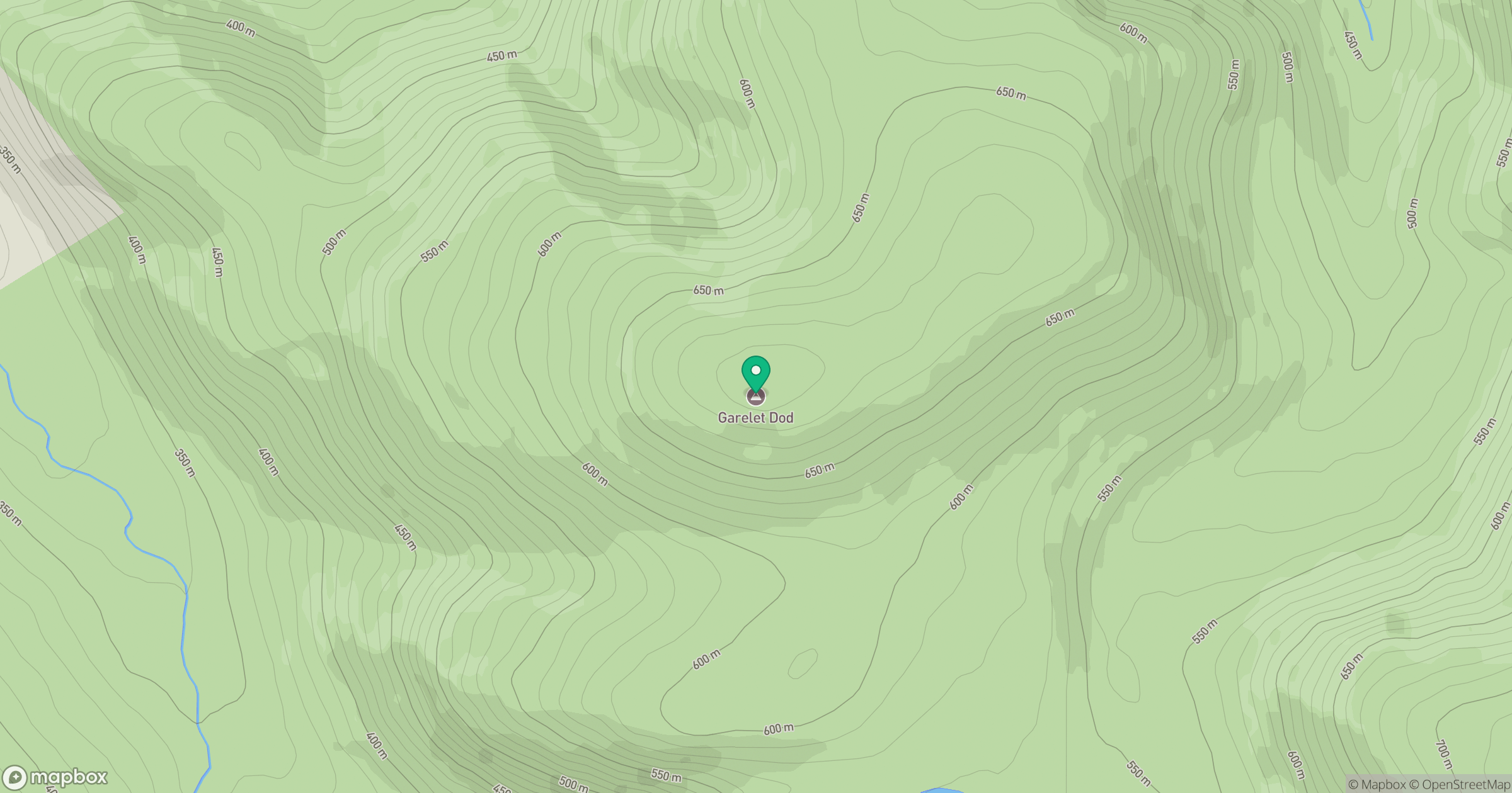
Grid reference: NT125172
View on OpenStreetMapOpens a map in a new tab, centred on the hill.
Hills within 30 km
Straight-line distance, not a walking route or confirmation of access.

No comments yet. Be the first.