

Lochcraig Head
Good walks are even better shared.
Overview
Lochcraig Head
Lochcraig Head stands proudly at an elevation of 782 meters, making it one of the prominent peaks in the beautiful Southern Uplands of Scotland. This Munro not only rewards hikers with its stunning views but also offers a hearty dose of geological history.
Geology
The mountain is primarily made up of greywacke sandstone, an ancient rock formation that has withstood the test of time — a bit like us post-hike! The rugged terrain showcases the power of glacial activities, leaving behind sharp ridges and valleys that provide breathtaking scenery and interesting hiking challenges.
Routes
One of the most popular routes to the summit begins in the charming town of Moffat. The path meanders through lush valleys and greenery before leading you up the rocky slopes of Lochcraig Head. The approximately 10.5 km distance can normally be tackled in about 4.5 hours, landing it at a Moderate difficulty level. Ideal for those who enjoy a good stretch of the legs without overdoing it!
Summit Features
As you reach the top, you’ll be greeted by a rocky outcrop adorned with a small cairn. And let’s be honest, who doesn’t love a good cairn? It’s perfect for snapping a quick photo to prove you’ve been here, and it offers a sneaky place for a quick snack — just don’t let the midges get to it first!
Terrain
Expect to traverse through rocky patches and grassy slopes, interspersed with lovely heather. The terrain can be tricky in places, so it's prudent to wear sturdy footwear. Nothing will ruin your hike like an unexpected tumble!
Views
The views from the summit are nothing short of spectacular. On a clear day, you can enjoy sights of the Moffatdale below, the rolling hills of the Southern Uplands, and with a fair bit of luck, even the Isle of Arran. Spring and autumn are the best times to soak in the views as the colours change and the skies clear.
Hazards
As weather in the mountains can change on a penny, it’s wise to check conditions prior to your ascent. Be cautious on rocky paths, especially when descending, as they can be deceptively slippery.
Nearby Summits
If you’re keen on making it a peak-bagging day, White Coomb standing tall at 840 meters and Hartfell at 821 meters are excellent companions to your adventure.
Access
Parking is available in Moffat (DG10 9HL), where you can also stock up on supplies for your day out. There are also public transport links from Dumfries, so you can leave the car behind if you fancy a good walk.
Facilities
Moffat has all the conveniences needed for a pre-hike pep talk or post-hike celebration, including public toilets and delightful little cafes serving proper Scottish fare.
History
The name Lochcraig translates to ‘lake rock,’ evoking the natural beauty that surrounds it. This mountain has long been a favourite among hikers, and its untamed beauty is sure to stir the soul of anyone who visits.
So lace up those boots, grab your walking poles, and prepare for a splendid day out on Lochcraig Head! Happy hiking!
Explore routes near Lochcraig Head
Public walks starting within 80 km of this hill. Nearby does not mean a route reaches the summit; check its map and access before setting out.
Moffat Gallow Hill Woodland and Viewpoint Circuit
View route
Cademuir Forest Pilots Trail
View route
Peebles to Neidpath Castle: Tweed Riverside Walk
View route
Selkirk Ettrick Water North Riverside Circuit
View route
Route planning notes
These notes describe possible approaches, not verified navigable routes or permission to cross land. Check current paths, local access rules and conditions before setting out.
Moffat to Lochcraig Head
This route starts from the picturesque town of Moffat, following paths that lead through scenic valleys and up to the summit of Lochcraig Head.
Make a day of it, together
Find someone to share the walk with, or organise a day out along a route you like.
Photo Gallery
View all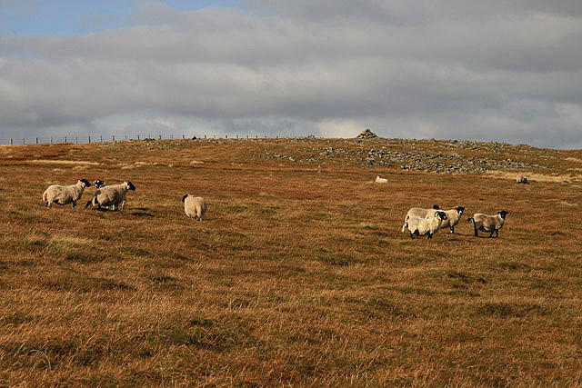 Photo could not load
NT1617 : Border hill sheep
Walter Baxter
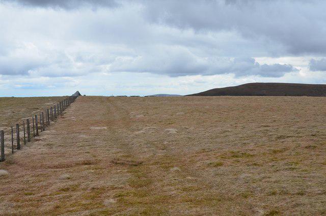 Photo could not load
NT1617 : Summit of Lochcraig Head
Jim Barton
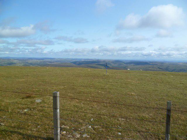 Photo could not load
NT1617 : Lochcraig Head
Michael Graham
Hill facts and local notes
Classifications
Elevation
801m
2,627 ft
Prominence
108m
Coordinates
55.4465, -3.3190
NT166177
OS Map
79
Explorer: 330
At the Summit
The summit features a distinctive rocky outcrop with a small cairn that, if you squint just right, could be mistaken for a miniature Stonehenge.
Terrain & Geology
Lochcraig Head is primarily composed of greywacke sandstone, typical of the Southern Uplands, which was formed during the Caledonian orogeny. The rocky outcrops provide a rugged splendour with evidence of glacial erosion evident in its sharp features.
Views & Scenery
From the summit, you can see the picturesque Moffatdale, the rolling hills of the Southern Uplands, and, on a clear day, the Isle of Arran.
History & Heritage
Name Origin
The name 'Lochcraig' derives from the Scots language, meaning ‘lake rock,’ which aptly describes its location near various lochs.
Historical Significance
Lochcraig Head has been a popular destination for hikers and climbers, and its rugged beauty has inspired many local stories.
Getting There & Facilities
Check current local access restrictions, parking rules and transport timetables before travelling. These notes do not confirm public access to the summit.
Parking
There is parking available at the entrance to Moffat in a public car park. Postcode: DG10 9HL.
Public Transport
Moffat is accessible by bus from Dumfries and other nearby towns.
Nearby Facilities
There are public toilets and a few cafes in Moffat. A great place to grab a scone before or after your hike!
Safety Information
Known Hazards
- Beware of sudden weather changes. The summit can be windy and exposed. Watch your step on rocky paths.
General Safety Tips
- Check weather conditions before setting out
- Carry appropriate clothing and equipment
- Let someone know your planned route
- Take a map, compass, and GPS device
- Carry emergency supplies: food, water, first aid kit, torch
Hills
Some common questions about the hills answered
Are there group walks up Lochcraig Head?
Many walkers use Walkmates to join or organise walks with others. You can check for group walks around Lochcraig Head through the maps
Are there other walkers around Lochcraig Head?
Activity varies by location and time, but Walkmates lets you see whether others have shared walks or shown interest in this area. Find other people through the walking friends search walking friends for Lochcraig Head search or of course create your own walk for Lochcraig Head
Can I organise a walk to Lochcraig Head?
Yes. If there aren’t any walks listed already, you can create a walk and make it available for others to join.
If you're signed up to Walkmates, you can create a walk to Lochcraig Head.
How do I find a walk up this hill?
There are often multiple ways to walk this hill, depending on experience and route preference. Walkmates helps you explore walks and routes that others have shared.
Can I suggest a new route up Lochcraig Head?
Yes. You can suggest or create routes to share with others. Walkmates focuses on the social side of walking, so routes are used to help people organise walks and explore areas together, rather than as detailed navigation tools or route libraries.
Other uses really appreciate knowledgeable walkers sharing their routes. Share your favourite route to Lochcraig Head here
The is an error or something incorrect about this hill. How do I let you know?
We always strive to keep the information on Walkmates as accurate as possible. If you find an error, please let us know through the contact form and we'll aim to correct it as quickly as possible
Community Discussion
Comments
Location
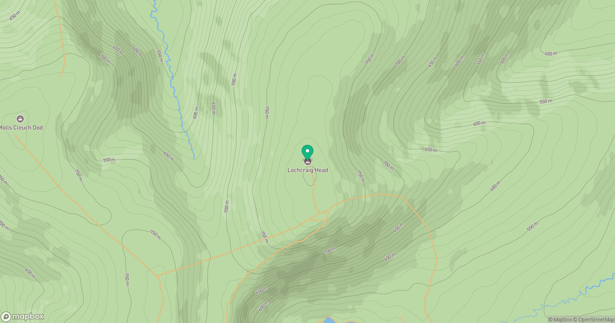
Grid reference: NT166177
View on OpenStreetMapOpens a map in a new tab, centred on the hill.
Hills within 30 km
Straight-line distance, not a walking route or confirmation of access.

No comments yet. Be the first.