

Wester Craiglockhart Hill
Good walks are even better shared.
NT2270 : Demolition viewers
Callum Black Photo source
Overview
Wester Craiglockhart Hill
Wester Craiglockhart Hill is a delightful little peak situated in the heart of Edinburgh. Standing at an elevation of 164 meters, while it may not break records in height, it surely delivers in character and stunning views. This Marilyn is a beloved choice for both seasoned hikers and leisurely strollers looking to soak up the Scottish scenery without a topographical battle.
Geology
The area around Wester Craiglockhart Hill is steeped in geological intrigue. Composed mainly of volcanic ash and ancient sandstone, the hill is a part of the rich volcanic history that shaped Edinburgh. It’s as if Mother Nature took a brush and painted this stunning landscape, though she might have had a few too many cups of tea!
Routes
There are a couple of commonly traversed routes that provide varying levels of challenge:
- Craiglockhart Nature Trail: A family-friendly loop that starts at the Craiglockhart Sports Centre and winds through scenic woodland and open fields. The perfect pothole-free path for everyone!
- Summit Approach from the South: For those feeling a bit more adventurous, this steeper ascent offers a more direct route to the summit. Just don’t forget to catch your breath before reaching the top—it’s a bit of a climb!
Summit Features
At the summit, you’ll find a classic trig point proudly standing guard. It offers a fantastic vantage point for snapping a few awe-inspiring photographs. There’s a chance you might want to outstay your welcome just to soak in the views!
Terrain Type
Expect a mix of grassy slopes interspersed with rocky patches—those little surprises are what keep life exciting, after all. Make sure to wear sturdy shoes to enhance your adventure while dodging the odd hidden rock!
Views
The views from Wester Craiglockhart Hill will take your breath away—don't forget to pack your camera! You’ll be able to see the rugged Pentland Hills, the historic Edinburgh Castle, and maybe even the Firth of Forth stretching out in the distance on a clear day.
Best Seasons
Spring and autumn offer the best times to visit, with their vibrant colours and crisp weather creating a magical atmosphere. A bit of cheese in the spring air, perhaps?
Hazards
While the hill may be inviting, be mindful of muddy patches during the wetter seasons and uneven rocky areas near the summit. A little caution never hurt anyone, despite what some might claim about 'living life on the edge'!
Nearby Summits
If you’re up for more exploration, nearby summits include Blackford Hill (261 meters) and the Braid Hills (250 meters). Plenty of peaks to keep your boots busy!
Access
Parking-wise, you'll find limited on-street options available nearby, with a small parking lot at the Craiglockhart Sports Centre. For public transport, buses run regularly from the city centre, so you won’t need to hitchhike with your walking stick!
Facilities
After your trek, the Craiglockhart Sports Centre is just a stone’s throw away, offering both toilets and a café for a well-earned slice of cake or perhaps a cuppa.
History
The name 'Wester Craiglockhart' means 'rocky hill near the loch', reflecting its geographical charm. Historically, this area was known for its Victorian villas, and today it has become a cherished recreational spot—a touch of history with every step.
So whether you're looking for a quick jaunt or a relaxed day out among the hills, Wester Craiglockhart Hill is a gem that should be on every hiker's list! Don’t forget to leave no trace and enjoy every moment up there. Happy hiking!
Explore routes near Wester Craiglockhart Hill
Walks starting near this hill. Open a route to check its map, distance and full itinerary.
Artists’ walk in Craigmillar Castle Park (group meeting)
View route
To Absent Friends: Holyrood Park walk
View route
Dalkeith Country Park: Estate and North Woods Green Trail
View route
East Calder: Almondell, Mandela Bridge and River Almond Circuit
View route
Route planning notes
These notes describe possible approaches. Check a route's map and access information when planning your walk.
Craiglockhart Nature Trail
A gentle loop starting at the Craiglockhart Sports Centre, offering a scenic stroll through wooded areas and open fields leading to the summit.
Summit Approach from the South
A steeper ascent from the base near the Craiglockhart Hill Road, offering more direct access for those looking to get the blood pumping.
Make a day of it, together
Find someone to share the walk with, or organise a day out along a route you like.
Photo Gallery
View all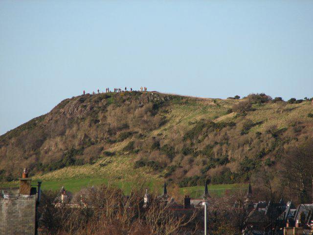 Photo could not load
NT2270 : Demolition viewers
Callum Black
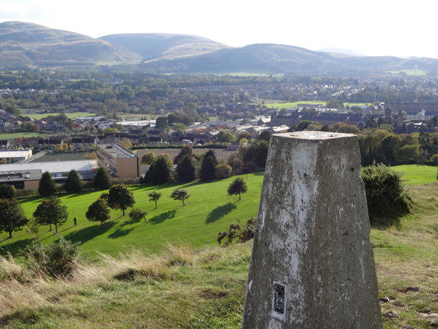 Photo could not load
NT2270 : Wester Craiglockhart
Brian Robertson
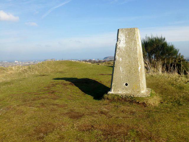 Photo could not load
NT2270 : Wester Craiglockhart Hill
Rude Health
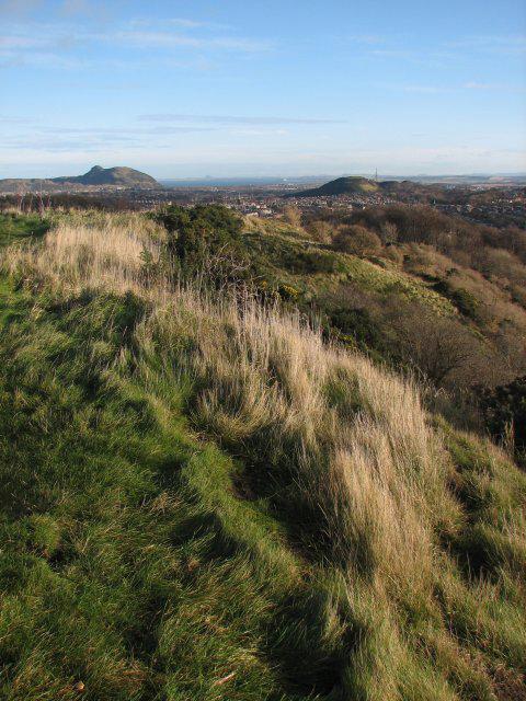 Photo could not load
NT2270 : Summit of Wester Craiglockhart Hill
Callum Black
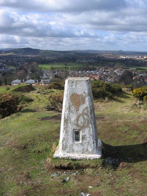 Photo could not load
NT2270 : Wester Craiglockart Summit
Richard Webb
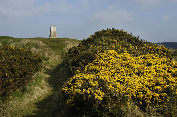 Photo could not load
NT2270 : Trig point, Wester Craiglockhart Hill
Tom Richardson
Hill facts and local notes
Classifications
Elevation
176m
577 ft
Prominence
62m
Coordinates
55.9175, -3.2363
NT228700
OS Map
66
Explorer: 350
At the Summit
The summit features a prominent trig point, offering a classic touch for the summit baggers, as well as stunning panoramic views of the surrounding landscape.
Terrain & Geology
Wester Craiglockhart Hill is primarily composed of volcanic ash and ancient sandstone formations, indicative of its geological history as part of the extinct volcanoes that shaped Edinburgh.
Views & Scenery
From the summit, hikers can enjoy views of the Pentland Hills, Edinburgh Castle, and if luck strikes, a glimpse of the Firth of Forth on a clear day.
History & Heritage
Name Origin
The name 'Craiglockhart' derives from the Scottish Gaelic 'Creag Lochard', meaning 'rocky hill near the loch', highlighting its geographical features.
Historical Significance
Historically, the hill was part of the area known for its Victorian villa residences and has become a popular recreational spot for locals and tourists alike.
Getting There & Facilities
Parking
There is limited on-street parking available on nearby residential streets, with a small parking lot at the Craiglockhart Sports Centre.
Public Transport
Buses run regularly from Edinburgh city centre with routes 27 and 11 stopping near the entrance to the Craiglockhart Nature Trail.
Nearby Facilities
The Craiglockhart Sports Centre offers amenities including toilets and a café for a post-hike treat. The nearby area also boasts various local shops.
Safety Information
Known Hazards
- Watch out for muddy patches during wet seasons and uneven rocky areas near the summit.
General Safety Tips
- Check weather conditions before setting out
- Carry appropriate clothing and equipment
- Let someone know your planned route
- Take a map, compass, and GPS device
- Carry emergency supplies: food, water, first aid kit, torch
Hills
Some common questions about the hills answered
Are there group walks up Wester Craiglockhart Hill?
Many walkers use Walkmates to join or organise walks with others. You can check for group walks around Wester Craiglockhart Hill through the maps
Are there other walkers around Wester Craiglockhart Hill?
Activity varies by location and time, but Walkmates lets you see whether others have shared walks or shown interest in this area. Find other people through the walking friends search walking friends for Wester Craiglockhart Hill search or of course create your own walk for Wester Craiglockhart Hill
Can I organise a walk to Wester Craiglockhart Hill?
Yes. If there aren’t any walks listed already, you can create a walk and make it available for others to join.
If you're signed up to Walkmates, you can create a walk to Wester Craiglockhart Hill.
How do I find a walk up this hill?
There are often multiple ways to walk this hill, depending on experience and route preference. Walkmates helps you explore walks and routes that others have shared.
Can I suggest a new route up Wester Craiglockhart Hill?
Yes. You can suggest or create routes to share with others. Walkmates focuses on the social side of walking, so routes are used to help people organise walks and explore areas together, rather than as detailed navigation tools or route libraries.
Other uses really appreciate knowledgeable walkers sharing their routes. Share your favourite route to Wester Craiglockhart Hill here
The is an error or something incorrect about this hill. How do I let you know?
We always strive to keep the information on Walkmates as accurate as possible. If you find an error, please let us know through the contact form and we'll aim to correct it as quickly as possible
Community Discussion
Comments
Location
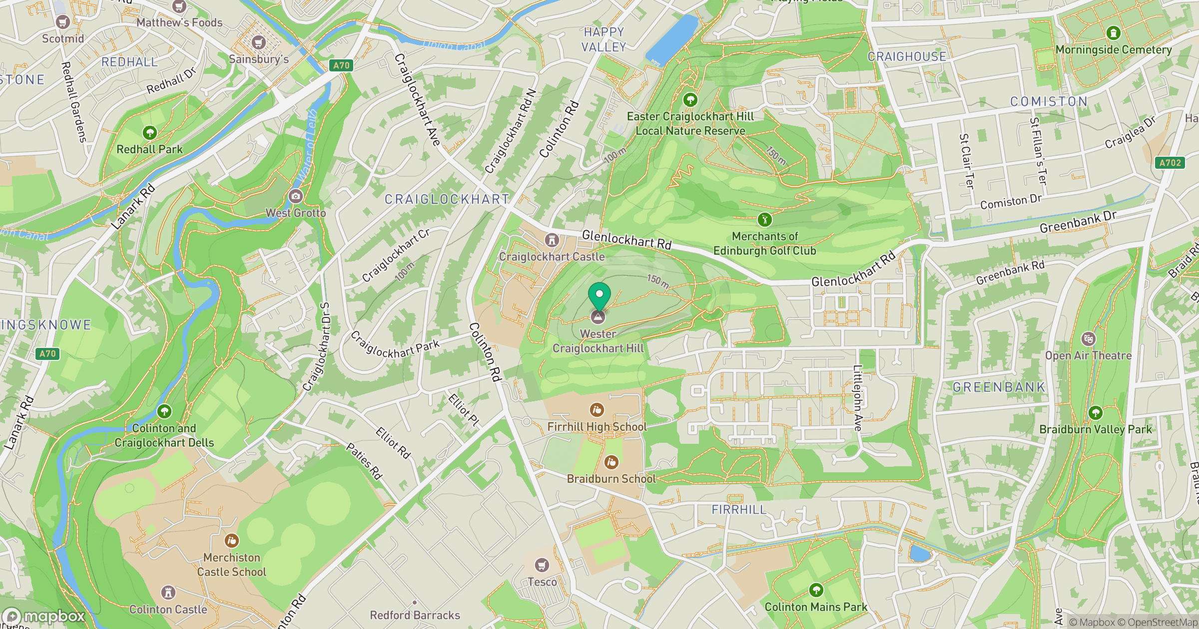
Grid reference: NT228700
View on OpenStreetMapOpens a map in a new tab, centred on the hill.


No comments yet. Be the first.