

Uwch-mynydd
Good walks are even better shared.
Overview
Uwch-mynydd: An Elevated Adventure
Introduction
Nestled in the stunning Snowdonia National Park, Uwch-mynydd stands proudly at 568 meters, serving as a welcoming summit for hikers and outdoor enthusiasts alike. With its intriguing geological features and captivating views, this Marilyn is not to be missed!
Geology
Uwch-mynydd is crafted from ancient metamorphic rocks, primarily slate, offering a glimpse into the region's geological past. This rugged terrain has been sculpted over millennia, providing hikers with not only an adventure but a history lesson on the forces that shaped it.
Routes
Two popular routes lead to Uwch-mynydd's summit:
- Bwlch Ddu route: A charming 5.5 km trek that typically takes around 2.5 hours. Suitable for moderately experienced walkers, you'll pass through beautiful woodlands before emerging onto more open ground.
- Gwern Gof route: Slightly longer at 7.2 km and taking roughly 3.5 hours, this route showcases rolling hills and scenic views, making every step worthwhile.
Summit Features
Upon reaching the summit, you'll find a humble stone cairn and a trig point, evidence of the countless footsteps that have tread this path. Be sure to snap that Instagram-worthy selfie! The expansive vistas will have you feeling like royalty on your own mountain throne.
Terrain
Expect a mix of grassy slopes and rocky outcrops. Some sections can be boggy, especially after rain, so sturdy footwear is recommended. Nothing can dampen your spirit more than soggy socks!
Views
The panoramic views from Uwch-mynydd are nothing short of breathtaking. On clear days, you can spot notable landmarks like the towering peaks of Snowdon and Moel Hebog, making it a prime spot for photography and reflection. Early mornings or late afternoons in late spring or autumn offer the best views when the air is crisp and clear.
Hazards
While Uwch-mynydd is accessible, it's crucial to be aware of potential hazards, such as loose stones on the path and rapidly changing weather conditions. Always be prepared!
Access
Parking
Bwlch Ddu's parking area is the closest place to start your adventure. It can be a popular spot, so get there early to secure a space.
Public Transport
Limited public transport options exist, but you may find services running from Caernarfon to Waunfawr.
Nearest Town
The nearest village with amenities is Waunfawr, about 7 miles away. It’s your last chance for a cuppa before you head off into the wild!
Facilities
Although there are no facilities at the summit, you'll find several cafés and toilets in Waunfawr—ideal for a pre-hike snack or post-hike treat.
History
The name Uwch-mynydd means ‘Upper Mountain’ in Welsh, a fitting title for such a towering figure. The mountain holds significant cultural relevance in the area and has long been a guiding landmark for locals and explorers.
Conclusion
Whether you're a seasoned walker or a weekend charger, Uwch-mynydd has something for everyone. With its stunning landscapes and friendly slopes, it beckons adventurers to explore its heights. Grab your boots, take a deep breath, and enjoy the climb!
Happy hiking!
Explore routes near Uwch-mynydd
Public walks starting within 80 km of this hill. Nearby does not mean a route reaches the summit; check its map and access before setting out.
Mawddach Trail: Penmaenpool to Dolgellau Riverside Return
View route
Mawddach Trail: Penmaenpool to Arthog Estuary Return
View route
Cadair Idris - Pony Path
View route
Mawddach Trail: Dolgellau to Barmouth
View route
Route planning notes
These notes describe possible approaches, not verified navigable routes or permission to cross land. Check current paths, local access rules and conditions before setting out.
Bwlch Ddu route
A well-trodden path that begins from the Bwlch Ddu, leading you through enchanting woodlands and emerging views towards Llyn Cwellyn.
Gwern Gof route
Another delightful option begins at the Gwern Gof car park, this route meanders through lush hillsides and presents a slightly longer trek to the summit.
Make a day of it, together
Find someone to share the walk with, or organise a day out along a route you like.
Photo Gallery
View all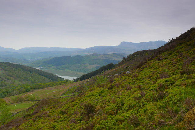 Photo could not load
SH6519 : Llethrau'r Figra / Slopes of Y Figra
Ian Medcalf
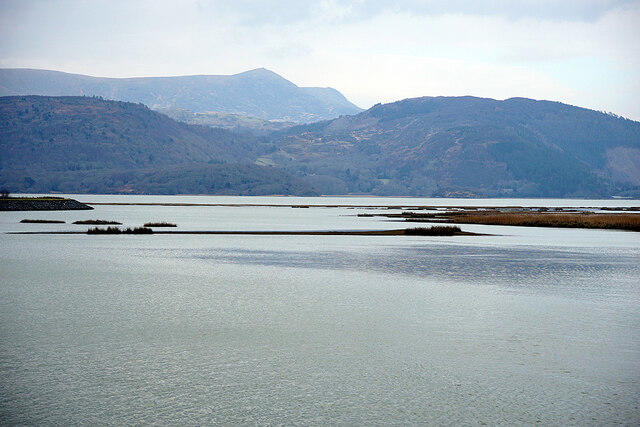 Photo could not load
SH6519 : Afon Mawddach
John Lucas
Hill facts and local notes
Classifications
Elevation
328m
1,076 ft
Prominence
105m
Coordinates
52.7552, -3.9909
SH657193
OS Map
124
Explorer: OL18W OL23W
At the Summit
The summit features a modest stone cairn and a trig point, perfect for that triumphant selfie. The views from here will have you feeling on top of the world, quite literally!
Terrain & Geology
Uwch-mynydd is primarily composed of metamorphic rocks, with slate being the most prominent. These rocks contribute to the rugged scenery and character of the region, giving it a unique geological palette that tells a story of ancient tectonic activity.
Views & Scenery
From the summit, you can feast your eyes on the stunning vistas of Snowdonia, including views of the nearby peaks like Snowdon and the lush valleys below.
History & Heritage
Name Origin
The name Uwch-mynydd translates from Welsh as ‘Upper Mountain’, aptly describing its lofty perch in the landscape.
Historical Significance
Uwch-mynydd has historical significance as a landmark for early navigators and walkers in the region, and is celebrated in local folklore.
Getting There & Facilities
Check current local access restrictions, parking rules and transport timetables before travelling. These notes do not confirm public access to the summit.
Parking
There are several parking areas near Bwlch Ddu, where you can safely leave your car. It’s a popular starting point for various hikes, so be aware it can fill up quickly!
Public Transport
Public transport is limited; however, services do operate from Caernarfon to nearby villages where you can start your hike.
Nearby Facilities
While there are no facilities at the summit itself, you'll find several cafés and toilet facilities in Waunfawr.
Safety Information
Known Hazards
- Watch out for loose stones on the ascent and sudden weather changes, which can lead to reduced visibility.
General Safety Tips
- Check weather conditions before setting out
- Carry appropriate clothing and equipment
- Let someone know your planned route
- Take a map, compass, and GPS device
- Carry emergency supplies: food, water, first aid kit, torch
Hills
Some common questions about the hills answered
Are there group walks up Uwch-mynydd?
Many walkers use Walkmates to join or organise walks with others. You can check for group walks around Uwch-mynydd through the maps
Are there other walkers around Uwch-mynydd?
Activity varies by location and time, but Walkmates lets you see whether others have shared walks or shown interest in this area. Find other people through the walking friends search walking friends for Uwch-mynydd search or of course create your own walk for Uwch-mynydd
Can I organise a walk to Uwch-mynydd?
Yes. If there aren’t any walks listed already, you can create a walk and make it available for others to join.
If you're signed up to Walkmates, you can create a walk to Uwch-mynydd.
How do I find a walk up this hill?
There are often multiple ways to walk this hill, depending on experience and route preference. Walkmates helps you explore walks and routes that others have shared.
Can I suggest a new route up Uwch-mynydd?
Yes. You can suggest or create routes to share with others. Walkmates focuses on the social side of walking, so routes are used to help people organise walks and explore areas together, rather than as detailed navigation tools or route libraries.
Other uses really appreciate knowledgeable walkers sharing their routes. Share your favourite route to Uwch-mynydd here
The is an error or something incorrect about this hill. How do I let you know?
We always strive to keep the information on Walkmates as accurate as possible. If you find an error, please let us know through the contact form and we'll aim to correct it as quickly as possible
Community Discussion
Comments
Location
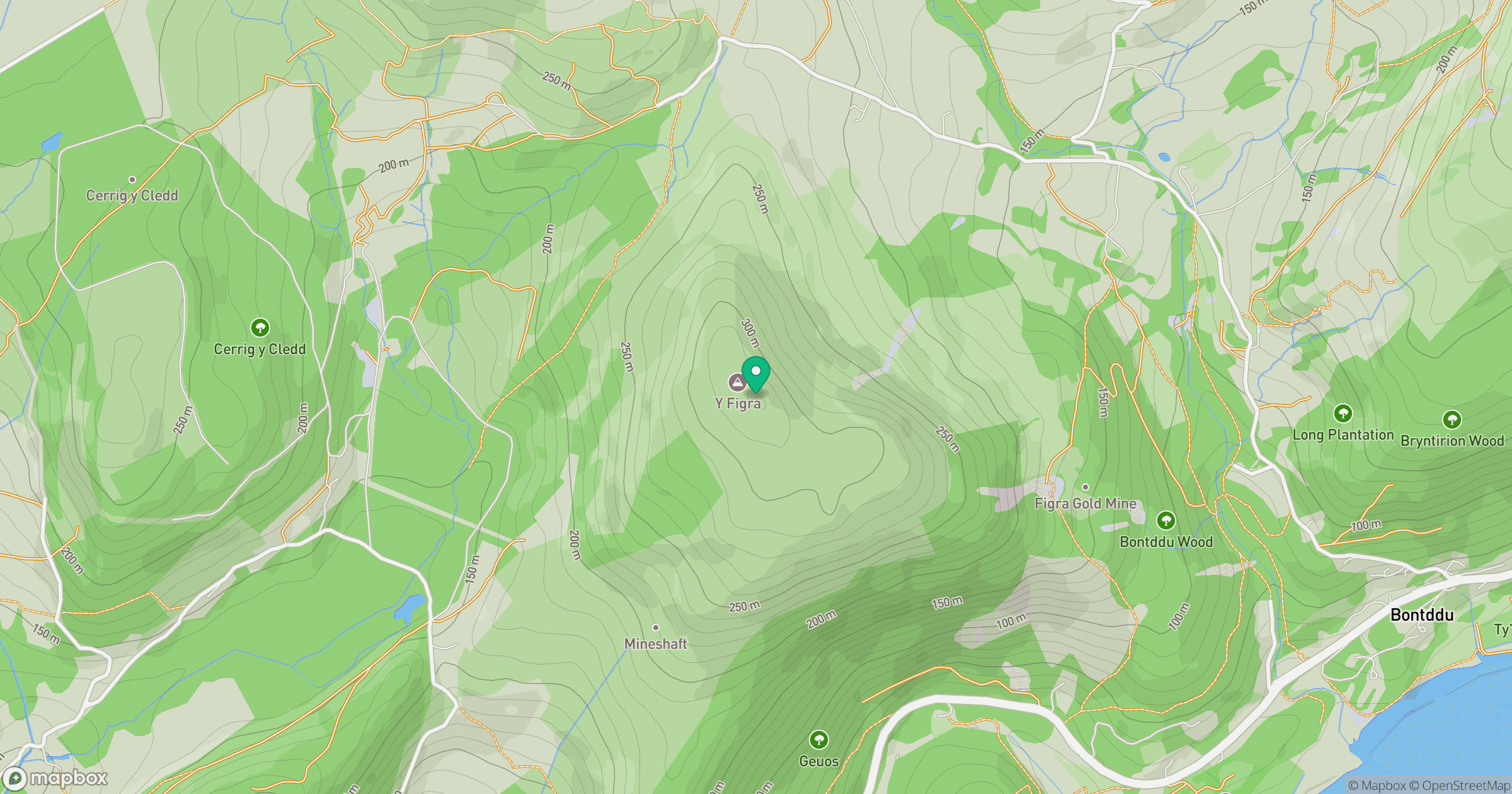
Grid reference: SH657193
View on OpenStreetMapOpens a map in a new tab, centred on the hill.
Hills within 30 km
Straight-line distance, not a walking route or confirmation of access.
No comments yet. Be the first.