
Torr Mor
Good walks are even better shared.
Overview
Torr Mor
Torr Mor is a delightful Marilyn nestled in the stunning Scottish Highlands. With an elevation of 556 meters, it's not the highest peak around, but what it lacks in height, it certainly makes up for in majesty and charm.
Geology
The mountain is primarily comprised of granite and schist, adding both ruggedness and beauty to the landscape. The weathering process has exposed fascinating rock formations, perfect for climbers and geology enthusiasts alike. Watch your step, though; the rocks can be slippery!
Routes
The most common approach is the Torr Mor Circuit, beginning from Strontian.
- Distance: 8.5 km
- Time: Approximately 3 hours
- Difficulty: Moderate
This loop offers impressive views and takes you through a variety of terrains, so be prepared for anything the Scottish weather might throw at you!
Summit Features
Upon reaching the summit, hikers are greeted by a stone cairn that marks the highest point. It's a perfect place for breathtaking photos—don't forget to capture the memory (and your mates struggling up behind you)!
Views
From the top of Torr Mor, you can feast your eyes on Loch Sunart, glistening in the sunlight, and surrounding peaks in the Morvern Mountains. For the best views, visit in spring or early summer when the landscape bursts with life.
Hazards
Watch out for the notorious Highland weather, which can turn from sunny to soggy in the blink of an eye! Be mindful of the bogs and wet patches, and always wear sturdy footwear.
Nearby Summits
If you're feeling adventurous, consider a trek to Beinn na Seilg, standing at an elevation of 671 meters, which offers even more stunning views of the surrounding area.
Access
The nearest parking is at Strontian, where you will find a small car park just a short walk (2 km) from the starting point of your hike. Buses are available periodically from Fort William to Strontian, making it accessible for those relying on public transport.
Facilities
Strontian is the place to go for some refreshments; it has a charming café and a small shop where you can refuel before your trek. Happy trails!
History
The name 'Torr Mor' literally translates to 'Big Mound' in Gaelic—a fitting title for such a prominent feature in the landscape. The area is rich in cultural significance, revered for its natural beauty and diverse ecosystems.
In conclusion, Torr Mor is an adventure waiting to happen. So lace up your walking boots, grab a snack (or two), and don't forget your camera. After all, memories are what make the best company on the trails!
Explore routes near Torr Mor
Public walks starting within 80 km of this hill. Nearby does not mean a route reaches the summit; check its map and access before setting out.
Fairy Lochs Liberator Wreckage Circuit
View route
Beinn Eighe Lancaster Wreckage at Coire Mhic Fhearchair
View route
Ben Klibreck
View route
Glen Affric: Coire Loch Woodland Trail
View route
Route planning notes
These notes describe possible approaches, not verified navigable routes or permission to cross land. Check current paths, local access rules and conditions before setting out.
Torr Mor Circuit
A popular loop that starts from the small hamlet of Strontian, taking in stunning views along the way while circling the mountain.
Make a day of it, together
Find someone to share the walk with, or organise a day out along a route you like.
Hill facts and local notes
Classifications
Elevation
137m
449 ft
Prominence
103m
Coordinates
57.8647, -5.4469
NG956913
OS Map
19
Explorer: 435N
At the Summit
The summit hosts a modest cairn, marking the highest point, with a rocky outcrop that offers delightful views and a perfect spot for a picnic (or a well-deserved snack).
Terrain & Geology
Torr Mor is primarily composed of granite and schist, typical of the rugged landscape of the Scottish Highlands. The weathering processes have exposed interesting rock formations that add character to the summits.
Views & Scenery
From the summit, one can see the beautiful Loch Sunart and the rugged peaks of the surrounding area, including the impressive Morvern Mountains to the west.
History & Heritage
Name Origin
The name 'Torr Mor' translates to 'Big Mound' in Gaelic, aptly reflecting its stature in the landscape.
Historical Significance
Historically, the area has been significant for its natural beauty and as a crucial habitat for wildlife.
Getting There & Facilities
Check current local access restrictions, parking rules and transport timetables before travelling. These notes do not confirm public access to the summit.
Parking
There is a small car park available at Strontian, about 2 km from the trailhead.
Public Transport
Buses run from Fort William to Strontian several times a day.
Nearby Facilities
The nearby village of Strontian has a café and a small shop for refreshments and necessities. Toilets are available at the café.
Safety Information
Known Hazards
- Potential for sudden weather changes typical in the Highlands, deep bogs in areas, and rocky outcrops that may require careful navigation.
General Safety Tips
- Check weather conditions before setting out
- Carry appropriate clothing and equipment
- Let someone know your planned route
- Take a map, compass, and GPS device
- Carry emergency supplies: food, water, first aid kit, torch
Hills
Some common questions about the hills answered
Are there group walks up Torr Mor?
Many walkers use Walkmates to join or organise walks with others. You can check for group walks around Torr Mor through the maps
Are there other walkers around Torr Mor?
Activity varies by location and time, but Walkmates lets you see whether others have shared walks or shown interest in this area. Find other people through the walking friends search walking friends for Torr Mor search or of course create your own walk for Torr Mor
Can I organise a walk to Torr Mor?
Yes. If there aren’t any walks listed already, you can create a walk and make it available for others to join.
If you're signed up to Walkmates, you can create a walk to Torr Mor.
How do I find a walk up this hill?
There are often multiple ways to walk this hill, depending on experience and route preference. Walkmates helps you explore walks and routes that others have shared.
Can I suggest a new route up Torr Mor?
Yes. You can suggest or create routes to share with others. Walkmates focuses on the social side of walking, so routes are used to help people organise walks and explore areas together, rather than as detailed navigation tools or route libraries.
Other uses really appreciate knowledgeable walkers sharing their routes. Share your favourite route to Torr Mor here
The is an error or something incorrect about this hill. How do I let you know?
We always strive to keep the information on Walkmates as accurate as possible. If you find an error, please let us know through the contact form and we'll aim to correct it as quickly as possible
Community Discussion
Comments
Location
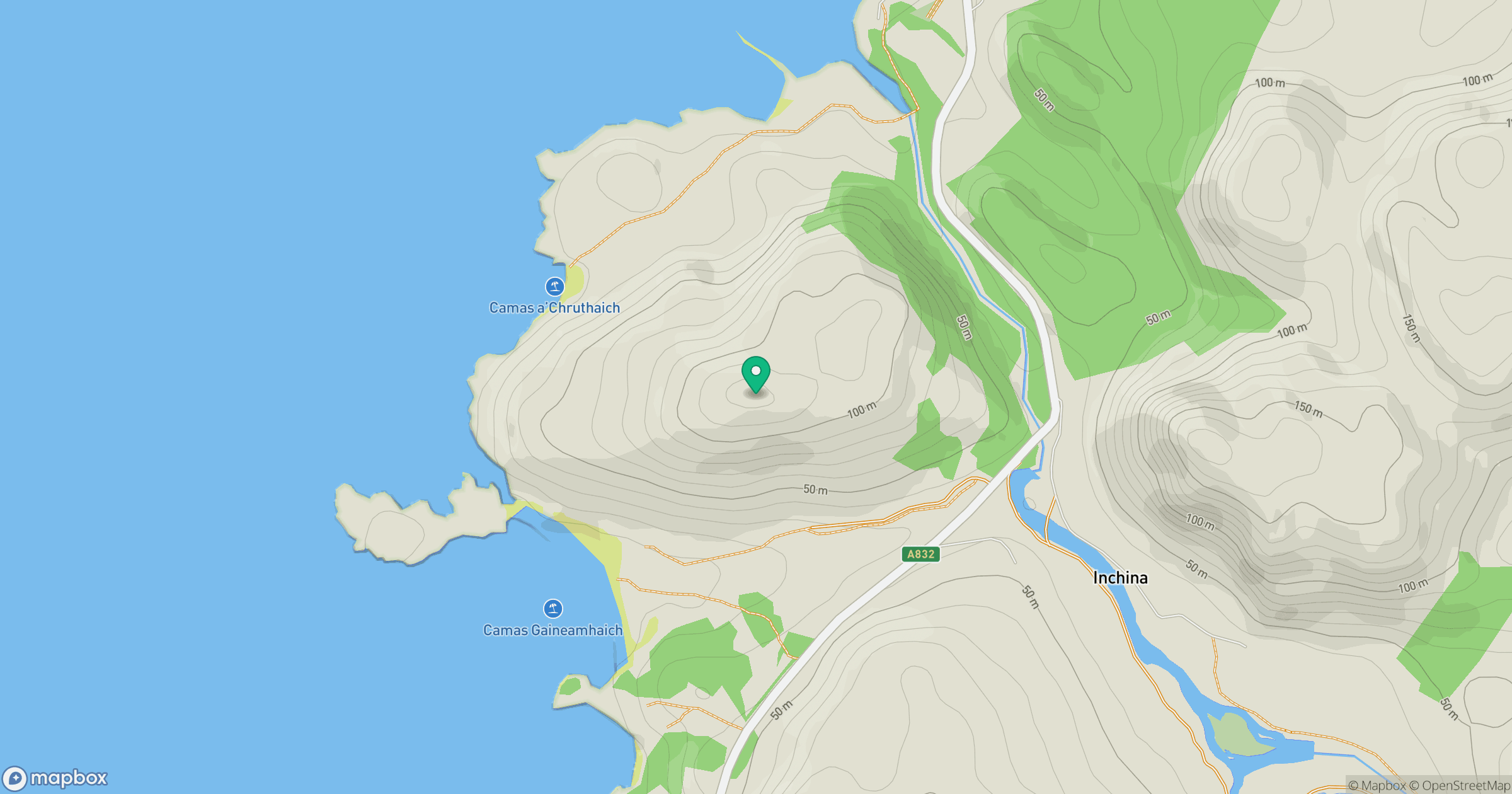
Grid reference: NG956913
View on OpenStreetMapOpens a map in a new tab, centred on the hill.
Hills within 30 km
Straight-line distance, not a walking route or confirmation of access.
A' Mhaighdean
966m
An Teallach - Sgurr Fiona
1,059m
An Teallach - Bidein a' Ghlas Thuill
1,063m
Slioch
981m
Mullach Coire Mhic Fhearchair
1,015m
No comments yet. Be the first.