
Blackbreast
Good walks are even better shared.
Overview
Blackbreast: A Hiker's Delight
Nestled in the scenic Southern Uplands, Blackbreast is an accessible gem for hikers of varying abilities. Standing at 579 meters, it may not be the tallest hill in the region, but it offers a wonderful mix of challenges and rewards.
Geology
Blackbreast's rugged features are primarily made of sandstone. The hill has a fascinating geology that tells tales of ancient seas, making it a prime spot for geological curiosity. Don't forget to look down as much as you look up!
Routes
The most popular route starts from Blackwood. This moderately challenging route spans approximately 6.5 kilometers and usually takes about 3.5 hours to complete. While the walk may not involve busting a gut, don’t underestimate the rocky sections—especially if your shoes have a mind of their own.
Summit Features
Reaching the summit is a joy, with a sizeable cairn marking the top. It’s the perfect spot to catch your breath and enjoy a snack while basking in your achievement. Just don’t forget to take a picture to prove you were there!
Terrain Type
The terrain is predominantly grassy, peppered with rocky patches that add a touch of excitement. Sturdy boots are recommended to tackle any sneaky slips!
Views
The views from Blackbreast are nothing short of breathtaking! On a clear day, you can see the Moffat Hills and Lowther Hills stretching into the distance, painting a picture worth a thousand words. Late spring and early autumn are ideal times for those Instagrammable views since the weather tends to play nice.
Hazards
Like any good hike, Blackbreast has its hazards. Be wary of the whims of the Scottish weather; gloomy skies can turn a sunny day into a murky mystery in the blink of an eye. Low visibility can cause navigation issues, so it’s wise to carry a map and compass, just in case.
Nearby Summits
For those eager to explore further, consider combining your Blackbreast venture with a visit to nearby Green Hill or Moffat Hill for an extra challenge!
Access
Getting to Blackbreast is fairly straightforward. You can find nearby parking at Blackwood, but spaces can fill up quickly. If you prefer public transport, buses regularly connect from Moffat and Lockerbie, so plan your trip accordingly.
Facilities
Moffat is the closest town bustling with cafes and public toilets. The Old Bell Inn serves delectable meals, perfect for refueling after your adventure.
History
As for the name, 'Blackbreast' likely mirrors the hill's rounded profile. Rich in local folklore, the hill remains a significant part of the cultural tapestry in the area.
So grab your gear and head out to Blackbreast! It’s a climb that promises both challenge and beauty. Just remember, the only thing better than the views is a good story to tell afterwards.
Explore routes near Blackbreast
Public walks starting within 80 km of this hill. Nearby does not mean a route reaches the summit; check its map and access before setting out.
Doach Wood Douglas Trail and Solway Viewpoint
View route
Kirkcudbright Harbour to Barrhill Woods Circuit
View route
Rockcliffe to Kippford Jubilee Path and Waterfront
View route
Threave Nature Reserve River Dee Circuit
View route
Route planning notes
These notes describe possible approaches, not verified navigable routes or permission to cross land. Check current paths, local access rules and conditions before setting out.
Starting from Blackwood
A popular and fairly straightforward route leading to the summit via grassy slopes and rocky outcrops.
Make a day of it, together
Find someone to share the walk with, or organise a day out along a route you like.
Hill facts and local notes
Classifications
Elevation
286m
938 ft
Prominence
127m
Coordinates
54.8481, -3.9332
NX759520
OS Map
84
Explorer: 312
At the Summit
The summit features a substantial cairn, providing a perfect backdrop for a celebratory snack and a selfie.
Terrain & Geology
Blackbreast is primarily composed of sandstone, which gives it a rugged charm. The underlying geology features ancient marine sediments that can be intriguing for geology enthusiasts.
Views & Scenery
From the summit, you can enjoy sweeping vistas of the surrounding Southern Uplands, including views of the nearby Moffat Hills and the expansive Lowther Hills.
History & Heritage
Name Origin
The name 'Blackbreast' is thought to be derived from the dark, rounded shape of the hill that resembles a breast when viewed from a distance.
Historical Significance
Blackbreast holds significance in local folklore, often being mentioned in stories of the area’s rich history and traditions.
Getting There & Facilities
Check current local access restrictions, parking rules and transport timetables before travelling. These notes do not confirm public access to the summit.
Parking
Parking is available at Blackwood, approximately 1 km from the start of the hike. Spaces are limited, so get there early to nab a spot!
Public Transport
Buses run regularly from nearby towns such as Moffat and Lockerbie, but check local schedules for timings.
Nearby Facilities
Moffat has various cafes and public toilets, perfect for a pitstop before or after your hike. The Old Bell Inn is a great choice for a hearty meal.
Safety Information
Known Hazards
- Keep an eye out for unpredictable weather conditions, as the forecast can change quicker than you can say 'toast'. Low visibility can lead to navigation issues.
General Safety Tips
- Check weather conditions before setting out
- Carry appropriate clothing and equipment
- Let someone know your planned route
- Take a map, compass, and GPS device
- Carry emergency supplies: food, water, first aid kit, torch
Hills
Some common questions about the hills answered
Are there group walks up Blackbreast?
Many walkers use Walkmates to join or organise walks with others. You can check for group walks around Blackbreast through the maps
Are there other walkers around Blackbreast?
Activity varies by location and time, but Walkmates lets you see whether others have shared walks or shown interest in this area. Find other people through the walking friends search walking friends for Blackbreast search or of course create your own walk for Blackbreast
Can I organise a walk to Blackbreast?
Yes. If there aren’t any walks listed already, you can create a walk and make it available for others to join.
If you're signed up to Walkmates, you can create a walk to Blackbreast.
How do I find a walk up this hill?
There are often multiple ways to walk this hill, depending on experience and route preference. Walkmates helps you explore walks and routes that others have shared.
Can I suggest a new route up Blackbreast?
Yes. You can suggest or create routes to share with others. Walkmates focuses on the social side of walking, so routes are used to help people organise walks and explore areas together, rather than as detailed navigation tools or route libraries.
Other uses really appreciate knowledgeable walkers sharing their routes. Share your favourite route to Blackbreast here
The is an error or something incorrect about this hill. How do I let you know?
We always strive to keep the information on Walkmates as accurate as possible. If you find an error, please let us know through the contact form and we'll aim to correct it as quickly as possible
Community Discussion
Comments
Location
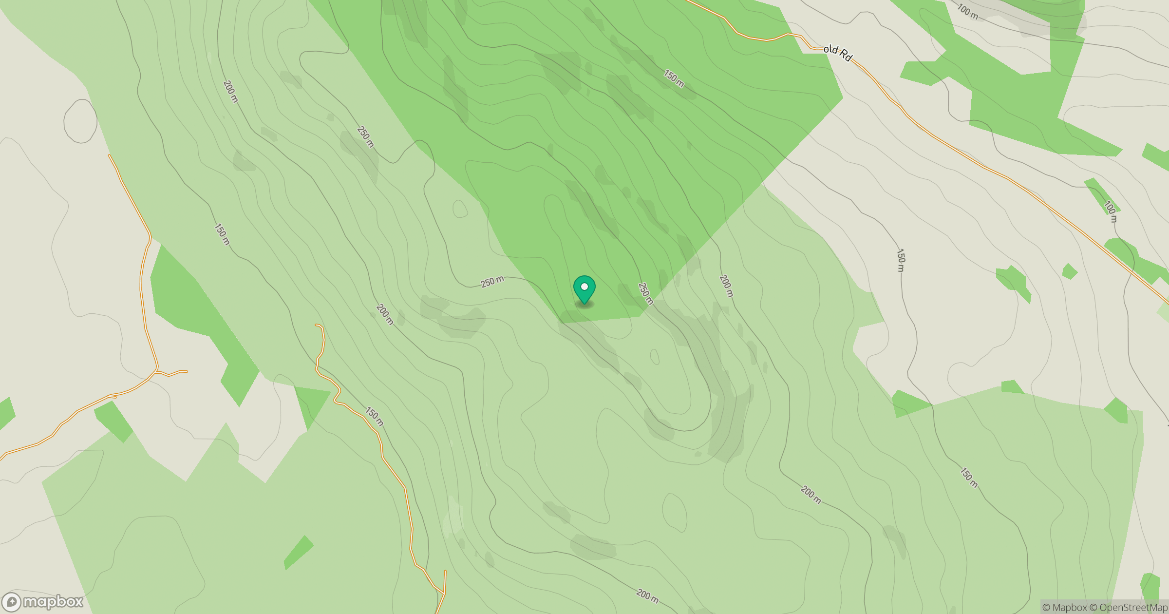
Grid reference: NX759520
View on OpenStreetMapOpens a map in a new tab, centred on the hill.
Hills within 30 km
Straight-line distance, not a walking route or confirmation of access.
No comments yet. Be the first.