

Stob Ghabhar North Top
Good walks are even better shared.
NN2246 : Aonach Mòr, Stob Gabhar
Richard Webb Photo source
Overview
Stob Ghabhar North Top
Stob Ghabhar North Top, reaching an elevation of 1029 meters, is a magnificent Munro situated in the heart of the Scottish Highlands. This peak is more than just a number; it offers vibrant views and a glimpse into the diverse geologic past of the region.
Geology
The impressive schist that makes up Stob Ghabhar was formed under extreme conditions, making it a reminder of nature's powerful forces. While you might be more interested in the views, take a moment to feel the ancient rocks beneath your feet. It’s almost like stepping back in time, or at least a few centuries!
Routes
The most favoured route is the Stob Ghabhar Circular Route, covering approximately 13 km. This path is challenging but incredibly rewarding, winding its way up to both Stob Ghabhar and the North Top. It's a route that will test your resolve but will leave you grinning like a Cheshire cat at the summit.
Terrain
Prepare for a mixture of rocky and grassy terrain. While you might enjoy skipping across the grass, let's not forget the hidden boggy patches lurking in the shadows, poised to claim unsuspecting footwear.
Summit Features
On reaching the summit, you’ll be greeted by a sturdy cairn, perfect for that obligatory summit selfie. Here, the views can take your breath away—just don’t forget to breathe again!
Views
From the top, the expansive scenery reveals Rannoch Moor and the captivating Black Mount range. Ideally, plan your hike during late spring or early autumn for the most breathtaking vistas with fewer chances of dodging showers.
Hazards
Stay alert! The weather in the Highlands has a reputation for being a bit temperamental. Be prepared for spontaneous bursts of rain or wind that could put your umbrella out of business. And while the stones provide an excellent climbing experience, they can be a tripping hazard on descents.
Access
For access, park at the Black Mount Hotel, but be warned—spots tend to disappear quicker than chips on a seaside plate! If you’re relying on public transport, the options are sparse, so planning ahead is essential. Crianlarich is the closest town with more substantial amenities.
Facilities
Facilities are quite limited, although the Black Mount Hotel serves food and drinks, making it a nice rest stop to refuel those hiking legs.
History
As for its name, 'Stob Ghabhar', translating to 'the peak of the fierce one', reflects its stature among local folklore. It’s not just a hike; it’s a journey into the heart of Scottish culture.
So, pack your bags, lace up those hiking boots, and embark on a thrilling adventure. Just remember, no mountain tries to impress you with flat ground, so get ready to climb! Enjoy your hike!
Explore routes near Stob Ghabhar North Top
Walks starting near this hill. Open a route to check its map, distance and full itinerary.
Ben Nevis via Mountain Path
View route
Banavie to Glen Loy Aqueduct: Neptune’s Staircase Canal Towpath
View route
Killin: Falls of Dochart, Finlarig and Moirlanich Longhouse
View route
Beinn Ime from Succoth
View route
Route planning notes
These notes describe possible approaches. Check a route's map and access information when planning your walk.
Stob Ghabhar Circular Route
A popular circular walk beginning from the nearby car park that takes in both Stob Ghabhar and the North Top. The route offers stunning views and a rewarding summit experience.
Make a day of it, together
Find someone to share the walk with, or organise a day out along a route you like.
Photo Gallery
View all Photo could not load
NN2246 : Aonach Mòr, Stob Gabhar
Richard Webb
Hill facts and local notes
Classifications
Elevation
895m
2,935 ft
Prominence
23m
Coordinates
56.5816, -4.8887
NN226470
OS Map
50
Explorer: 377E 384
At the Summit
The summit features a modest cairn, which stands proud amidst the magnificent views. Add a little imagination and it's almost a mountain top headquarters!
Terrain & Geology
The mountain is primarily composed of schist, a metamorphic rock that tells the story of intense geological processes and the close of the Caledonian Orogeny. It brings a sense of rugged charm.
Views & Scenery
From the summit, you can see the expansive vistas of Rannoch Moor, the Black Mount range, and, on a clear day, the distant peaks of Glencoe.
History & Heritage
Name Origin
The name 'Stob Ghabhar' translates to 'the peak of the fierce one', which adds a certain mystique to its standing.
Historical Significance
The mountain has great cultural significance for local communities, often featured in folklore and hiking tales.
Getting There & Facilities
Parking
The nearest parking is at the Black Mount Hotel, located approximately 5 km from the summit. Spaces can fill quickly during peak times.
Public Transport
Public transport options are limited. The nearest bus stop is in the village of Bridge of Orchy, around 9 km away.
Nearby Facilities
Facilities are sparse in the immediate area. However, the Black Mount Hotel offers food and drink for weary hikers.
Safety Information
Known Hazards
- Weather can change rapidly, with fog, rain, and wind. Loose rocks underfoot can also be a concern, particularly on steep descents.
General Safety Tips
- Check weather conditions before setting out
- Carry appropriate clothing and equipment
- Let someone know your planned route
- Take a map, compass, and GPS device
- Carry emergency supplies: food, water, first aid kit, torch
Hills
Some common questions about the hills answered
Are there group walks up Stob Ghabhar North Top?
Many walkers use Walkmates to join or organise walks with others. You can check for group walks around Stob Ghabhar North Top through the maps
Are there other walkers around Stob Ghabhar North Top?
Activity varies by location and time, but Walkmates lets you see whether others have shared walks or shown interest in this area. Find other people through the walking friends search walking friends for Stob Ghabhar North Top search or of course create your own walk for Stob Ghabhar North Top
Can I organise a walk to Stob Ghabhar North Top?
Yes. If there aren’t any walks listed already, you can create a walk and make it available for others to join.
If you're signed up to Walkmates, you can create a walk to Stob Ghabhar North Top.
How do I find a walk up this hill?
There are often multiple ways to walk this hill, depending on experience and route preference. Walkmates helps you explore walks and routes that others have shared.
Can I suggest a new route up Stob Ghabhar North Top?
Yes. You can suggest or create routes to share with others. Walkmates focuses on the social side of walking, so routes are used to help people organise walks and explore areas together, rather than as detailed navigation tools or route libraries.
Other uses really appreciate knowledgeable walkers sharing their routes. Share your favourite route to Stob Ghabhar North Top here
The is an error or something incorrect about this hill. How do I let you know?
We always strive to keep the information on Walkmates as accurate as possible. If you find an error, please let us know through the contact form and we'll aim to correct it as quickly as possible
Community Discussion
Comments
Location
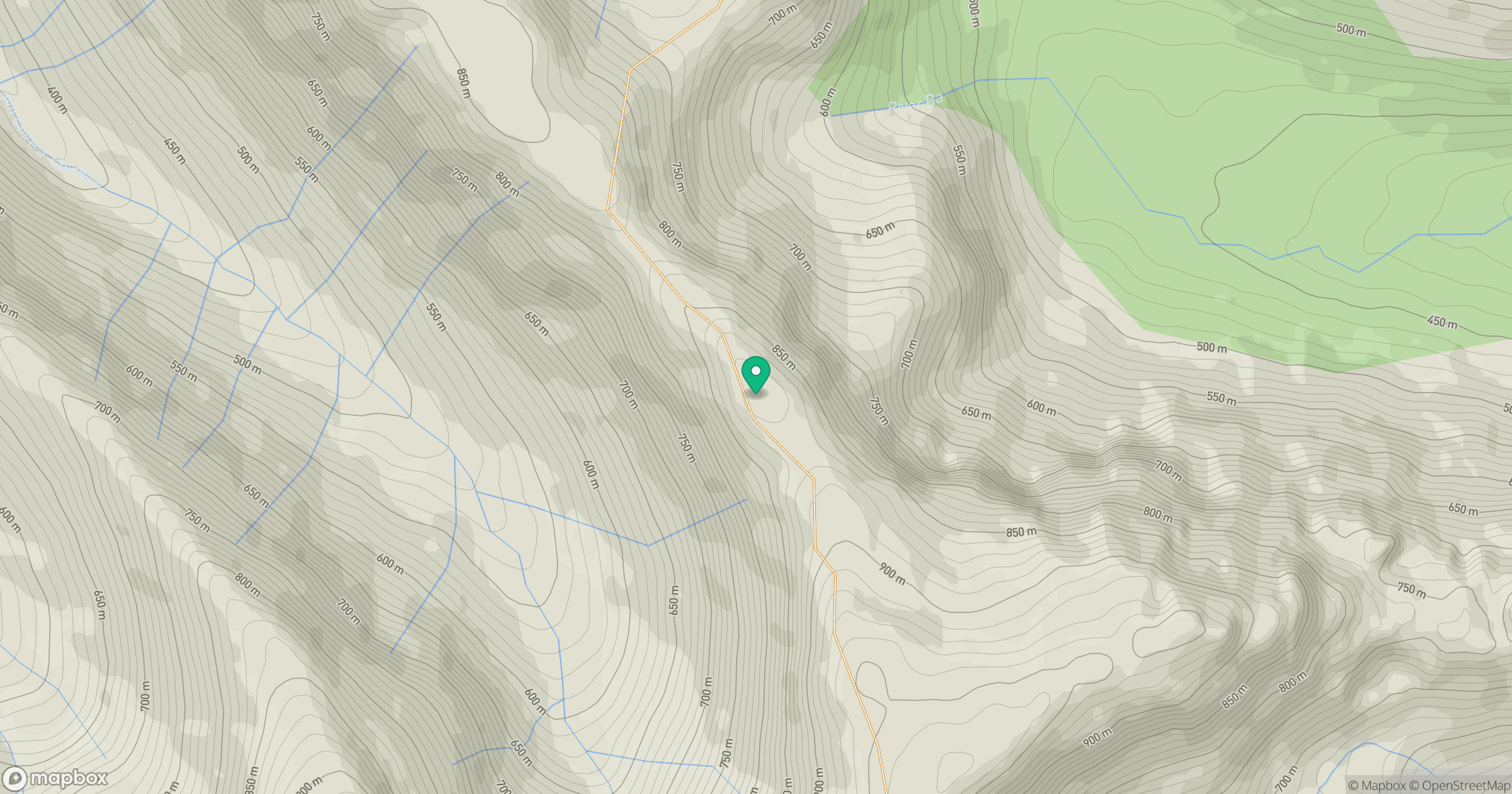
Grid reference: NN226470
View on OpenStreetMapOpens a map in a new tab, centred on the hill.
No comments yet. Be the first.