

Stob a' Choire Odhair
Good walks are even better shared.
NN2546 : View north from Stob a' Choire Odhair
Nigel Brown Photo source
Overview
Stob a' Choire Odhair
Stob a' Choire Odhair stands proudly in the heart of the Scottish Highlands, reaching a lofty height of 945 meters. This Munro is known for both its striking scenery and the challenges it offers to adventurous hikers.
Geology
The geological composition of Stob a' Choire Odhair consists primarily of schist and granite, remnants of ancient volcanic activity and glacial erosion that have sculpted the landscape into the rugged beauty we see today. The rocky outcroppings and smooth schist slopes testify to the dynamic forces of nature that have shaped this area.
Routes
There are a couple of popular routes to the summit:
- Coire a' Chreachain: A moderately challenging route that begins from the car park. It features a gradual incline, with spectacular views as you make your way through the scenic corries. The last segment demands a bit more effort, rewarding your perseverance with stunning vistas.
- Glencoe Mountain Resort Route: Known for its challenging paths, this option delivers a real workout but provides breathtaking views across Glencoe towards the ski slopes and beyond.
Summit Features
On reaching the summit, you’ll be greeted by a substantial stone cairn—perfect for a celebratory selfie or two. The surrounding area offers ample spots to take in the beauty of the Highlands, so make sure you take a moment to soak in the achievement!
Terrain
Expect a variety of terrains while hiking Stob a' Choire Odhair, from rocky paths that might keep you on your toes to grassy sections that encourage a gentler pace. Some boggier patches will add to the adventure, so a comfy pair of hiking boots becomes essential.
Views
Once at the top, the reward is worth every bit of effort. Awe-inspiring views stretch in all directions, including neighbouring peaks like Bidean nam Bian and the tranquil waters of Loch Etive. The best times to experience these sights are in the spring and autumn when the weather is typically clearer.
Hazards
Be aware that conditions can change suddenly in these highlands; a sunny day can quickly turn into a wet and windy one. Rocky terrain can become slippery when wet, so always keep an eye on the forecast and tread carefully.
Access
The nearest parking is at the 'Road to the Isles' (NN205457), approximately a short drive from the town of Ballachulish. If you prefer to leave the car behind, several bus services connect Glasgow to Glencoe, making it easier for you to focus on conquering the mountain.
Facilities
Before you embark on your adventure, ensure to stop by a cafe or two in Ballachulish for refreshments and comfort breaks, as facilities along the trail are limited.
History
The name Stob a' Choire Odhair is a poetic reminder of the mountain’s character, translating to the 'Peak of the Dark Corry.' It has intrigued hikers for generations, standing as a testament to the stunning landscapes of the Highlands.
Embark on this memorable journey and make your way to the summit of Stob a' Choire Odhair—you won’t regret it! Just remember to fill your backpack with snacks; after all, adventures are best enjoyed with a little nibble!
Explore routes near Stob a' Choire Odhair
Walks starting near this hill. Open a route to check its map, distance and full itinerary.
Ben Nevis via Mountain Path
View route
Killin: Falls of Dochart, Finlarig and Moirlanich Longhouse
View route
Banavie to Glen Loy Aqueduct: Neptune’s Staircase Canal Towpath
View route
Beinn Ime from Succoth
View route
Route planning notes
These notes describe possible approaches. Check a route's map and access information when planning your walk.
Coire a' Chreachain
A popular route starting from the nearby car park, leading up through scenic corries and with a gentle ascent at first, progressing to steeper sections as you near the summit.
Glencoe Mountain Resort Route
Another well-trodden path, this route offers stunning views of the ski areas and leads up through heather-covered slopes, providing a more challenging ascent but rewards hikers with panoramic vistas.
Make a day of it, together
Find someone to share the walk with, or organise a day out along a route you like.
Photo Gallery
View all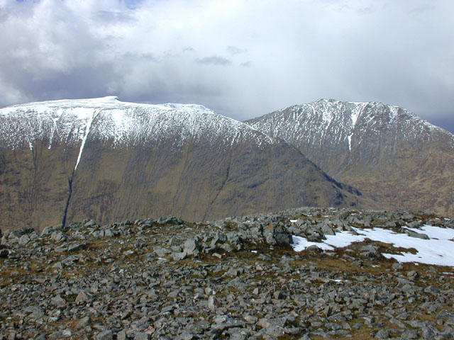 Photo could not load
NN2546 : View north from Stob a' Choire Odhair
Nigel Brown
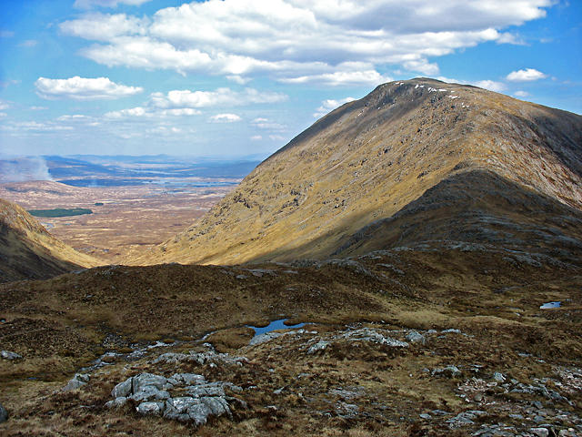 Photo could not load
NN2545 : View towards Stob a' Choire Odhair
William Starkey
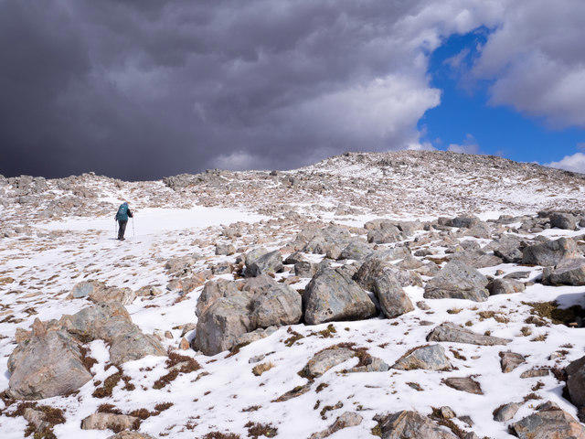 Photo could not load
NN2545 : Boulders near summit of Stob a' Choire Odhair
Trevor Littlewood
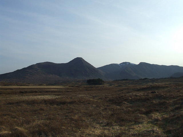 Photo could not load
NN2546 : The Black Mount
Stan Campbell
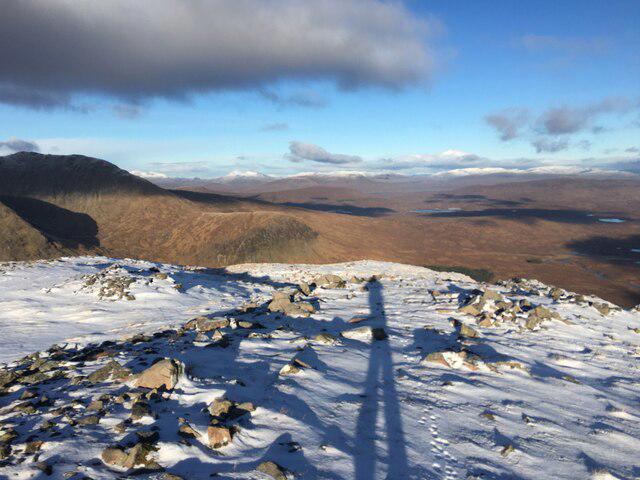 Photo could not load
NN2546 : From the summit of Stob a’ Choire Odhair
Steven Brown
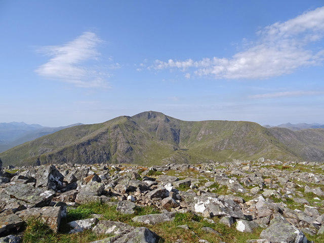 Photo could not load
NN2545 : Stob Ghabhar from Stob a' Choire Odhair
Adam Ward
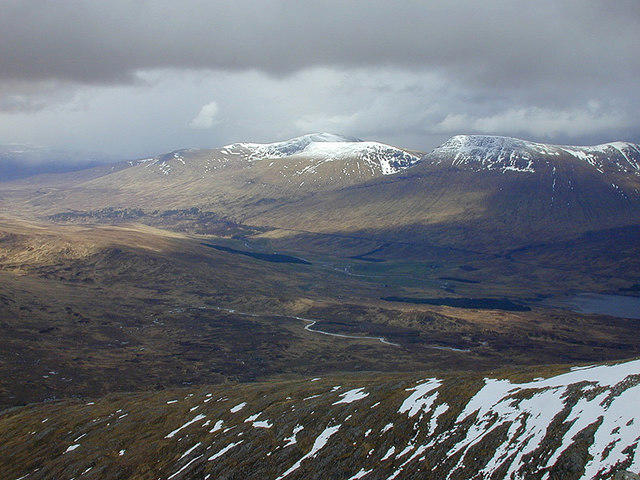 Photo could not load
NN2546 : View east from Stob a' Choire Odhair
Nigel Brown
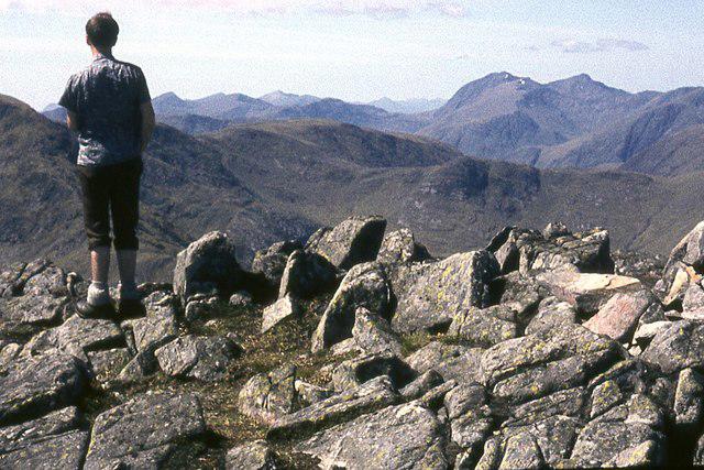 Photo could not load
NN2546 : On Stob a' Choire Odhair
Alan Reid
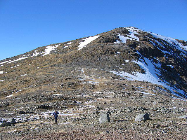 Photo could not load
NN2545 : Stob a' Choire Odhair
Richard Webb
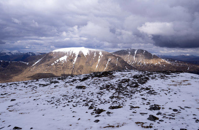
NN2546 : Stony mountain top
Trevor Littlewood
Hill facts and local notes
Classifications
Elevation
945m
3,100 ft
Prominence
279m
Coordinates
56.5733, -4.8383
NN257459
OS Map
50
Explorer: 377E 384
At the Summit
The summit features a distinctive cairn made of stones, a testament to previous intrepid hikers. It also offers a fabulous platform for a proudly taken summit selfie—make sure to include your best victory pose!
Terrain & Geology
The mountain primarily consists of schist and granite, reflective of the geological processes that shaped the Scottish Highlands over millennia. Jagged peaks and rocky outcrops offer a reminder of ancient glacial activity.
Views & Scenery
From the summit, you'll be graced with sights of the surrounding peaks, including Bidean nam Bian and the expansive valleys of Glencoe. Keep an eye out for Loch Etive shimmering in the distance!
History & Heritage
Name Origin
The name 'Stob a' Choire Odhair' translates to 'Peak of the Dark Corry', which is fitting given the looming presence of the mountain and its deep corries.
Historical Significance
The mountain has historical significance as a point of interest for climbers and is featured in various hiking guides due to its challenging ascents and breathtaking views.
Getting There & Facilities
Parking
Car park at the 'Road to the Isles', approximately NN205457. Facilities are limited so arriving early is advisable during peak season.
Public Transport
Bus services run from Glasgow to Glencoe with a local service connecting to the car park at the foot of the mountain.
Nearby Facilities
There are a few cafes and toilets located in Ballachulish, but facilities near the trailhead are sparse. It’s always best to be adequately supplied before setting off.
Safety Information
Known Hazards
- Sudden changes in weather can occur, so be prepared for all four seasons in one day. Rocky terrain can be unstable, especially in wet conditions.
General Safety Tips
- Check weather conditions before setting out
- Carry appropriate clothing and equipment
- Let someone know your planned route
- Take a map, compass, and GPS device
- Carry emergency supplies: food, water, first aid kit, torch
Hills
Some common questions about the hills answered
Are there group walks up Stob a' Choire Odhair?
Many walkers use Walkmates to join or organise walks with others. You can check for group walks around Stob a' Choire Odhair through the maps
Are there other walkers around Stob a' Choire Odhair?
Activity varies by location and time, but Walkmates lets you see whether others have shared walks or shown interest in this area. Find other people through the walking friends search walking friends for Stob a' Choire Odhair search or of course create your own walk for Stob a' Choire Odhair
Can I organise a walk to Stob a' Choire Odhair?
Yes. If there aren’t any walks listed already, you can create a walk and make it available for others to join.
If you're signed up to Walkmates, you can create a walk to Stob a' Choire Odhair.
How do I find a walk up this hill?
There are often multiple ways to walk this hill, depending on experience and route preference. Walkmates helps you explore walks and routes that others have shared.
Can I suggest a new route up Stob a' Choire Odhair?
Yes. You can suggest or create routes to share with others. Walkmates focuses on the social side of walking, so routes are used to help people organise walks and explore areas together, rather than as detailed navigation tools or route libraries.
Other uses really appreciate knowledgeable walkers sharing their routes. Share your favourite route to Stob a' Choire Odhair here
The is an error or something incorrect about this hill. How do I let you know?
We always strive to keep the information on Walkmates as accurate as possible. If you find an error, please let us know through the contact form and we'll aim to correct it as quickly as possible
Community Discussion
Comments
Location
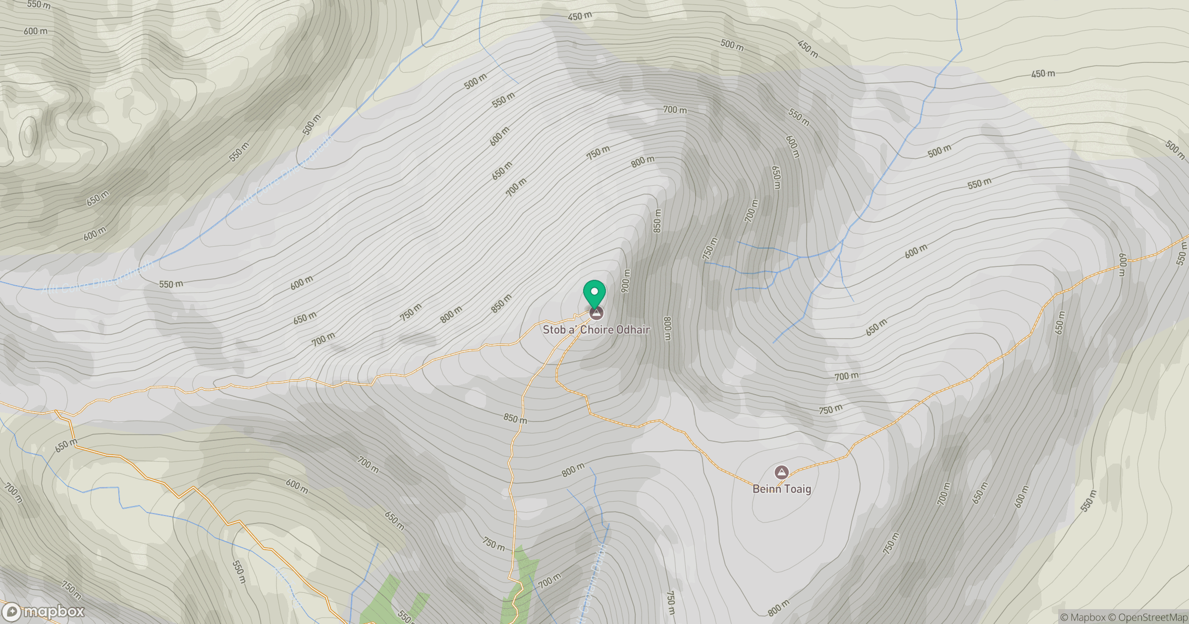
Grid reference: NN257459
View on OpenStreetMapOpens a map in a new tab, centred on the hill.
No comments yet. Be the first.