

St Tudwal's Island East
Good walks are even better shared.
SH3426 : St Tudwal's Island East
David Medcalf Photo source
Overview
St Tudwal's Island East
Nestled off the picturesque coast of Gwynedd, St Tudwal's Island East is a treat for those who love both history and breathtaking ocean views. Don’t let its low elevation fool you—this island packs a punch!
Geology
The island is composed primarily of limestone, with a unique mix of coastal features that epitomise the beauty of the Welsh coastline. These rocky formations serve as a reminder of the powerful forces that shaped our planet, and they are also home to a plethora of marine life.
Access and Facilities
Getting to St Tudwal's Island East is an adventure in itself! You can set off from Abersoch, where you will find ample parking options. Trust us, you won’t need to bring your own boulder to sit on.
For those without wheels, worry not! Buses routinely run from Pwllheli to Abersoch, especially during the summer season. This little seaside town is more than a pit stop; you’ll find cafes that serve a cracking cup of tea and shops selling everything from sun hats to sea kayaks.
Routes
One of the most popular routes is the Rugged Coastal Path, a moderately challenging trek of approximately 3.5 km. It takes about 1.5 hours to reach the island, give or take a break at the cliff’s edge to soak in the views (and maybe ponder life’s big questions).
Summit Features
At the summit, you’ll encounter a charming lighthouse standing as a proud sentinel over the bay. There’s even a lovely bench to park yourself on while you take in the sweeping views. Bring a friend—but maybe don’t ask them to join you on the bench unless you’re in great shape!
Views
The vistas from St Tudwal's Island East are simply stunning. Depending on the weather, you might see the Llyn Peninsula stretching out to the west or the rugged peaks of Snowdonia to the east. Pro tip: come during late spring or early autumn for the clearest skies!
Hazards
Although the island is easy on the eyes, it demands your respect. Weather conditions can change faster than a seagull can swipe your chips, and the rocky terrain may pose slip hazards, so good footwear is essential.
Nearby Summits
Don’t miss your chance to hop over to St Tudwal's Island West, just a stone’s throw away (but perhaps don’t throw stones—those puffins might take offense!).
History
Fascinatingly, the island’s name comes from a local saint, known for establishing a monastery back in the 6th century. The lighthouse that stands today has guided many ships since 1866, reflecting its lasting importance for sailors navigating these waters.
In summary, St Tudwal's Island East may not be the highest summit around, but it certainly offers a treasure trove of sights, sounds, and stories. Happy hiking!
Explore routes near St Tudwal's Island East
Walks starting near this hill. Open a route to check its map, distance and full itinerary.
Yr Eifl and the Gyrns guided mountain walk
View route
Northern Rhinogydd guided mountain walk
View route
Beddgelert Forest: Llyn Llywelyn Woodland Circuit
View route
Beddgelert Forest: Derwen Circuit and Llyn Llywelyn
View route
Route planning notes
These notes describe possible approaches. Check a route's map and access information when planning your walk.
Rugged Coastal Path
A scenic route starting from Abersoch, following the coastline to the island with stunning sea views.
Make a day of it, together
Find someone to share the walk with, or organise a day out along a route you like.
Photo Gallery
View all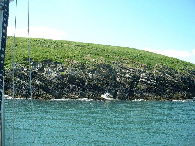 Photo could not load
SH3426 : St Tudwal's Island East
David Medcalf
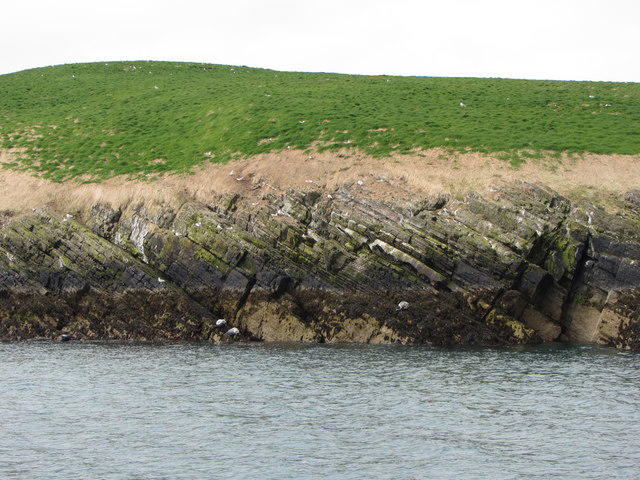 Photo could not load
SH3426 : St Tudwal's Island East
Gareth James
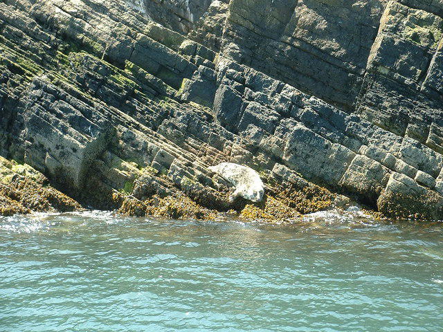 Photo could not load
SH3426 : Basking seal on St Tudwal's Island East
David Medcalf
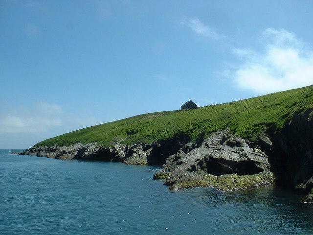 Photo could not load
SH3426 : Slipway and steps for the old Priory
David Medcalf
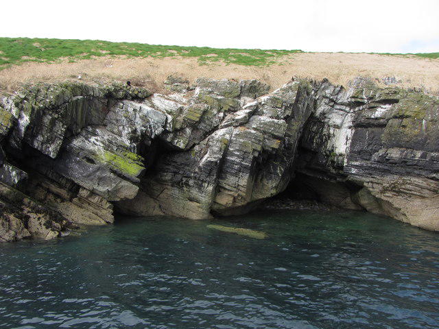 Photo could not load
SH3426 : Cave on St. Tudwal's Island East
Gareth James
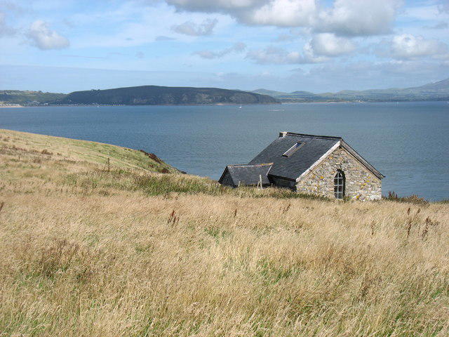 Photo could not load
SH3425 : The house on St Tudwal's Island East
David Purchase
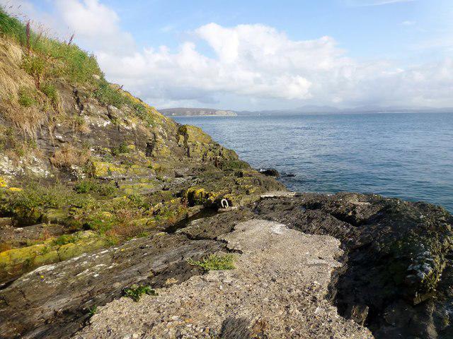 Photo could not load
SH3426 : Landing Point On St Tudwal's Island East
Rude Health
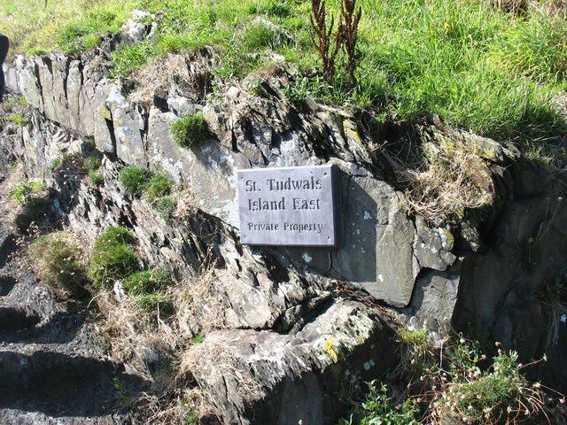 Photo could not load
SH3426 : Welcome to the island!
David Purchase
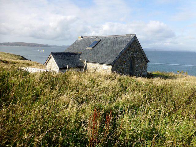 Photo could not load
SH3425 : Building On St Tudwal's Island East
Rude Health
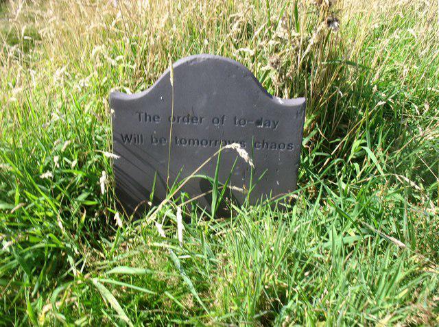
SH3425 : A stone near the house on St Tudwal's Island East
David Purchase
Hill facts and local notes
Classifications
Elevation
36m
119 ft
Prominence
36m
Coordinates
52.8057, -4.4636
SH340259
OS Map
123
Explorer: 253
At the Summit
The summit is adorned with a quaint lighthouse and offers sweeping views of Cardigan Bay—there's even a bench for post-hike contemplation!
Terrain & Geology
The island features a mix of coastal limestone and shingle, offering unique opportunities to explore both geological formations and marine ecology.
Views & Scenery
On a clear day, you can see the Llyn Peninsula, as well as the mainland peaks of Snowdonia in the distance.
History & Heritage
Name Origin
The name 'St Tudwal' derives from a local saint who is said to have founded a monastery here in the 6th century.
Historical Significance
The islands are significant historically and architecturally, particularly the lighthouse, which has guided sailors since 1866.
Getting There & Facilities
Parking
Abersoch has several parking areas, including a pay-and-display option right near the beach.
Public Transport
Regular bus services run from Pwllheli to Abersoch during the summer months.
Nearby Facilities
Abersoch offers a variety of cafes, shops, and public toilets for hikers’ convenience.
Safety Information
Known Hazards
- Strong coastal weather can change rapidly, so be prepared for sudden winds and rain. Slip hazards can be present on rocky paths.
General Safety Tips
- Check weather conditions before setting out
- Carry appropriate clothing and equipment
- Let someone know your planned route
- Take a map, compass, and GPS device
- Carry emergency supplies: food, water, first aid kit, torch
Hills
Some common questions about the hills answered
Are there group walks up St Tudwal's Island East?
Many walkers use Walkmates to join or organise walks with others. You can check for group walks around St Tudwal's Island East through the maps
Are there other walkers around St Tudwal's Island East?
Activity varies by location and time, but Walkmates lets you see whether others have shared walks or shown interest in this area. Find other people through the walking friends search walking friends for St Tudwal's Island East search or of course create your own walk for St Tudwal's Island East
Can I organise a walk to St Tudwal's Island East?
Yes. If there aren’t any walks listed already, you can create a walk and make it available for others to join.
If you're signed up to Walkmates, you can create a walk to St Tudwal's Island East.
How do I find a walk up this hill?
There are often multiple ways to walk this hill, depending on experience and route preference. Walkmates helps you explore walks and routes that others have shared.
Can I suggest a new route up St Tudwal's Island East?
Yes. You can suggest or create routes to share with others. Walkmates focuses on the social side of walking, so routes are used to help people organise walks and explore areas together, rather than as detailed navigation tools or route libraries.
Other uses really appreciate knowledgeable walkers sharing their routes. Share your favourite route to St Tudwal's Island East here
The is an error or something incorrect about this hill. How do I let you know?
We always strive to keep the information on Walkmates as accurate as possible. If you find an error, please let us know through the contact form and we'll aim to correct it as quickly as possible
Community Discussion
Comments
Location
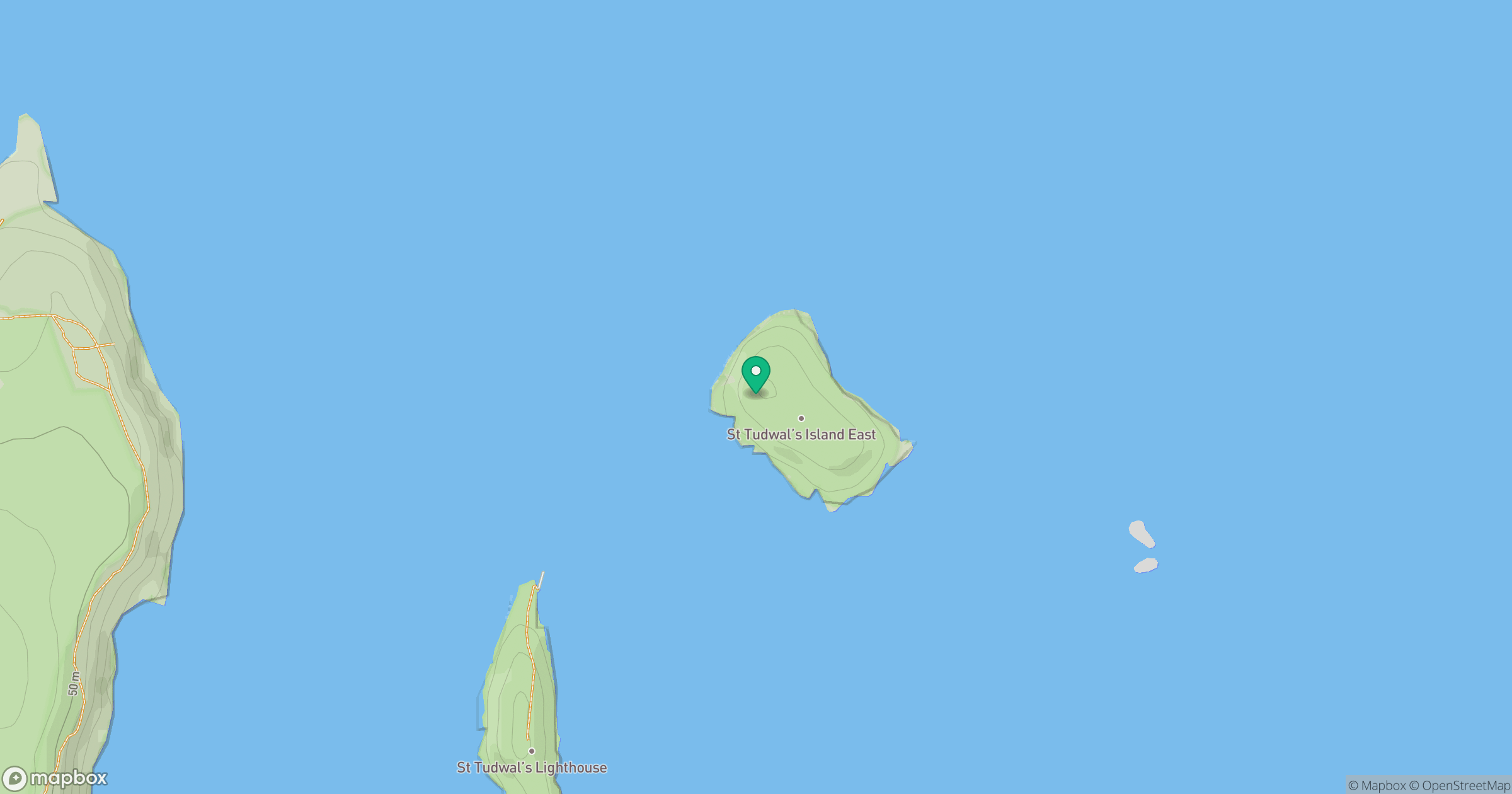
Grid reference: SH340259
View on OpenStreetMapOpens a map in a new tab, centred on the hill.
No comments yet. Be the first.