

Mynydd Cilan
Good walks are even better shared.
Overview
Mynydd Cilan
Mynydd Cilan, standing at an elevation of 151 meters, is a delightful Marilyn located on the picturesque Llŷn Peninsula in North Wales. This area is renowned for its stunning coastal vistas and charming rural landscape.
Geology
The mountain's geology is primarily volcanic, with an array of rock types, including basalt and andesite. It offers a fascinating glimpse into past geological events that shaped the region. Ideal for geology buffs or anyone curious about the world beneath their feet!
Routes
One popular route is the Cilan Head Circular which spans approximately 6.5 km and generally takes around 2.5 hours to complete. This moderate hike provides an engaging mix of coastal views and undulating terrain.
Summit Features
At the summit, adventurers will discover a trig point, perfect for those Instagram moments after conquering the hill. Don’t forget to give it a tap for good luck!
Terrain
Expect a mix of grassy slopes transitioning to rocky outcrops, with the terrain occasionally resembling a soggy sponge after a rainy day. Good hiking boots are a must, unless puddles are your thing!
Views
The views from the top are worth every step! On a clear day, you can enjoy sights of Bardsey Island and the Snowdonia range. Spring and early autumn are particularly spectacular times to visit; mother nature surely has her paintbrush out, creating a dazzling landscape.
Hazards
This part of the world is known for its rapidly changing weather. Be prepared for anything, and be careful of slippery paths that could challenge even the most experienced hiker. A sturdy walking stick may come in handy!
Nearby Summits
Nearby summits such as Mynyddoedd Penllyn offer additional walking opportunities for those looking to extend their outdoor adventure.
Access
Nearest Parking: The convenient parking near Cilan Farm allows easy access to your hike (Grid Reference: SH288241).
Public Transport: Abersoch serves as the nearest transport hub, with bus services connecting it to larger towns.
Nearest Town: Located approximately 10 minutes' drive away, Abersoch provides essential amenities such as cafes and shops, making for a pleasant start or end to your journey.
Facilities
Facilities around Mynydd Cilan may be limited, but after your strenuous efforts, you can reward yourself at any of the welcoming cafes in Abersoch.
History
The etymology of 'Cilan' relates to slopes, a humble yet fitting description of the mountain. Culturally, Mynydd Cilan is woven into the local folklore, deeply rooted in the heritage of the Llŷn Peninsula.
Mynydd Cilan may be small in stature, but it packs a punch in terms of rewards for those willing to lace up their boots and explore its wonders. Happy hiking!
Explore routes near Mynydd Cilan
Public walks starting within 80 km of this hill. Nearby does not mean a route reaches the summit; check its map and access before setting out.
Yr Eifl and the Gyrns guided mountain walk
View route
Northern Rhinogydd guided mountain walk
View route
Beddgelert Forest: Llyn Llywelyn Woodland Circuit
View route
Beddgelert Forest: Derwen Circuit and Llyn Llywelyn
View route
Route planning notes
These notes describe possible approaches, not verified navigable routes or permission to cross land. Check current paths, local access rules and conditions before setting out.
Cilan Head Circular
A charming circular route that wraps around the base of Mynydd Cilan, showcasing stunning coastal views along the way.
Make a day of it, together
Find someone to share the walk with, or organise a day out along a route you like.
Photo Gallery
View all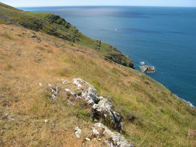 Photo could not load
SH2824 : Trwyn Carreg-y-tir
Jonathan Wilkins
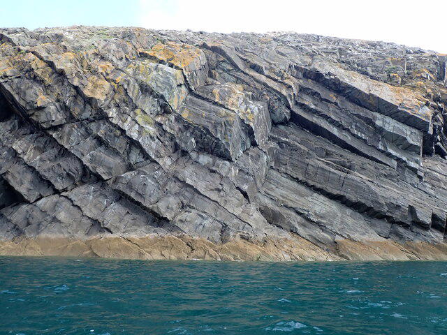 Photo could not load
SH2824 : Massive rock beds tilting into the sea
David Medcalf
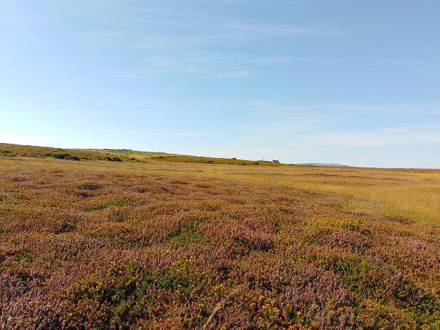 Photo could not load
SH2824 : Open access land near Mynydd Cilan
Oscar Taylor
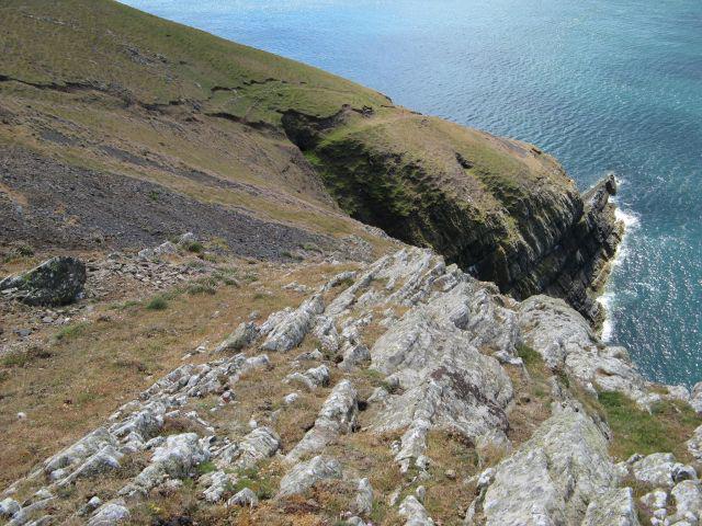 Photo could not load
SH2824 : Hell's Mouth Formation
Jonathan Wilkins
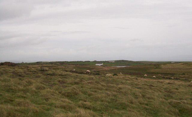 Photo could not load
SH2824 : Sheep feeding on rough grazing on Mynydd Cilan
Eric Jones
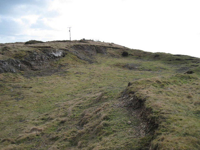 Photo could not load
SH2824 : Mine workings near Pen-y-mynydd
David Medcalf
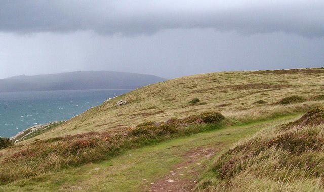 Photo could not load
SH2824 : View north along the cliff top above Trwyn Carreg-y-tir
Eric Jones
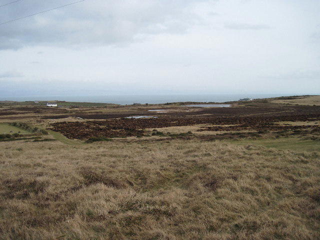 Photo could not load
SH2824 : Looking over Mynydd Gilan
David Medcalf
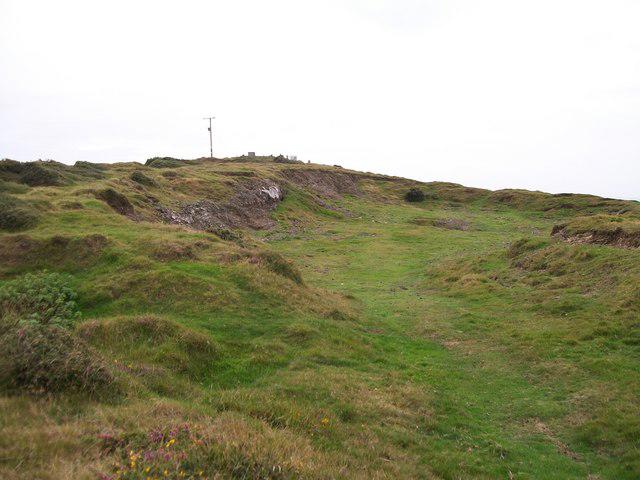 Photo could not load
SH2824 : Abandoned open cast lead workings north of the triangulation pillar
Eric Jones
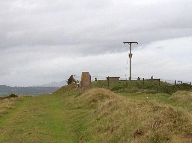
SH2824 : Triangulation Pillar and Reservoir near Pen-y-mynydd
Eric Jones
Hill facts and local notes
Classifications
Elevation
117m
384 ft
Prominence
110m
Coordinates
52.7881, -4.5389
SH288241
OS Map
123
Explorer: 253
At the Summit
The summit features a well-constructed trig point, which is a geodetic marker installed by the Ordnance Survey. It serves not just as a navigational aid but also as a perfect spot for those summit selfies.
Terrain & Geology
Mynydd Cilan is primarily composed of volcanic rock, with unique formations that tell the tale of ancient geological activity. The rugged landscape offers a variety of rock types, including basalt and andesite, which are a delight for geology enthusiasts.
Views & Scenery
From the summit, you can gaze over the stunning coastline of the Llŷn Peninsula, with views of Bardsey Island and the Snowdonia mountain range in the distance on a clear day.
History & Heritage
Name Origin
The name 'Cilan' is derived from the Welsh word meaning 'to incline' or 'slope', a fitting description of this charming hill.
Historical Significance
Mynydd Cilan has cultural significance in local folklore and is part of the ancient landscape of the Llŷn Peninsula, which is steeped in myths and legends.
Getting There & Facilities
Check current local access restrictions, parking rules and transport timetables before travelling. These notes do not confirm public access to the summit.
Parking
Parking is available at the end of the road near Cilan Farm (Grid Reference: SH288241). It’s a small area, so arrive early during peak seasons.
Public Transport
The nearest bus service operates through Abersoch, with connections to larger towns like Pwllheli. Check local timetables for the latest service updates.
Nearby Facilities
Facilities are quite limited on the mountain itself, but Abersoch offers various cafes, shops, and public toilets.
Safety Information
Known Hazards
- Beware of sudden weather changes, as conditions can shift quickly in this coastal area. Be mindful of slippery paths, especially after rain.
General Safety Tips
- Check weather conditions before setting out
- Carry appropriate clothing and equipment
- Let someone know your planned route
- Take a map, compass, and GPS device
- Carry emergency supplies: food, water, first aid kit, torch
Hills
Some common questions about the hills answered
Are there group walks up Mynydd Cilan?
Many walkers use Walkmates to join or organise walks with others. You can check for group walks around Mynydd Cilan through the maps
Are there other walkers around Mynydd Cilan?
Activity varies by location and time, but Walkmates lets you see whether others have shared walks or shown interest in this area. Find other people through the walking friends search walking friends for Mynydd Cilan search or of course create your own walk for Mynydd Cilan
Can I organise a walk to Mynydd Cilan?
Yes. If there aren’t any walks listed already, you can create a walk and make it available for others to join.
If you're signed up to Walkmates, you can create a walk to Mynydd Cilan.
How do I find a walk up this hill?
There are often multiple ways to walk this hill, depending on experience and route preference. Walkmates helps you explore walks and routes that others have shared.
Can I suggest a new route up Mynydd Cilan?
Yes. You can suggest or create routes to share with others. Walkmates focuses on the social side of walking, so routes are used to help people organise walks and explore areas together, rather than as detailed navigation tools or route libraries.
Other uses really appreciate knowledgeable walkers sharing their routes. Share your favourite route to Mynydd Cilan here
The is an error or something incorrect about this hill. How do I let you know?
We always strive to keep the information on Walkmates as accurate as possible. If you find an error, please let us know through the contact form and we'll aim to correct it as quickly as possible
Community Discussion
Comments
Location
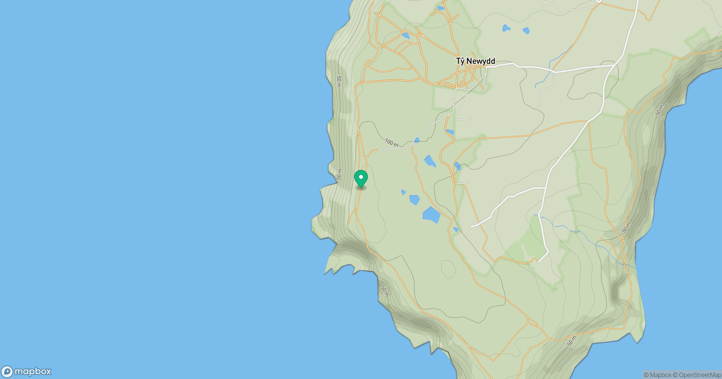
Grid reference: SH288241
View on OpenStreetMapOpens a map in a new tab, centred on the hill.
Hills within 30 km
Straight-line distance, not a walking route or confirmation of access.
No comments yet. Be the first.