

Mynydd Carnguwch
Good walks are even better shared.
SH3743 : Mynydd Carnguwch from round the back
Eric Jones Photo source
Overview
Mynydd Carnguwch
Introduction
Mynydd Carnguwch stands proudly at 353 meters above sea level, offering a delightful hike in the heart of Snowdonia. Known locally as a Marilyn, it boasts significant prominence despite its modest height. This mountain is perfect for those looking to revel in stunning scenery without the sweat of serious mountaineering.
Geology
Mynydd Carnguwch is composed of mudstones and sandstones that tell the story of ancient marine environments. As you hike, take a moment to appreciate the rocks beneath your feet—they've endured a lot more than any of us!
Routes
The Cwm Cycha route is the go-to for hikers wanting to tackle this mountain. It's a moderate climb with rocky outcrops that require a bit of scrambling at times. At a distance of 4.5 km, it usually takes about 2.5 hours to reach the summit, depending on how many selfies you stop to take.
Summit Features
Upon reaching the summit, you'll be greeted by a stone cairn and a trig point, perfect for a triumphant photo op. The views are worth every step you took, so don’t forget to soak it all in!
Terrain
Expect a mix of rocky paths and grassy slopes, with some boggy patches that may sneak up on you. Good footwear is a must, unless you fancy a swim in the muddy shallows.
Views
From the top, the panorama is nothing short of spectacular. Look out for the iconic peaks of Snowdonia and, on particularly clear days, the distant Brecon Beacons. The best times for views are late spring and early autumn, when the visibility is typically at its best.
Hazards
Be cautious on your ascent and descent, especially after rain—those mud patches can be slippery! Keep an eye on loose rocks, and avoid the urge to strike a victory pose too close to the edge.
Nearby Summits
After conquering Mynydd Carnguwch, why not extend your adventure to nearby summits? Mynydd y Gwaun at 391 meters and Moel Eilio at 726 meters are both excellent options.
Access
Parking is available at a small car park by the Cwm Cycha route, where around 10 vehicles can fit comfortably. Public transport options exist, but make sure to check schedules as they can be a tad irregular.
The closest town, Llanberis, is just a stone's throw away and provides for all your pre-hike needs, including cafes and shops.
Facilities
Llanberis has a plethora of facilities such as cafés to fuel up on before your hike and toilets for those urgent moments!
History
The name 'Mynydd Carnguwch' reflects its summit's historical significance, known as the 'Mountain of the Cairn.' The trails here have been walked for centuries, linking shepherds to their flocks and giving adventurers a chance to explore the breathtaking Welsh countryside.
Enjoy your adventure, and remember: every mountain climbed is another story waiting to be told!
Explore routes near Mynydd Carnguwch
Walks starting near this hill. Open a route to check its map, distance and full itinerary.
Yr Eifl and the Gyrns guided mountain walk
View route
Beddgelert Forest: Llyn Llywelyn Woodland Circuit
View route
Beddgelert Forest: Derwen Circuit and Llyn Llywelyn
View route
Northern Rhinogydd guided mountain walk
View route
Route planning notes
These notes describe possible approaches. Check a route's map and access information when planning your walk.
Cwm Cycha Route
A scenic climb starting from the Cwm Cycha valley, this route offers a moderate ascent with some rocky sections that require careful navigation.
Make a day of it, together
Find someone to share the walk with, or organise a day out along a route you like.
Photo Gallery
View all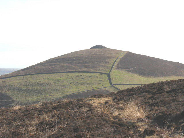 Photo could not load
SH3743 : Mynydd Carnguwch from round the back
Eric Jones
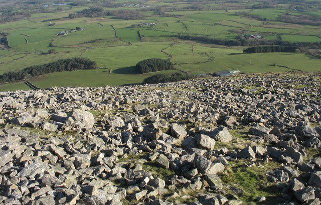 Photo could not load
SH3742 : View east across the summit plateau of Carnguwch
Eric Jones
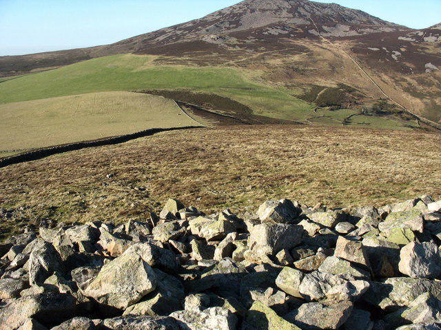 Photo could not load
SH3743 : View due north along the summit of Mynydd Carnguwch
Eric Jones
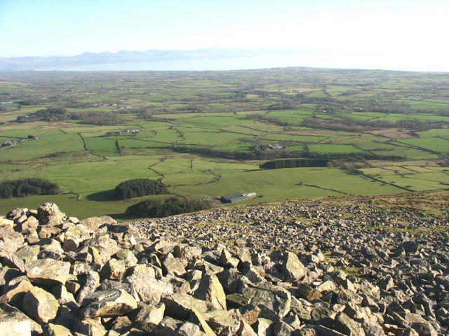 Photo could not load
SH3742 : Boulder field on the summit plateau of Mynydd Carnguwch
Eric Jones
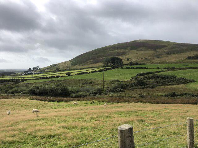 Photo could not load
SH3743 : Looking towards Mynydd Carnguwch
Eirian Evans
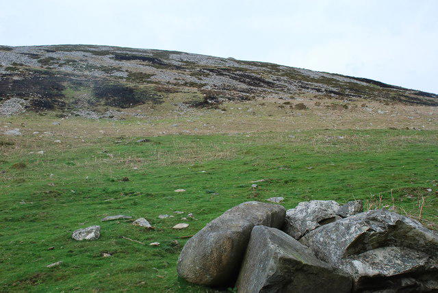 Photo could not load
SH3742 : Mynydd Carnguwch
Alan Fryer
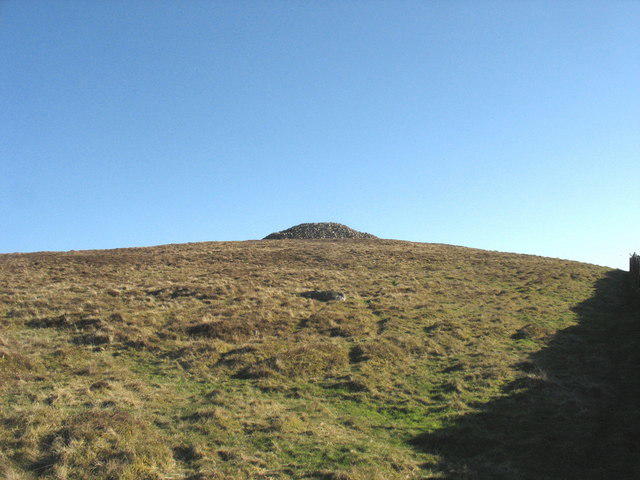 Photo could not load
SH3743 : The final climb to the summit of Mynydd Carnguwch
Eric Jones
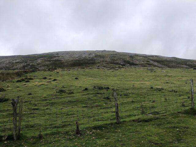 Photo could not load
SH3742 : Mynydd Carnguwch
Eirian Evans
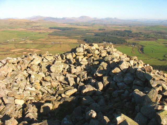 Photo could not load
SH3742 : Atop the Carnguwch cairn looking due East
Eric Jones
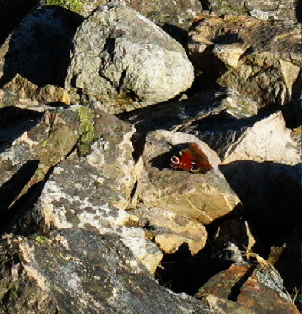
SH3742 : Peacock butterfly spotted on Carnguwch 13th February, 2008
Eric Jones
Hill facts and local notes
Classifications
Elevation
358m
1,173 ft
Prominence
102m
Coordinates
52.9590, -4.4213
SH374429
OS Map
123
Explorer: 253 254
At the Summit
The summit features a prominent stone cairn, with a trig point nearby that marks the highest point. A perfect spot for a triumphant photo for those who make it!
Terrain & Geology
Mynydd Carnguwch is primarily composed of mudstones and sandstones, typical of the region. The varied geology offers an interesting glimpse into the Earth's past, with layers that tell tales of ancient seabeds.
Views & Scenery
From the summit, one can enjoy expansive views of the surrounding valleys, including glimpses of the iconic peaks of Snowdonia. On a clear day, even the peaks of the Brecon Beacons can be seen.
History & Heritage
Name Origin
The name 'Mynydd Carnguwch' loosely translates to 'Mountain of the Cairn,' referring to the prominent feature on its summit.
Historical Significance
The area holds historical significance, with ancient pathways used by local shepherds and hikers for centuries, connecting communities across the landscape.
Getting There & Facilities
Parking
There is a small car park located at the start of the Cwm Cycha route, with spaces for about 10 cars. Arrive early on weekends to secure a spot!
Public Transport
Buses run from nearby villages to the trailhead, but service may be limited; it's best to check local schedules.
Nearby Facilities
Llanberis is well equipped with cafes, shops, and public toilets, making it a convenient spot to rest before or after your hike.
Safety Information
Known Hazards
- The path can be muddy and slippery after rainfall; be mindful of loose rocks, especially on steeper sections.
General Safety Tips
- Check weather conditions before setting out
- Carry appropriate clothing and equipment
- Let someone know your planned route
- Take a map, compass, and GPS device
- Carry emergency supplies: food, water, first aid kit, torch
Hills
Some common questions about the hills answered
Are there group walks up Mynydd Carnguwch?
Many walkers use Walkmates to join or organise walks with others. You can check for group walks around Mynydd Carnguwch through the maps
Are there other walkers around Mynydd Carnguwch?
Activity varies by location and time, but Walkmates lets you see whether others have shared walks or shown interest in this area. Find other people through the walking friends search walking friends for Mynydd Carnguwch search or of course create your own walk for Mynydd Carnguwch
Can I organise a walk to Mynydd Carnguwch?
Yes. If there aren’t any walks listed already, you can create a walk and make it available for others to join.
If you're signed up to Walkmates, you can create a walk to Mynydd Carnguwch.
How do I find a walk up this hill?
There are often multiple ways to walk this hill, depending on experience and route preference. Walkmates helps you explore walks and routes that others have shared.
Can I suggest a new route up Mynydd Carnguwch?
Yes. You can suggest or create routes to share with others. Walkmates focuses on the social side of walking, so routes are used to help people organise walks and explore areas together, rather than as detailed navigation tools or route libraries.
Other uses really appreciate knowledgeable walkers sharing their routes. Share your favourite route to Mynydd Carnguwch here
The is an error or something incorrect about this hill. How do I let you know?
We always strive to keep the information on Walkmates as accurate as possible. If you find an error, please let us know through the contact form and we'll aim to correct it as quickly as possible
Community Discussion
Comments
Location
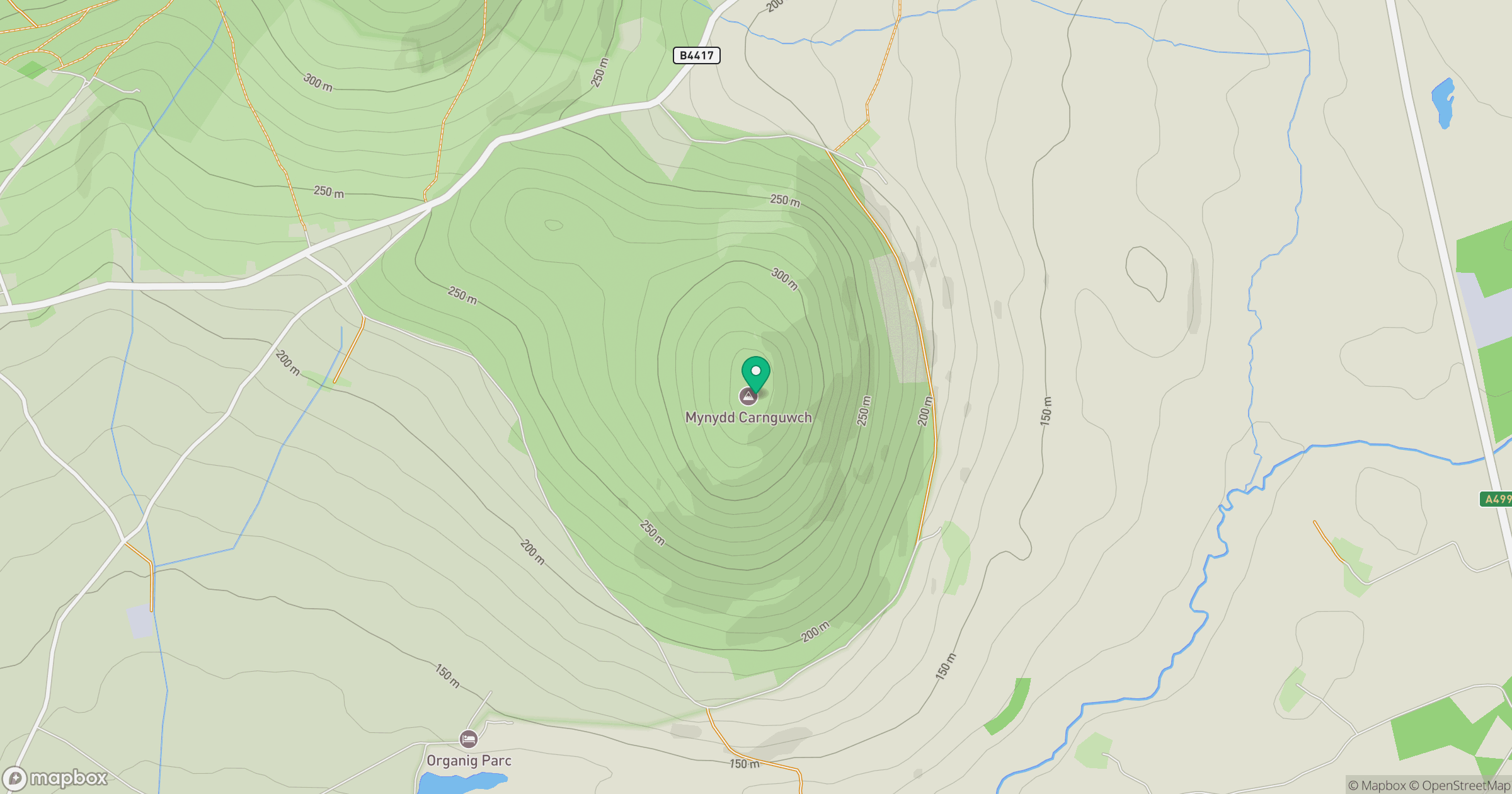
Grid reference: SH374429
View on OpenStreetMapOpens a map in a new tab, centred on the hill.
No comments yet. Be the first.