

Garn Boduan
Good walks are even better shared.
SH3139 : The fort wall on Garn Boduan
David Medcalf Photo source
Overview
Garn Boduan
Garn Boduan rises above Nefyn on the Llŷn Peninsula. The current DoBIH record gives 280.1 m, with 176.7 m prominence, and retains its Marilyn identity. A change applied on 23 February 2025 superseded the old 279 m height. Current hill record · Applied change
Summit and heritage
The natural high point is a rock 2 m from the brass-marker plinth, at SH3121139352, marginally above the nearby shelter. The plateau contains an extensive Iron Age hillfort, with stone ramparts and roundhouse remains. Do not dismantle archaeology for shelters. Coflein record
BGS names the local Garn Boduan Microgranodiorite Intrusion. Its index entry supplies no geological age, so none is asserted here. BGS
Walking and access
North Wales Magazine publishes an 8.04 km complete circuit from Nefyn, crossing Garn Boduan and returning through Mynydd Nefyn woodland. It is strenuous, with steep ground and faint paths. Use its full map and directions; no ascent-only distance or guaranteed duration is substituted for the complete walk. Route guide
The guide dates from 2020. A hill log dated May 2026 reports obstruction on the Nefyn approach. Check current access locally and follow lawful paths; if blocked, turn back rather than force a fence. Keep dogs on leads, take navigation equipment and avoid mist.
Travel
The published start is Parc-y-Ddol car park, SH308404. Follow current parking signs. Gwynedd lists bus 8 through Nefyn and Boduan; verify the return timetable. Shops and refreshments are available in the Nefyn area, subject to opening hours. Sources checked 18 October 2026; no recent on-foot inspection is claimed.
Explore routes near Garn Boduan
Walks starting near this hill. Open a route to check its map, distance and full itinerary.
Yr Eifl and the Gyrns guided mountain walk
View route
Beddgelert Forest: Llyn Llywelyn Woodland Circuit
View route
Beddgelert Forest: Derwen Circuit and Llyn Llywelyn
View route
Northern Rhinogydd guided mountain walk
View route
Route planning notes
These notes describe possible approaches. Check a route's map and access information when planning your walk.
Nefyn, Garn Boduan and Mynydd Nefyn circuit
A published 8.04 km full circuit from Parc-y-Ddol car park, Nefyn (SH308404), ascending via Y Fron and Frondirion, crossing Garn Boduan, then returning by southern lanes and Mynydd Nefyn woodland to the same car park. The route passes the summit plinth; the natural high point is the adjacent rock 2 m away. Use the complete linked directions. The guide dates from 2020 and a May 2026 hill log reports obstruction on the Nefyn approach: check current access, and turn back if the lawful path is blocked. Source: https://northwalesmagazine.com/the-ascent-of-garn-boduan
Make a day of it, together
Find someone to share the walk with, or organise a day out along a route you like.
Photo Gallery
View all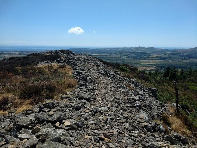 Photo could not load
SH3139 : The fort wall on Garn Boduan
David Medcalf
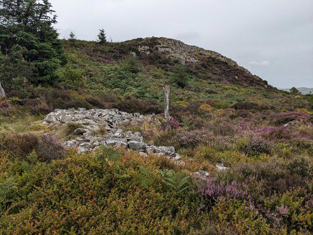 Photo could not load
SH3139 : The slopes of Garn Boduan with the remains of a hut circle
David Medcalf
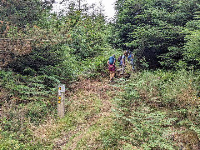 Photo could not load
SH3139 : Rights of Way in Boduan forest
David Medcalf
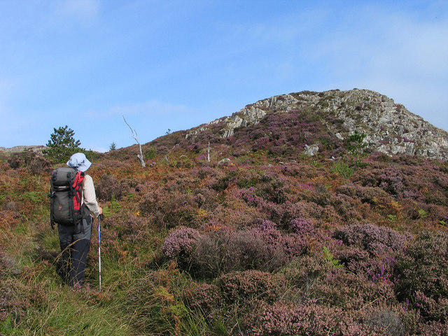 Photo could not load
SH3139 : Rocks and heathers on Garn Boduan
Trevor Littlewood
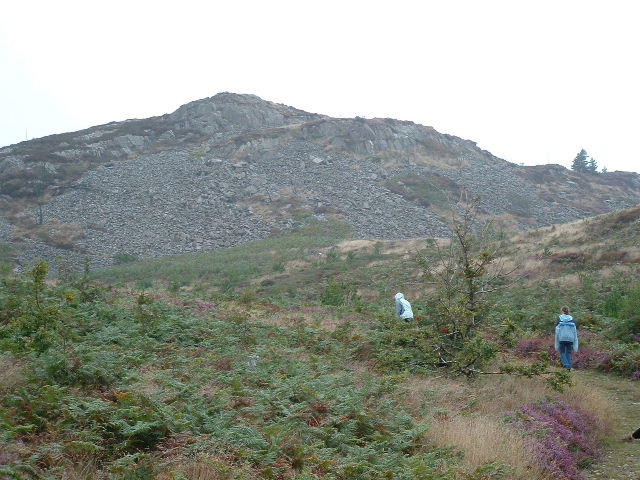 Photo could not load
SH3139 : Garn Boduan
Chris Shaw
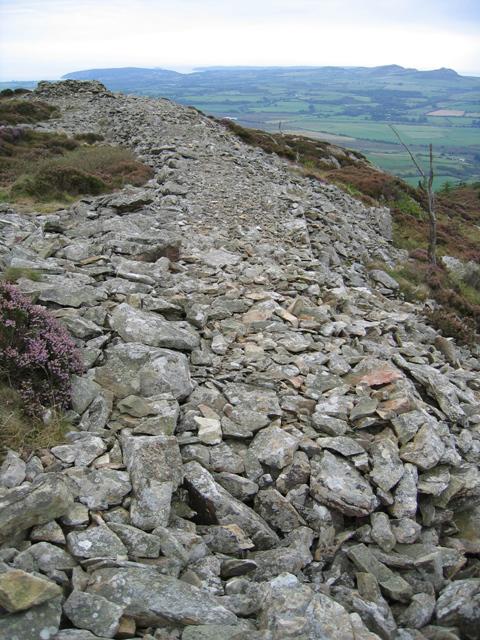 Photo could not load
SH3139 : Garn Boduan Hillfort
John S Turner
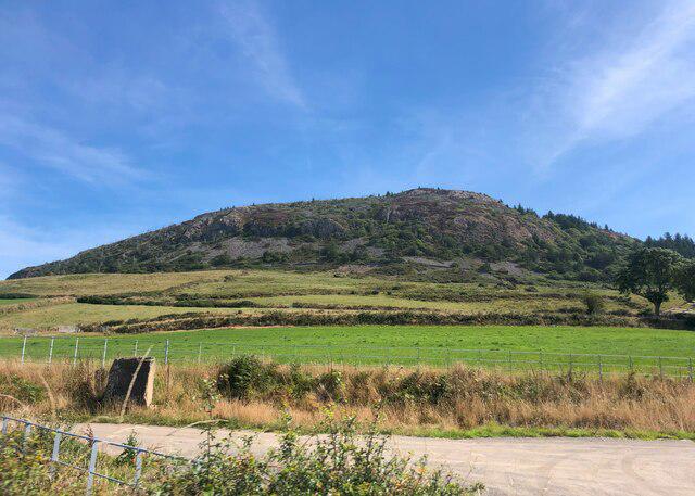 Photo could not load
SH3139 : Garn Boduan
Eirian Evans
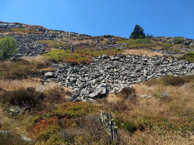 Photo could not load
SH3139 : The north east face of Garn Boduan
David Medcalf
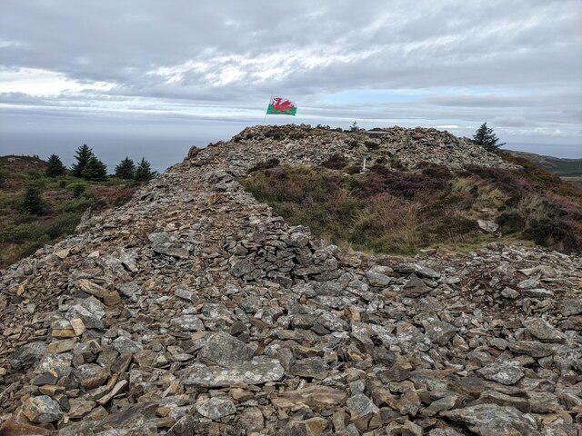 Photo could not load
SH3139 : An ancient fort and a modern flag on Garn Boduan
David Medcalf
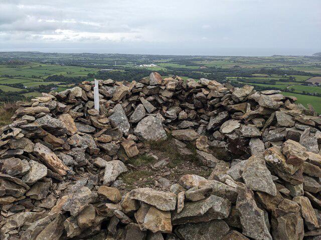
SH3139 : The summit shelter of Garn Boduan
David Medcalf
Hill facts and local notes
Classifications
Elevation
280m
919 ft
Prominence
177m
Coordinates
52.9250, -4.5124
SH312393
OS Map
123
Explorer: 253
At the Summit
The recorded summit is a rock 2 m from a plinth with a brass spot-height marker, at SH3121139352. It is marginally higher than the nearby wind shelter. A conventional standing trig pillar is not the recorded feature.
Terrain & Geology
The British Geological Survey names the Garn Boduan Microgranodiorite Intrusion. Its index record does not specify an age; the previous Tertiary basalt-and-tuff account is unsupported.
Views & Scenery
From the top, you can see the magnificent Snowdonia range, the Llyn Peninsula, and sometimes even as far as Anglesey on a clear day.
History & Heritage
Historical Significance
Garn Boduan has an extensive Iron Age hillfort with successive stone ramparts and about 170 circular structures recorded by Coflein. A smaller enclosure occupies the higher eastern part. The archaeological record includes evidence of second-century AD occupation; avoid disturbing walls or building shelters.
Getting There & Facilities
Parking
The published Nefyn circuit starts at Parc-y-Ddol car park, near the disused chapel on Stryd y Plas, SH308404. Check present parking signs and charges; the guide’s 2020 statement of free parking is not a current guarantee.
Public Transport
Gwynedd’s current timetable index links service 8 between Pwllheli, Nefyn and Tudweiliog, with stops at Boduan and Nefyn. Check the council’s latest timetable and return connection before travelling. The bus does not reach the summit.
Nearby Facilities
Nefyn and Morfa Nefyn offer shops and places to eat. Check opening times and carry food and water; no summit facilities are promised.
Safety Information
Known Hazards
- Carry a map and compass; avoid the rough, faint summit approach in poor visibility.
- A May 2026 visitor log reports obstruction on the Nefyn approach. Check current signs and rights of way; turn back rather than forcing fences or crossing unpermitted land.
- Keep dogs on leads on the published circuit, especially around livestock.
- Leave the hillfort walls and hut remains intact; do not move stones or build shelters.
General Safety Tips
- Check weather conditions before setting out
- Carry appropriate clothing and equipment
- Let someone know your planned route
- Take a map, compass, and GPS device
- Carry emergency supplies: food, water, first aid kit, torch
Hills
Some common questions about the hills answered
Are there group walks up Garn Boduan?
Many walkers use Walkmates to join or organise walks with others. You can check for group walks around Garn Boduan through the maps
Are there other walkers around Garn Boduan?
Activity varies by location and time, but Walkmates lets you see whether others have shared walks or shown interest in this area. Find other people through the walking friends search walking friends for Garn Boduan search or of course create your own walk for Garn Boduan
Can I organise a walk to Garn Boduan?
Yes. If there aren’t any walks listed already, you can create a walk and make it available for others to join.
If you're signed up to Walkmates, you can create a walk to Garn Boduan.
How do I find a walk up this hill?
There are often multiple ways to walk this hill, depending on experience and route preference. Walkmates helps you explore walks and routes that others have shared.
Can I suggest a new route up Garn Boduan?
Yes. You can suggest or create routes to share with others. Walkmates focuses on the social side of walking, so routes are used to help people organise walks and explore areas together, rather than as detailed navigation tools or route libraries.
Other uses really appreciate knowledgeable walkers sharing their routes. Share your favourite route to Garn Boduan here
The is an error or something incorrect about this hill. How do I let you know?
We always strive to keep the information on Walkmates as accurate as possible. If you find an error, please let us know through the contact form and we'll aim to correct it as quickly as possible
Community Discussion
Comments
Location
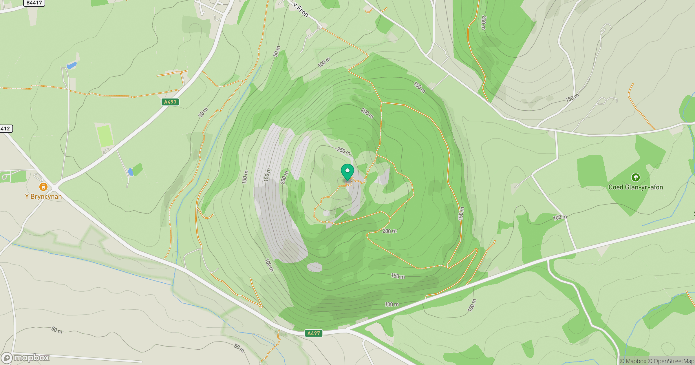
Grid reference: SH312393
View on OpenStreetMapOpens a map in a new tab, centred on the hill.
No comments yet. Be the first.