

Bwlch Mawr
Good walks are even better shared.
Overview
Exploring Bwlch Mawr
Introduction
Nestled in the breathtaking landscape of Snowdonia National Park, Bwlch Mawr stands as a gem waiting to be discovered by hikers and outdoor enthusiasts alike. Not only does it offer splendid views, but it also serves as a gateway to the rugged beauty of the surrounding peaks.
Geology
Bwlch Mawr boasts an intriguing geological background primarily composed of mudstone and slate. This combination shapes the mountain’s distinctive features and provides insights into Snowdonia's rich geological history. Coveted for its slate, the region once hosted bustling quarries, remnants of which are found tucked away in the valleys.
Routes
The most popular route to summit Bwlch Mawr is the Bwlch Mawr Circular Loop. Starting from Trawsfynydd, this moderate hike spans approximately 11 km and generally takes around 4 hours to complete. It’s an excellent choice for those looking to enjoy a relaxing day out, with plenty of scenic pauses along the way.
Summit Features
Reaching the summit, hikers are greeted by a sturdy trig point and a charming stone cairn—perfect for those all-important photos. Just be sure to channel your inner mountain goat and strike a pose to share your high-altitude success!
Terrain Type
Expect a delightful mix of grassy expanses and rocky outcrops. The terrain strikes a balance, offering a straightforward ascent that rewards climbers with fun scrambling sections that will keep your heart racing and your legs engaged.
Views
One of the most rewarding aspects of reaching the top of Bwlch Mawr is the stunning vistas. On a clear day, you’ll be rewarded with sweeping views of the Rhinog mountains and the glistening Trawsfynydd Lake. The late spring and early autumn seasons are ideal for optimal visibility and vibrant hues in the landscape.
Hazards
As a friendly reminder, always be aware of the ever-changing weather conditions in the mountains. Sudden fog and rain can create tricky situations, and slippery rocks are commonplace, so tread carefully.
Nearby Summits
For those eager to continue their adventure, consider exploring nearby peaks such as Cadair Idris and Rhinog Fawr, both of which promise exhilarating hikes and magnificent views.
Access and Facilities
Access to Bwlch Mawr is straightforward. There’s a small car park in Trawsfynydd, and bus services run regularly from Dolgellau. After an invigorating hike, you can grab some refreshments at local cafes and shops to replenish those energy levels.
History
The name 'Bwlch Mawr' captures the essence of its position as a significant pass within Snowdonia’s landscape. Historically, this area was a vital route for shepherds and traders, making it rich in culture and stories.
In conclusion, whether you’re a seasoned climber or just looking for a delightful hike to enjoy with family or friends, Bwlch Mawr offers a hunting ground for splendid views, fascinating geology, and a delightful experience in the great outdoors. So pack your bag, lace up your boots, and remember—a bad day on the hill is still better than a good day in the office!
Explore routes near Bwlch Mawr
Public walks starting within 80 km of this hill. Nearby does not mean a route reaches the summit; check its map and access before setting out.
Yr Eifl and the Gyrns guided mountain walk
View route
Beddgelert Forest: Llyn Llywelyn Woodland Circuit
View route
Beddgelert Forest: Derwen Circuit and Llyn Llywelyn
View route
Snowdon Pyg Track returning by Miner's Track
View route
Route planning notes
These notes describe possible approaches, not verified navigable routes or permission to cross land. Check current paths, local access rules and conditions before setting out.
Bwlch Mawr Circular Loop
A scenic circular route starting from the village of Trawsfynydd, offering a gentle ascent and views of the surrounding hills.
Make a day of it, together
Find someone to share the walk with, or organise a day out along a route you like.
Photo Gallery
View all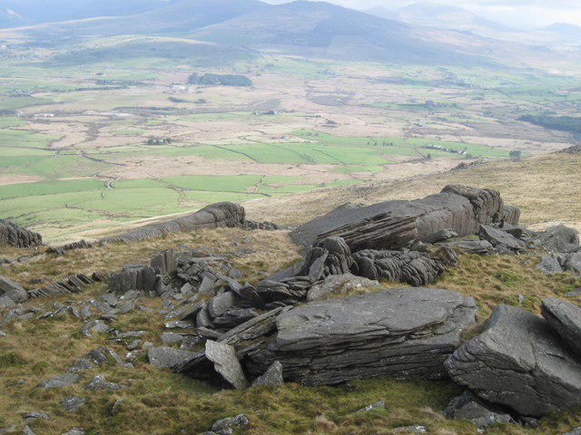 Photo could not load
SH4247 : Lava flows?
David Medcalf
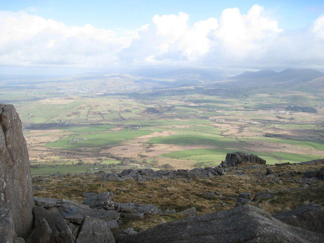 Photo could not load
SH4247 : Looking north east from Bwlch Mawr
David Medcalf
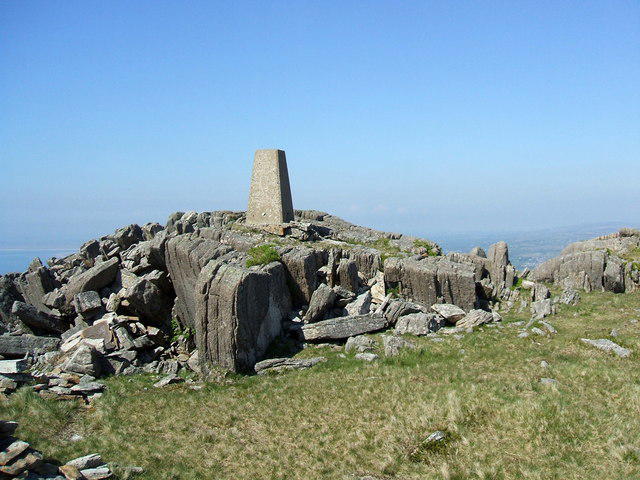 Photo could not load
SH4247 : Bwlch Mawr
David Brown
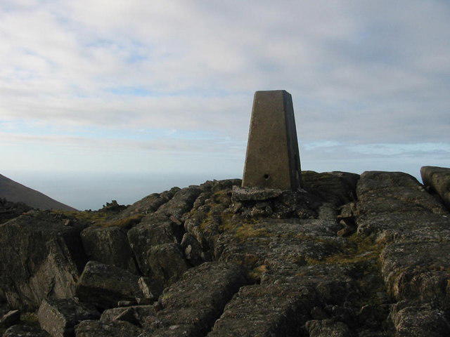 Photo could not load
SH4247 : Bwlch Mawr
Dewi
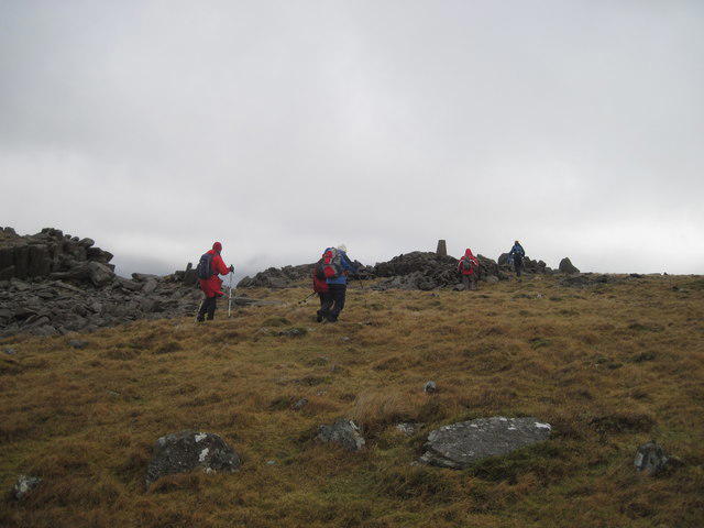 Photo could not load
SH4247 : Approaching the trig point on Bwlch Mawr
David Medcalf
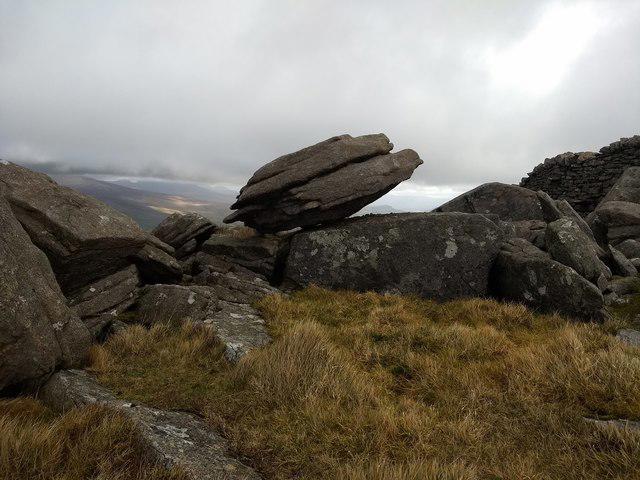 Photo could not load
SH4247 : Perched boulder near the summit of Bwlch Mawr
David Medcalf
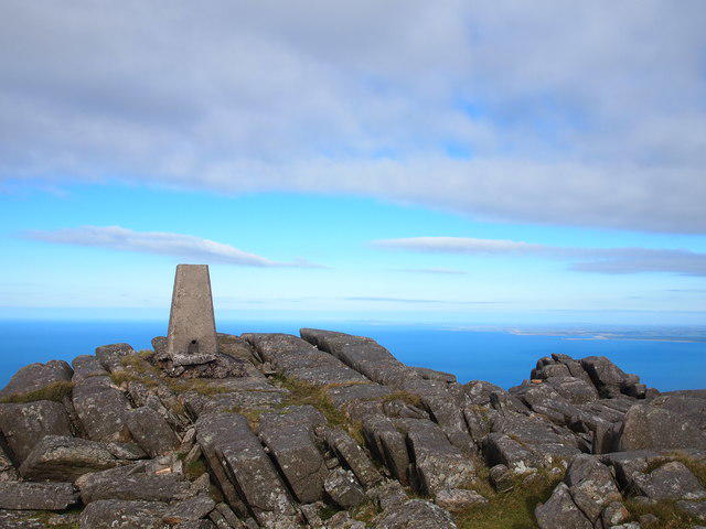 Photo could not load
SH4247 : Trig Point, Bwlch Mawr
Chris Andrews
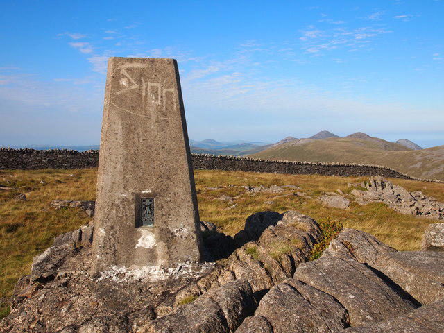 Photo could not load
SH4247 : Trig Point, Bwlch Mawr
Chris Andrews
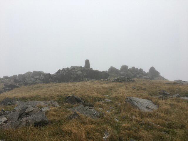 Photo could not load
SH4247 : Summit of Bwlch Mawr
Steven Brown
Hill facts and local notes
Classifications
Elevation
510m
1,674 ft
Prominence
148m
Coordinates
53.0048, -4.3462
SH426478
OS Map
115 123
Explorer: 254
At the Summit
The summit features a prominent trig point and a small stone cairn, which makes for a perfect spot to rest the legs and take some photos—don't forget to strike a pose!
Terrain & Geology
Bwlch Mawr is primarily composed of mudstone and slate, featuring typical Snowdonia geology that contributes to its rugged and dramatic landscapes. The area's geological history is rich, with slate quarries dotting the region, vestiges of a once-thriving industry.
Views & Scenery
From the summit, you can see the stunning Rhinog mountains to the south, Treks past Trawsfynydd Lake to the east, and on a clear day, even the peaks of Snowdon far to the north.
History & Heritage
Name Origin
The name 'Bwlch Mawr' translates to 'Great Pass', which is quite fitting as it marks a notable saddle in the surrounding landscape.
Historical Significance
This area has historical significance linked to local legends and ancient paths used by shepherds and traders long before modern roads were constructed.
Getting There & Facilities
Check current local access restrictions, parking rules and transport timetables before travelling. These notes do not confirm public access to the summit.
Parking
There is a small car park at Trawsfynydd Village, approximately 1.5 km from the trailhead. It's free but can get quite busy on weekends.
Public Transport
Bus services from Dolgellau to Trawsfynydd run several times a day, making it relatively easy to access the area without a car.
Nearby Facilities
The nearest facilities are in Trawsfynydd, which has a small shop and a few cafes where you can grab a bite before or after your hike.
Safety Information
Known Hazards
- As with any mountain trek, watch out for sudden weather changes which can bring fog and rain. Slippery rocks and the potential for uneven terrain also warrant caution.
General Safety Tips
- Check weather conditions before setting out
- Carry appropriate clothing and equipment
- Let someone know your planned route
- Take a map, compass, and GPS device
- Carry emergency supplies: food, water, first aid kit, torch
Hills
Some common questions about the hills answered
Are there group walks up Bwlch Mawr?
Many walkers use Walkmates to join or organise walks with others. You can check for group walks around Bwlch Mawr through the maps
Are there other walkers around Bwlch Mawr?
Activity varies by location and time, but Walkmates lets you see whether others have shared walks or shown interest in this area. Find other people through the walking friends search walking friends for Bwlch Mawr search or of course create your own walk for Bwlch Mawr
Can I organise a walk to Bwlch Mawr?
Yes. If there aren’t any walks listed already, you can create a walk and make it available for others to join.
If you're signed up to Walkmates, you can create a walk to Bwlch Mawr.
How do I find a walk up this hill?
There are often multiple ways to walk this hill, depending on experience and route preference. Walkmates helps you explore walks and routes that others have shared.
Can I suggest a new route up Bwlch Mawr?
Yes. You can suggest or create routes to share with others. Walkmates focuses on the social side of walking, so routes are used to help people organise walks and explore areas together, rather than as detailed navigation tools or route libraries.
Other uses really appreciate knowledgeable walkers sharing their routes. Share your favourite route to Bwlch Mawr here
The is an error or something incorrect about this hill. How do I let you know?
We always strive to keep the information on Walkmates as accurate as possible. If you find an error, please let us know through the contact form and we'll aim to correct it as quickly as possible
Community Discussion
Comments
Location
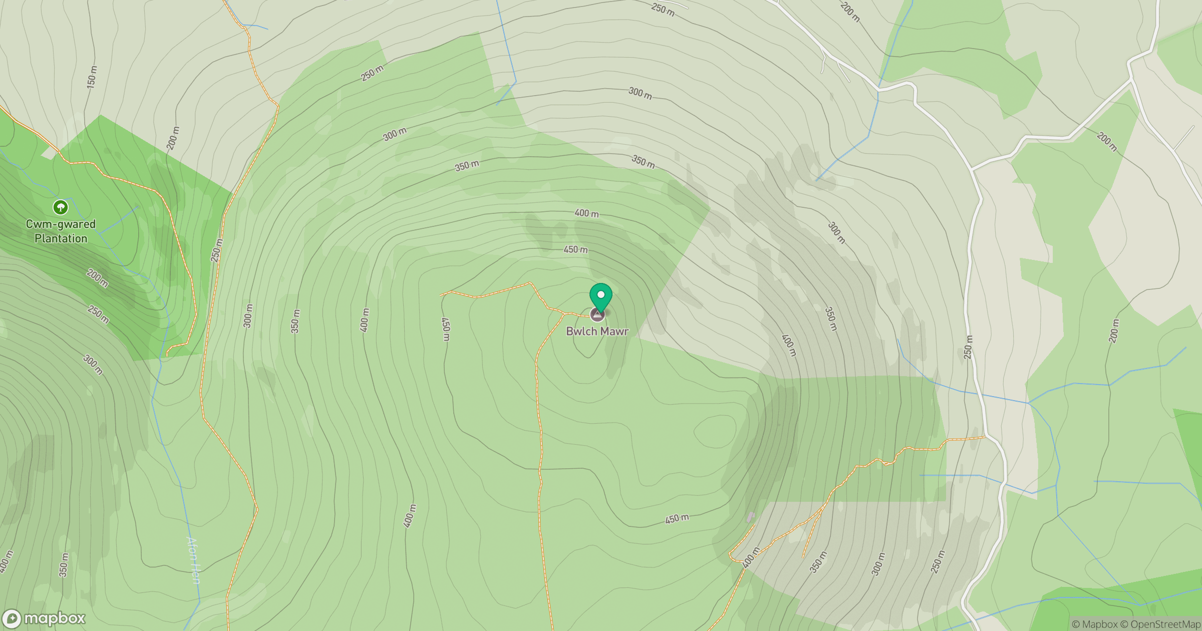
Grid reference: SH426478
View on OpenStreetMapOpens a map in a new tab, centred on the hill.
Hills within 30 km
Straight-line distance, not a walking route or confirmation of access.
No comments yet. Be the first.