

Yr Eifl
Good walks are even better shared.
SH3644 : The northern flank of the summit plateau of Yr Eifl
Eric Jones Photo source
Overview
Yr Eifl’s main summit, Garn Ganol, rises to 560.7 m on the Llŷn Peninsula in Gwynedd. A trig pillar stands on its prehistoric summit cairn. The separate eastern summit carries Tre’r Ceiri hillfort, while Garn Fôr is the quarried northern top. Mountain circuits begin at the upper car park above Llithfaen; the coastal circuit from Pistyll does not reach the summits.
Yr Eifl
The main summit
Yr Eifl’s highest summit, also called Garn Ganol, is 560.7 m high and is the highest point on the Llŷn Peninsula. Its trig pillar stands on a prehistoric burial cairn. Tre’r Ceiri, with its hillfort, is the separate eastern summit; Garn Fôr is the quarried northern top.
Walking routes
The upper Yr Eifl car park, on the road from Llithfaen to Nant Gwrtheyrn, is the start for the mountain circuits. It is separate from the heritage centre’s car park down in the valley.
The Caergribin circuit visits Tre’r Ceiri and Garn Ganol. The three-top circuit adds Garn Fôr and returns by the southern slopes. Gwynedd’s longer two-loop walk combines the main summit and hillfort with Nant Gwrtheyrn and the coast. The Pistyll coastal circuit passes the upper car park but does not reach any of the three summits.
Terrain and care
Steep paths cross rock, heather and wet ground. Mist makes the col and branching paths harder to follow. Garn Fôr has quarry drops; return by its stepped approach rather than the quarry inclines. Tre’r Ceiri has uneven stones and unprotected drops around its ramparts. Leave the archaeological stonework and summit cairns undisturbed.
Landscape and history
In clear conditions, views extend along Llŷn and towards Eryri, Cardigan Bay and Anglesey. The massif contains igneous intrusions including granophyre and microgranodiorite. Quarrying shaped the northern slopes and the former settlement at Nant Gwrtheyrn.
The main summit’s two burial cairns are probably Bronze Age. Tre’r Ceiri is a separate late Iron Age hillfort that remained in use during the Roman period. John Rhys interpreted Yr Eifl as “the two forks”, describing the gaps between the three peaks.
Access and facilities
Service 27 links Pwllheli and Nefyn via Llithfaen; plan the walk from the village to the upper car park and check the return timetable. Toilets and Caffi Meinir are at Nant Gwrtheyrn below the mountain. Tafarn y Fic is in Llithfaen.
Explore routes near Yr Eifl
Walks starting near this hill. Open a route to check its map, distance and full itinerary.
Yr Eifl and the Gyrns guided mountain walk
View route
Beddgelert Forest: Llyn Llywelyn Woodland Circuit
View route
Beddgelert Forest: Derwen Circuit and Llyn Llywelyn
View route
Northern Rhinogydd guided mountain walk
View route
Route planning notes
These notes describe possible approaches. Check a route's map and access information when planning your walk.
Yr Eifl and Tre’r Ceiri via Caergribin
Start and finish at Yr Eifl car park above Llithfaen (SH353440). Follow the southern hillside path to Caergribin, then the northeast path to the wall crossing and Tre’r Ceiri hillfort. Return to the wall crossing, climb the main Yr Eifl summit (Garn Ganol), then descend southwest to the car park. This complete circuit excludes Garn Fôr and Nant Gwrtheyrn. Rough rocks among heather and steep summit paths; the published walking time is 3 hours 40 minutes.
Yr Eifl, Tre’r Ceiri and Nant Gwrtheyrn
A two-loop circuit from Yr Eifl car park above Llithfaen (SH353440). First climb to Bwlch yr Eifl, turn up Garn Ganol, continue to Tre’r Ceiri, then return southwest to the car park. For the second loop take the lane down to Nant Gwrtheyrn, join the coastal path above the beach, then turn inland past Ciliau Canol and follow the marked field route back to the car park. The published 13 km and 4 hours cover both loops, including the descent to the coast and climb back. Several sections are steep.
Yr Eifl three-top circuit
From Yr Eifl car park (SH353440), follow the coast-path track to Bwlch yr Eifl. Use the steps beside the telecoms building to climb Garn Fôr, then return to the bwlch. Climb Garn Ganol and continue across the wet col to Tre’r Ceiri. Leave the fort southwest and return via Caergribin and the higher ground joining the Yr Eifl path back to the car park. The published 8.62 km and 3 hours cover this full three-top circuit. Stay on the summit approach and away from quarry edges; do not descend through the quarry workings.
Pistyll–Nant Gwrtheyrn circuit (no summit)
The National Trust circuit starts and finishes at the limited parking near its sign above St Beuno’s Church, Pistyll (LL53 6LR). Follow the inland route through fields to the upper Nant Gwrtheyrn car park, descend the lane to the heritage centre, then follow the coastal path above Porth y Nant back to St Beuno’s Church and up the lane to the start. This 9.6 km circuit does not climb Garn Ganol, Garn Fôr or Tre’r Ceiri. It has steep sections, gates, stiles and grazing livestock; keep dogs on leads.
Make a day of it, together
Find someone to share the walk with, or organise a day out along a route you like.
Photo Gallery
View all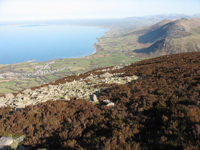 Photo could not load
SH3644 : The northern flank of the summit plateau of Yr Eifl
Eric Jones
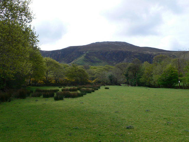 Photo could not load
SH3644 : View towards Mynydd Canol
Eirian Evans
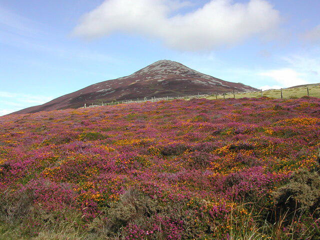 Photo could not load
SH3644 : Garn Ganol from the road to Nant Gwrtheyrn
Rod Grealish
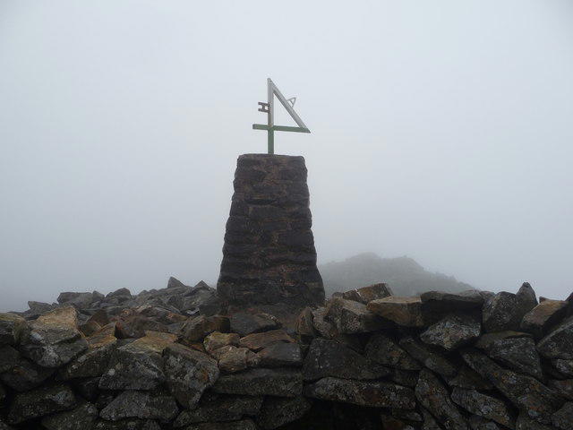 Photo could not load
SH3644 : Trig pillar on Yr Eifl
Jeremy Bolwell
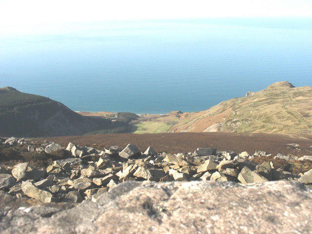 Photo could not load
SH3644 : The scree strewn upper slopes of Yr Eifl overlooking the Nant Gwrtheyrn Valley
Eric Jones
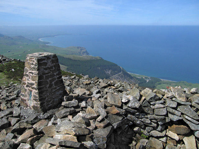 Photo could not load
SH3644 : Triangulation pillar on Yr Eifl
Dave Croker
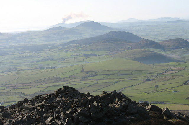 Photo could not load
SH3644 : The summit cairn of Yr Eifl
Eric Jones
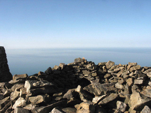 Photo could not load
SH3644 : The wind shelter formed out of the hollowed-out cairn on the summit of the central peak of Yr Eifl
Eric Jones
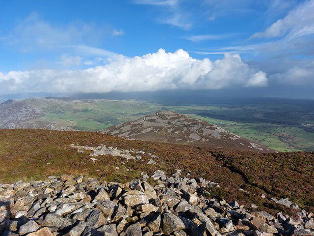 Photo could not load
SH3644 : View from Eifl to Tre'r Ceiri
Hansjoerg Lipp
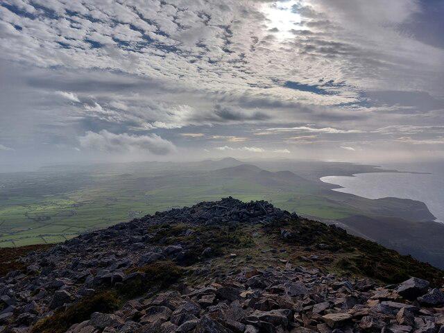
SH3644 : View from Eifl over Pen Llŷn (Lleyn)
Hansjoerg Lipp
Hill facts and local notes
Classifications
Elevation
561m
1,840 ft
Prominence
429m
Coordinates
52.9751, -4.4366
SH364447
OS Map
123
Explorer: 253 254
At the Summit
A trig pillar stands on the main summit’s prehistoric burial cairn. A second, smaller cairn lies about 25 m southwest. Both form the scheduled Yr Eifl Summit Cairns monument; leave their stones undisturbed.
Terrain & Geology
The Yr Eifl massif exposes igneous intrusions, including granophyre and microgranodiorite. Nearby Garn Fôr and its quarries expose the Garnfor Multiple Intrusion, formed during Ordovician magmatism.
Views & Scenery
In clear weather the summit overlooks the Llŷn Peninsula, Cardigan Bay, Eryri (Snowdonia), Caernarfon Bay and Anglesey.
History & Heritage
Name Origin
John Rhys interpreted Yr Eifl as “the two forks”, referring to the gaps between its three peaks.
Historical Significance
The two main-summit burial cairns are probably Bronze Age and form scheduled monument CN076. Tre’r Ceiri, on the separate eastern summit, is a late Iron Age hillfort used during the Roman period. Quarrying later reshaped Garn Fôr and supported the settlement at Nant Gwrtheyrn.
Getting There & Facilities
Parking
Yr Eifl car park above Llithfaen, on the road to Nant Gwrtheyrn, at approximately SH353440. This is the upper mountain car park, separate from parking at the heritage centre down in Nant Gwrtheyrn. The Pistyll coastal circuit starts at limited parking near the National Trust sign above St Beuno’s Church (LL53 6LR).
Public Transport
Service 27 runs between Pwllheli and Nefyn via Llithfaen and Pistyll. Check Traveline Cymru for the current timetable and return journey. The mountain car park is up the road from Llithfaen, so allow for that extra walk.
Nearby Facilities
Toilets and Caffi Meinir are at Nant Gwrtheyrn in the valley below the mountain; check the café’s current opening hours. Tafarn y Fic is in Llithfaen. These facilities are separate from the summit and upper mountain car park.
Safety Information
Known Hazards
- Steep rocks and boulders can be slippery, and the col towards Tre’r Ceiri can be wet and boggy.
- Sea mist and low cloud can obscure the summits and branching paths; navigation is important between the tops.
- Garn Fôr has steep quarry drops. Use its stepped approach for the return and keep away from quarry edges and workings.
- Tre’r Ceiri has uneven stonework and unprotected drops at ramparts and outcrops.
- Longer circuits include lanes and grazed fields; watch for vehicles and keep dogs on leads near livestock.
General Safety Tips
- Check weather conditions before setting out
- Carry appropriate clothing and equipment
- Let someone know your planned route
- Take a map, compass, and GPS device
- Carry emergency supplies: food, water, first aid kit, torch
Hills
Some common questions about the hills answered
Are there group walks up Yr Eifl?
Many walkers use Walkmates to join or organise walks with others. You can check for group walks around Yr Eifl through the maps
Are there other walkers around Yr Eifl?
Activity varies by location and time, but Walkmates lets you see whether others have shared walks or shown interest in this area. Find other people through the walking friends search walking friends for Yr Eifl search or of course create your own walk for Yr Eifl
Can I organise a walk to Yr Eifl?
Yes. If there aren’t any walks listed already, you can create a walk and make it available for others to join.
If you're signed up to Walkmates, you can create a walk to Yr Eifl.
How do I find a walk up this hill?
There are often multiple ways to walk this hill, depending on experience and route preference. Walkmates helps you explore walks and routes that others have shared.
Can I suggest a new route up Yr Eifl?
Yes. You can suggest or create routes to share with others. Walkmates focuses on the social side of walking, so routes are used to help people organise walks and explore areas together, rather than as detailed navigation tools or route libraries.
Other uses really appreciate knowledgeable walkers sharing their routes. Share your favourite route to Yr Eifl here
The is an error or something incorrect about this hill. How do I let you know?
We always strive to keep the information on Walkmates as accurate as possible. If you find an error, please let us know through the contact form and we'll aim to correct it as quickly as possible
Community Discussion
Comments
Location
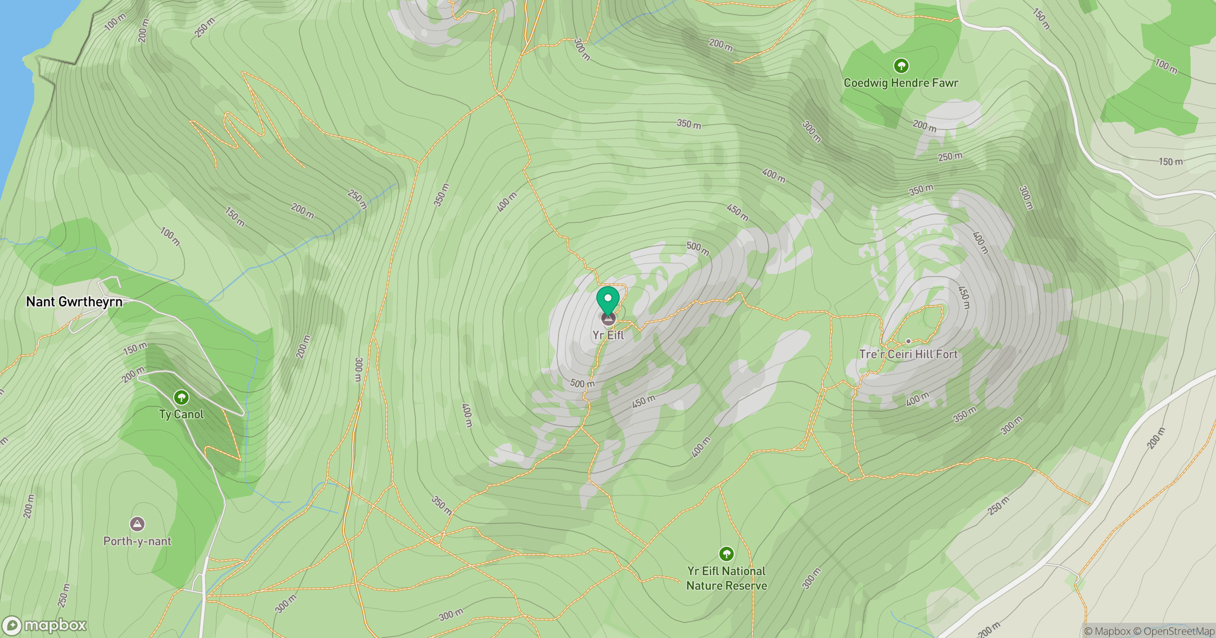
Grid reference: SH364447
View on OpenStreetMapOpens a map in a new tab, centred on the hill.
No comments yet. Be the first.