

Smearsett Scar
Good walks are even better shared.
Overview
Smearsett Scar
Smearsett Scar stands proudly within the iconic Yorkshire Dales National Park, offering hikers a delightful mix of moderate challenge and stunning scenery. At an elevation of 214 meters, this Nuttall is a perfect destination for those looking to stretch their legs without the need for mountaineering gear.
Geology
As a limestone hill, Smearsett Scar boasts fascinating geological features. The karst landscape presents limestone pavements, sinkholes, and a smattering of rock formations that could appear as if crafted by nature’s own sculptor. If you fancy a geology lesson, you might find yourself gazing in wonder at how water has been chiselling away at the stone for eons!
Routes
The most popular route begins in Ingleton, a charming village famed for its waterfall walk. The hike is about 9 km and typically takes 3.5 hours to complete. This moderate trek showcases some of the Dales’ finest views, making every step worthwhile.
Summit Features
Upon reaching the summit, adventurers are greeted by a modest stone cairn and a stunning outcrop of weathered limestone—ideal for a well-earned rest and perhaps a cheeky snack while taking in the surroundings.
Terrain Type
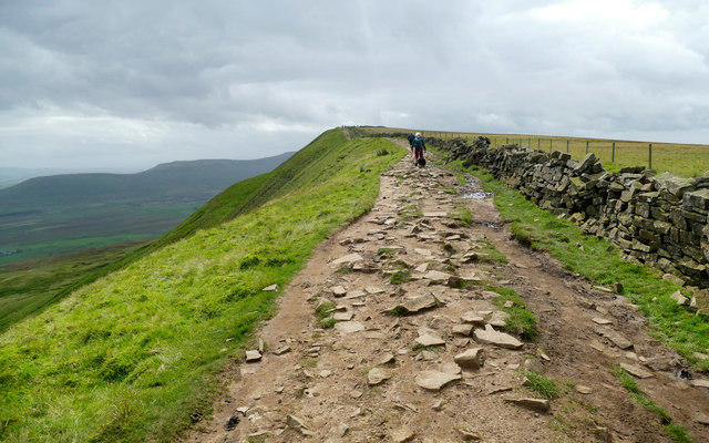
The terrain varies from rocky to grassy, with patches of limestone, making it a versatile trek. Don’t forget to watch your step; there’s nothing more embarrassing than tripping over your own feet!
Views
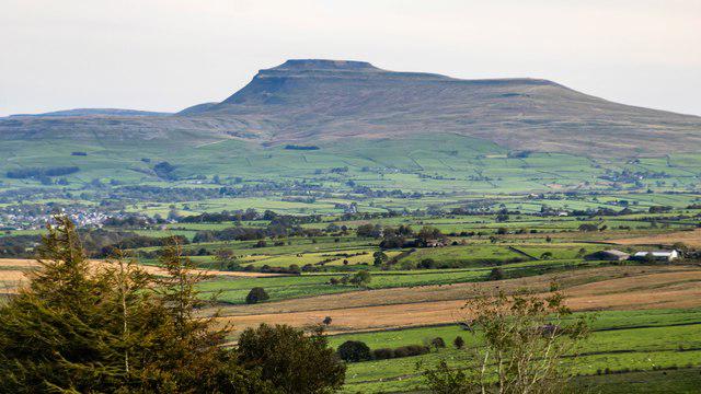
The view from Smearsett Scar does not disappoint. On a clear day, expect to see Ingleborough rising majestically to the south and the gentle hills of the Yorkshire Dales unfurling before you. Pack your camera—the sunsets here are nothing short of spectacular!
Hazards
As with all good hikes, there are a few hazards to keep in mind. The limestone can become quite slick in wet conditions, and the weather can change faster than you can say 'lovely Yorkshire'. Always check the forecast before setting off!
Access
Getting to Smearsett Scar is easy. There’s ample parking in Ingleton, and you can hop on a bus from nearby towns. Just follow the footprints of previous hikers, and you’ll soon be enjoying the view from the top!
Facilities
Once you’ve conquered the Scar, head back to Ingleton for a hot cuppa or a bite to eat at one of the local cafes. And fear not—public loos are available to ensure no one is making a mad dash to the nearest bush!
History
The name 'Smearsett' might sound as mysterious as the landscape itself. Thought to have roots in Old Norse, it adds an air of intrigue. Historically, this area thrived on limestone mining, contributing not only to the culture but also to the character of the region.
So, whether you're a seasoned hiker or a beginner looking for a great day out, Smearsett Scar is well worth your consideration. Perhaps you’ll find that the tussocky grasses and limestone rocks serve not just as a path to the summit but as a reminder that adventure is just a step away!
Happy hiking!
Explore routes near Smearsett Scar
Public walks starting within 80 km of this hill. Nearby does not mean a route reaches the summit; check its map and access before setting out.
Yorkshire Three Peaks Challenge – Gentle Pace
View route
Yorkshire Three Peaks Challenge – Sub-12 Hour
View route
Yorkshire Three Peaks Challenge – Gentle Pace
View route
Yorkshire Three Peaks Challenge – Sub-12 Hour
View route
Route planning notes
These notes describe possible approaches, not verified navigable routes or permission to cross land. Check current paths, local access rules and conditions before setting out.
Ingleton to Smearsett Scar
A rewarding hike starting from Ingleton, winding through picturesque landscapes before ascending to the summit of Smearsett Scar.
Make a day of it, together
Find someone to share the walk with, or organise a day out along a route you like.
Photo Gallery
View all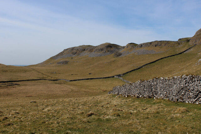 Photo could not load
SD8067 : Hidden Valley below Smearsett Scar
Chris Heaton
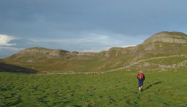 Photo could not load
SD8067 : Smearsett scar to Pot scar
Paul Glover
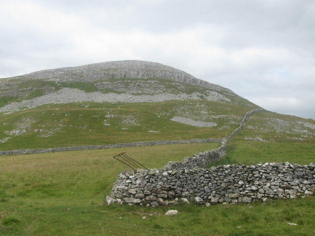 Photo could not load
SD8067 : Smearsett Scar
John Slater
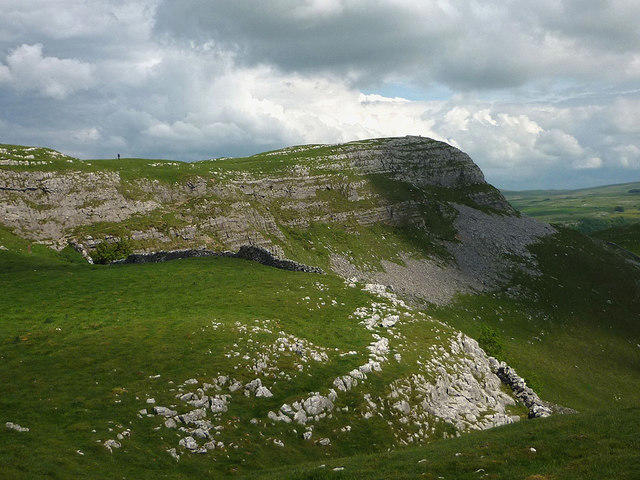 Photo could not load
SD8067 : Smearsett Scar
Karl and Ali
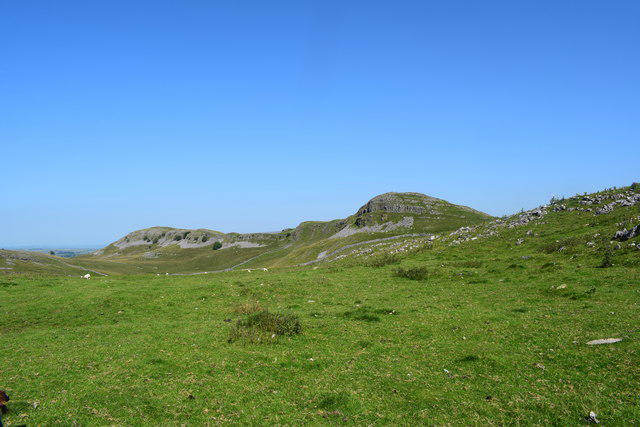 Photo could not load
SD8067 : Smearsett Scar
steven ruffles
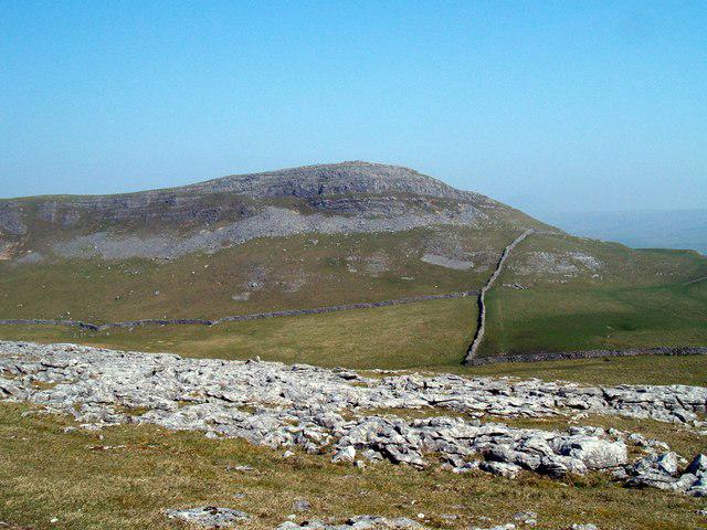 Photo could not load
SD8067 : Smearsett Scar
Roy W Lambert
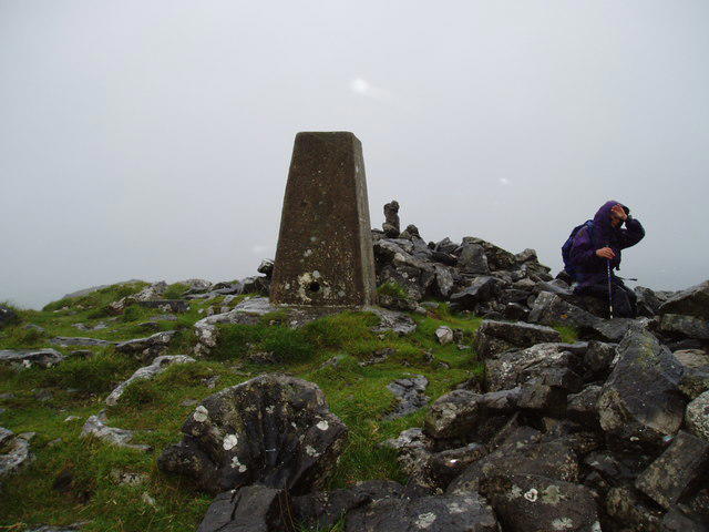 Photo could not load
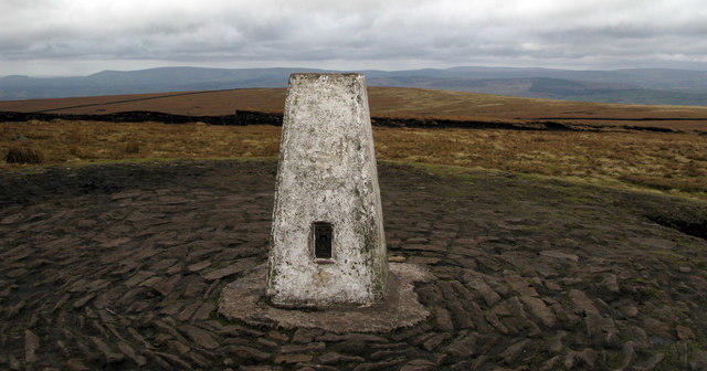
SD8067 : Trig Point on Smearsett Scar
Ray Woodcraft
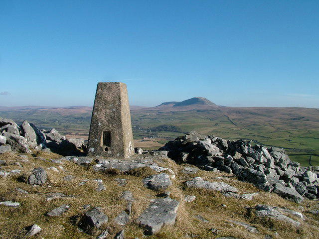 Photo could not load
SD8067 : Smearsett Scar Trig pillar
David Brown
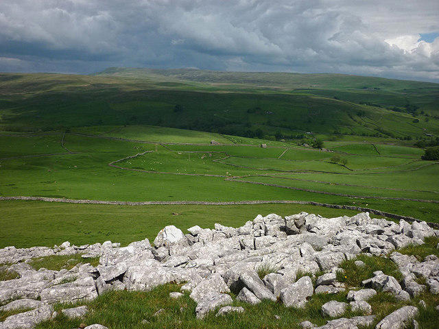 Photo could not load
SD8067 : Limestone outcrops on Smearsett Scar
Karl and Ali
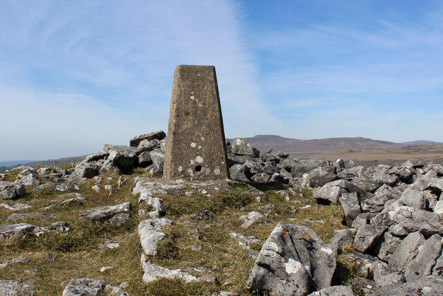
SD8067 : Trig Point on Smearsett Scar
Chris Heaton
Hill facts and local notes
Classifications
Elevation
363m
1,191 ft
Prominence
139m
Coordinates
54.1058, -2.3036
SD802678
OS Map
98
Explorer: OL2S OL41E
At the Summit
The summit features a small rocky outcrop and offers a stone cairn, which could be mistaken for a fashionable garden feature if you squint.
Terrain & Geology
Predominantly limestone, Smearsett Scar features classic karst topography, including limestone pavements and unique geological formations which could fool a geologist into thinking they're at an alien landscape.
Views & Scenery
Stunning panoramas of the surrounding Yorkshire Dales, including views of Ingleborough and the gentle rolling hills of the Dales.
History & Heritage
Name Origin
The name 'Smearsett' is believed to derive from Old Norse, related to 'smeira', meaning 'to smear or spread', possibly referring to the landscape.
Historical Significance
The area is rich in history, once a mining hub for limestone, contributing to the local economy and landscape.
Getting There & Facilities
Check current local access restrictions, parking rules and transport timetables before travelling. These notes do not confirm public access to the summit.
Parking
Ingleton Village offers several car parks, with Ingleton Primary School Car Park being popular and spacious.
Public Transport
Ingleton is served by buses from nearby towns; check local timetables for routes from Settle or Kirkby Lonsdale.
Nearby Facilities
Ingleton has a quaint village centre with cafes, pubs, and public toilets, perfect for a post-hike refreshment.
Safety Information
Known Hazards
- Careful of slippery limestone, especially when wet; also, be mindful of sudden weather changes typical in the Dales.
General Safety Tips
- Check weather conditions before setting out
- Carry appropriate clothing and equipment
- Let someone know your planned route
- Take a map, compass, and GPS device
- Carry emergency supplies: food, water, first aid kit, torch
Hills
Some common questions about the hills answered
Are there group walks up Smearsett Scar?
Many walkers use Walkmates to join or organise walks with others. You can check for group walks around Smearsett Scar through the maps
Are there other walkers around Smearsett Scar?
Activity varies by location and time, but Walkmates lets you see whether others have shared walks or shown interest in this area. Find other people through the walking friends search walking friends for Smearsett Scar search or of course create your own walk for Smearsett Scar
Can I organise a walk to Smearsett Scar?
Yes. If there aren’t any walks listed already, you can create a walk and make it available for others to join.
If you're signed up to Walkmates, you can create a walk to Smearsett Scar.
How do I find a walk up this hill?
There are often multiple ways to walk this hill, depending on experience and route preference. Walkmates helps you explore walks and routes that others have shared.
Can I suggest a new route up Smearsett Scar?
Yes. You can suggest or create routes to share with others. Walkmates focuses on the social side of walking, so routes are used to help people organise walks and explore areas together, rather than as detailed navigation tools or route libraries.
Other uses really appreciate knowledgeable walkers sharing their routes. Share your favourite route to Smearsett Scar here
The is an error or something incorrect about this hill. How do I let you know?
We always strive to keep the information on Walkmates as accurate as possible. If you find an error, please let us know through the contact form and we'll aim to correct it as quickly as possible
Community Discussion
Comments
Location
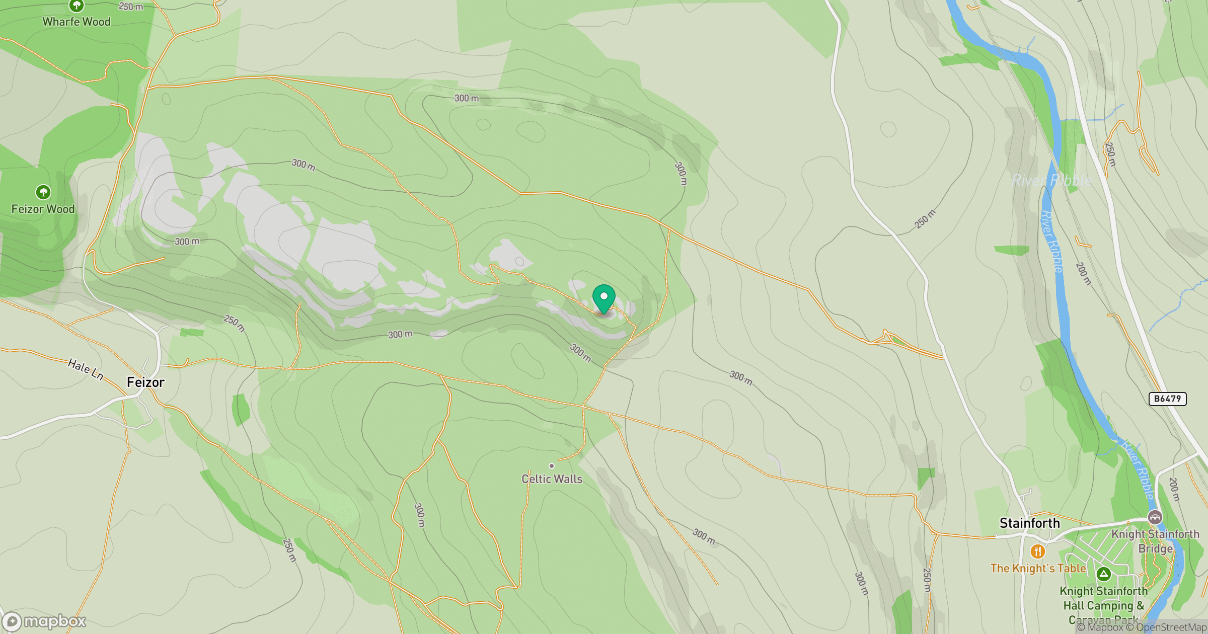
Grid reference: SD802678
View on OpenStreetMapOpens a map in a new tab, centred on the hill.
Hills within 30 km
Straight-line distance, not a walking route or confirmation of access.
No comments yet. Be the first.